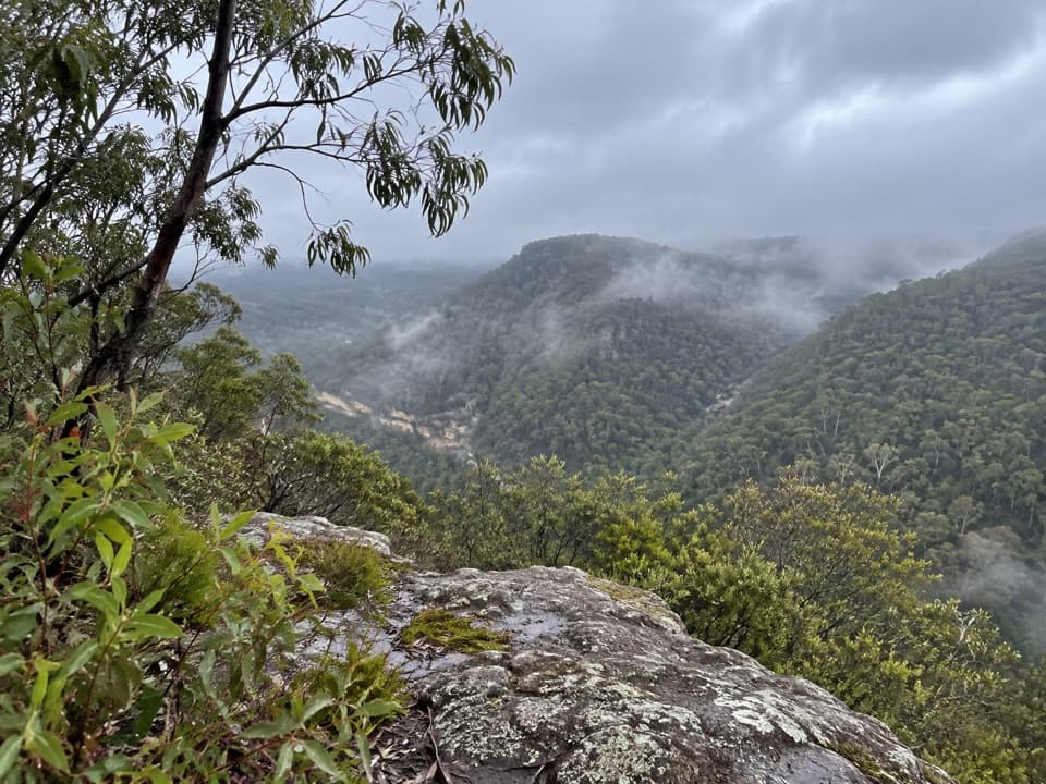
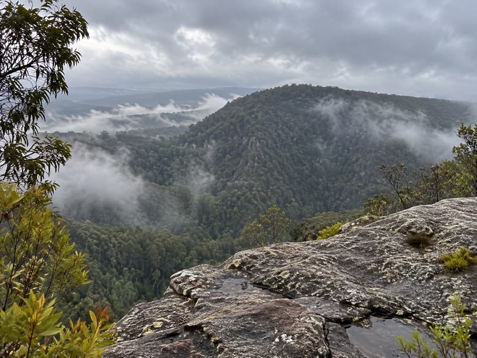
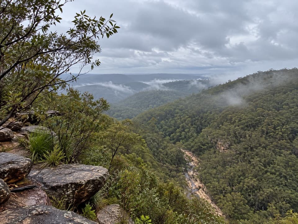
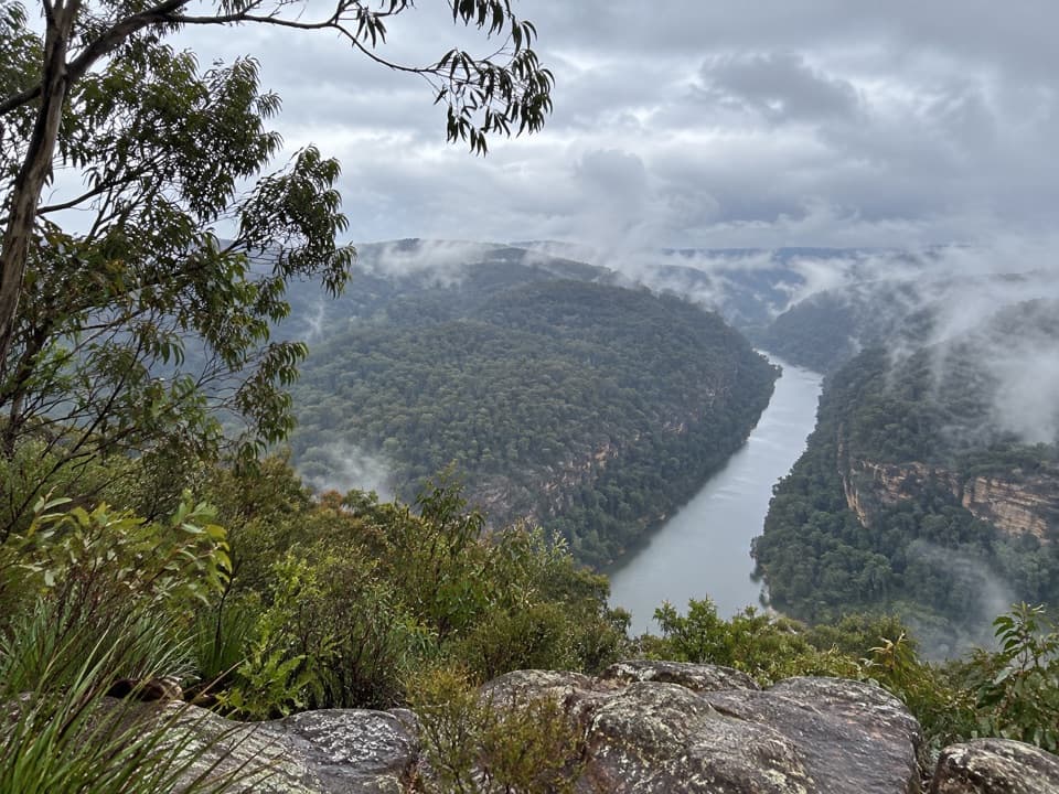
Jack Evans walking track in Blue Mountains National Park

Blue Mountains National Park, NSW

Jack Evans walking track

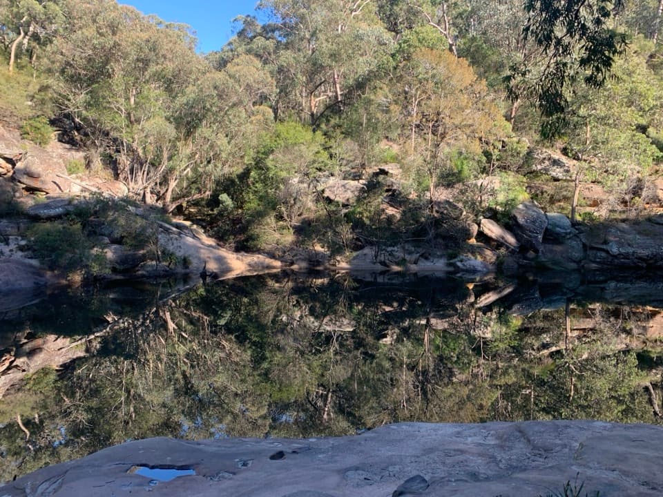
A steep descent to Erskine Creek's deep swimming holes.

Length
2.6km
Time
1hr
Elev. change
162m
Difficulty
Challenging
  • No dogs
  • High point 228 m

Hear the audio tour

Nepean Lookout and the Jack Evans Track

Overview

About Jack Evans walking track

Why go

  • Deep swimming holes at Erskine Creek
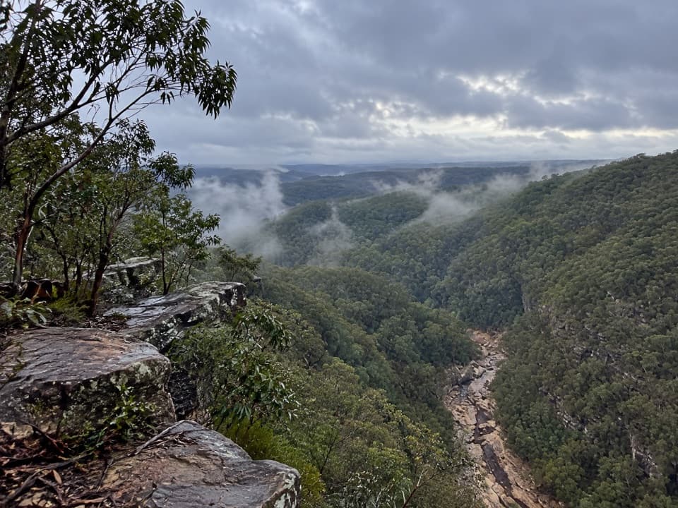
  • Angophoras, grass trees and gorge rock formations

Heads up

  • Short distance, but a steep climb back out
Jack Evans walking track is a 2.6 km return out-and-back from Nepean Lookout Trail down to Erskine Creek in the Blue Labyrinth. The payoff is a steep gorge walk to deep creek swimming holes; it is a hard Grade 3 track, not a relaxed waterside stroll. Allow about an hour for the walk, and longer if you stop to picnic, swim or rock-hop.
Parkwolf’s verdictIs this one for you?

Map & elevation

The route

Loading the Blue Mountains map
Full map
Elevation66–228 m
TrailheadJack Evans track entry, Nepean Lookout Trail-33.84035, 150.58141
Keep this map with you offline in the Parkwolf app

Plan your hike

Before you go

Parking

From Glenbrook, follow Ross Street to Bruce Road, cross the causeway on The Oaks trail and turn left onto Nepean Lookout Trail. Parking is available along that road; Jack Evans track branches off on the right shortly before the lookout. The access road can become boggy after rain.

Safety

The track descends steeply and has some obstacles, making the return climb demanding. Do not cross Erskine Creek into the Scheduled Lands water-protection area; that continuation is closed to walkers.

3 active Blue Mountains alerts

  • ClosureRoads and tracks closed across Blue Mountains National ParkMany roads, fire trails and walking tracks across Blue Mountains National Park are closed; do not enter closed areas.Official details
  • CautionPark-wide solid-fuel fire banA park fire ban is active across Blue Mountains National Park: campfires and solid-fuel barbecues and stoves are prohibited. - Gas and electric cookers are permitted, subject to safety rules.Official details
See all 3 alerts
A park ranger sits on a dash-mounted phone, talking, as Parkwolf’s Tour Guide plays “Army Cutworm Moths: A Grizzly Bear Buffet” on Grand Loop Road below Dunraven Pass in Yellowstone
Parkwolf Tour GuideThe highest, rockiest slopes around here are a summer buffet for grizzly bears.

Blue Mountains Tour Guide

Your drive to Jack Evans walking track, narrated.

Parkwolf is a GPS audio tour guide for Blue Mountains National Park. As you drive, it chimes in with what’s ahead: hidden gems, upcoming stops, history, geology, and wildlife, right through your car’s speakers.

See the Blue Mountains audio tour

Recorded for this trailhead

Nepean Lookout and the Jack Evans Track
0:00 / 0:31
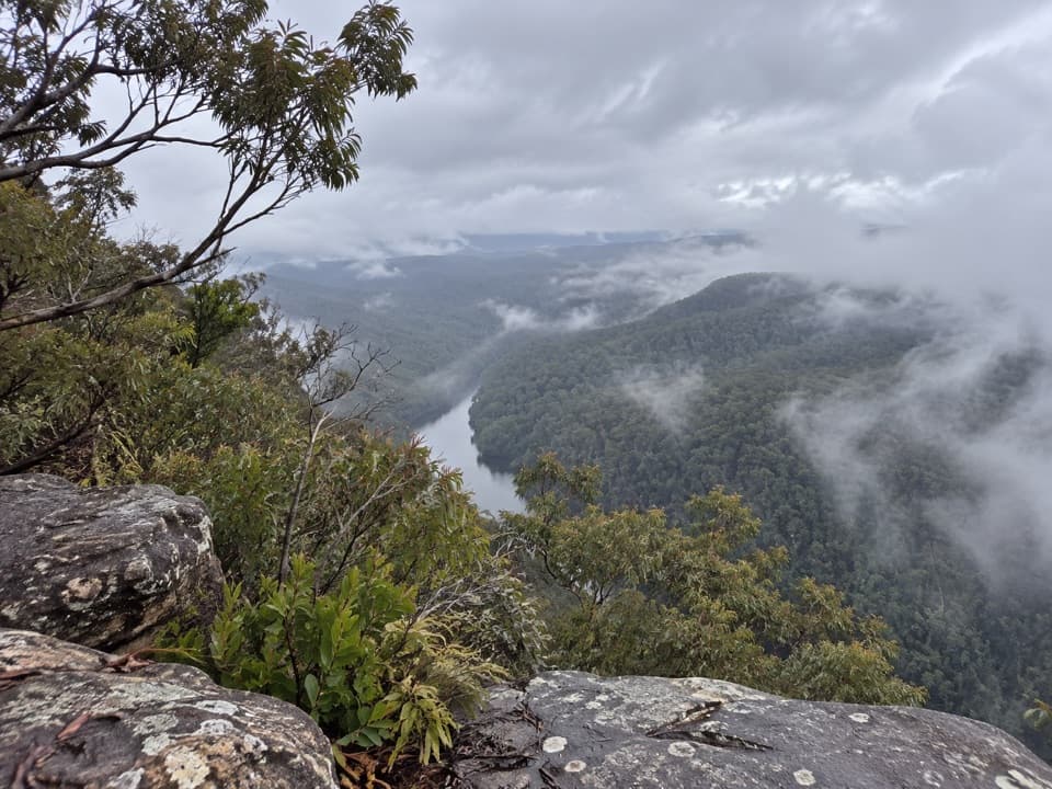
“You're nearing Nepean lookout, where a short, easy walk from the car park opens onto Fairlight Gorge and the river below.”

Plays as you drive up to this trailhead in the Parkwolf Blue Mountains Tour Guide.

More stories near here in the app

  • Pisgah Rock: Lookout or Creek Scramble
  • The Kangaroo's Fifth Foot
  • The Sandstone Sharpening Stone
  • The Tree That Built Coaches
  • 188 audio storiesacross Blue Mountains’s roads, triggered by GPS as you drive
  • Wildlife heatmapsfor Grey Kangaroo, Wombat, Red-necked Wallaby, and 13 more
  • Works offlinemaps, 110 trails, 84 places, and audio download before you lose signal
  • CarPlay readysimple controls built for the drive
★★★★★
“Fantastic app with many points of information… It’s great to just turn on while you’re driving and it gives you an audio tour of the national Park. We love it!!!!”
JMJamesApp Store review
Download Parkwolf on the App StoreGet Parkwolf on Google Play

4.7 from 8,600+ ratings

Trail guide

Hiking Jack Evans walking track

Down into the gorgeThe formed path drops steeply through towering angophoras and grass trees.

The formed path drops steeply through towering angophoras and grass trees. It has some obstacles, and the same steep route is the climb back out. The return is the main effort, so leave time to stop at the creek before heading uphill.

At Erskine CreekAt the bottom, look for the deep swimming holes and picturesque rock formations.

At the bottom, look for the deep swimming holes and picturesque rock formations. You can picnic or rock-hop along the creek before retracing your steps. The continuation across the creek is off limits to walkers because it enters Scheduled Lands set aside for water protection; turn around on the public side. For a photo, include the water below the gorge walls so the sandstone and creek sit together in the frame.

Plants, wildlife and a namesakeLook for the rare ground orchids among the angophoras and grass trees.

Look for the rare ground orchids among the angophoras and grass trees. A platypus may turn up in the waterway, though there is no guarantee. The track is named for Jack Evans, a labourer from the nearby Warragamba Dam.

Getting thereFrom Glenbrook, follow Ross Street and Bruce Road into the park, cross the causeway on The Oaks…

From Glenbrook, follow Ross Street and Bruce Road into the park, cross the causeway on The Oaks trail, then turn left onto Nepean Lookout Trail. The track entry is on the right shortly before the lookout, and parking is available along that road. The access road can become boggy after rain. Nepean Lookout is a separate drive-up stop with Fairlight Gorge views. Pets are not permitted.

Wildlife

Wildlife in Blue Mountains

All Blue Mountains wildlife maps

Sighting maps show where each species has been reported across Blue Mountains. Wildlife moves, so no sighting is guaranteed.

Keep exploring

Near Jack Evans walking track

See it all on the map

Trails that start nearby

Places near the trailhead

Parkwolf’s Blue Mountains ranking

Top-rated trails in Blue Mountains

All 110 trails
  1. 1Grand Canyon trackModerate · 6.3 km
  2. 2Three Sisters walkEasy · 0.8 km
  3. 3Lockley Pylon walking trackModerate · 7 km
  4. 4National PassChallenging · 5.1 km
  5. 5Wentworth Pass loop walking trackChallenging · 5 km
  6. 6Prince Henry Cliff walkModerate · 7 km

Take Parkwolf to Blue Mountains.

The audio tour guide for the drive, plus offline maps, trails, and wildlife heatmaps for when the signal drops.

4.7 from 8,600+ ratings

Download Parkwolf on the App StoreGet Parkwolf on Google Play