Parking
Start at Mount Banks picnic area; its car park holds about 10 vehicles. From Bells Line of Road, turn left at the signed picnic-area turn roughly 7 km after Mount Tomah. The access road is unsealed.

Blue Mountains National Park, NSW
An unsealed ridge road ends above the Grose Valley
Overview
Map & elevation
Plan your hike

The highest, rockiest slopes around here are a summer buffet for grizzly bears.
Blue Mountains Tour Guide
Parkwolf is a GPS audio tour guide for Blue Mountains National Park. As you drive, it chimes in with what’s ahead: hidden gems, upcoming stops, history, geology, and wildlife, right through your car’s speakers.
See the Blue Mountains audio tourRecorded for this trailhead
Mount Banks: Ridge Views and Monkey Gums“Mount Banks picnic area is coming up, where you can have lunch among eucalyptus trees or start the summit walk. The climb takes two to three hours return, with steep steps and unfenced cliff edges.”
Plays as you drive up to this trailhead in the Parkwolf Blue Mountains Tour Guide.
More stories near here in the app
“Fantastic app with many points of information… It’s great to just turn on while you’re driving and it gives you an audio tour of the national Park. We love it!!!!”


Trail guide
Mount Banks Road cycle route is a 10 km return walk or ride from Mount Banks picnic area around the mountain's base to the cliff edge above Banks Wall. The unsealed route runs through open heath and woodland, with Mount Banks on your right. Walkers should allow three to five hours; the terrain has several steep sections. This is the longer ridge-road outing, separate from the uphill Mount Banks Summit walk.
Expect an undulating gravel road and track, not a smooth bike path. Rocks, fallen trees and overgrowth can slow you down, and the steep pitches make the return feel longer than the map suggests. Spring and summer are the main wildflower season. Wedge-tailed eagles and peregrine falcons may circle on the valley thermals.
The route's main payoff is a view across the Grose Valley toward the Grose River, Govetts Leap and Blue Gum Forest. Keep well back from the escarpment edge. To continue, follow the narrowing clifftop track about 1.1 km farther one way to a second, unfenced lookout; the longer return is about 12.2 km, with views toward Lockley Pylon and Mount Hay. From the main lookout, include the valley below from a safe distance rather than edging toward the drop for a photo.
Mount Banks' double-humped profile comes from lava laid down about 12 to 17 million years ago. The hard basalt cap helped protect the softer sandstone below it as erosion cut the Grose Valley. The dark summit above the pale cliff bands is the same contrast that makes the Banks Wall viewpoint so distinctive.
The start is Mount Banks picnic area, with picnic tables and non-flush toilets; the car park has room for about 10 vehicles. From Bells Line of Road, turn left at the Mount Banks picnic-area sign roughly 7 km after Mount Tomah. The access road is unsealed. Groups in Grose Wilderness are limited to eight people.
Wildlife
 58 sightingsGrey KangarooMost seen around 6 AMSighting map
 43 sightingsWombatMost seen around 6 PMSighting map
 18 sightingsRed-necked WallabyMost seen around 6 PMSighting map
 53 sightingsSwamp WallabyMost seen around 7 AMSighting map
 23 sightingsBrushtail PossumMost seen around 7 PMSighting map
 30 sightingsRing-tailed PossumMost seen around 7 PMSighting map
Sighting maps show where each species has been reported across Blue Mountains. Wildlife moves, so no sighting is guaranteed.
Keep exploring
 ModerateMount Banks Summit walk2.4 km · 2.5 hr · At the trailheadOpen ridge views make the steep climb to a wooded summit worthwhile.
 EasyWalls Lookout Track2.5 km · 1 hr · 2.4 km awayA short out-and-back to big Grose Valley views.
 ChallengingPierces Pass to Blue Gum Forest walking track16 km · 7 hr · 2.7 km awayA steep Grose Valley descent to rainforest, river and Blue Gum Forest.
 EasyRigby Hill walking track1.2 km · 1 hr · 2.7 km awayA short ridge walk ends above the Grose Valley.
 ChallengingPierces Pass to Grose River4.9 km · 3 hr · 2.7 km awayA steep track to the river, then every step back up.
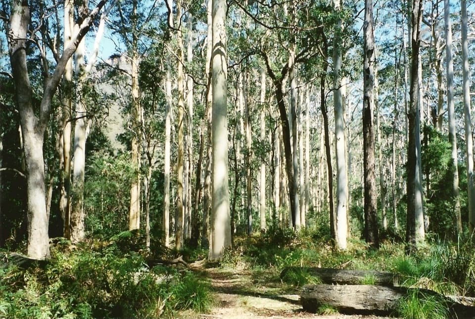 ChallengingPerrys Lookdown to Blue Gum Forest walking track5.3 km · 3.5 hr · 2.8 km awayDescend steeply to a forest bushwalkers saved from logging.
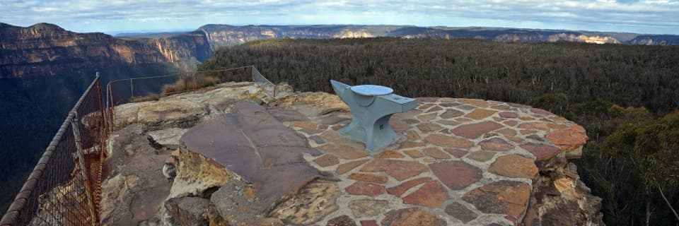 EasyAnvil Rock and Wind Eroded Cave Walk0.7 km · 24 min · 3.1 km awayTwo short spurs pair a valley lookout with a sculpted cave.
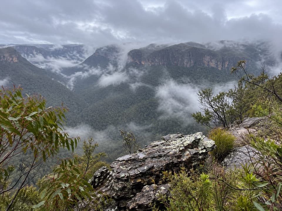 ModerateHat Hill to Bald Head6.8 km · 2.8 hr · 4.9 km awayA rugged ridge walk to a wide Grose Valley view.
 Picnic area · At the trailheadMount Banks picnic areaQuiet tables at Mount Banks' base, with a steep summit walk beyond.
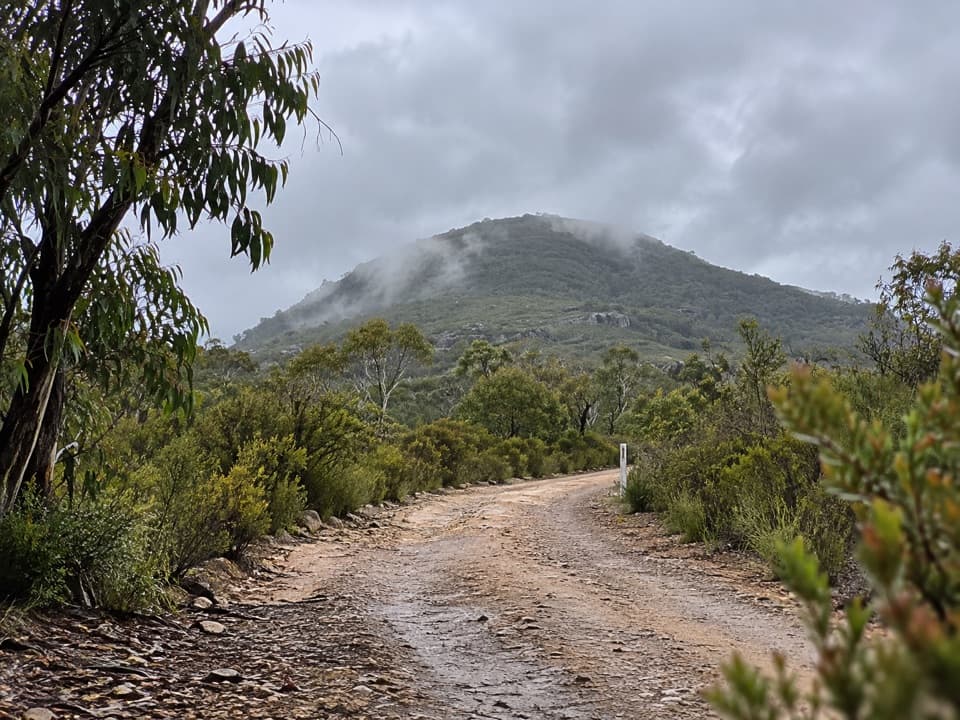 Sight · 0.9 km awayMount BanksA steep climb to a double-humped summit above Grose Wilderness.
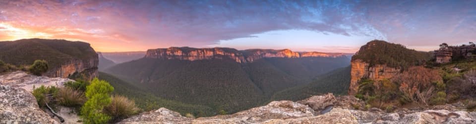 Sight · 2.4 km awayWalls LookoutA short rocky walk opens onto a huge Grose Valley panorama.
 Picnic area · 2.7 km awayPierces Pass picnic areaTwo very different walks start at this small Grose Valley picnic stop.
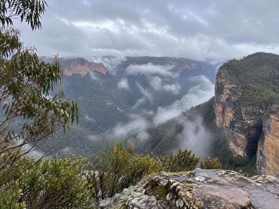 Sight · 2.7 km awayRigby Hill lookoutA short ridge walk to a broad Grose Valley panorama.
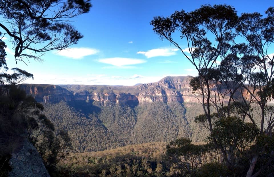 Sight · 2.8 km awayPerrys LookdownBig Grose Valley views, with the Blue Gum Forest far below.
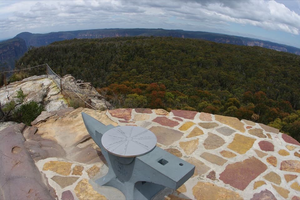 Sight · 2.9 km awayAnvil RockA real anvil, a real story, and a wide Grose Valley view.
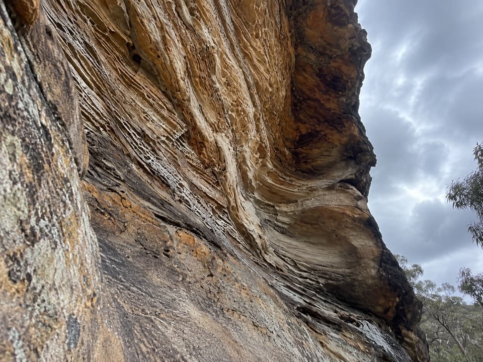 Sight · 3.2 km awayWind Eroded CaveA short stop for wave-shaped sandstone and a Grose Gorge view.
Parkwolf’s Blue Mountains ranking

The audio tour guide for the drive, plus offline maps, trails, and wildlife heatmaps for when the signal drops.





