Parking
Start at Katoomba Falls Kiosk. Overnight parking is available at Katoomba Kiosk car park and Katoomba Oval; allow for the return to this same Katoomba access.
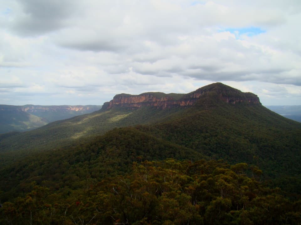
Blue Mountains National Park, NSW
Rainforest, tramway history, and a rough ridge in a three-day loop.
Overview
Mount Solitary walking track is a 34 km loop from Katoomba Falls Kiosk, planned as a three-day backcountry trip with nights at Ruined Castle and Kedumba River campgrounds. It descends Furber Steps to Federal Pass, crosses the rough ridge of Mount Solitary, then returns through Sublime Point, Leura Forest and Fern Bower. This is a Grade 5 walk for experienced, self-reliant bushwalkers. I’d choose it for a full wilderness traverse, not a quick summit visit. The published day legs are 7, 9 and 14 km, which total 30; use the full 34 km distance to plan the return to Katoomba. If you only want the summit, a separate roughly 13 km return from Golden Stairs via Ruined Castle is shorter, but it’s a different route.
 Parkwolf’s verdictIs this the hike for you?
Map & elevation
Plan your hike

The highest, rockiest slopes around here are a summer buffet for grizzly bears.
Blue Mountains Tour Guide
Parkwolf is a GPS audio tour guide for Blue Mountains National Park. As you drive, it chimes in with what’s ahead: hidden gems, upcoming stops, history, geology, and wildlife, right through your car’s speakers.
See the Blue Mountains audio tourRecorded for this trailhead
Katoomba Falls and Cascades“You're nearing the Katoomba Falls and Cascades area, where you can choose a short look at the river or a longer waterfall walk. The Cascades are low falls over rock shelves, reached by a short path with steps.”
Plays as you drive up to this trailhead in the Parkwolf Blue Mountains Tour Guide.
More stories near here in the app
“Fantastic app with many points of information… It’s great to just turn on while you’re driving and it gives you an audio tour of the national Park. We love it!!!!”


Trail guide
From the kiosk, descend Furber Steps and join Federal Pass, the old horse-drawn tramway corridor. This first 7 km takes about 4.5 hours; expect rocky ground under tree ferns and mountain blue gums. Ruined Castle campground sits beside mining remains dated to 1882. A short walk reaches the sandstone formation itself, with Jamison Valley spread behind it. Leave time for this spur; it’s a distinct view from the ridge you’ll reach tomorrow.
The 9 km second day is the hardest, with an official estimate of about 8 hours. The western climb follows Korowal (also spelled Korrowal) Knife Edge, a rough, unformed track that makes footing and navigation the main challenge. A short detour reaches Chinamans Gully for wide views across Jamison Valley and south toward the Wild Dog Mountains and Kanangra-Boyd wilderness. Cross the Mount Solitary plateau, then descend steeply down its eastern side to Kedumba River campground.
Mountain heath, old man banksias and scribbly gums give the top a different feel from the rainforest start. The park also notes wedge-tailed eagles riding thermals over the valley and peregrine falcons heard around the ridge. From Chinamans Gully, frame the cliffline with the valley below to show the drop and the scale of the southern ranges.
From Kedumba River, the route climbs back toward Sublime Point fire trail, then heads west past Jamison and Leura Falls creeks, through Leura Forest and the rainforest gully of Fern Bower. Linda and Lila waterfalls lie close to the track; spring waratah adds a red flash to the grey forest gums. The final rise returns to Katoomba; the Prince Henry Cliff Walk option finishes at Furber Steps. The day plan’s 14 km does not match the full 34 km circuit length, so allow for the return connection and use the loop total.
The route has two bush-camp nights; non-flush toilets and picnic tables are listed only at Ruined Castle. Treat water collected from creeks, waterholes and tanks. No dependable source on the plateau was verified, so plan water between camps rather than assuming it will be there. The park recommends a trip intention form, map, compass, PLB and supplies for all weather. No pets are permitted except certified assistance animals. Katoomba Falls Kiosk is at the start; treat it as a separate café stop, not a backcountry resupply point.
Wildlife
 58 sightingsGrey KangarooMost seen around 6 AMSighting map
 43 sightingsWombatMost seen around 6 PMSighting map
 18 sightingsRed-necked WallabyMost seen around 6 PMSighting map
 53 sightingsSwamp WallabyMost seen around 7 AMSighting map
 23 sightingsBrushtail PossumMost seen around 7 PMSighting map
 30 sightingsRing-tailed PossumMost seen around 7 PMSighting map
Sighting maps show where each species has been reported across Blue Mountains. Wildlife moves, so no sighting is guaranteed.
Keep exploring
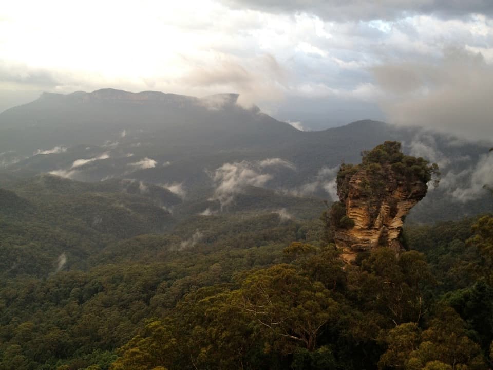 ModerateRound walking track1.2 km · 1 hr · At the trailheadA compact loop pairs waterfall lookouts with a shady ferny gorge.
 ModeratePrince Henry Cliff walk7 km · 3.5 hr · 0.2 km awayA cliff-top walk with Three Sisters views and more than 20 lookouts.
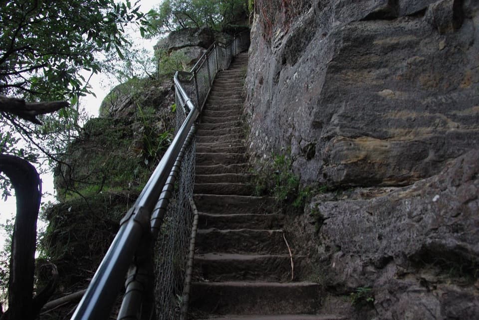 ModerateFurber Steps walk2.2 km · 1.5 hr · 0.4 km awayA stairway drops through rainforest to the base of Katoomba Falls.
 EasyScenic Walkway1.9 km · 50 min · 0.6 km awayA ticketed rainforest boardwalk links valley stations beneath the canopy.
 EasyThree Sisters walk0.8 km · 35 min · 1 km awayA short paved walk to three sandstone spires above a vast valley.
 ChallengingEcho Point to Scenic World via Giant Stairway4.7 km · 2.5 hr · 1 km awayDescend the Giant Stairway, cross the valley, climb to Scenic World.
 ChallengingDardanelles Pass loop walking track5.3 km · 3 hr · 1 km awayMore than 900 stairs descend into rainforest before the climb out.
 ChallengingGiant Stairway0.5 km · 36 min · 1 km away998 steps take you down to Honeymoon Bridge.
 Sight · 0.1 km awayKatoomba FallsA stepped gorge loop pairs a waterfall with a Three Sisters view.
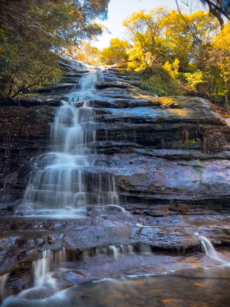 Sight · 0.2 km awayKatoomba CascadesA quick stairway detour to the Kedumba River's ferny cascades.
 Sight · 0.3 km awayCliff View LookoutQuick walk for broad Kedumba Valley views beneath the Skyway
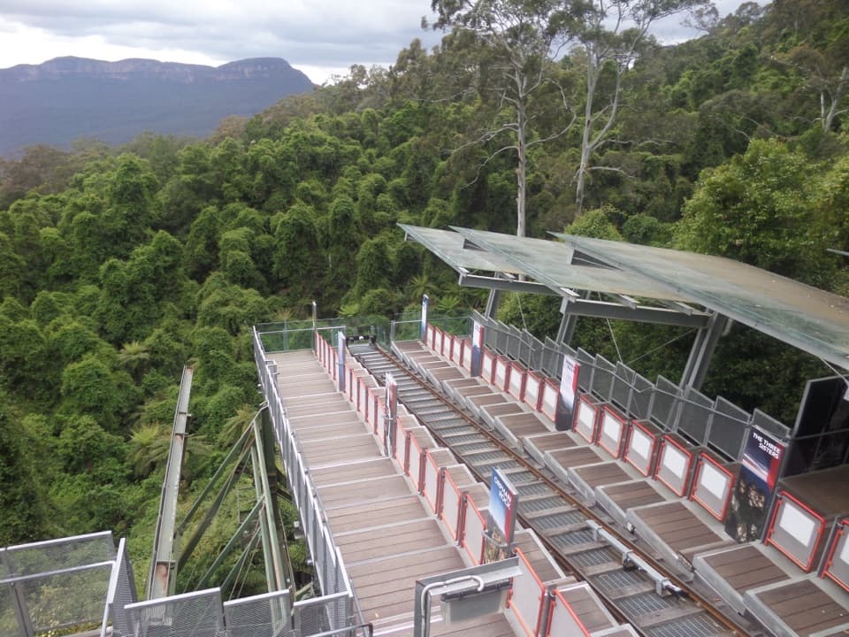 Sight · 0.4 km awayScenic WorldThree rides, rainforest boardwalks, and close views into Jamison Valley
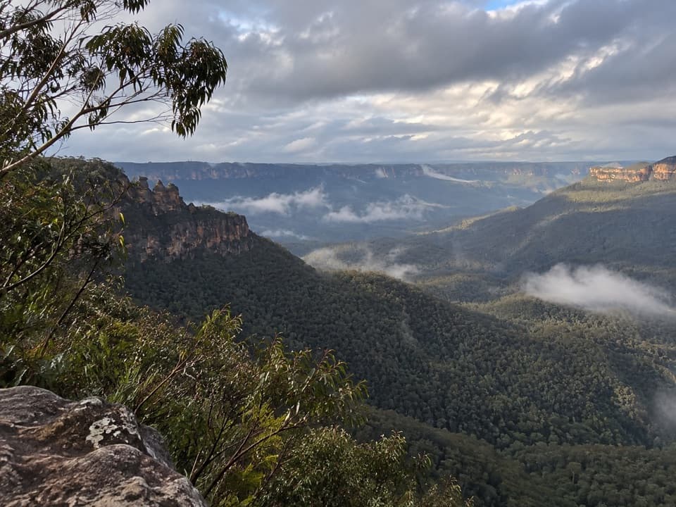 Sight · 0.7 km awayEagle Hawk LookoutA quieter Jamison Valley view toward the Three Sisters.
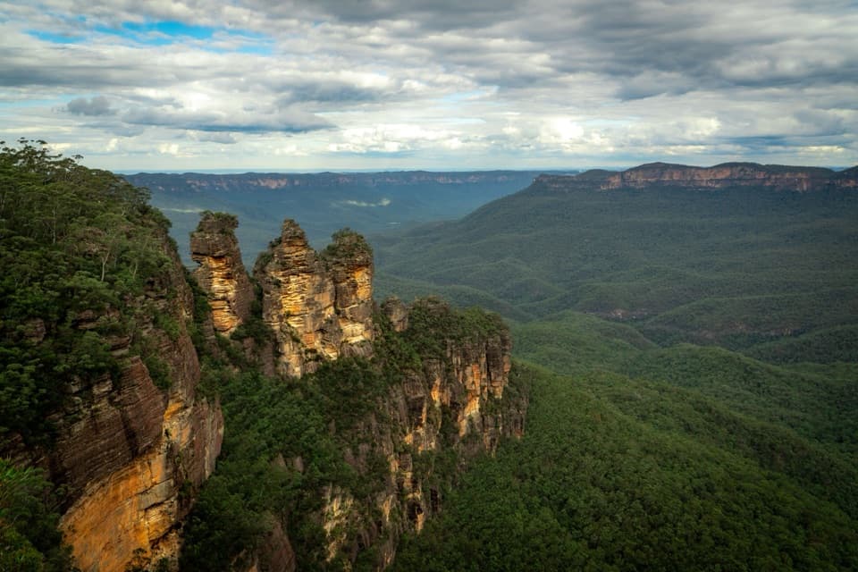 Sight · 1 km awayEcho Point Lookout (Three Sisters)A wide panorama to the Three Sisters, Mount Solitary and Ruined Castle.
 Sight · 1.1 km awayNarrow Neck LookoutA quick stop for the Jamison and Megalong valleys.
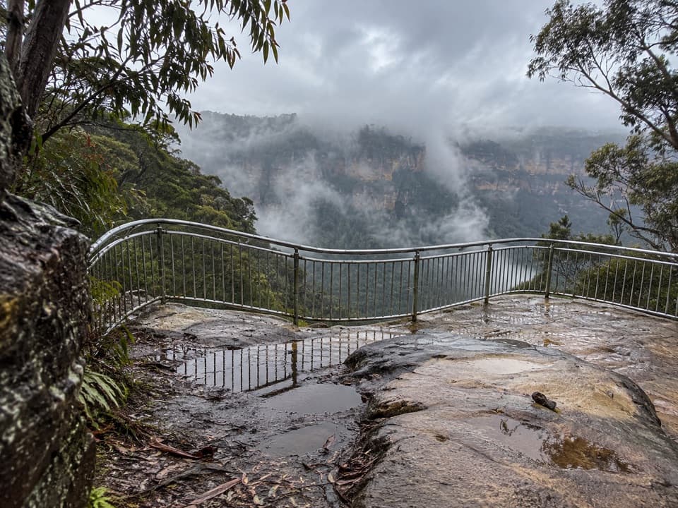 Sight · 1.2 km awayTallawalla lookoutA shaded pause on the walk for Leura and Sublime Point cliffs.
Parkwolf’s Blue Mountains ranking
The audio tour guide for the drive, plus offline maps, trails, and wildlife heatmaps for when the signal drops.



