Upheaval Canyon Trail in Canyonlands National Park

Canyonlands National Park, UT

Upheaval Canyon Trail

Seven miles round trip along a remote, sandy canyon wash.

Length
7mi
Time
3.5hr
Elev. change
263ft
Difficulty
Challenging
  • No dogs
  • High point 4,211 ft
Parkwolf audio tour43 stories across Canyonlands’s roads

Overview

About Upheaval Canyon Trail

Why go

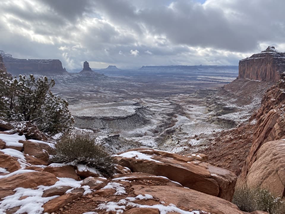
  • A distinct route along Upheaval Canyon’s sandy wash bottom.

Heads up

  • Remote White Rim Road access requires planning and a permit for vehicle or bicycle trips.
  • There is no potable water along hiking trails.

Map & elevation

The route

Loading the Canyonlands map
Full map
Elevation3,948–4,211 ft
TrailheadUpheaval Canyon Trail at White Rim Road38.46814, -109.99880
Keep this map with you offline in the Parkwolf app

Plan your hike

Before you go

Parking

Start at the Upheaval Canyon Trail junction with White Rim Road. The NPS map does not identify a named parking lot at this exact access. A day-use permit is required for single-day vehicle or bicycle trips on the road; driving requires a high-clearance 4WD vehicle with low range.

Safety

The trail follows a primitive wash with no potable water. Do not enter a canyon during storms or cross a flooding wash. White Rim Road access requires a permit for single-day vehicle or bicycle trips, and vehicles need high clearance and four-wheel drive with low range; check road conditions before traveling. Pets are prohibited on hiking trails, even when carried.

2 active Canyonlands alerts

  • ClosureRain-damaged Needles backcountry roads impassableRecent rains have made several Needles backcountry roads impassable; do not drive these routes.Official details
  • CautionMaze access roads require high-clearance 4WDOnly use high-clearance 4WD to reach Hans Flat or Horseshoe Canyon in The Maze; low-clearance vehicles are not recommended on these damaged, rutted, muddy routes.Official details
Canyonlands alerts
A park ranger sits on a dash-mounted phone, talking, as Parkwolf’s Tour Guide plays “Army Cutworm Moths: A Grizzly Bear Buffet” on Grand Loop Road below Dunraven Pass in Yellowstone
Parkwolf Tour GuideThe highest, rockiest slopes around here are a summer buffet for grizzly bears.

Canyonlands Tour Guide

Your drive to Upheaval Canyon Trail, narrated.

Parkwolf is a GPS audio tour guide for Canyonlands National Park. As you drive, it chimes in with what’s ahead: hidden gems, upcoming stops, history, geology, and wildlife, right through your car’s speakers.

See the Canyonlands audio tour

More stories near here in the app

  • Upheaval Dome
  • Whale Rock
  • Alcove Spring and Moses and Zeus
  • 43 audio storiesacross Canyonlands’s roads, triggered by GPS as you drive
  • Wildlife heatmapsfor Bighorn Sheep, Mule Deer, Coyote, and 13 more
  • Works offlinemaps, 63 trails, 65 places, and audio download before you lose signal
  • CarPlay readysimple controls built for the drive
★★★★★
“Fantastic app with many points of information… It’s great to just turn on while you’re driving and it gives you an audio tour of the national Park. We love it!!!!”
JMJamesApp Store review
Download Parkwolf on the App StoreGet Parkwolf on Google Play

4.7 from 8,600+ ratings

Trail guide

Hiking Upheaval Canyon Trail

A canyon-bottom out-and-backUpheaval Canyon Trail is a 7-mile round-trip out-and-back, taking about 3 to 4 hours.

Upheaval Canyon Trail is a 7-mile round-trip out-and-back, taking about 3 to 4 hours. It follows a sandy wash between White Rim Road and the Syncline connection, then returns the same way. This is the canyon spur, separate from the 8.1-mile Syncline Loop and the 3-mile Upheaval Crater spur.

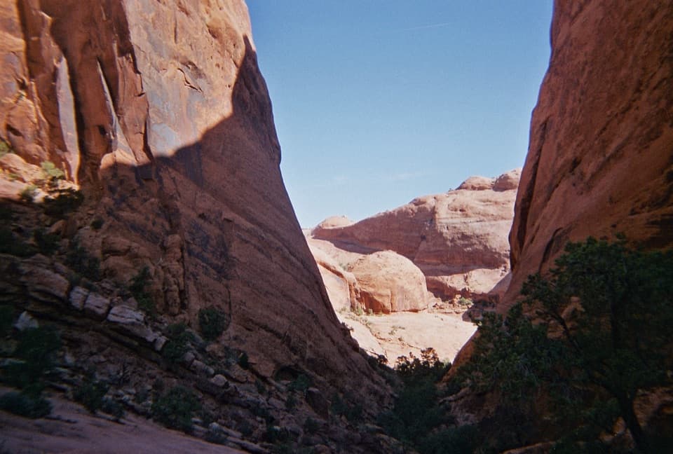
What the walk is likeThe route follows the wash bottom over primitive backcountry ground.

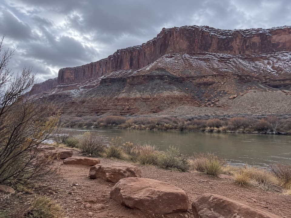
The route follows the wash bottom over primitive backcountry ground. Expect sandy footing and about 400 feet of one-way elevation change. The wash is the travel corridor, so carry a topographic map and stick to the established route rather than improvising a shortcut. The drainage can flood; stay out of canyons during storms and never cross a flooding wash.

The nearby geological puzzleUpheaval Dome is a roughly three-mile-wide area of disrupted rock, with a central uplift and…

Upheaval Dome is a roughly three-mile-wide area of disrupted rock, with a central uplift and surrounding downwarp. Its origin is still debated. Newer research supports an impact about 60 million years ago, while a salt-dome theory attributes the deformation to ancient salt rising through the rock and later erosion. This canyon spur is distinct from the dome’s overlook walks and crater-floor route.

The access is part of the hikeThe trail begins at White Rim Road, a remote backcountry road.

The trail begins at White Rim Road, a remote backcountry road. Vehicles need high clearance and four-wheel drive with low range; a day-use permit is required for single-day vehicle or bicycle trips. There is no potable water along hiking trails, so bring enough for the full walk. Pets are not allowed on park trails, even if carried. Check road conditions before setting out.

Wildlife

Wildlife in Canyonlands

All Canyonlands wildlife maps

Sighting maps show where each species has been reported across Canyonlands. Wildlife moves, so no sighting is guaranteed.

Keep exploring

Near Upheaval Canyon Trail

See it all on the map

Trails that start nearby

Places near the trailhead

Parkwolf’s Canyonlands ranking

Top-rated trails in Canyonlands

All 63 trails
  1. 1Mesa Arch TrailEasy · 0.6 mi
  2. 2Chesler Park Loop and Joint TrailChallenging · 10.7 mi
  3. 3Druid Arch TrailChallenging · 10.8 mi
  4. 4Grand View Point TrailEasy · 1.8 mi
  5. 5Horseshoe Canyon Trail to the Great GalleryChallenging · 7 mi
  6. 6White Rim Overlook TrailEasy · 1.8 mi

Take Parkwolf to Canyonlands.

The audio tour guide for the drive, plus offline maps, trails, and wildlife heatmaps for when the signal drops.

4.7 from 8,600+ ratings

Download Parkwolf on the App StoreGet Parkwolf on Google Play