Upper Spring Canyon in Capitol Reef National Park

Capitol Reef National Park, UT

Upper Spring Canyon

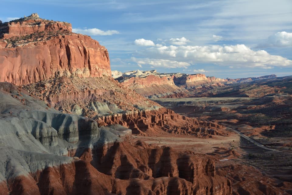
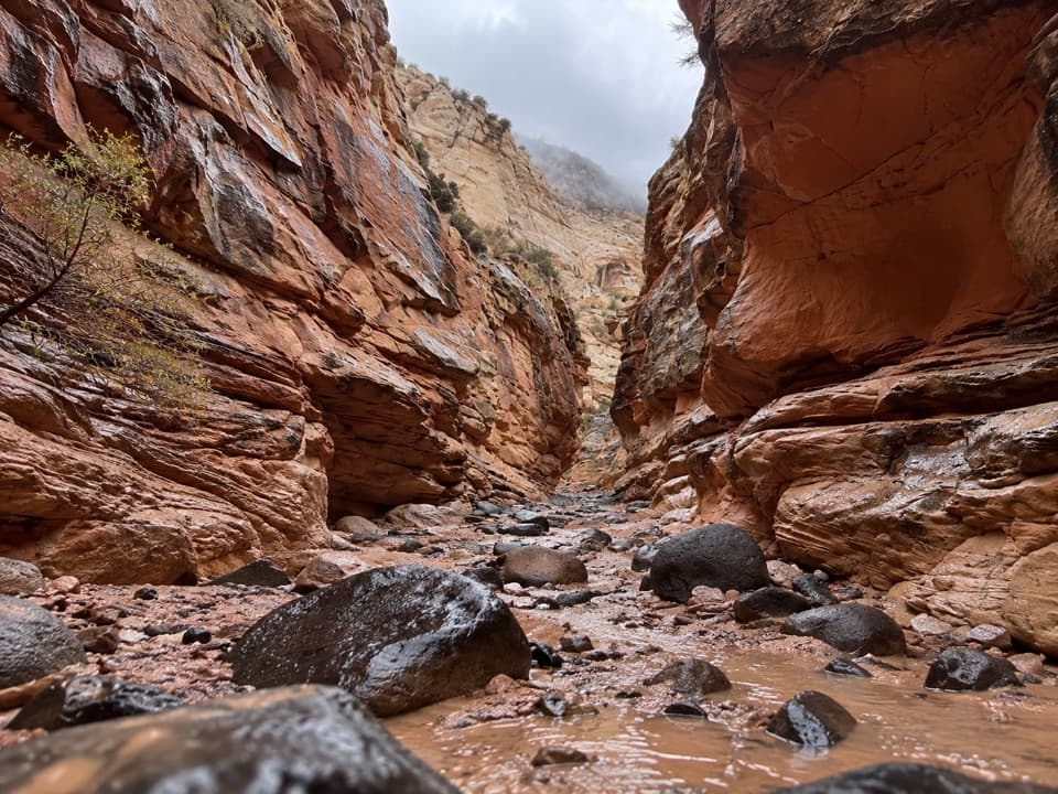
Remote traverse through Wingate narrows and a boulder filled wash.

Length
18.7mi
Time
16hr
Elev. change
1,631ft
Difficulty
Challenging
  • No dogs
  • High point 7,684 ft

Hear the audio tour

The Caterpillars’ Shared Shelter

Overview

About Upper Spring Canyon

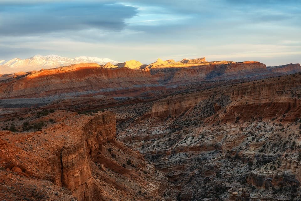
Upper Spring Canyon is an unmaintained, strenuous point-to-point traverse from Holt Draw to the Chimney Rock parking area. The one-way route is 18.7 miles; it is not a loop, and the shuttle back is separate. It crosses a steep route-finding descent through the paired Wingate clefts called the W, then follows a long boulder-and-sand wash to a cottonwood-marked spring alcove and exits through Chimney Rock Canyon. A 16-hour one-push estimate is for very fit, experienced canyon hikers; a two- to three-day backpack is another option. Arrange a shuttle: the Highway 24 return variant is 22.7 miles.

Why go

  • Towering Wingate narrows and dramatic boulder-wash scenery
  • A memorable route through the W and the cottonwood spring alcove

Heads up

  • Unmaintained route-finding at the W and exit junction
  • Long one-way traverse with scarce water and a shuttle between trailheads
  • Exposed bypass around a major pour-off

Map & elevation

The route

Loading the Capitol Reef map
Full map
Elevation6,053–7,684 ft
TrailheadHolt Draw gate38.32583, -111.37278
Keep this map with you offline in the Parkwolf app

Plan your hike

Before you go

Parking

Holt Draw gate: the access is on the north side of Highway 24, about 0.9 mile west of the park boundary. Leave the car at the Forest Service gate; vehicles cannot continue beyond it. The route finishes at the Chimney Rock trailhead parking area, roughly 3 miles west of the visitor center. This is a point-to-point hike and needs a shuttle. The Highway 24 return is a different 22.7-mile variant.

Best time to go

Spring and fall are generally the best seasons. Flash floods can rise in narrow canyons, and summer heat is extreme; avoid entering with a storm threat. Overnight trips require a free backcountry permit. Pets and fires are prohibited. Camp at least 300 feet from the spring and do not bathe or wash there.

Safety

This unmaintained, sparsely marked canyon route is for experienced hikers with reliable navigation. Flash floods can rise in narrow canyons, the roughly 50-foot pour-off bypass is exposed, summer heat is severe, and the spring is unreliable. Carry all water needed and check weather and park guidance before setting out. Overnight trips require a free backcountry permit; pets and fires are prohibited.

2 active Capitol Reef alerts

  • CautionFlash-flood hazard in canyons and washesHeavy rains can cause sudden flooding in Capitol Reef’s canyons and washes; do not hike or drive through floodwater.Official details
  • CautionE. coli advisory for Fremont River and Sulphur CreekDo not swim in the Fremont River or Sulphur Creek or get water in your mouth: NPS reports elevated E. coli in both waterways, and Utah DEQ has issued a warning advisory. - DEQ reports Sulphur Creek E.Official details
Capitol Reef alerts
A park ranger sits on a dash-mounted phone, talking, as Parkwolf’s Tour Guide plays “Army Cutworm Moths: A Grizzly Bear Buffet” on Grand Loop Road below Dunraven Pass in Yellowstone
Parkwolf Tour GuideThe highest, rockiest slopes around here are a summer buffet for grizzly bears.

Capitol Reef Tour Guide

Your drive to Upper Spring Canyon, narrated.

Parkwolf is a GPS audio tour guide for Capitol Reef National Park. As you drive, it chimes in with what’s ahead: hidden gems, upcoming stops, history, geology, and wildlife, right through your car’s speakers.

See the Capitol Reef audio tour

Recorded for this area

The Caterpillars’ Shared Shelter
0:00 / 0:30
“A silken bag in a cottonwood tree may be a tent full of caterpillars. Southwestern tent caterpillars hatch in spring and share these shelters, feeding on cottonwood leaves between rest periods.”

Plays on the road 0.6 mi from the trailhead in the Parkwolf Capitol Reef Tour Guide.

More stories near here in the app

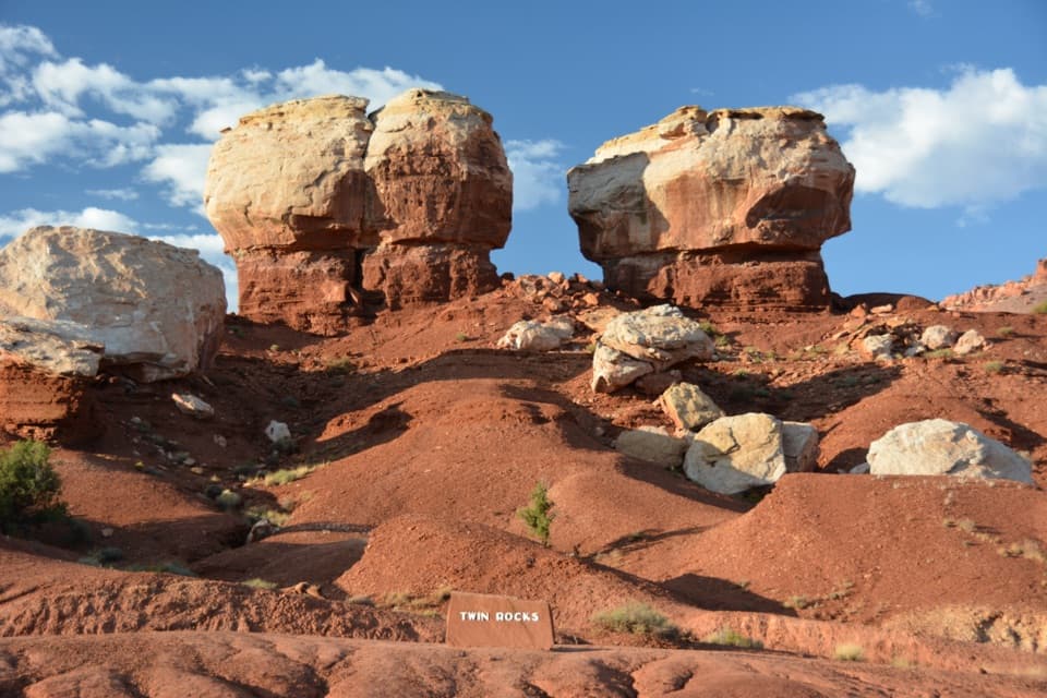
  • Twin Rocks Viewpoint
  • Upper Sulphur Creek Trailhead
  • Chimney Rock
  • Panorama Point
  • 116 audio storiesacross Capitol Reef’s roads, triggered by GPS as you drive
  • Wildlife heatmapsfor Bighorn Sheep, Mule Deer, Marmot, and 13 more
  • Works offlinemaps, 48 trails, 52 places, and audio download before you lose signal
  • CarPlay readysimple controls built for the drive
★★★★★
“Fantastic app with many points of information… It’s great to just turn on while you’re driving and it gives you an audio tour of the national Park. We love it!!!!”
JMJamesApp Store review
Download Parkwolf on the App StoreGet Parkwolf on Google Play

4.7 from 8,600+ ratings

Trail guide

Hiking Upper Spring Canyon

Find the WFrom the Holt Draw gate, follow the old road for about 1.

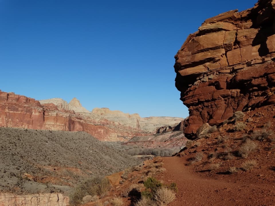
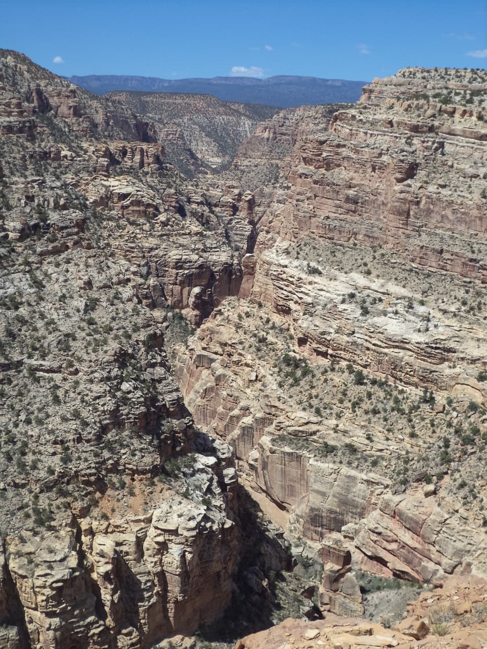
From the Holt Draw gate, follow the old road for about 1.3 miles, then continue on the horse path and up the creek bed for about 2.2 miles. Stay in the main wash. At the red Wingate wall, leave through a small northeast drainage and low rib to the gray-green bench, then traverse east around two cliff points to the W. The route uses the west cleft and its steep gully into Spring Canyon. Cairns are unofficial and may be absent, so carry a topographic map and reliable navigation; this is the main route-finding crux. The descent does not require ropes or technical climbing.

Through the canyonExpect long stretches of boulders, sand and towering red walls.

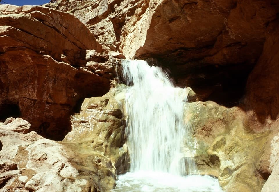
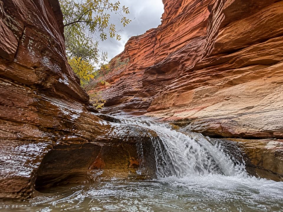
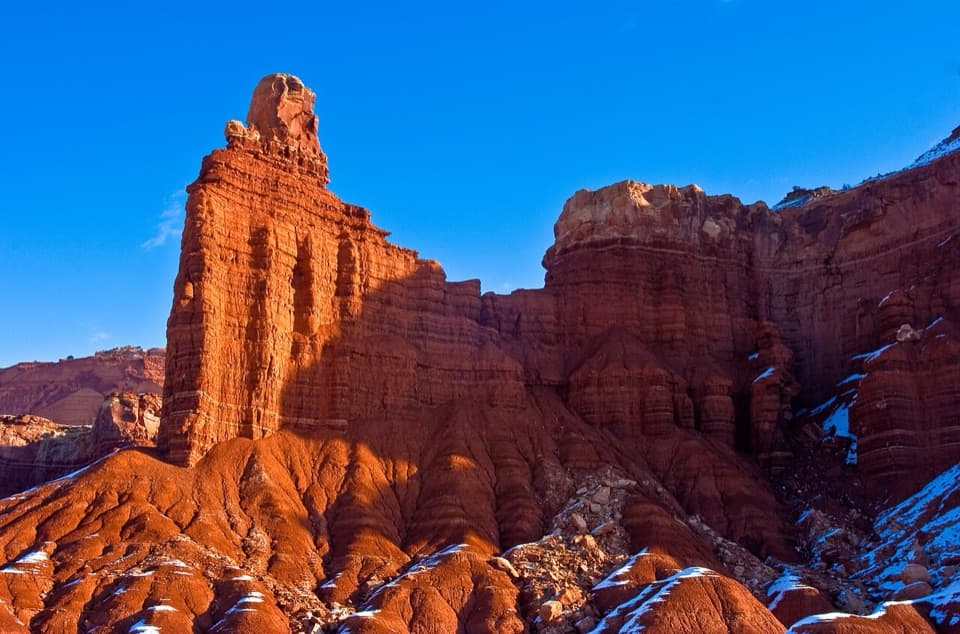
Expect long stretches of boulders, sand and towering red walls. About three-quarters of a mile below the W, a roughly 50-foot pour-off has an exposed bypass; another drop of about 8 feet is bypassed on the left. The walls expose contrasting Wingate sandstone, Chinle slopes and Shinarump bedrock. Progress is slow, with little reliable water along the way.

Spring and exitThe spring alcove, marked by large cottonwoods, is roughly 14 miles into the route, but its…

The spring alcove, marked by large cottonwoods, is roughly 14 miles into the route, but its water is seasonal and unreliable—carry what you need for the entire hike. Continue about 1.7 miles downstream to the Chimney Rock Canyon junction and turn into the canyon. Do not miss this exit: continuing downstream adds about 6.8 miles through Lower Spring Canyon. Follow Chimney Rock Canyon and its marked switchbacks to the parking area.

Wildlife

Wildlife in Capitol Reef

All Capitol Reef wildlife maps

Sighting maps show where each species has been reported across Capitol Reef. Wildlife moves, so no sighting is guaranteed.

Keep exploring

Near Upper Spring Canyon

See it all on the map

Trails that start nearby

Places near the trailhead

Parkwolf’s Capitol Reef ranking

Top-rated trails in Capitol Reef

All 48 trails
  1. 1Hickman Bridge TrailModerate · 1.8 mi
  2. 2Cassidy Arch TrailChallenging · 3.4 mi
  3. 3Grand Wash TrailEasy · 4.4 mi
  4. 4Capitol Gorge TrailEasy · 2 mi
  5. 5Navajo Knobs TrailChallenging · 9.4 mi
  6. 6Rim Overlook TrailChallenging · 4.6 mi

Take Parkwolf to Capitol Reef.

The audio tour guide for the drive, plus offline maps, trails, and wildlife heatmaps for when the signal drops.

4.7 from 8,600+ ratings

Download Parkwolf on the App StoreGet Parkwolf on Google Play