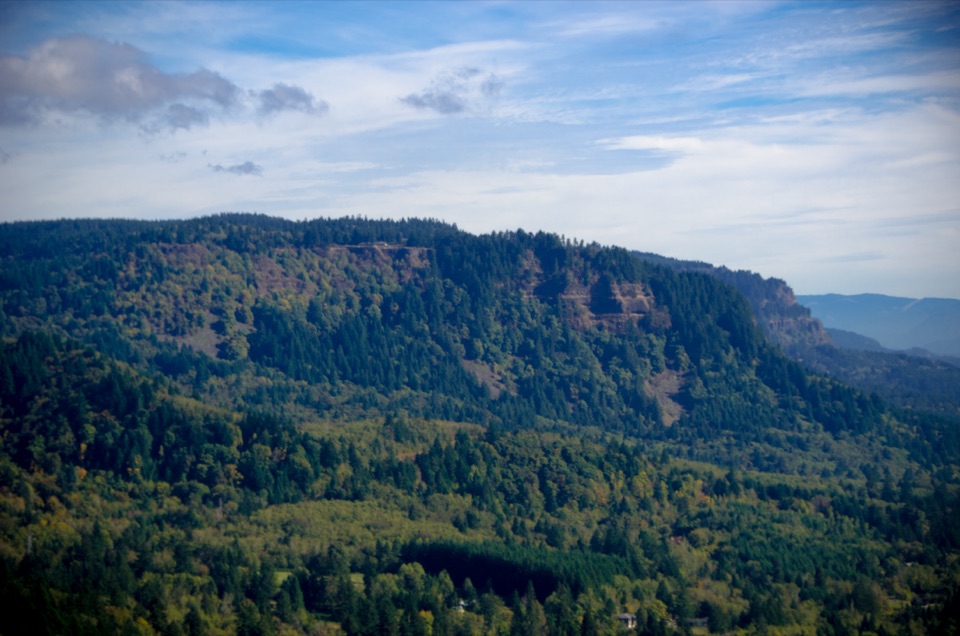
Latourell Falls Loop in Columbia River Gorge National Scenic Area

#10 of 111 trails in Columbia River Gorge

Columbia River Gorge National Scenic Area, OR · WA

Latourell Falls Loop

Follow Latourell Creek to two waterfalls and a hidden upper drop.

Photo: Wikimedia Commons
Length
2mi
Time
1.5hr
Elev. change
480ft
Difficulty
Moderate
  • Loop
  • Dogs allowed
  • High point 573 ft

Hear the audio tour

Latourell Falls

Overview

About Latourell Falls Loop

Why go

  • Two distinct waterfalls in one compact loop
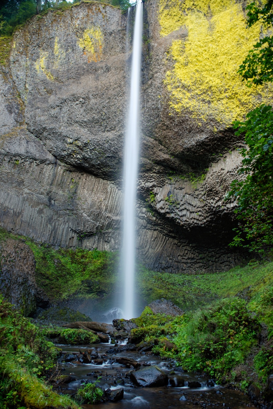
  • Chartreuse lichen brightens the basalt beside Lower Falls

Heads up

  • A moderate rocky climb to Upper Falls
  • A brief Historic Highway shoulder or crossing on the return

Map & elevation

The route

Loading the Columbia River Gorge map
Full map
Elevation92–573 ft
TrailheadLatourell Falls Trailhead45.53881, -122.21789
Keep this map with you offline in the Parkwolf app

Plan your hike

Before you go

Parking

Use the Latourell Falls Trailhead lot on the Historic Columbia River Highway. A day-use parking permit is required and sold on site. If that lot is full, use the lower Guy W. Talbot State Park parking near the carriage house and walk back to the trailhead; restrooms are available at the trailhead and lower picnic area.

Safety

Expect rocky, uneven tread and several small bridges. The return reaches the Historic Columbia River Highway; use care at the roadside shoulder and crossing.

8 active Columbia River Gorge alerts

  • ClosureEagle Creek Fire area closureDo not enter Oneonta Gorge or the specified trail sections because hazards remain following the Eagle Creek Fire.Official details
  • CautionAircraft and drone restrictions at developed recreation sitesAircraft and drone landings, drop-offs, and pickups are prohibited at six high-use developed recreation sites to protect visitor safety.Official details
See all 8 alerts
A park ranger sits on a dash-mounted phone, talking, as Parkwolf’s Tour Guide plays “Army Cutworm Moths: A Grizzly Bear Buffet” on Grand Loop Road below Dunraven Pass in Yellowstone
Parkwolf Tour GuideThe highest, rockiest slopes around here are a summer buffet for grizzly bears.

Columbia River Gorge Tour Guide

Your drive to Latourell Falls Loop, narrated.

Parkwolf is a GPS audio tour guide for Columbia River Gorge National Scenic Area. As you drive, it chimes in with what’s ahead: hidden gems, upcoming stops, history, geology, and wildlife, right through your car’s speakers.

Recorded for this trailhead

Latourell Falls
0:00 / 0:33
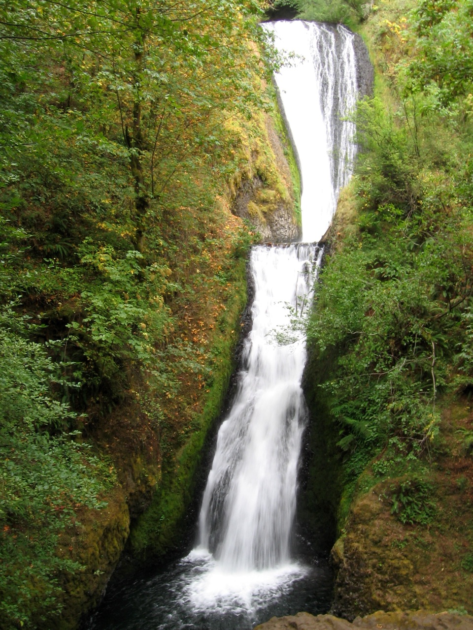
“Up ahead is Latourell Falls, where a long white plunge drops past a dark basalt wall striped with bright green lichen.”

Plays as you drive up to this trailhead in the Parkwolf Columbia River Gorge Tour Guide.

More stories near here in the app

  • Two Gifts, Two Waterfalls
  • The Rock Behind Latourell
  • A Garden Above Your Head
  • Rooster Rock State Park
  • 217 audio storiesacross Columbia River Gorge’s roads, triggered by GPS as you drive
  • Wildlife heatmapsfor Bald Eagle, Black Bear, American Pika, and 13 more
  • Works offlinemaps, 111 trails, 78 places, and audio download before you lose signal
  • CarPlay readysimple controls built for the drive
★★★★★
“Fantastic app with many points of information… It’s great to just turn on while you’re driving and it gives you an audio tour of the national Park. We love it!!!!”
JMJamesApp Store review
Download Parkwolf on the App StoreGet Parkwolf on Google Play

4.7 from 8,600+ ratings

Trail guide

Hiking Latourell Falls Loop

Two waterfalls in one loopLatourell Falls Loop is a 2-mile loop from the east-side trailhead, following Latourell Creek…

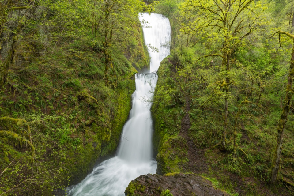
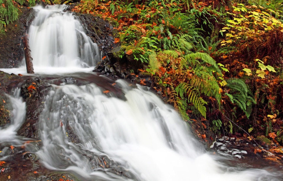
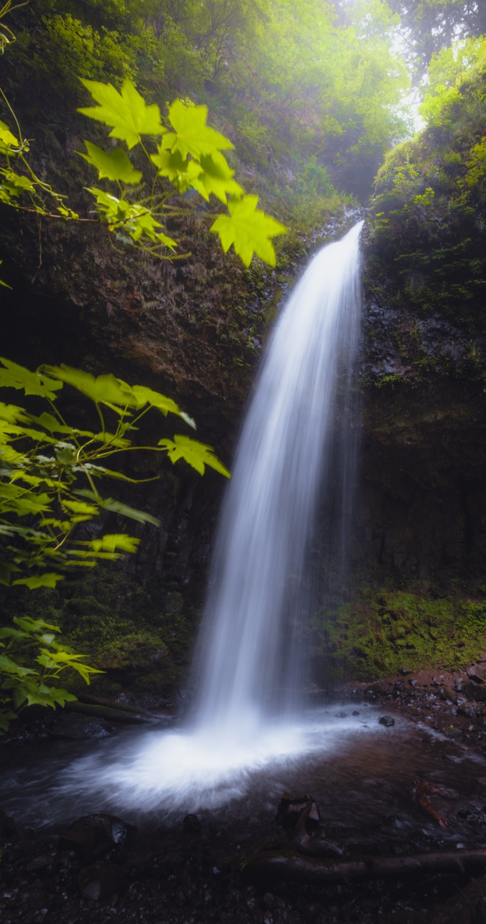
Latourell Falls Loop is a 2-mile loop from the east-side trailhead, following Latourell Creek to Upper Latourell Falls and returning along the opposite bank. It brings you close to two very different drops: Lower Latourell Falls is a sheer plunge over columnar basalt, while the upper waterfall breaks into a partly hidden top tier and a lower fall that spills into a pool. Chartreuse lichen brightens the dark rock around the lower cascade. The standard route also crosses small wooden bridges and keeps the creek in view through much of the canyon. A few published descriptions give longer distances because they continue through the lower picnic area and under the old highway bridge; those added paths are outside this two-mile loop.

A short hike with a real climbAllow about 1½ to 2 hours if you stop at both waterfalls.

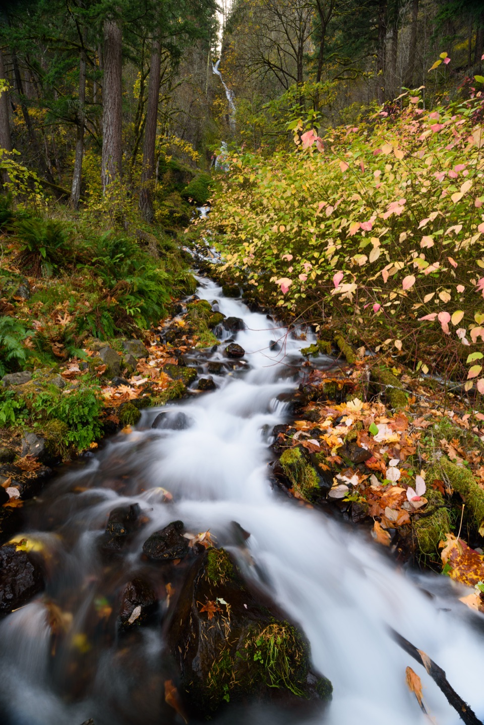
Allow about 1½ to 2 hours if you stop at both waterfalls. The path climbs soon after leaving the trailhead and is moderately difficult, with rocky patches, uneven ground and several small bridges rather than a smooth paved stroll. Early on, the trail gives you a quick look back toward Lower Falls; farther up, it narrows into a shaded creek canyon beneath large cedars and firs. A succession of bends and switchbacks carries you toward Upper Falls. The last approach crosses the creek beside the waterfall, where the upper block drop is partly hidden behind rock before the lower tier falls into its pool. The waterfall spray reaches the bridge, so pause there for the close view, then cross and follow the return trail on the far bank.

Follow the return carefullyThe west-bank path climbs a little more, passes a spur with another look toward Lower Falls,…

The west-bank path climbs a little more, passes a spur with another look toward Lower Falls, then meanders before turning downhill to the Historic Columbia River Highway. That wandering section can feel as though it has lost the way; keep following the marked trail rather than turning back at the first bend. The route comes close to the highway on its return, so watch for traffic at the roadside shoulder and crossing. For a photo, the early lower-falls viewpoint puts the long plunge and its vivid lichen-streaked basalt in one frame. At Upper Falls, the footbridge gives a tighter composition with the hidden upper lip, falling water and creek pool. The full loop is rougher than the separate accessible walk to Lower Falls; that shorter option is about a mile round trip and stays by the historic bridge.

Parking and simple add-onsStart at the Latourell Falls Trailhead lot on the Historic Columbia River Highway.

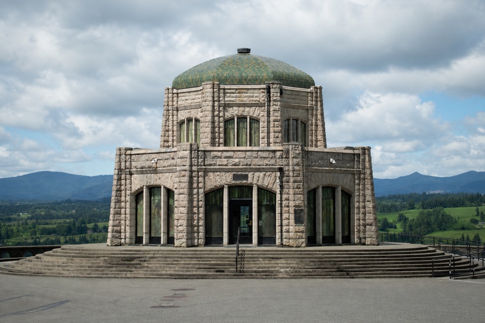
Start at the Latourell Falls Trailhead lot on the Historic Columbia River Highway. Oregon State Parks currently requires a day-use parking permit there, sold on site; that is a parking requirement, not a hiking reservation. If the highway-side lot is full, the lower Guy W. Talbot State Park parking near the carriage house is the documented overflow option. Restrooms are available at the trailhead and lower picnic area, which also has a covered shelter. Dogs may join on leash. There is no food stop on the route; Vista House, about 2.4 miles west along the Historic Highway, is a separate stop with an espresso stand, interpretive displays and a gift shop. If you only want an easy look at Lower Falls, use its paved approach beneath the 1914 bridge instead of committing to the creekside loop.

Wildlife

Wildlife in Columbia River Gorge

All Columbia River Gorge wildlife maps

Sighting maps show where each species has been reported across Columbia River Gorge. Wildlife moves, so no sighting is guaranteed.

Keep exploring

Near Latourell Falls Loop

See it all on the map

Trails that start nearby

Places near the trailhead

Parkwolf’s Columbia River Gorge ranking

Top-rated trails in Columbia River Gorge

All 111 trails
  1. 1Eagle Creek Trail #440 to Tunnel FallsChallenging · 11.7 mi
  2. 2Multnomah Falls Trail to the TopModerate · 2.4 mi
  3. 3Multnomah–Wahkeena Falls LoopChallenging · 4.8 mi
  4. 4Dog Mountain LoopChallenging · 6.9 mi
  5. 5Angel's Rest TrailModerate · 4.8 mi
  6. 6Cape Horn Loop TrailChallenging · 6.5 mi

Take Parkwolf to Columbia River Gorge.

The audio tour guide for the drive, plus offline maps, trails, and wildlife heatmaps for when the signal drops.

4.7 from 8,600+ ratings

Download Parkwolf on the App StoreGet Parkwolf on Google Play