Parking
Use the Cleetwood Cove Trailhead on East Rim Drive, then take a boat to Wizard Island dock; this hike has no road access. The separate Cleetwood Cove Trail drops 700 feet in 1.1 miles to the lake and must be climbed again on the return.
Crater Lake National Park, OR
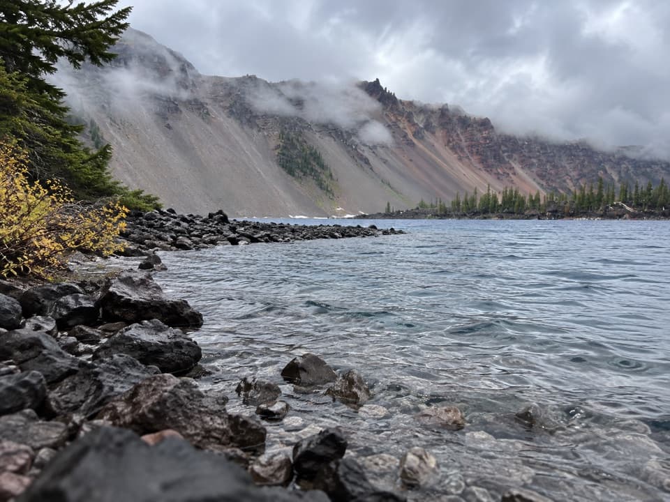
A rocky Wizard Island shore walk to a clear, shallow bay.
Overview
Map & elevation
Plan your hike

The highest, rockiest slopes around here are a summer buffet for grizzly bears.
Crater Lake Tour Guide
Parkwolf is a GPS audio tour guide for Crater Lake National Park. As you drive, it chimes in with what’s ahead: hidden gems, upcoming stops, history, geology, and wildlife, right through your car’s speakers.
See the Crater Lake audio tourRecorded for this trailhead
Cleetwood Cove Trailhead“You're coming up on Cleetwood Cove Trailhead, the start of the only legal walking route down to the lake when the trail is open.”
Plays as you drive up to this trailhead in the Parkwolf Crater Lake Tour Guide.
More stories near here in the app
“Fantastic app with many points of information… It’s great to just turn on while you’re driving and it gives you an audio tour of the national Park. We love it!!!!”


Trail guide
Fumarole Bay Trail is a 1.5-mile out-and-back along Wizard Island’s rough volcanic shore, from the boat dock to a clear, shallow bay and back. It’s an easy, roughly one-hour walk by distance and climb, but the lava rock makes footing uneven. Think of it as the shoreline option alongside the island’s summit trail, not a stand-alone drive-up hike: boat access and the steep trip down to and back up from the lake make the island visit a day outing.
From the dock, climb two short switchbacks to the junction shared with the summit route. Keep left toward Fumarole Bay; at the next fork, stay left again. The first swimming platform is about 0.4 mile beyond the summit junction. The maintained trail continues west around the bay to more shoreline spots, then ends on the north side where the tread becomes hard to follow. Turn around there instead of pushing into the rough, undeveloped volcanic ground beyond the trail.
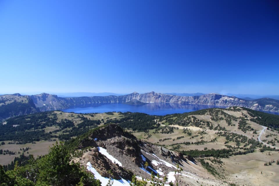
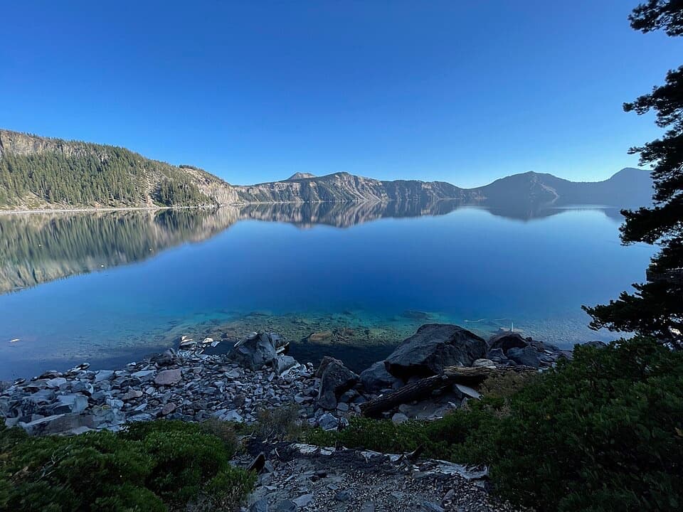
The bay is shallow and clear, with a low lava spit along the shore and the west caldera wall rising behind it. Watchman Peak is visible on the rim above. If you want more room by the water, continue beyond the first platform to the farther shoreline before turning back; swimming and fishing are part of the draw here.
Wizard Island grew from eruptions inside Mount Mazama’s caldera after the big collapse. As the lake filled, only this cone rose above the waterline; most of the island is still hidden below it. The last known eruption at Crater Lake was an underwater lava dome on the east flank of Wizard Island about 4,800 years ago. That’s a reminder that the black, broken shoreline is part of a volcanic island, not a sandy lake beach.
Take the concessioner boat from Cleetwood Cove to Wizard Island dock; there’s no road route to this trail. The island walk takes about an hour, but the boat schedule and the 1.1-mile Cleetwood Cove descent to the lake—and steep climb back to Rim Drive—shape the whole outing. Check that boat service is running before planning around the trail. Pets aren’t allowed on this trail or on the required Cleetwood Cove access.
Wildlife
 16 sightingsBlack BearMost seen around 8 PMSighting map
 178 sightingsMule DeerMost seen around 7 PMSighting map
 26 sightingsCommon RavenMost seen around 9 AMSighting map
 33 sightingsTurkey VultureMost seen around 1 PMSighting map
 47 sightingsRed-tailed HawkMost seen around 11 AMSighting map
 71 sightingsCascades FrogMost seen around 5 PMSighting map
Sighting maps show where each species has been reported across Crater Lake. Wildlife moves, so no sighting is guaranteed.
Keep exploring
 ModerateWizard Island Summit Trail2.4 mi · 1.5 hr · At the trailheadA steep volcanic climb to a crater above the lake.
 ChallengingSmall PCT Loop24.8 mi · 12 hr · 1 mi awayRim views and remote PCT miles make this a real loop.
 ModerateLightning Spring Trail8.4 mi · 4.5 hr · 1 mi awayA spring breaks up the long descent from the rim.
 ChallengingRim Trail16.2 mi · 9.5 hr · 1.1 mi awayWizard Island shifts position as you follow the western rim.
 ModerateWatchman Peak Trail1.6 mi · 1 hr · 1.2 mi awayA short climb to a 1930s lookout above Wizard Island
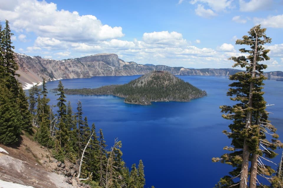 EasyDiscovery Point Trail2 mi · 1 hr · 1.6 mi awayWizard Island keeps appearing through the wind-shaped rim forest.
 ModerateDutton/Lightning Loop12.9 mi · 7 hr · 1.6 mi awayA long forest loop earns its lake view at the west rim.
 ModerateDutton Creek Trail4.6 mi · 3 hr · 1.6 mi awayA steep forest descent to Dutton Creek and the Pacific Crest Trail.
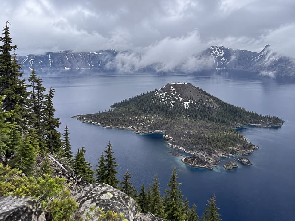 Sight · 0.4 mi awayWizard IslandA cinder cone with a crater, rising from the caldera lake.Picnic area · 1 mi awayLightning Spring Picnic AreaWalk up from the picnic area for a Wizard Island view.Sight · 1.1 mi awayDiscovery PointA lake view with Wizard Island and the Lost Cabin story.
 Sight · 1.2 mi awayWatchman OverlookA direct Wizard Island view without the summit climb.
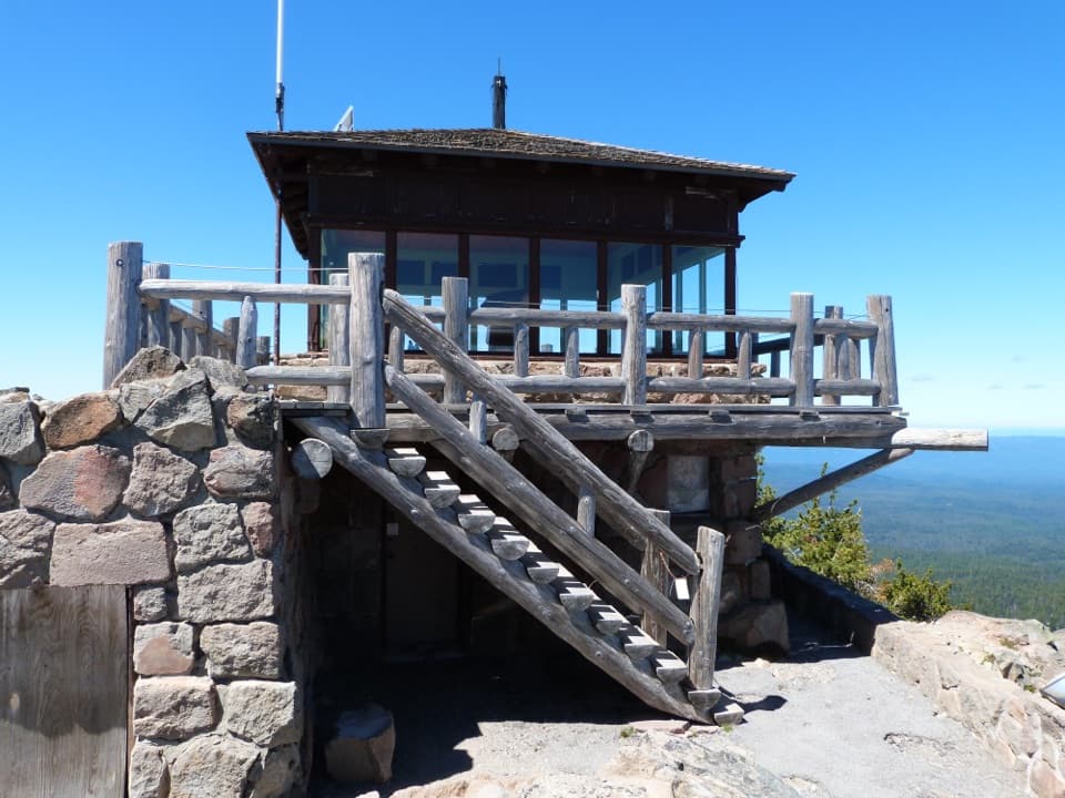 Sight · 1.3 mi awayWatchman Observation StationA steep summit climb with a 360-degree caldera panorama.
 Sight · 1.6 mi awaySinnott Memorial OverlookA stone shelter frames the lake and explains the caldera.
 Food · 1.6 mi awayRim Village Café & GiftsA quick bite, lake-view patio, and souvenirs in one stop.
 Visitor center · 1.6 mi awayRim Visitor CenterStart here for ranger help, passport stamps, and a rim-side stroll.
Parkwolf’s Crater Lake ranking

The audio tour guide for the drive, plus offline maps, trails, and wildlife heatmaps for when the signal drops.