Canal Exploration Center to Tinkers Creek Aqueduct Walk in Cuyahoga Valley National Park

Cuyahoga Valley National Park, OH

Canal Exploration Center to Tinkers Creek Aqueduct Walk

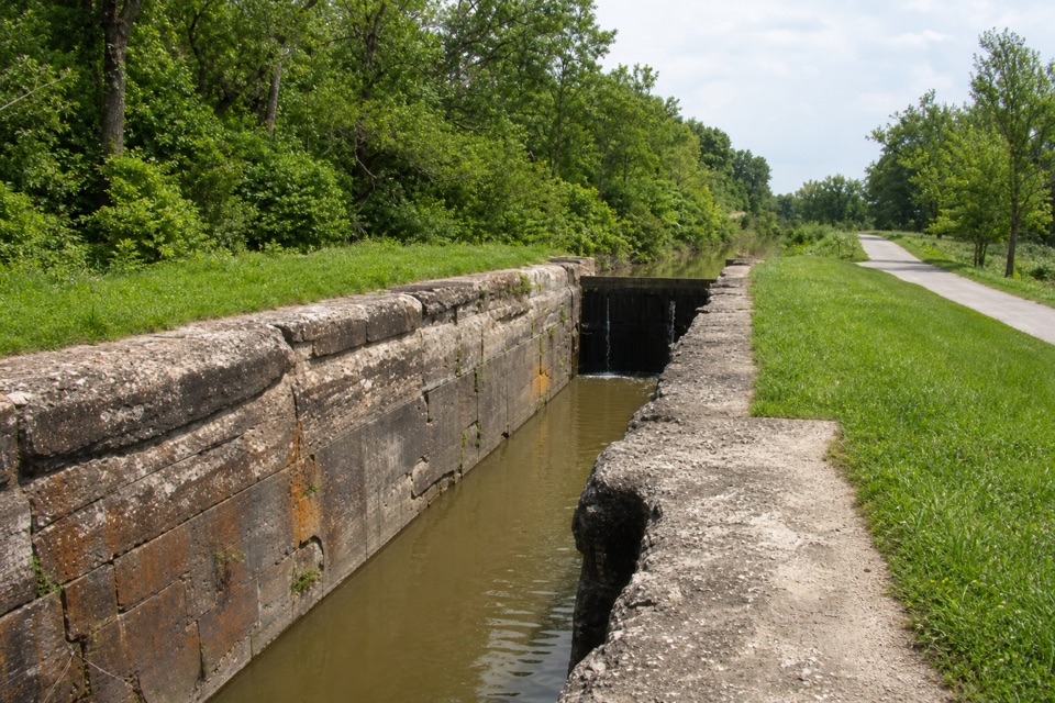
A short canal walk past Lock 38 to Tinkers Creek Aqueduct.

Photo: Wikimedia Commons
Length
1.3mi
Time
45min
Elevation
Flat
Difficulty
Easy
  • Dogs allowed
  • High point 630 ft

Hear the audio tour

Canal Exploration Center

Overview

About Canal Exploration Center to Tinkers Creek Aqueduct Walk

Why go

  • Lock 38, Blossom and the aqueduct pack canal history into an easy short walk.

Heads up

  • You retrace the Towpath, and the mapped route is longer than the published one-mile estimate.

Map & elevation

The route

Loading the Cuyahoga Valley map
Full map
Elevation607–630 ft
TrailheadCanal Exploration Center41.37262, -81.61302
Keep this map with you offline in the Parkwolf app

Plan your hike

Before you go

Parking

Park at Canal Exploration Center, 7104 Canal Road, Valley View, Ohio 44125. Start at the walkway and kiosk, then follow the Towpath south. Picnic tables and restrooms are at the trailhead; the restrooms remain open when the seasonal visitor center is closed.

Safety

The Towpath is shared with cyclists. Snow and ice are not cleared, and heavy rain can leave sections muddy or flooded; wheelchair access may be limited in those conditions. Dogs must stay on a leash six feet long or shorter.

3 active Cuyahoga Valley alerts

  • ClosureTowpath Trail improvement closureThe Ohio & Erie Canal Towpath Trail from Boston Trailhead to Lock 29 in Peninsula is closed for improvements during the August 24–November 20, 2026 closure period.Official details
  • CautionCuyahoga River paddling closure and hazardsPaddlers must portage the current river-wide closure near river mile 17 and avoid serious river hazards. - The closure is due to bridge demolition and construction.Official details
See all 3 alerts
A park ranger sits on a dash-mounted phone, talking, as Parkwolf’s Tour Guide plays “Army Cutworm Moths: A Grizzly Bear Buffet” on Grand Loop Road below Dunraven Pass in Yellowstone
Parkwolf Tour GuideThe highest, rockiest slopes around here are a summer buffet for grizzly bears.

Cuyahoga Valley Tour Guide

Your drive to Canal Exploration Center to Tinkers Creek Aqueduct Walk, narrated.

Parkwolf is a GPS audio tour guide for Cuyahoga Valley National Park. As you drive, it chimes in with what’s ahead: hidden gems, upcoming stops, history, geology, and wildlife, right through your car’s speakers.

Recorded for this trailhead

Canal Exploration Center
0:00 / 0:36
“You're approaching Canal Exploration Center, where a former tavern and store puts you inside the canal's everyday world. Give the exhibits about half an hour if you're curious about the people who worked here.”

Plays as you drive up to this trailhead in the Parkwolf Cuyahoga Valley Tour Guide.

More stories near here in the app

  • Oxbow Orchard and Farm Market
  • A Bridge for Canal Boats
  • Alexander-Wilson Mill and Lock 37
  • How Ice Splits a Cliff
  • 97 audio storiesacross Cuyahoga Valley’s roads, triggered by GPS as you drive
  • Wildlife heatmapsfor Bald Eagle, River Otter, Coyote, and 13 more
  • Works offlinemaps, 63 trails, 88 places, and audio download before you lose signal
  • CarPlay readysimple controls built for the drive
★★★★★
“Fantastic app with many points of information… It’s great to just turn on while you’re driving and it gives you an audio tour of the national Park. We love it!!!!”
JMJamesApp Store review
Download Parkwolf on the App StoreGet Parkwolf on Google Play

4.7 from 8,600+ ratings

Trail guide

Hiking Canal Exploration Center to Tinkers Creek Aqueduct Walk

What this walk isThis is an easy out-and-back on the Ohio & Erie Canal Towpath, from Canal Exploration Center…

This is an easy out-and-back on the Ohio & Erie Canal Towpath, from Canal Exploration Center south to Tinkers Creek Aqueduct and back. The published itinerary gives 1 mile round trip; the mapped line is about 0.64 mile each way, so plan on roughly 1.3 miles total. Allow 30 to 60 minutes, including time for the exhibits and a rest at one of the benches. The trailhead has a kiosk, maps, picnic tables and restrooms; the restrooms stay open when the seasonal visitor center is closed.

The route is a good short choice if you want canal history more than a long hike. It was promoted for visitors with mobility needs, families and people short on time. The Towpath is wheelchair accessible in normal conditions, though snow, ice, mud or flooding can change that.

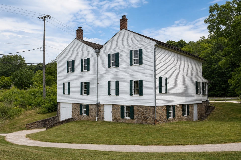
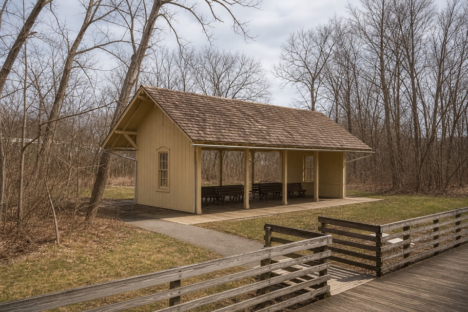
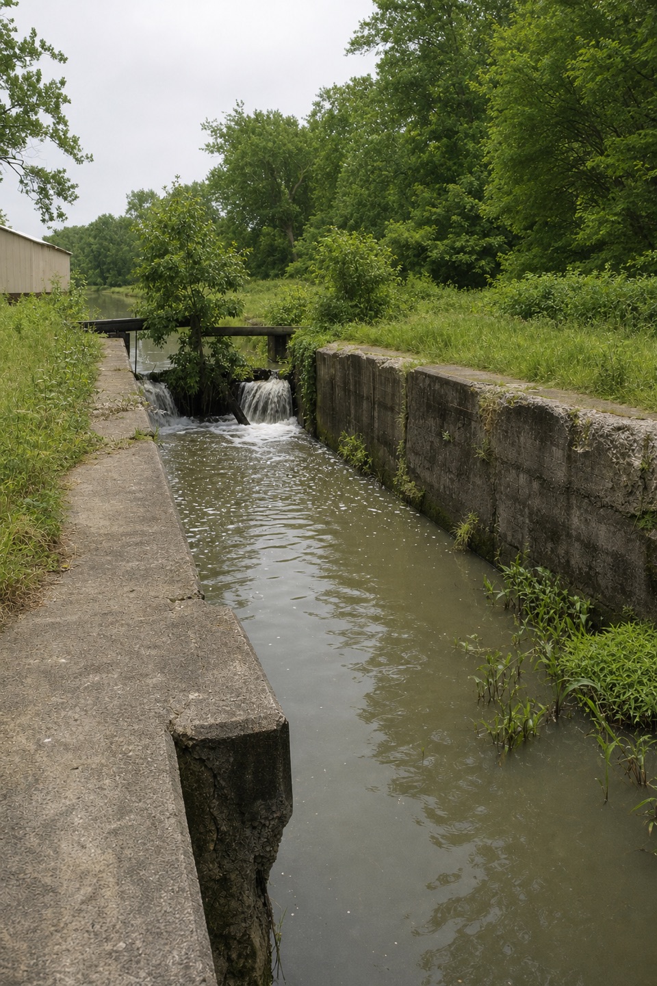
Lock 38 and canal lifeFollow the walkway to the historic white Canal Exploration Center beside reconstructed Lock 38.

Follow the walkway to the historic white Canal Exploration Center beside reconstructed Lock 38. Outdoor exhibits explain how a lock raised and lowered boats and the businesses that served people waiting along the canal. The canal opened across Ohio in 1832, linking Lake Erie at Cleveland with the Ohio River at Portsmouth. The center building has served as a tavern, general store and residence. Bronze mule Blossom recalls the animals that pulled canal boats; pause here before heading south.

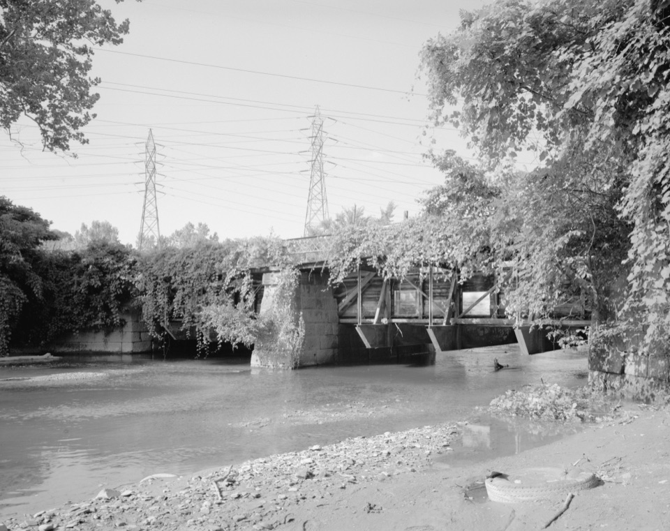
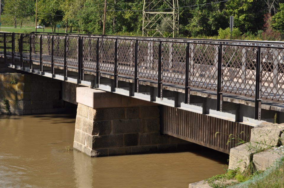
Turn around at the aqueductThe Towpath leads to Tinkers Creek Aqueduct, where the canal crosses over the creek.

The Towpath leads to Tinkers Creek Aqueduct, where the canal crosses over the creek. This is the natural turnaround for the short walk. There is a separate, longer itinerary to Wilson/Alexander Mill, with Frazee House just beyond; the aqueduct walk does not include that extension.

The Towpath is shared with cyclists, so keep an eye out as you walk. Dogs are allowed on a leash no longer than six feet. The park describes most of its Towpath as compacted crushed limestone, with some paved stretches and footbridges, but does not specify the exact surface mix here. Snow and ice are not cleared, and heavy rain can leave parts muddy or flooded.

Wildlife

Wildlife in Cuyahoga Valley

All Cuyahoga Valley wildlife maps

Sighting maps show where each species has been reported across Cuyahoga Valley. Wildlife moves, so no sighting is guaranteed.

Keep exploring

Near Canal Exploration Center to Tinkers Creek Aqueduct Walk

See it all on the map

Trails that start nearby

Places near the trailhead

Parkwolf’s Cuyahoga Valley ranking

Top-rated trails in Cuyahoga Valley

All 63 trails
  1. 1Ledges TrailModerate · 1.8 mi
  2. 2Brandywine Gorge LoopModerate · 1.4 mi
  3. 3Blue Hen Falls TrailModerate · 3 mi
  4. 4Beaver Marsh WalkEasy · 0.6 mi
  5. 5Ohio & Erie Canal Towpath TrailModerate · 19.8 mi
  6. 6Stanford TrailModerate · 3.5 mi

Take Parkwolf to Cuyahoga Valley.

The audio tour guide for the drive, plus offline maps, trails, and wildlife heatmaps for when the signal drops.

4.7 from 8,600+ ratings

Download Parkwolf on the App StoreGet Parkwolf on Google Play