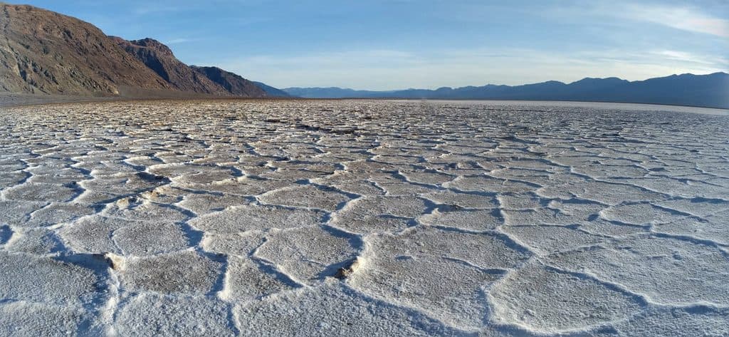
Grotto Canyon in Death Valley National Park

Death Valley National Park, CA · NV

Grotto Canyon

Unmarked desert-canyon scramble through polished narrows to a high chokestone

Length
3.4mi
Time
4.5hr
Elev. change
991ft
Difficulty
Challenging
  • No dogs
  • High point 1,467 ft

Hear the audio tour

Reading the Night's Story on the Dunes

Overview

About Grotto Canyon

Grotto Canyon is an unmarked desert-canyon route south of Stovepipe Wells, with polished narrows, dryfalls, and hands-on scrambling in the Tucki Mountain foothills. This is a route rather than a maintained trail: the mapped visitor line starts at the current 2WD trailhead on Grotto Canyon Road, follows the old road into the wash, then continues up-canyon to the third choke stone.

Why go

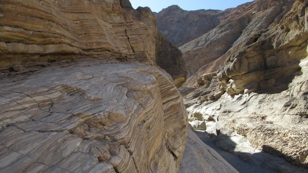
  • Polished, water-sculpted narrows and chokestones provide a memorable canyon scramble
  • A connected route from the 2WD trailhead reaches the third choke stone without inventing line across gaps

Heads up

  • Multiple dryfalls, exposed bypasses, and route-finding make this a technical high-difficulty outing
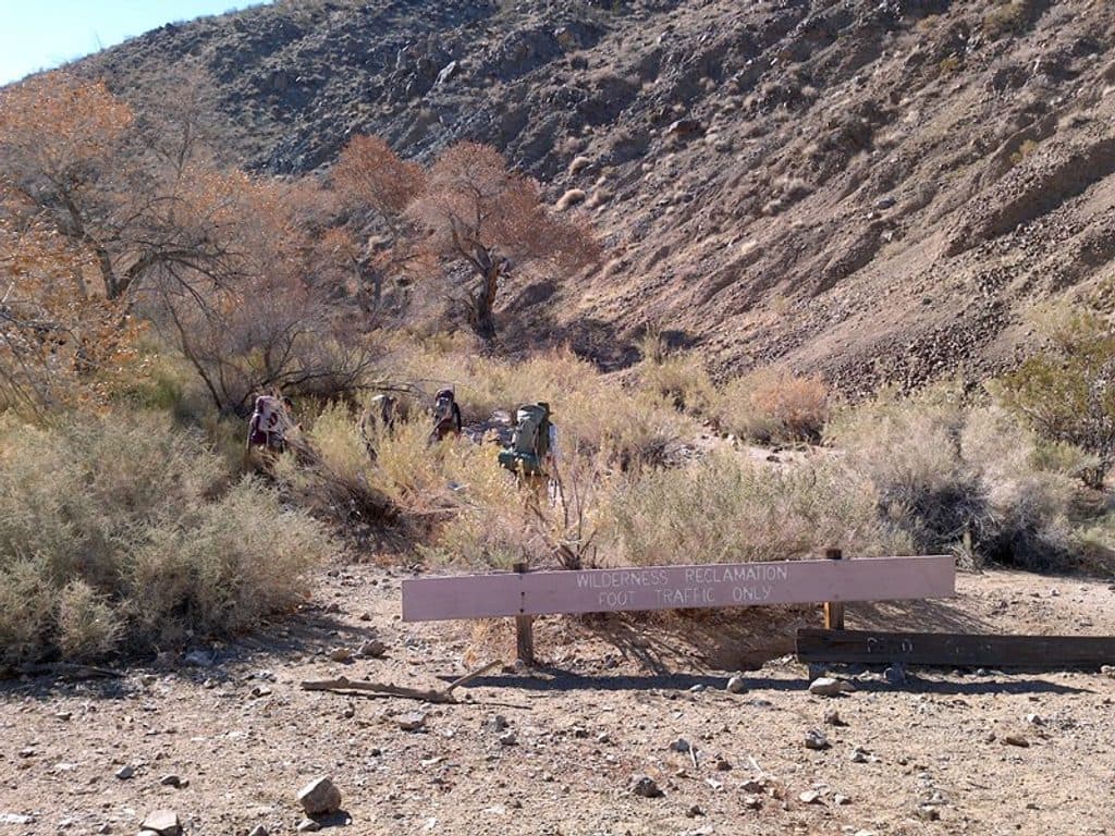
  • The vehicle approach ends at the 2WD trailhead and the canyon has no water, signs, or reliable cell service

Map & elevation

The route

Loading the Death Valley map
Full map
Elevation476–1,467 ft
TrailheadGrotto Canyon 2WD Trailhead36.59143, -117.11056
Keep this map with you offline in the Parkwolf app

Plan your hike

Before you go

Parking

From CA-190 about 2.2 miles east of Stovepipe Wells, turn onto the unsigned Grotto Canyon Road. Follow the gravel access road about 0.2 miles to the low-clearance 2WD trailhead at approximately 36.591435, -117.110564, and park there. The road into the wash beyond this point is washed out/not a dependable vehicle approach; continue on foot.

Safety

Unmaintained wilderness canyon with several dryfalls, chokestones, loose and exposed bypasses, and route-finding. Do not climb an obstacle you cannot reverse safely; rope or webbing may be useful. Carry ample water, expect no reliable cell service, and avoid the canyon during thunderstorms or possible flash flooding.

3 active Death Valley alerts

  • ClosurePark roads closed or hazardousPlan around multiple closed roads and use extra caution on damaged routes. - Paved roads: North Highway and Beatty Cut-off are closed due to flooding and debris from the October 22 storm.Official details
  • ClosureSaline Valley Lower Springs closed after wildfireLower Springs at Saline Valley Warm Springs remains closed after the September 15 wildfire; stay out because the fire left safety hazards, including potential hazardous chemicals.Official details
See all 3 alerts
A park ranger sits on a dash-mounted phone, talking, as Parkwolf’s Tour Guide plays “Army Cutworm Moths: A Grizzly Bear Buffet” on Grand Loop Road below Dunraven Pass in Yellowstone
Parkwolf Tour GuideThe highest, rockiest slopes around here are a summer buffet for grizzly bears.

Death Valley Tour Guide

Your drive to Grotto Canyon, narrated.

Parkwolf is a GPS audio tour guide for Death Valley National Park. As you drive, it chimes in with what’s ahead: hidden gems, upcoming stops, history, geology, and wildlife, right through your car’s speakers.

See the Death Valley audio tour

Recorded for this area

Reading the Night's Story on the Dunes
Listen
“The sand here is like the morning paper, telling the story of who was out last night. Most desert animals are nocturnal to beat the heat, so an early walk lets you read the news.”

Plays on the road 1.1 mi from the trailhead in the Parkwolf Death Valley Tour Guide.

More stories near here in the app

  • Stovepipe Wells Village: Desert Outpost and Dune Gateway
  • Mosaic Canyon: A Hike Through Polished Marble
  • Stovepipe Wells Campground: The Convenient Basecamp
  • Stovepipe Wells Airport: A Runway for Stargazing
  • 130 audio storiesacross Death Valley’s roads, triggered by GPS as you drive
  • Wildlife heatmapsfor Bighorn Sheep, Desert Tortoise, Coyote, and 13 more
  • Works offlinemaps, 36 trails, 114 places, and audio download before you lose signal
  • CarPlay readysimple controls built for the drive
★★★★★
“Fantastic app with many points of information… It’s great to just turn on while you’re driving and it gives you an audio tour of the national Park. We love it!!!!”
JMJamesApp Store review
Download Parkwolf on the App StoreGet Parkwolf on Google Play

4.7 from 8,600+ ratings

Trail guide

Hiking Grotto Canyon

Distance, Time, and DifficultyThe mapped corridor is about 1.72 miles one way, or approximately 3.

The mapped corridor is about 1.72 miles one way, or approximately 3.4 miles round trip from the 2WD trailhead. Allow about 4–5 hours for the round trip because the route includes route-finding, bypasses, and technical scrambling rather than ordinary trail walking. The route gains roughly 1,000 feet cumulatively. Difficulty is high (8/10): early dryfalls can require chimneying, downclimbing, or a rope, and many parties turn around before the mapped endpoint.

Route and AccessTurn onto the unsigned Grotto Canyon Road from CA-190, about 2.

Turn onto the unsigned Grotto Canyon Road from CA-190, about 2.2 miles east of Stovepipe Wells, and follow the gravel access road to the low-clearance 2WD trailhead. Park there and continue on foot; the road into the wash beyond the 2WD parking area is not a dependable vehicle approach. The route follows the wash and connected canyon paths to the third choke stone, where most hikers turn around. The line represents the out-and-back experience as one stored corridor; it is not a loop and the return is not duplicated in the geometry.

What You’ll See and DoExpect polished, water-sculpted narrows, several dryfalls, chokestones, and a changing canyon…

Expect polished, water-sculpted narrows, several dryfalls, chokestones, and a changing canyon corridor. The connected bypass section avoids the lower obstacle cluster, but it is still steep, loose, and exposed in places. The final mapped turnaround is near the third choke stone; additional upper-canyon exploration is beyond this reviewed route.

Safety and ConditionsThis is an unmaintained wilderness route with no signs, water, or reliable cell service.

This is an unmaintained wilderness route with no signs, water, or reliable cell service. Carry ample water, use a map or GPS, and do not commit to a dryfall unless you can safely reverse it. A rope or webbing may be useful for the larger obstacles. Avoid the canyon during storms or when flash flooding is possible, and respect any road or area closures.

Wildlife

Wildlife in Death Valley

All Death Valley wildlife maps

Sighting maps show where each species has been reported across Death Valley. Wildlife moves, so no sighting is guaranteed.

Keep exploring

Near Grotto Canyon

See it all on the map

Trails that start nearby

Places near the trailhead

Parkwolf’s Death Valley ranking

Top-rated trails in Death Valley

All 36 trails
  1. 1Badwater Basin Salt FlatsEasy · 1.9 mi
  2. 2Zabriskie Point Overlook TrailEasy · 0.3 mi
  3. 3Mesquite Flat Sand DunesEasy · 2 mi
  4. 4Telescope PeakChallenging · 12.5 mi
  5. 5Titus Canyon NarrowsEasy · 3 mi
  6. 6Mosaic CanyonModerate · 4 mi

Take Parkwolf to Death Valley.

The audio tour guide for the drive, plus offline maps, trails, and wildlife heatmaps for when the signal drops.

4.7 from 8,600+ ratings

Download Parkwolf on the App StoreGet Parkwolf on Google Play