1 active Glacier alert
- ClosureTwo Medicine Campground closed for 2026 constructionTwo Medicine Campground is closed throughout 2026 because of construction in the Two Medicine developed area.Official details
Sight · Glacier National Park
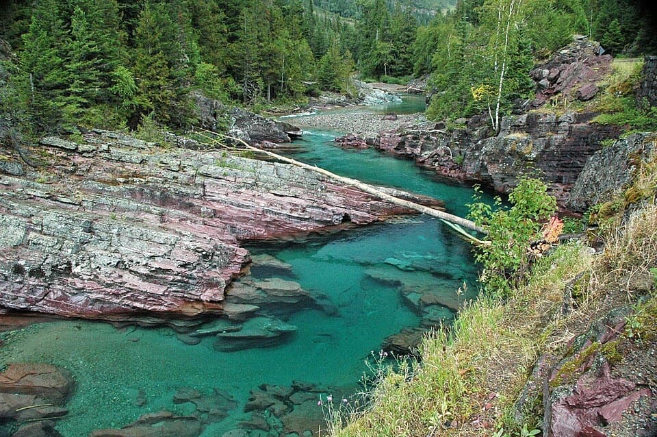
Rust-red ledges turn McDonald Creek into a roadside cascade.
Map
Plan your stop

The highest, rockiest slopes around here are a summer buffet for grizzly bears.
Glacier Tour Guide
Parkwolf is a GPS audio tour guide for Glacier National Park. As you drive, it chimes in with what’s ahead: hidden gems, upcoming stops, history, geology, and wildlife, right through your car’s speakers.
See the Glacier audio tourRecorded for this place
Red Rock Point“You’re nearing Red Rock Point, where McDonald Creek slips over red and pink ledges into blue-green pools. I’d allow about ten minutes for this viewpoint stop.”
Plays as you drive up to Red Rock Point in the Parkwolf Glacier Tour Guide.
More stories near here in the app
“Our first time to glacier and we used the audio portion for Going to the Sun Road. Wonderful information with perfect advice of what to see and do along the road.”


Guide
Red Rock Point is a roadside viewpoint over McDonald Creek, where water slips over bands of red and pink rock into blue-green pools. It’s a short stop; an itinerary allows about ten minutes. For a photo, keep the layered ledges and turquoise water together in the frame—that contrast is the whole draw.
The ledges are tilted argillite in the Grinnell Formation, part of Glacier’s ancient Belt rocks. Iron in these sediments oxidized when the old Belt Sea retreated and exposed them to oxygen, leaving the rusty red color beside the creek.
The point sits along Going-to-the-Sun Road, so access follows the road’s seasonal opening and weather conditions. Check the park’s current road status before making it a stop.
Wildlife
 404 sightingsGrizzly BearMost seen around 6 AMSighting map
 11 sightingsWolverineMost seen around 8 PMSighting map
 1,173 sightingsMountain GoatMost seen around 6 AMSighting map
 1,000 sightingsBighorn SheepMost seen around 6 AMSighting map
 395 sightingsMooseMost seen around 6 AMSighting map
 506 sightingsBlack BearMost seen around 8 PMSighting map
Sighting maps show where each species has been reported across Glacier. Wildlife moves, so no sighting is guaranteed.
Keep exploring
 EasyTrail of the Cedars0.9 mi · 36 min · 1 mi awayA cedar boardwalk with an easy look into Avalanche Gorge.
 ModerateAvalanche Lake Trail5 mi · 4.5 hr · 1.3 mi awayA half-mile of cedars before the big lake payoff.
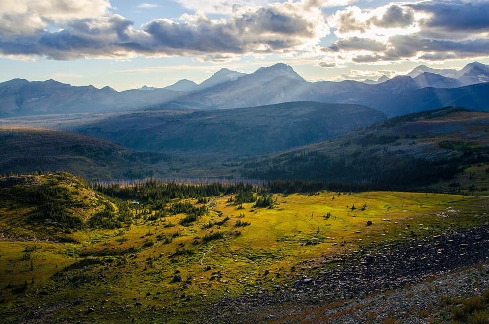 ChallengingFlattop Mountain Trail12 mi · 9 hr · 3.9 mi awayA remote 12-mile crossing from Packer's Roost to Fifty Mountain.
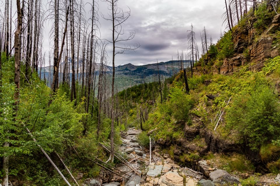 ChallengingGranite Park Trail from The Loop8.4 mi · 6 hr · 4.2 mi awayA steep climb through the 2003 burn to a historic chalet.
 ModerateHidden Lake Overlook Trail2.6 mi · 2.5 hr · 4.5 mi awayBoardwalk and switchbacks open onto a lake beneath Bearhat Mountain.
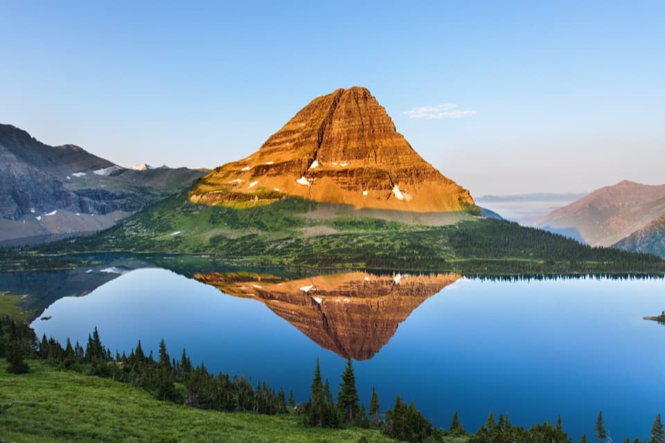 ChallengingHidden Lake Trail5.4 mi · 3.5 hr · 4.5 mi awayGo past the overlook only if you’re ready for a steep return.
 ChallengingHighline Trail11.8 mi · 8 hr · 4.5 mi awayA Garden Wall ledge walk with a long, steep finish.
 ChallengingHighline Trail to Grinnell Glacier Overlook15.1 mi · 9 hr · 4.5 mi awayA long, exposed traverse earns a knockout view over the glacier basin.
 Picnic area · 1.2 mi awayAvalanche Creek Picnic AreaA creekside lunch beneath old-growth cedar and hemlock.
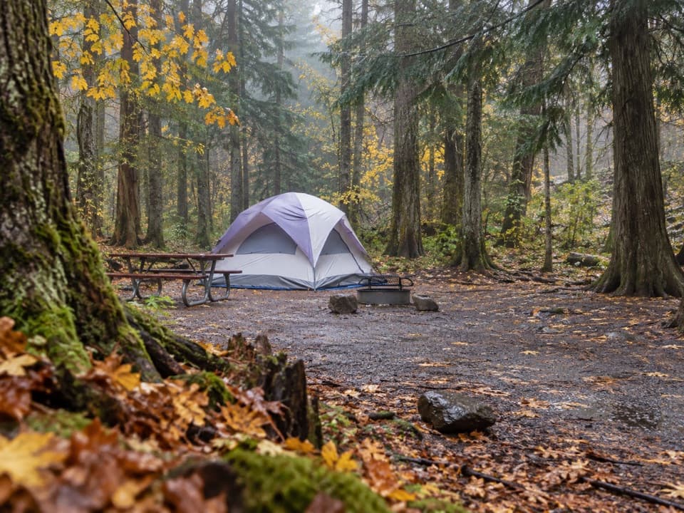 Campground · 1.2 mi awayAvalanche CampgroundA cedar-forest base for Avalanche Lake and Trail of the Cedars.
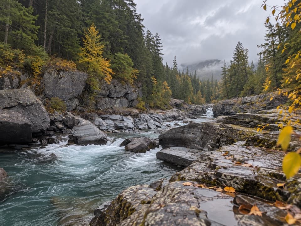 Sight · 2.9 mi awayMcDonald Creek OverlookA close look at Glacier's longest creek system.
 Sight · 3.1 mi awayAvalanche LakeThin waterfalls stripe steep walls above a clear lake.
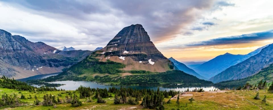 Sight · 3.5 mi awayHidden Lake OverlookAn exposed climb earns the park's classic view of Hidden Lake.
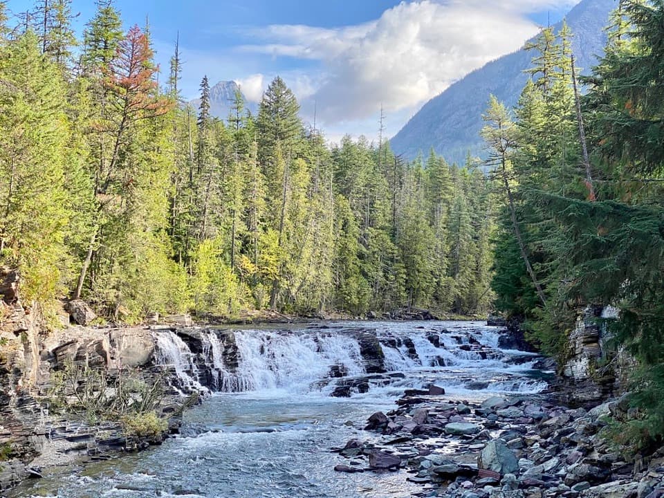 Sight · 4 mi awaySacred Dancing CascadeA quick stop for clear water spilling over layered creek rock.
 Sight · 4.1 mi awayWest TunnelTwo windows frame Heavens Peak and McDonald Creek from the road.
 Sight · 4.2 mi awayThe LoopThe Sun Road's only west-side switchback, framed by Heavens Peak.
Parkwolf’s Glacier ranking

The audio tour guide for the drive, plus offline maps, trails, and wildlife heatmaps for when the signal drops.