St. Mary Falls Trail in Glacier National Park

#14 of 157 trails in Glacier

Glacier National Park, MT

St. Mary Falls Trail

A short descent to a bridge beneath a three-tier waterfall

Photo: Public Domain
Length
1.6mi
Time
1.3hr
Elev. change
259ft
Difficulty
Moderate
  • No dogs
  • High point 4,803 ft

Hear the audio tour

St. Mary and Virginia Falls

Overview

About St. Mary Falls Trail

Why go

  • A three-tier waterfall and close bridge view under a mile from the shuttle stop
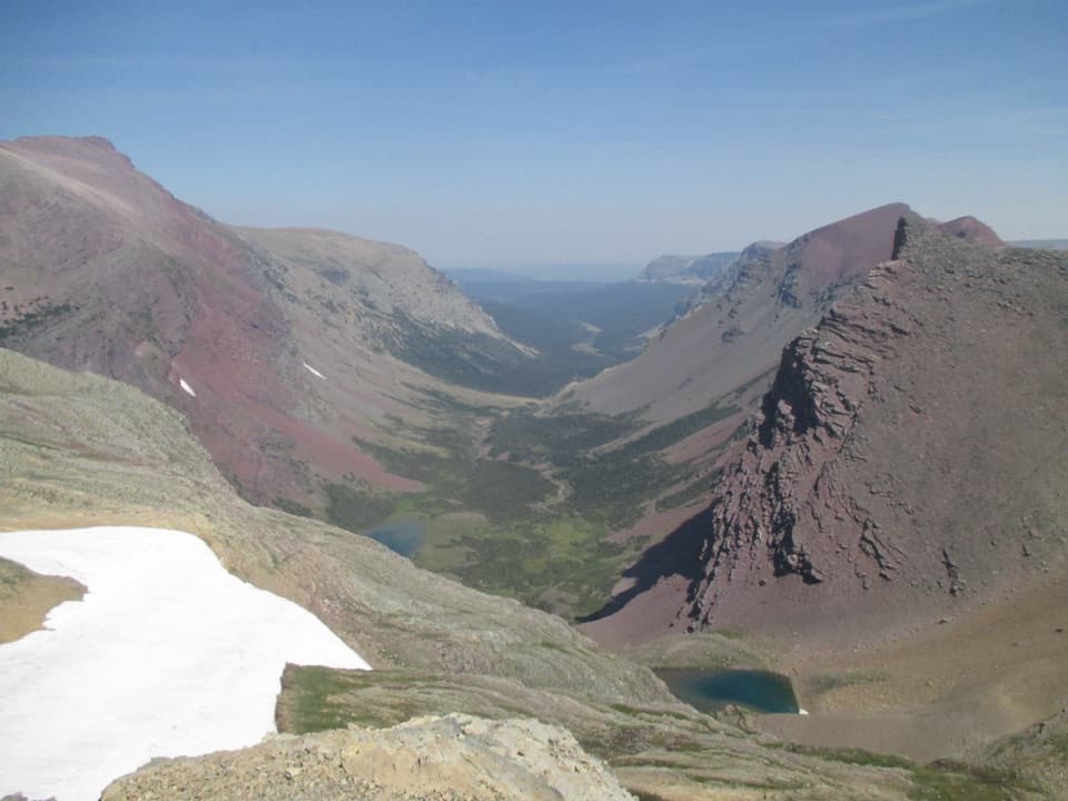
  • Open views toward Little Chief Mountain across the fire area

Heads up

  • The downhill approach becomes a climb on the return
  • The separate trailhead parking area is very small and can fill in peak summer

Map & elevation

The route

Loading the Glacier map
Full map
Elevation4,544–4,803 ft
TrailheadSt. Mary Falls Shuttle Stop48.67445, -113.60866
Keep this map with you offline in the Parkwolf app

Plan your hike

Before you go

Parking

Start at the St. Mary Falls Shuttle Stop on Going-to-the-Sun Road. The National Park Service lists a separate St. Mary Falls Trailhead parking start 1.2 miles one way from the falls; that lot is small and often full in peak summer, making the shuttle a practical option when operating.

Safety

This route crosses the 2015 burn area, where unstable tread, rolling rocks, or falling snags are possible. The trail drops about 260 feet to the falls and climbs it back on the return. Pets are prohibited on Glacier trails; access depends on seasonal Going-to-the-Sun Road and shuttle operations.

1 active Glacier alert

  • ClosureTwo Medicine Campground closed for 2026 constructionTwo Medicine Campground is closed throughout 2026 because of construction in the Two Medicine developed area.Official details
Glacier alerts
A park ranger sits on a dash-mounted phone, talking, as Parkwolf’s Tour Guide plays “Army Cutworm Moths: A Grizzly Bear Buffet” on Grand Loop Road below Dunraven Pass in Yellowstone
Parkwolf Tour GuideThe highest, rockiest slopes around here are a summer buffet for grizzly bears.

Glacier Tour Guide

Your drive to St. Mary Falls Trail, narrated.

Parkwolf is a GPS audio tour guide for Glacier National Park. As you drive, it chimes in with what’s ahead: hidden gems, upcoming stops, history, geology, and wildlife, right through your car’s speakers.

See the Glacier audio tour

Recorded for this trailhead

St. Mary and Virginia Falls
0:00 / 0:24
“You're nearing the trail access for St. Mary and Virginia Falls, a good stop if you want waterfalls and time on foot. From the shuttle stop, St.”

Plays as you drive up to this trailhead in the Parkwolf Glacier Tour Guide.

More stories near here in the app

  • Sunrift Gorge and Baring Falls
  • Why the Lakes Turn Turquoise
  • Sun Point's View and Vanished Chalets
  • Jackson Glacier Overlook
  • 204 audio storiesacross Glacier’s roads, triggered by GPS as you drive
  • Wildlife heatmapsfor Grizzly Bear, Wolverine, Mountain Goat, and 13 more
  • Works offlinemaps, 157 trails, 91 places, and audio download before you lose signal
  • CarPlay readysimple controls built for the drive
★★★★★
“Our first time to glacier and we used the audio portion for Going to the Sun Road. Wonderful information with perfect advice of what to see and do along the road.”
PaisleyParkFanApp Store review
Download Parkwolf on the App StoreGet Parkwolf on Google Play

4.7 from 8,600+ ratings

Trail guide

Hiking St. Mary Falls Trail

A short waterfall walkThis is a 1.6-mile out-and-back from the St.

This is a 1.6-mile out-and-back from the St. Mary Falls shuttle stop to the bridge below the falls, about 0.8 mile each way. It drops roughly 260 feet on the way in, then climbs back out. Give it about an hour to an hour and a half, including time at the water. It is a good choice for a vivid waterfall without committing to the longer Virginia Falls hike.

Choose the right startThe route in this listing begins at the St. Mary Falls Shuttle Stop on Going-to-the-Sun Road.

The route in this listing begins at the St. Mary Falls Shuttle Stop on Going-to-the-Sun Road. The National Park Service also lists the separate St. Mary Falls Trailhead parking start at 1.2 miles one way (2.4 miles round trip). That lot is very small and often fills during peak summer, so the shuttle stop is a practical start when service is operating. Road and shuttle access are seasonal; check conditions before setting out.

Through the burn areaFrom the stop, the path heads southwest and descends on moderate grades through the area burned…

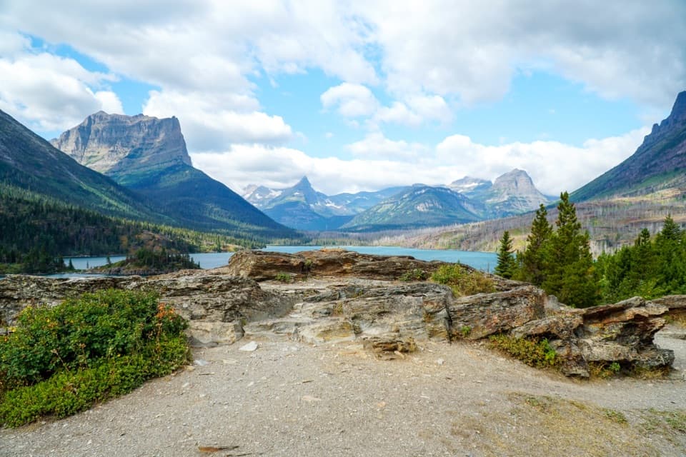
From the stop, the path heads southwest and descends on moderate grades through the area burned in the 2015 Reynolds Creek Fire. The open slope gives you long views across the valley, including Little Chief Mountain and other peaks. The burned stretch is less sheltered from the sun than the tree-lined section below, so a warm afternoon can feel exposed. The Park Service also cautions that burned slopes can have loose tread, rolling rocks, or falling snags. At about 0.3 mile, the route meets the branch from the parking trailhead. A second junction with Piegan Pass Trail follows; stay left toward St. Mary Falls.

Follow the riverThe grade eases as the trail reaches the north side of the St. Mary River at roughly 0.6 mile.

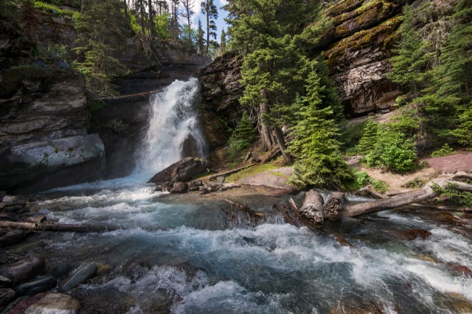
The grade eases as the trail reaches the north side of the St. Mary River at roughly 0.6 mile. Turn west and follow the river through trees toward the falls. At about 0.8 mile, a bridge crosses below the cascade. The bridge is the natural turnaround for this shorter walk and gives the clearest close view of the gorge and falling water.

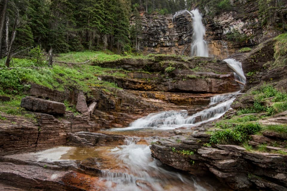
The falls from the bridgeSt. Mary Falls breaks into three tiers over layered rock and drops into a large pool.

St. Mary Falls breaks into three tiers over layered rock and drops into a large pool. The lower water continues foaming through the gorge, and spray can hang around the bridge. This is the route’s signature view: frame the falls with the rock walls and pool from the bridge, rather than leaving the tread for a closer angle.

Where the longer trail goesThe path continues beyond the bridge toward Virginia Falls.

The path continues beyond the bridge toward Virginia Falls. It follows the river briefly, climbs a low hill to an overlook above Virginia Creek, then rises beside the creek past smaller cascades. Virginia Falls is a separate, longer destination on this corridor; the Park Service lists it 1.6 miles one way from the shuttle stop. Turn around at St. Mary Falls if you want the 1.6-mile outing described here.

Return and rulesThe return reverses the route, so the 260-foot descent becomes the climb back to the shuttle…

The return reverses the route, so the 260-foot descent becomes the climb back to the shuttle stop. Pets are not allowed on Glacier trails. If you are driving instead, use the separate parking start and plan for its longer distance and limited spaces; do not count on finding a spot during the busiest summer hours.

Wildlife

Wildlife in Glacier

All Glacier wildlife maps

Sighting maps show where each species has been reported across Glacier. Wildlife moves, so no sighting is guaranteed.

Keep exploring

Near St. Mary Falls Trail

See it all on the map

Trails that start nearby

Places near the trailhead

Parkwolf’s Glacier ranking

Top-rated trails in Glacier

All 157 trails
  1. 1Highline TrailChallenging · 11.8 mi
  2. 2Grinnell Glacier TrailChallenging · 10 mi
  3. 3Iceberg Lake TrailModerate · 9.6 mi
  4. 4Hidden Lake Overlook TrailModerate · 2.6 mi
  5. 5Avalanche Lake TrailModerate · 5 mi
  6. 6Trail of the CedarsEasy · 0.9 mi

Take Parkwolf to Glacier.

The audio tour guide for the drive, plus offline maps, trails, and wildlife heatmaps for when the signal drops.

4.7 from 8,600+ ratings

Download Parkwolf on the App StoreGet Parkwolf on Google Play