Ariel Point Trail in Grand Canyon National Park

Grand Canyon National Park, AZ

Ariel Point Trail

A long North Rim walk to a rugged canyon projection.

Length
12.2mi
Time
6.5hr
Elev. change
686ft
Difficulty
Challenging
  • No dogs
  • High point 8,497 ft

Hear the audio tour

Rain That Never Lands

Overview

About Ariel Point Trail

Why go

  • The rugged rim projection opens onto an unobstructed canyon view.

Heads up

  • About 12.2 miles round trip, with route-finding on a fading track.
  • No designated parking or walking connector at the mapped road access was verified.
There is no verified water source or service point along this remote route; plan to carry everything you need. The trailhead is already high on the plateau, around 8,500 feet, and the rocky rim ending is exposed. Dogs are not allowed on this route. Choose it if you want a long, lightly used North Rim outing and are comfortable navigating a fading track; choose a signed short rim walk instead if you mainly want an easy canyon view.
Parkwolf’s verdictWhat to bring and who should go

Map & elevation

The route

Loading the Grand Canyon map
Full map
Elevation7,812–8,497 ft
TrailheadKomo Point Fire Road access on Cape Royal Road36.23049, -111.98261
Keep this map with you offline in the Parkwolf app

Plan your hike

Before you go

Parking

The mapped route starts where the Komo Point Fire Road meets Cape Royal Road. The 2026 park map shows parking at Vista Encantada, about 0.5 mile east along the road, but does not mark parking at the route entrance or a walking connector. Confirm a safe, permitted approach before setting out.

Safety

This is a remote, high-elevation route with a fading old roadbed and markers that disappear in burned sections. Route-finding is necessary. The final rocky projection is exposed and has no described guardrail. No reliable on-route water source was found; carry all water. Pets are prohibited on this trail.

4 active Grand Canyon alerts

  • ClosureInner Canyon and North Rim trail closuresMentions North Rim, referenced in this guideDo not enter the closed trails, bridges, campgrounds, and inner-canyon areas.Official details
  • ClosureNorth Rim scenic roads closed for repairsMentions North Rim, referenced in this guideCape Royal Road and Point Imperial Road are closed from sunset October 15 through sunrise November 3, 2026. - The roads are closed to accommodate critical road repair and rehabilitation work.Official details
See all 4 alerts
A park ranger sits on a dash-mounted phone, talking, as Parkwolf’s Tour Guide plays “Army Cutworm Moths: A Grizzly Bear Buffet” on Grand Loop Road below Dunraven Pass in Yellowstone
Parkwolf Tour GuideThe highest, rockiest slopes around here are a summer buffet for grizzly bears.

Grand Canyon Tour Guide

Your drive to Ariel Point Trail, narrated.

Parkwolf is a GPS audio tour guide for Grand Canyon National Park. As you drive, it chimes in with what’s ahead: hidden gems, upcoming stops, history, geology, and wildlife, right through your car’s speakers.

See the Grand Canyon audio tour

Recorded for this area

Rain That Never Lands
0:00 / 0:30
“A streak of rain hanging beneath a cloud can disappear before it reaches the canyon floor. That's called virga. Raindrops fall into dry air and evaporate on the way down, leaving wispy trails below the cloud.”

Plays on the road 0.3 mi from the trailhead in the Parkwolf Grand Canyon Tour Guide.

More stories near here in the app

  • Vista Encantada’s Picnic Stop
  • Greenland Lake’s Limestone Basin
  • Walhalla Glades’ Old-Road Hike
  • Why the River Changes Color
  • 79 audio storiesacross Grand Canyon’s roads, triggered by GPS as you drive
  • Wildlife heatmapsfor California Condor, Bighorn Sheep, American Bison, and 13 more
  • Works offlinemaps, 73 trails, 96 places, and audio download before you lose signal
  • CarPlay readysimple controls built for the drive
★★★★★
“Fantastic app with many points of information… It’s great to just turn on while you’re driving and it gives you an audio tour of the national Park. We love it!!!!”
JMJamesApp Store review
Download Parkwolf on the App StoreGet Parkwolf on Google Play

4.7 from 8,600+ ratings

Trail guide

Hiking Ariel Point Trail

A long walk to the rimAriel Point Trail is a remote out-and-back across the Walhalla Plateau to a rocky projection on…

Ariel Point Trail is a remote out-and-back across the Walhalla Plateau to a rocky projection on Grand Canyon’s North Rim. From the mapped Cape Royal Road access, the full route is about 12.2 miles round trip: follow the Komo Point Fire Road for roughly 3 miles, then take the Ariel branch about 3.1 miles to the rim and return the same way. Allow 6 to 7 hours from the road access. The nearest named parking is at Vista Encantada, about half a mile east; using it adds about a mile on the road round trip, and no walking connector or parking pullout at the route entrance was verified.

This is a half-day-plus backcountry walk, not a quick viewpoint stop. The plateau approach is long, and the return includes the same 3-mile Komo section after the Ariel branch.

Follow the old road carefullyThe Komo approach and Ariel branch follow rough old roadbeds through plateau forest and…

The Komo approach and Ariel branch follow rough old roadbeds through plateau forest and occasional meadows. The grade is relatively gentle across the high ground, but the old tread fades and route-finding is necessary. Markers disappear in burned sections. At the Walhalla Connector junction, stay straight and south for Ariel Point; the final stretch drops more steeply toward the rim.

At Ariel PointThe route ends near Ariel Point on a rugged rocky projection with an unobstructed view into the…

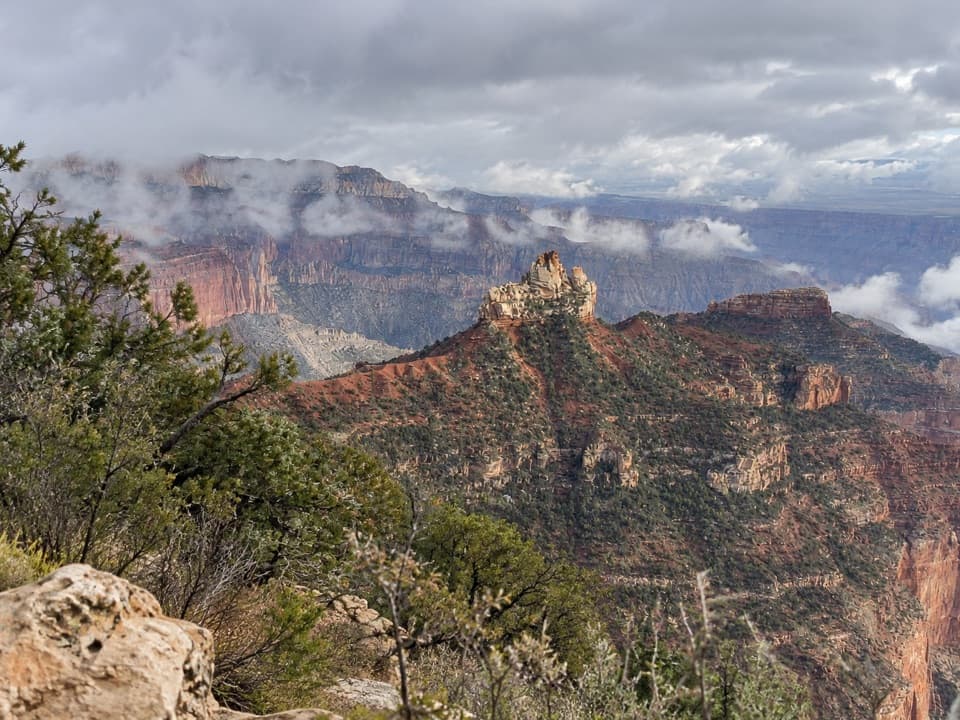
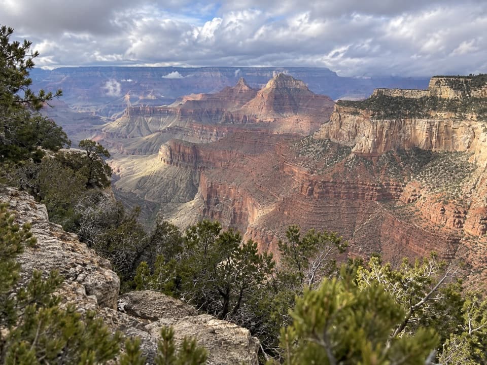
The route ends near Ariel Point on a rugged rocky projection with an unobstructed view into the canyon. There is no described built overlook or guardrail at the end, so keep well back from the rim. The return follows the same route, including the climb back from the point.

Wildlife

Wildlife in Grand Canyon

All Grand Canyon wildlife maps

Sighting maps show where each species has been reported across Grand Canyon. Wildlife moves, so no sighting is guaranteed.

Keep exploring

Near Ariel Point Trail

See it all on the map

Trails that start nearby

Places near the trailhead

Parkwolf’s Grand Canyon ranking

Top-rated trails in Grand Canyon

All 73 trails
  1. 1Rim-to-Rim: North Kaibab to Bright AngelChallenging · 23.5 mi
  2. 2South Kaibab TrailChallenging · 6.3 mi
  3. 3Bright Angel TrailChallenging · 7.8 mi
  4. 4Rim TrailModerate · 12.8 mi
  5. 5Rim-to-Rim: South Kaibab to North KaibabChallenging · 21 mi
  6. 6Cape Royal TrailEasy · 0.8 mi

Take Parkwolf to Grand Canyon.

The audio tour guide for the drive, plus offline maps, trails, and wildlife heatmaps for when the signal drops.

4.7 from 8,600+ ratings

Download Parkwolf on the App StoreGet Parkwolf on Google Play