Upper Pictograph Cave in Great Basin National Park

Sight · Great Basin National Park

Upper Pictograph Cave

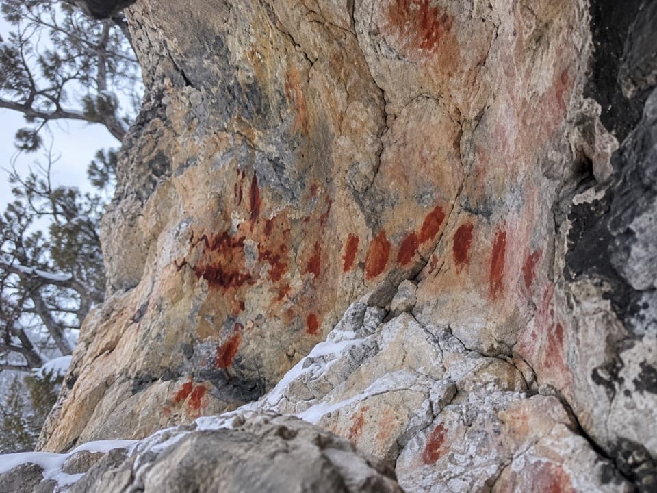
Red pictographs worth a look from outside the shelter.

Type
Sight
Nearest trail
0.2 mi
Audio stories
7 nearby

Hear the audio tour

Grey Cliffs and Pole Canyon: A Shaded Lunch Stop

Overview

About Upper Pictograph Cave

Why stop

  • Painted human, animal and abstract figures in a rock shelter.

Heads up

  • No cave entry, and the final approach is unclear.

Map

Where it is

Loading the Great Basin map
Full map
SightUpper Pictograph Cave38.99054, -114.21825
Keep this map with you offline in the Parkwolf app

Plan your stop

Before you go

4 active Great Basin alerts

  • CautionStage II fire restrictions prohibit outdoor fires and smokingStage II fire restrictions are active throughout Great Basin National Park because of extreme fire danger. - Do not use campfires, charcoal grills, or smoke outdoors anywhere in the park.Official details
  • CautionPotable water is unavailable at park campgroundsPotable water is currently unavailable in every Great Basin National Park campground; bring sufficient water or fill containers before settling in.Official details
See all 4 alerts
A park ranger sits on a dash-mounted phone, talking, as Parkwolf’s Tour Guide plays “Army Cutworm Moths: A Grizzly Bear Buffet” on Grand Loop Road below Dunraven Pass in Yellowstone
Parkwolf Tour GuideThe highest, rockiest slopes around here are a summer buffet for grizzly bears.

Great Basin Tour Guide

Your drive to Upper Pictograph Cave, narrated.

Parkwolf is a GPS audio tour guide for Great Basin National Park. As you drive, it chimes in with what’s ahead: hidden gems, upcoming stops, history, geology, and wildlife, right through your car’s speakers.

Recorded for this area

Grey Cliffs and Pole Canyon: A Shaded Lunch Stop
0:00 / 0:28
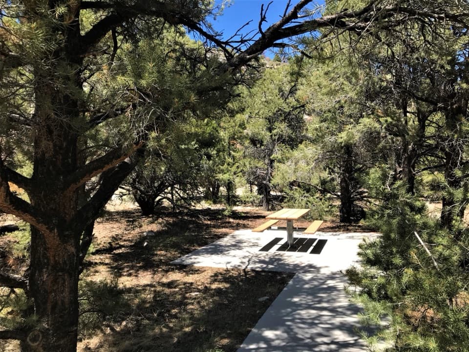
“You're nearing Grey Cliffs and the access to Pole Canyon's picnic area. For a lunch break, choose the day-use tables and charcoal grills, with shade among the trees and accessible tables on paved ground.”

Plays on the road 0.1 mi from Upper Pictograph Cave in the Parkwolf Great Basin Tour Guide.

More stories near here in the app

  • Packrats Keep a Climate Record
  • Lehman Caves: Look for the Shields
  • Astronomy Amphitheater: An Evening at the Telescopes
  • Baker Creek Campground: Choose Your Setting
  • 36 audio storiesacross Great Basin’s roads, triggered by GPS as you drive
  • Wildlife heatmapsfor Elk, Mule Deer, Wild Turkey, and 13 more
  • Works offlinemaps, 29 trails, 29 places, and audio download before you lose signal
  • CarPlay readysimple controls built for the drive
★★★★★
“Fantastic app with many points of information… It’s great to just turn on while you’re driving and it gives you an audio tour of the national Park. We love it!!!!”
JMJamesApp Store review
Download Parkwolf on the App StoreGet Parkwolf on Google Play

4.7 from 8,600+ ratings

Guide

More about Upper Pictograph Cave

The painted shelterUpper Pictograph Cave is a rock shelter in Great Basin National Park, known for red pictographs…

Upper Pictograph Cave is a rock shelter in Great Basin National Park, known for red pictographs across its sheltered wall. The panel includes human-like and animal-like figures alongside abstract marks. This is a look-from-outside stop, not a cave tour: visitors must not enter or touch the paintings. For a photo, frame the panel with some of the overhang and keep your distance.

Reaching the caveThe Baker Creek area is reached from Highway 488 by Baker Creek Road, a 3.

The Baker Creek area is reached from Highway 488 by Baker Creek Road, a 3.5-mile dirt-and-gravel road. The park's directions do not identify a specific cave pullout or the final walk, and sources disagree about whether two-wheel drive is suitable. Check current park road conditions before setting out; winter weather can close the road.

The people and the shelterThe park attributes the paintings to Fremont culture, but its pages give conflicting dates, so…

The park attributes the paintings to Fremont culture, but its pages give conflicting dates, so the chronology is unsettled. The images' meaning is unknown. In the 1930s, archaeologist E. P. Harrington recovered stone artifacts, animal bones, ash, charcoal and fire-cracked rocks from the cave floor, evidence that people used the shelter for more than painting. Packrats have built middens here, and Townsend's big-eared bats occasionally use the cave; staying outside helps protect both the artwork and the bats.

Wildlife

Wildlife in Great Basin

All Great Basin wildlife maps

Sighting maps show where each species has been reported across Great Basin. Wildlife moves, so no sighting is guaranteed.

Keep exploring

Near Upper Pictograph Cave

See it all on the map

Trails nearby

More stops nearby

Parkwolf’s Great Basin ranking

Top sights in Great Basin

All 29 places
  1. 1Lehman CavesSight
  2. 2Wheeler Peak Bristlecone GroveSight
  3. 3Wheeler PeakSight
  4. 4Mather OverlookSight
  5. 5Wheeler Peak OverlookSight
  6. 6Astronomy AmphitheaterSight

Take Parkwolf to Great Basin.

The audio tour guide for the drive, plus offline maps, trails, and wildlife heatmaps for when the signal drops.

4.7 from 8,600+ ratings

Download Parkwolf on the App StoreGet Parkwolf on Google Play