Parking
The Wye entrance starts behind the CFA building; designated parking was not verified. The Separation Creek end meets Stanway Drive about 50 metres from the Great Ocean Road.
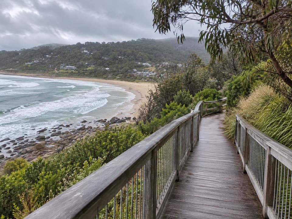
Great Otway National Park, VIC
A timber boardwalk looks over Wye Beach from an old tramway line.
Overview
Map & elevation
Plan your hike

The highest, rockiest slopes around here are a summer buffet for grizzly bears.
Great Otway Tour Guide
Parkwolf is a GPS audio tour guide for Great Otway National Park. As you drive, it chimes in with what’s ahead: hidden gems, upcoming stops, history, geology, and wildlife, right through your car’s speakers.
See the Great Otway audio tourRecorded for this trailhead
Wye River: Paddy's Path“Wye River is coming up, and Paddy's Path is a good choice for a short coastal walk. Start behind the CFA building and allow about forty minutes out and back, with a steep section at the Separation Creek end.”
Plays as you drive up to this trailhead in the Parkwolf Great Otway Tour Guide.
More stories near here in the app
“Fantastic app with many points of information… It’s great to just turn on while you’re driving and it gives you an audio tour of the national Park. We love it!!!!”


Trail guide
Paddy’s Path is a 0.47-mile (0.75 km) one-way connector between Wye River and Separation Creek, usually about 20 minutes each way. It crosses the wooded hillside above the Great Ocean Road and follows much of an old timber tramway. It is a short township-to-township walk; arrange a pickup or return the same way if you need to finish where you started.
The gravel track is fairly level through the middle. The timber boardwalk sits about a third of the way from the Separation Creek end, with a seat looking south over Wye Beach, the rocky shore and Sturt Point. Crushed rock resumes before a steep descent to the Separation Creek end at Stanway Drive. For a photo, frame the boardwalk rails with the beach below.
Much of the alignment follows an early-20th-century timber tramway that carried wood from Separation Creek mills to Wye River’s original jetty. Accounts disagree on its exact construction year, so no single date is given. The path is named for Paddy Harrington; a local account says a memorial plaque was installed with the 2019 reopening, but its present-day status was not confirmed.
The Wye River entrance is behind the CFA building; the opposite end meets Stanway Drive about 50 metres from the Great Ocean Road. A local notice reported reopening after landslip repairs in 2019, but the current managing authority and access status could not be independently confirmed. Check local access signs before setting out.
Wildlife
 204 sightingsKoalaMost seen around 6 PMSighting map
 35 sightingsGrey KangarooMost seen around 6 AMSighting map
 109 sightingsEchidnaMost seen around 5 PMSighting map
 58 sightingsKookaburraMost seen around 6 AMSighting map
 97 sightingsSwamp WallabyMost seen around 6 PMSighting map
 20 sightingsBrushtail PossumMost seen around 8 PMSighting map
Sighting maps show where each species has been reported across Great Otway. Wildlife moves, so no sighting is guaranteed.
Keep exploring
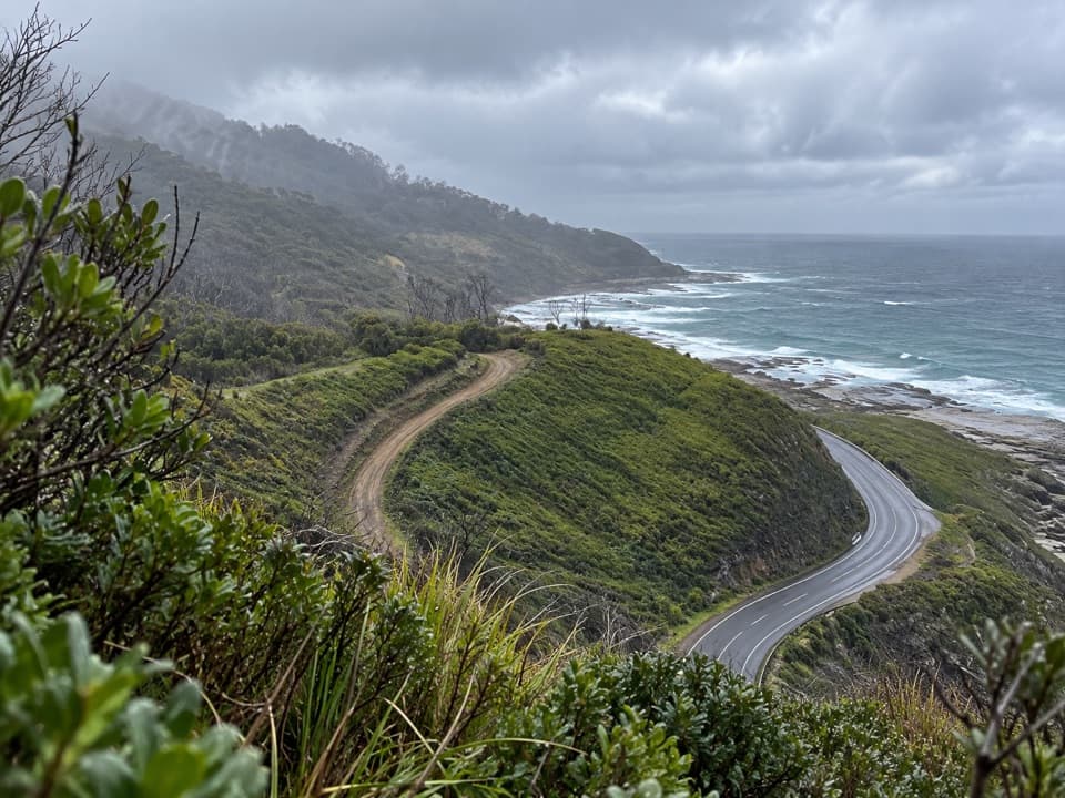 ModerateWye to Kennett River Walk5.5 km · 3 hr · 0.3 km awayCoastal views give way to ferny gullies and old mill country.
 EasyKennett River Nature Walk2.5 km · 45 min · 4.4 km awayAn easy riverbank walk with local wildlife and history to notice.
 ModerateJamieson Creek to Separation Creek Walk5.3 km · 2.5 hr · 4.6 km awayShort climbs trade forest shade for long coastal views.
 EasyKennett River Glow-Worm Walk0.2 km · 30 min · 7.1 km awayA 0.15-mile night walk to a creekside glow-worm grotto.
 ChallengingMount Defiance–Jamieson Creek Circuit22 km · 5.5 hr · 8.2 km awayA 22 km ridge circuit with a 4 km road return.
 ModerateCumberland Falls Walk6 km · 3 hr · 8.3 km awayA forested river walk with crossings and two small cascades.
 ModerateCumberland River–Jebb’s Pool Walk3 km · 1.5 hr · 8.3 km awayA fern-lined gorge walk ends at a cascade-fed pool.
 EasyCarisbrook Falls Walk0.6 km · 24 min · 9.6 km awayA short climb opens a distant view of Carisbrook Falls.
 Campground · 4.6 km awayJamieson Creek CampgroundA 24-site coastal camp, with ocean views and a short beach walk.
 Picnic area · 7.1 km awayGrey River Picnic AreaA quiet rainforest picnic stop with a glow-worm walk after dark.
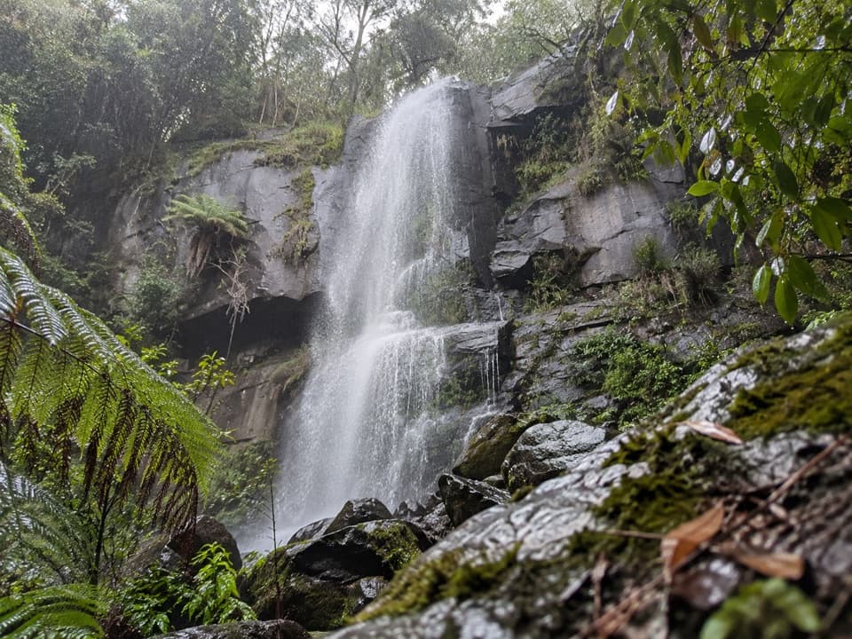 Sight · 8.1 km awayUpper Kalimna FallsA long forest walk leads to cascades above Lower Kalimna Falls.
 Sight · 8.5 km awayLower Kalimna FallsA waterfall pours from a rock ledge you can stand behind.
 Sight · 8.8 km awayJebbs PoolA leafy gorge walk ends at cascades and a river poolSight · 9.4 km awayCarisbrook FallsA short climb to a long cascade across a steep gorge.
 Sight · 9.7 km awaySwallow CaveA honeycombed shelter above Sheoak Creek's upper cascades.
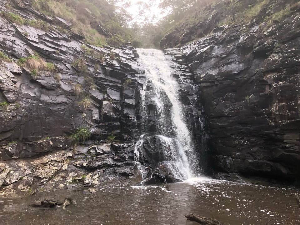 Sight · 9.9 km awaySheoak FallsA short, stepped walk to a waterfall that varies with the rain.
Parkwolf’s Great Otway ranking

The audio tour guide for the drive, plus offline maps, trails, and wildlife heatmaps for when the signal drops.





