Parking
Start near Wye River Hotel and follow Morley Avenue uphill about 0.6 km to the signed entry; parking by the upper sign is very limited. Leave a pickup car at Kennett River Picnic Area by the bridge.
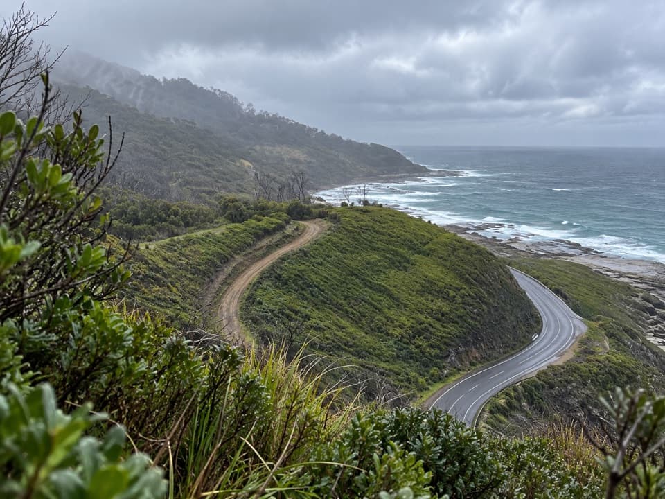
Great Otway National Park, VIC
Coastal views give way to ferny gullies and old mill country.
Overview
Map & elevation
Plan your hike

The highest, rockiest slopes around here are a summer buffet for grizzly bears.
Great Otway Tour Guide
Parkwolf is a GPS audio tour guide for Great Otway National Park. As you drive, it chimes in with what’s ahead: hidden gems, upcoming stops, history, geology, and wildlife, right through your car’s speakers.
See the Great Otway audio tourRecorded for this trailhead
Wye River: Paddy's Path“Wye River is coming up, and Paddy's Path is a good choice for a short coastal walk. Start behind the CFA building and allow about forty minutes out and back, with a steep section at the Separation Creek end.”
Plays as you drive up to this trailhead in the Parkwolf Great Otway Tour Guide.
More stories near here in the app
“Fantastic app with many points of information… It’s great to just turn on while you’re driving and it gives you an audio tour of the national Park. We love it!!!!”


Trail guide
Wye to Kennett River Walk is a point-to-point coastal crossing of about 5.5 km one way from Wye River Hotel to the Kennett River Picnic Area by the bridge. Allow around three hours. The mapped visitor line includes roughly 640 m of town-street approach and the short finish to the pickup car park; the coastal track itself measures about 4.5 km, close to the published 4.6 km track figure. Other directions round the full crossing to 6 km. Arrange a car shuttle; this is not a loop.
From near Wye River Hotel, follow Morley Avenue uphill to the signed entry. The climb is described as about 800 m; mapped streets measure closer to 640 m. There is very little parking by the upper sign, so plan the shuttle around the Kennett River Picnic Area. The walk starts with a steep descent, then alternates ridge walking and long climbs into gullies. Uneven ground and steps make it more demanding than the distance alone suggests.
A seat near the early descent looks out toward the ocean. Further along, steps and steep slopes open views toward Kennett River; standing trunks from the 2015 fire rise above recovering vegetation. At Birds Track, turn right briefly, then left onto the smaller path. Descend into Monash Gully and climb out before Hitchcock Gully, where taller eucalypts, ferns, large rocks and a creek crossing give the walk a cooler, greener feel. At the ocean-view seat, include a bend of track in the frame to show the ridge setting.
After a short climb, cross Kennett Road beside the old timber-mill site; an interpretation sign explains the area's milling history. A view over Kennett River Valley comes before the final descent to the bridge and pickup point. Listen for birds such as Rufous Bristlebird, Yellow-faced Honeyeater and Eastern Spinebill. Koalas, kangaroos, wallabies and echidnas are possible, not promised.
Expect uneven slopes, steps and creek crossings over rocks, which can be slippery. Mobile coverage is absent along the route; falling limbs or trees and snakes are also flagged hazards. Dogs are prohibited. The coastal track sits above rough surf, so stay on the path and away from the edge.
Wildlife
 204 sightingsKoalaMost seen around 6 PMSighting map
 35 sightingsGrey KangarooMost seen around 6 AMSighting map
 109 sightingsEchidnaMost seen around 5 PMSighting map
 58 sightingsKookaburraMost seen around 6 AMSighting map
 97 sightingsSwamp WallabyMost seen around 6 PMSighting map
 20 sightingsBrushtail PossumMost seen around 8 PMSighting map
Sighting maps show where each species has been reported across Great Otway. Wildlife moves, so no sighting is guaranteed.
Keep exploring
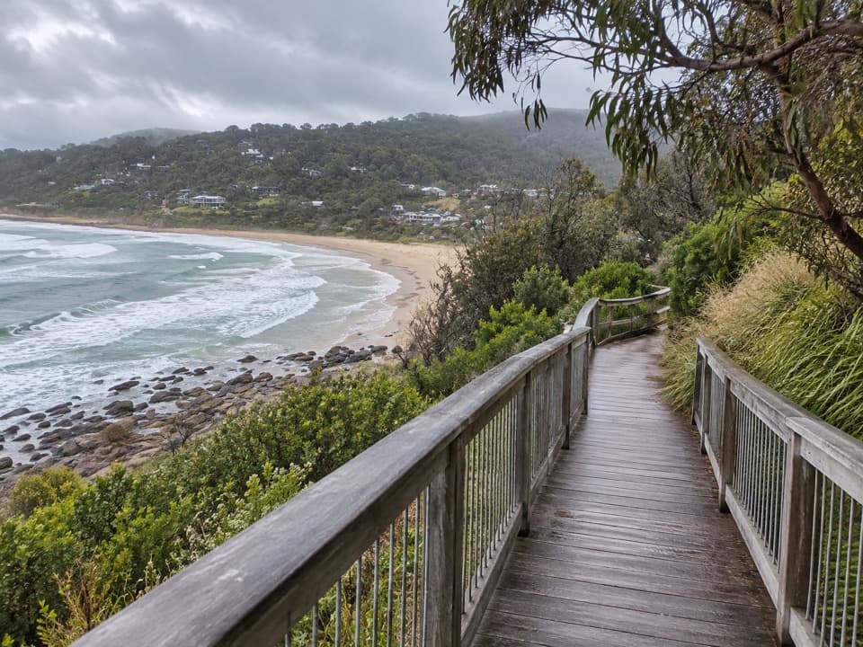 EasyPaddy’s Path0.8 km · 20 min · 0.3 km awayA timber boardwalk looks over Wye Beach from an old tramway line.
 EasyKennett River Nature Walk2.5 km · 45 min · 4.2 km awayAn easy riverbank walk with local wildlife and history to notice.
 ModerateJamieson Creek to Separation Creek Walk5.3 km · 2.5 hr · 4.8 km awayShort climbs trade forest shade for long coastal views.
 EasyKennett River Glow-Worm Walk0.2 km · 30 min · 7 km awayA 0.15-mile night walk to a creekside glow-worm grotto.
 ChallengingMount Defiance–Jamieson Creek Circuit22 km · 5.5 hr · 8.5 km awayA 22 km ridge circuit with a 4 km road return.
 ModerateCumberland Falls Walk6 km · 3 hr · 8.5 km awayA forested river walk with crossings and two small cascades.
 ModerateCumberland River–Jebb’s Pool Walk3 km · 1.5 hr · 8.5 km awayA fern-lined gorge walk ends at a cascade-fed pool.
 EasyCarisbrook Falls Walk0.6 km · 24 min · 9.4 km awayA short climb opens a distant view of Carisbrook Falls.
 Campground · 4.8 km awayJamieson Creek CampgroundA 24-site coastal camp, with ocean views and a short beach walk.
 Picnic area · 7 km awayGrey River Picnic AreaA quiet rainforest picnic stop with a glow-worm walk after dark.
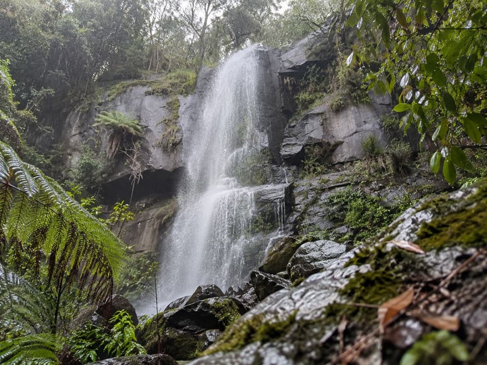 Sight · 8.4 km awayUpper Kalimna FallsA long forest walk leads to cascades above Lower Kalimna Falls.
 Sight · 8.8 km awayLower Kalimna FallsA waterfall pours from a rock ledge you can stand behind.
 Sight · 9 km awayJebbs PoolA leafy gorge walk ends at cascades and a river poolSight · 9.2 km awayCarisbrook FallsA short climb to a long cascade across a steep gorge.
 Sight · 9.9 km awaySwallow CaveA honeycombed shelter above Sheoak Creek's upper cascades.
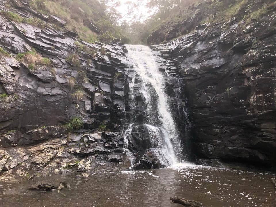 Sight · 10.1 km awaySheoak FallsA short, stepped walk to a waterfall that varies with the rain.
Parkwolf’s Great Otway ranking

The audio tour guide for the drive, plus offline maps, trails, and wildlife heatmaps for when the signal drops.





