Jasper National Park, AB

Elysium Pass Trail

Remote, unmaintained alpine out-and-back to Elysium Pass with big views and serious route-finding.

Length
28km
Time
16hr
Elev. change
1,078m
Difficulty
Challenging
  • Dogs allowed
  • High point 2,171 m
  • #45 of 91 in Jasper

Hear the audio tour

The Great Divide Trail Crossing

Overview

About Elysium Pass Trail

Why go

  • Remote alpine scenery and broad Victoria Cross Range views
  • A genuine multi-day wilderness route with a strong pass destination
  • Highpoint meadows and solitude close to Jasper by road

Heads up

  • Long, steep, and unmaintained with difficult navigation
  • Limited signage, unreliable cell service, and no dependable trail amenities
  • Rough bridge or stream crossings and serious bear-country exposure
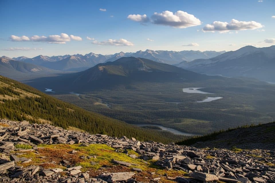
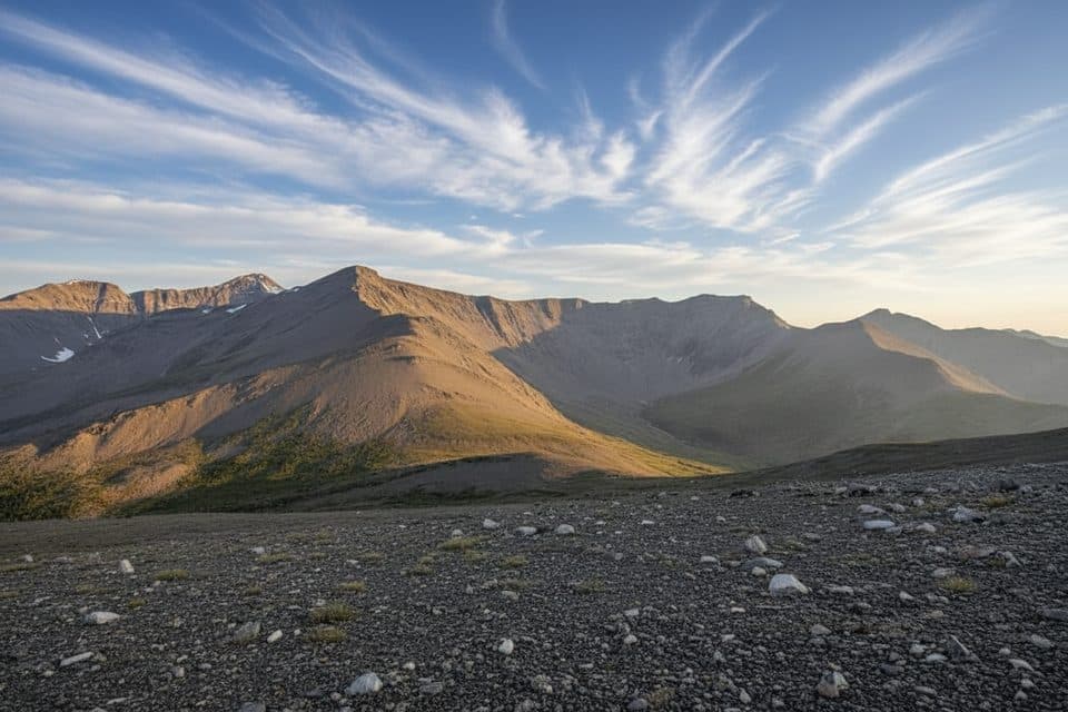
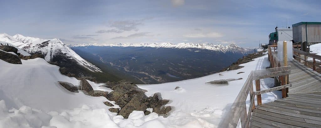
Elysium Pass is a remote Jasper backcountry destination with broad views toward the Victoria Cross Range, Elysium Mountain, and the surrounding alpine valleys. The route is a demanding wilderness trip for hikers who want solitude, high-country scenery, and a serious multi-day objective.
Parkwolf’s verdictWhy go

Map & elevation

The route

Loading the Jasper map
Full map
Elevation1,093–2,171 m
TrailheadDorothy & Christine Lakes Trailhead52.86707, -118.25153
Keep this map with you offline in the Parkwolf app

Plan your hike

Before you go

Parking

Use the Dorothy and Christine Lakes trailhead parking area about 11.5 km west of Jasper on Highway 16, just west of the Meadow Creek bridge. Start from the railway access road at the signed trailhead; cross the tracks carefully and use the Miette River bridge before joining the route.

Safety

This is an unmaintained, remote backcountry route. Expect route-finding, mud, steep terrain, rough bridge or stream crossings, no reliable cell service, and grizzly and black-bear habitat. Carry navigation, emergency gear, food, warm layers, and bear spray; winter travel adds avalanche hazards.

8 active Jasper alerts

  • ClosureWildfire-impacted areas and facilities closedStay out of closed wildfire-impacted areas and facilities in Jasper National Park; closures protect public safety after the 2024 wildfire and remain in effect while recovery and safety work continues.Official details
  • Closure93A (Wabasso Road) no through travel during roadworkFrom mid-October to early November 2026, plan for 93A (Wabasso Road) to be accessible from the south entrance only; no through travel is expected during roadwork.Official details
See all 8 alerts
A park ranger sits on a dash-mounted phone, talking, as Parkwolf’s Tour Guide plays “Army Cutworm Moths: A Grizzly Bear Buffet” on Grand Loop Road below Dunraven Pass in Yellowstone
Parkwolf Tour GuideThe highest, rockiest slopes around here are a summer buffet for grizzly bears.

Jasper Tour Guide

Your drive to Elysium Pass Trail, narrated.

Parkwolf is a GPS audio tour guide for Jasper National Park. As you drive, it chimes in with what’s ahead: hidden gems, upcoming stops, history, geology, and wildlife, right through your car’s speakers.

See the Jasper audio tour

Recorded for this area

The Great Divide Trail Crossing
Listen
“If you see a hiker near the road with a lightweight pack and a weary but focused look, they might be tackling the Great Divide Trail. This is a monster of a route—over 1,100 kilometers along the spine of the Rockies.”

Plays on the road 0.2 km from the trailhead in the Parkwolf Jasper Tour Guide.

More stories near here in the app

  • Hiking Jasper 101: Trail Etiquette and Bear-Spray Basics
  • Who Was the Yellowhead?
  • Reading the Rails: How Modern Trains Run the Yellowhead
  • Beavers of Wynd Road
  • 157 audio storiesacross Jasper’s roads, triggered by GPS as you drive
  • Wildlife heatmapsfor Grizzly Bear, Caribou, Gray Wolf, and 13 more
  • Works offlinemaps, 91 trails, 129 places, and audio download before you lose signal
  • CarPlay readysimple controls built for the drive
★★★★★
“Fantastic app with many points of information… It’s great to just turn on while you’re driving and it gives you an audio tour of the national Park. We love it!!!!”
JMJamesApp Store review
Download Parkwolf on the App StoreGet Parkwolf on Google Play

4.7 from 8,600+ ratings

Trail guide

Hiking Elysium Pass Trail

Route and distanceThis is an out-and-back from the Dorothy and Christine Lakes trailhead.

This is an out-and-back from the Dorothy and Christine Lakes trailhead. Follow the Dorothy and Christine Lakes Trail through the forest, then leave it near the Minaga Creek section at the signed or historic Elysium Pass junction. The route continues on the rough Elysium Pass Trail toward its highpoint and the pass. The stored line follows the physical corridor once from the start to the pass; it does not duplicate the return leg.

Plan for about 28 km (17.4 miles) total round trip, roughly 1,100 m of elevation gain, and about 16 hours of total hiking time. Most visitors should treat this as a two- to three-day backpacking trip rather than a day hike. The route is long, steep, and remote, and the final approach beyond the mapped OSM section is an unmaintained wilderness route.


Access and trail characterThe primary access is the Dorothy and Christine Lakes trailhead, about 11.

The primary access is the Dorothy and Christine Lakes trailhead, about 11.5 km west of Jasper off Highway 16, just west of the Meadow Creek bridge. The route begins on the railway access road, crosses the tracks, and uses the Miette River bridge before climbing toward the Elysium junction. A valid Jasper National Park entry pass is required. The old trail, bridges, and campsite are no longer maintained as a normal frontcountry hiking facility, so visitors must be self-sufficient and prepared for route-finding and rough travel.

Conditions and cautionsExpect steep terrain, muddy or wet sections, limited signage, difficult route-finding, and…

Expect steep terrain, muddy or wet sections, limited signage, difficult route-finding, and unreliable cell service. Carry a current map or GPX, extra food, warm layers, repair and emergency gear, and bear spray; this is grizzly and black-bear country. Treat water before drinking. Stream and bridge crossings may be damaged or awkward, and snow can obscure the route well into the season. Winter travel is an advanced alpine undertaking with avalanche hazards.

Wildlife

Wildlife in Jasper

All Jasper wildlife maps

Sighting maps show where each species has been reported across Jasper. Wildlife moves, so no sighting is guaranteed.

Keep exploring

Near Elysium Pass Trail

See it all on the map

Trails that start nearby

Places near the trailhead

Parkwolf’s Jasper ranking

Top-rated trails in Jasper

All 91 trails
  1. 1Skyline TrailChallenging · 44.1 km
  2. 2Maligne CanyonModerate · 3.7 km
  3. 3Cavell MeadowsModerate · 8.4 km
  4. 4Sulphur SkylineChallenging · 8.9 km
  5. 5Athabasca Falls LoopEasy · 0.8 km
  6. 6Indian RidgeChallenging · 8.9 km

Take Parkwolf to Jasper.

The audio tour guide for the drive, plus offline maps, trails, and wildlife heatmaps for when the signal drops.

4.7 from 8,600+ ratings

Download Parkwolf on the App StoreGet Parkwolf on Google Play