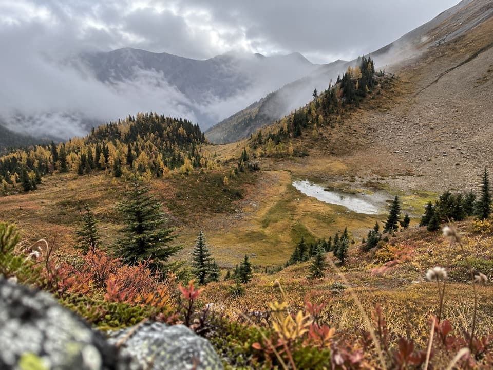
Chickadee Valley in Kootenay National Park

Kootenay National Park, BC

Chickadee Valley

A winter valley outing where you have to find the line.

Length
10km
Time
3hr
Elev. change
230m
Difficulty
Moderate
  • Dogs allowed
  • High point 1,875 m

Hear the audio tour

Continental Divide: Watersheds and Forest Regrowth

Overview

About Chickadee Valley

Why go

  • Creekside travel opens into a broad mountain valley.

Heads up

  • Unmarked winter tracks can be faint and confusing.
  • The route starts with a crossing of Highway 93.

Map & elevation

The route

Loading the Kootenay map
Full map
Elevation1,645–1,875 m
TrailheadGreat Divide parking lot51.22820, -116.05028
Keep this map with you offline in the Parkwolf app

Plan your hike

Before you go

Parking

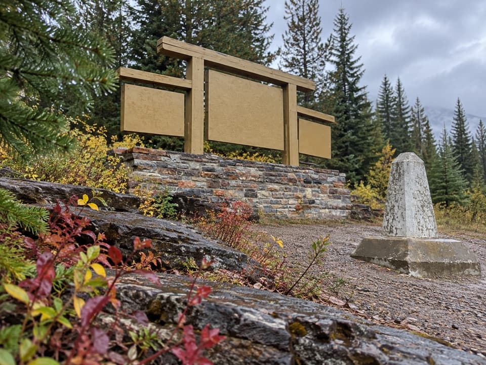
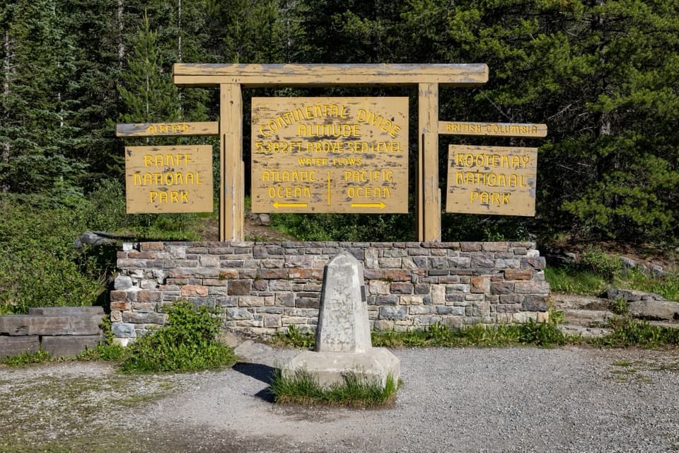
Use the Great Divide parking lot on the south side of Highway 93. Cross to the valley side by the Continental Divide sign; the unmarked route begins about 75 m beyond the road. Washrooms are reported at the lot. A valid park pass is required.

Safety

This is an unmaintained winter route with difficult routefinding. Check the current avalanche bulletin and stay in the valley bottom: Parks Canada classifies the terrain above it as complex. Creek crossings can have open water early in the season. Cross Highway 93 carefully.

5 active Kootenay alerts

  • ClosureWatercraft and angling prohibitedWatercraft and angling are prohibited on every waterbody in Kootenay National Park until March 31, 2027, to reduce the spread of aquatic invasive species (AIS), including whirling disease.Official details
  • ClosureSinclair Canyon construction closures and delaysRepairs to the Sinclair Creek Rock Tunnel and rehabilitation of the retaining wall at Sinclair Canyon require construction closures; expect alternating single-lane traffic on Highway 93S and…Official details
See all 5 alerts
A park ranger sits on a dash-mounted phone, talking, as Parkwolf’s Tour Guide plays “Army Cutworm Moths: A Grizzly Bear Buffet” on Grand Loop Road below Dunraven Pass in Yellowstone
Parkwolf Tour GuideThe highest, rockiest slopes around here are a summer buffet for grizzly bears.

Kootenay Tour Guide

Your drive to Chickadee Valley, narrated.

Parkwolf is a GPS audio tour guide for Kootenay National Park. As you drive, it chimes in with what’s ahead: hidden gems, upcoming stops, history, geology, and wildlife, right through your car’s speakers.

See the Kootenay audio tour

Recorded for this trailhead

Continental Divide: Watersheds and Forest Regrowth
0:00 / 0:28
“The Continental Divide day-use area is ahead at Vermilion Pass, where the Pacific and Atlantic watersheds part. The wooden sign and concrete marker give you a simple way to picture that split.”

Plays as you drive up to this trailhead in the Parkwolf Kootenay Tour Guide.

More stories near here in the app

  • Ice That Flows and Cracks
  • Stanley Glacier Trailhead: Basin and Fossils
  • The Shrimp That Was a Claw
  • Marble Canyon: Beyond the First Bridge
  • 49 audio storiesacross Kootenay’s roads, triggered by GPS as you drive
  • Wildlife heatmapsfor Grizzly Bear, Gray Wolf, Moose, and 13 more
  • Works offlinemaps, 38 trails, 29 places, and audio download before you lose signal
  • CarPlay readysimple controls built for the drive
★★★★★
“Fantastic app with many points of information… It’s great to just turn on while you’re driving and it gives you an audio tour of the national Park. We love it!!!!”
JMJamesApp Store review
Download Parkwolf on the App StoreGet Parkwolf on Google Play

4.7 from 8,600+ ratings

Trail guide

Hiking Chickadee Valley

A winter valley outingChickadee Valley is an unmarked winter out-and-back for snowshoes or cross-country skis,…

Chickadee Valley is an unmarked winter out-and-back for snowshoes or cross-country skis, following a creek toward a meadow. Plan for about 10 km (6.2 miles) round trip and roughly three hours. That estimate assumes about 5 km each way to the reported meadow; no marker confirms a fixed endpoint. The creekside climb is most noticeable in the first kilometre, then the route eases through trees and opens to mountain views. This outing covers the valley bottom, not the separate climb toward Chickadee Peak; no maintained summer hiking route is established.

Finding the trackStart at the Great Divide parking lot on the south side of Highway 93, cross the road to the…

Start at the Great Divide parking lot on the south side of Highway 93, cross the road to the valley side, and look for faint tracks about 75 m beyond the highway. They weave among trees and can be hard to follow, so carry an offline map and navigation. Washrooms are available at the lot; bring food and water, as there are no services along the route. Dogs can join on leash and under control.

Keep to the valley bottomThis route is not maintained.

This route is not maintained. Parks Canada classifies the valley bottom as simple avalanche terrain and the slopes above it as complex; check the current avalanche bulletin and stay on the valley-floor outing described here. Early-season creek crossings can have open water, and the highway crossing needs care. Where trees open toward the mountains, leave some of the snow track in the foreground to show the route’s character.

Wildlife

Wildlife in Kootenay

All Kootenay wildlife maps

Sighting maps show where each species has been reported across Kootenay. Wildlife moves, so no sighting is guaranteed.

Keep exploring

Near Chickadee Valley

See it all on the map

Trails that start nearby

Places near the trailhead

Parkwolf’s Kootenay ranking

Top-rated trails in Kootenay

All 38 trails
  1. 1Rockwall TrailChallenging · 54.1 km
  2. 2Floe LakeChallenging · 21.6 km
  3. 3Stanley GlacierModerate · 8.8 km
  4. 4Marble CanyonEasy · 1.8 km
  5. 5Paint Pots TrailEasy · 2 km
  6. 6Kindersley-Sinclair LoopChallenging · 16.3 km

Take Parkwolf to Kootenay.

The audio tour guide for the drive, plus offline maps, trails, and wildlife heatmaps for when the signal drops.

4.7 from 8,600+ ratings

Download Parkwolf on the App StoreGet Parkwolf on Google Play