Fireweed Loop in Kootenay National Park

Kootenay National Park, BC

Fireweed Loop

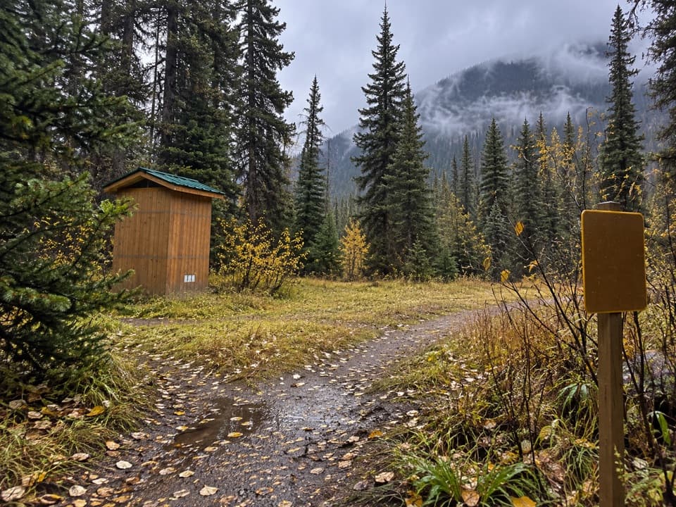
A shaded little loop through the 1968 fire’s recovering forest

Length
0.6km
Time
20min
Elevation
Flat
Difficulty
Easy
  • Loop
  • Dogs allowed
  • High point 1,648 m

Hear the audio tour

Continental Divide: Watersheds and Forest Regrowth

Overview

About Fireweed Loop

Why go

  • A quick, shaded stop with a useful forest-regeneration story.
  • Easy to fit into a drive through Vermilion Pass.

Heads up

  • The named loop is very short; a longer walk follows a separate connected path.

Map & elevation

The route

Loading the Kootenay map
Full map
Elevation1,640–1,648 m
TrailheadContinental Divide day-use area51.22800, -116.05006
Keep this map with you offline in the Parkwolf app

Plan your hike

Before you go

Parking

Park at the Continental Divide day-use area on Highway 93 at Vermilion Pass, about 96 km north of Radium Hot Springs. Follow the Fireweed footpath to the smaller-loop junction; this route includes the short approach and return along the shared path.

5 active Kootenay alerts

  • ClosureWatercraft and angling prohibitedWatercraft and angling are prohibited on every waterbody in Kootenay National Park until March 31, 2027, to reduce the spread of aquatic invasive species (AIS), including whirling disease.Official details
  • ClosureSinclair Canyon construction closures and delaysRepairs to the Sinclair Creek Rock Tunnel and rehabilitation of the retaining wall at Sinclair Canyon require construction closures; expect alternating single-lane traffic on Highway 93S and…Official details
See all 5 alerts
A park ranger sits on a dash-mounted phone, talking, as Parkwolf’s Tour Guide plays “Army Cutworm Moths: A Grizzly Bear Buffet” on Grand Loop Road below Dunraven Pass in Yellowstone
Parkwolf Tour GuideThe highest, rockiest slopes around here are a summer buffet for grizzly bears.

Kootenay Tour Guide

Your drive to Fireweed Loop, narrated.

Parkwolf is a GPS audio tour guide for Kootenay National Park. As you drive, it chimes in with what’s ahead: hidden gems, upcoming stops, history, geology, and wildlife, right through your car’s speakers.

See the Kootenay audio tour

Recorded for this trailhead

Continental Divide: Watersheds and Forest Regrowth
0:00 / 0:28
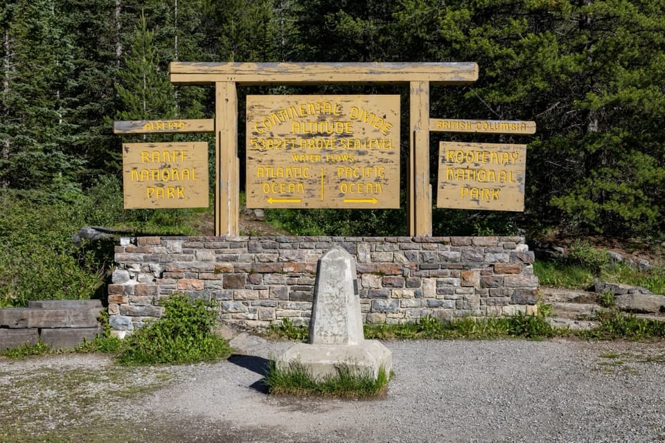
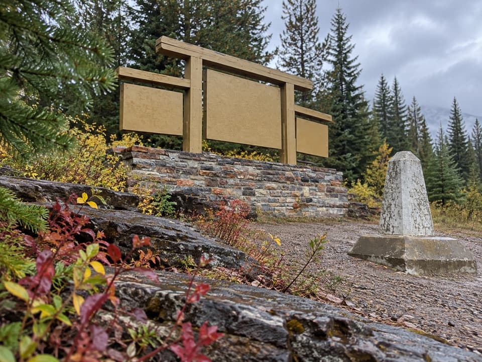
“The Continental Divide day-use area is ahead at Vermilion Pass, where the Pacific and Atlantic watersheds part. The wooden sign and concrete marker give you a simple way to picture that split.”

Plays as you drive up to this trailhead in the Parkwolf Kootenay Tour Guide.

More stories near here in the app

  • Ice That Flows and Cracks
  • Stanley Glacier Trailhead: Basin and Fossils
  • The Shrimp That Was a Claw
  • Marble Canyon: Beyond the First Bridge
  • 49 audio storiesacross Kootenay’s roads, triggered by GPS as you drive
  • Wildlife heatmapsfor Grizzly Bear, Gray Wolf, Moose, and 13 more
  • Works offlinemaps, 38 trails, 29 places, and audio download before you lose signal
  • CarPlay readysimple controls built for the drive
★★★★★
“Fantastic app with many points of information… It’s great to just turn on while you’re driving and it gives you an audio tour of the national Park. We love it!!!!”
JMJamesApp Store review
Download Parkwolf on the App StoreGet Parkwolf on Google Play

4.7 from 8,600+ ratings

Trail guide

Hiking Fireweed Loop

Is this the short walk you want?Fireweed Loop is a 0.2 km (0.12 mi) loop through shaded forest at the Continental Divide.

Fireweed Loop is a 0.2 km (0.12 mi) loop through shaded forest at the Continental Divide. The named loop takes about 15 minutes. From the day-use lot, this mapped walk follows a shared approach to the smaller loop and returns on the same path, about 0.35 mi all in. It is an easy, quick stop to stretch your legs and notice how the forest is recovering after fire; it will not feel like a destination hike. Allow about 20 minutes if you stop at the signs.

Look for the fire’s marksThe Vermilion Pass wildfire burned this area in 1968.

The Vermilion Pass wildfire burned this area in 1968. Parks Canada points visitors toward marks the fire left behind, and interpretive signs tell the story of forest regeneration. Slow down and look at the trees around the trail; the point here is seeing regrowth up close, not chasing a viewpoint.

Start at the Continental DividePark at the Continental Divide day-use area on Highway 93 at Vermilion Pass, about 96 km north…

Park at the Continental Divide day-use area on Highway 93 at Vermilion Pass, about 96 km north of Radium Hot Springs. The short loop branches from a longer connected Fireweed path. This route includes the approach to the small loop and the return along that shared path; it does not include the longer loop. Dogs are allowed on leash, and visitors should stay on designated trails.

Wildlife

Wildlife in Kootenay

All Kootenay wildlife maps

Sighting maps show where each species has been reported across Kootenay. Wildlife moves, so no sighting is guaranteed.

Keep exploring

Near Fireweed Loop

See it all on the map

Trails that start nearby

Places near the trailhead

Parkwolf’s Kootenay ranking

Top-rated trails in Kootenay

All 38 trails
  1. 1Rockwall TrailChallenging · 54.1 km
  2. 2Floe LakeChallenging · 21.6 km
  3. 3Stanley GlacierModerate · 8.8 km
  4. 4Marble CanyonEasy · 1.8 km
  5. 5Paint Pots TrailEasy · 2 km
  6. 6Kindersley-Sinclair LoopChallenging · 16.3 km

Take Parkwolf to Kootenay.

The audio tour guide for the drive, plus offline maps, trails, and wildlife heatmaps for when the signal drops.

4.7 from 8,600+ ratings

Download Parkwolf on the App StoreGet Parkwolf on Google Play