Crystal Mountain Trail 1163 in Mount Rainier National Park

Mount Rainier National Park, WA

Crystal Mountain Trail 1163

A long ridge climb to Rainier and White River views.

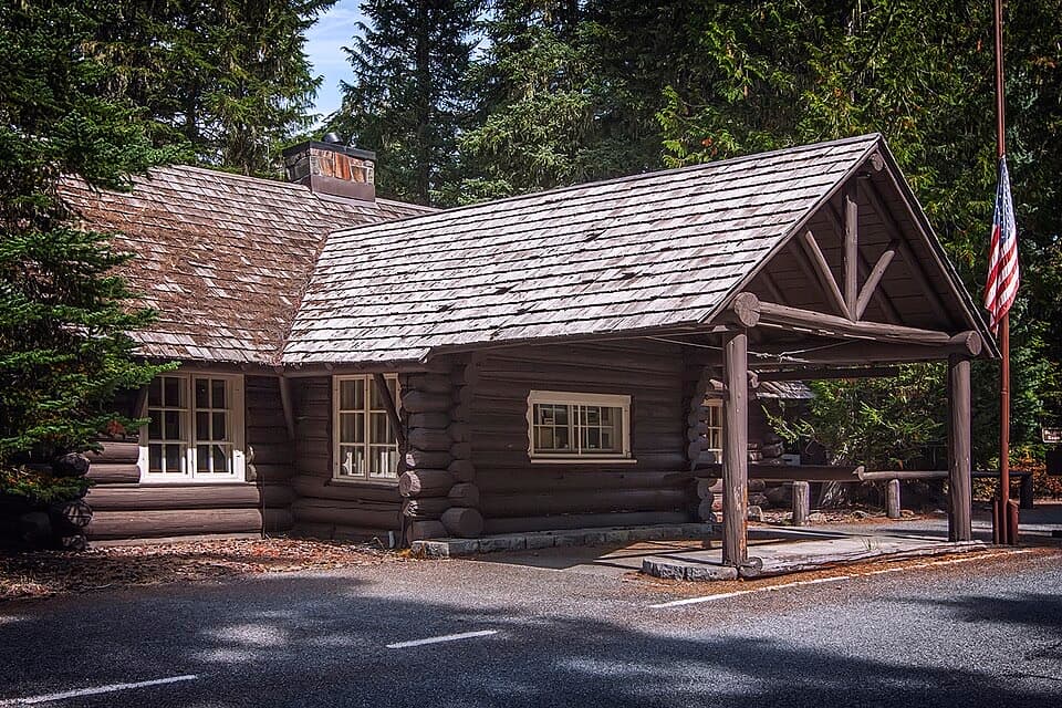
Photo: Wikimedia Commons
Length
12mi
Time
9hr
Elev. change
2,913ft
Difficulty
Challenging
  • Dogs allowed
  • High point 6,801 ft
Parkwolf audio tour77 stories across Mount Rainier’s roads

Overview

About Crystal Mountain Trail 1163

Why go

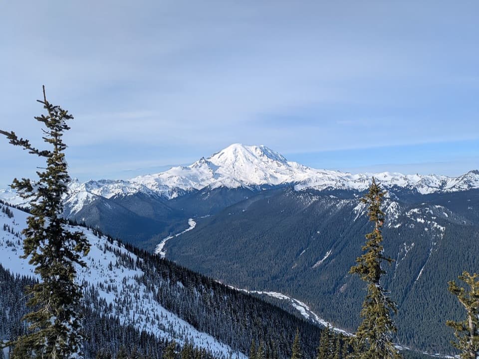
  • Big Rainier and White River views from an open ridge
  • Summit House gives the full hike a clear destination

Heads up

  • The full out-and-back is a 12-mile, near-nine-hour day
  • The upper ridge is exposed and can hold snow into early summer

Map & elevation

The route

Loading the Mount Rainier map
Full map
Elevation3,888–6,801 ft
TrailheadSand Flats Trailhead46.96194, -121.48389
Keep this map with you offline in the Parkwolf app

Plan your hike

Before you go

Parking

From Enumclaw, take Highway 410 east to Crystal Mountain Road (FS Road 7190), then follow FS Road 7190510 to its end at Sand Flats Trailhead. A large parking area is described at the access, and a valid Recreation Pass is required. The nearby Sand Flats Horse Camp has a pit toilet.

Safety

The ridge is wind-swept and some stretches run close to steep edges. Snow can linger into early summer, and potable drinking water is not listed along the route; carry enough for the full day.

7 active Mount Rainier alerts

  • ClosureWildfire closures in the northern parkGrand Park 2 and Wonderland Complex fire closures affect trails, backcountry camps, and Sunrise access; stay out of closed areas.Official details
  • ClosureSR 165 bridge closed: no public access to Carbon River or Mowich LakeThe SR 165 Carbon River/Fairfax Bridge is closed to vehicles, bicycles, and pedestrians; there is no public access or alternate route to Carbon River or Mowich Lake.Official details
See all 7 alerts
A park ranger sits on a dash-mounted phone, talking, as Parkwolf’s Tour Guide plays “Army Cutworm Moths: A Grizzly Bear Buffet” on Grand Loop Road below Dunraven Pass in Yellowstone
Parkwolf Tour GuideThe highest, rockiest slopes around here are a summer buffet for grizzly bears.

Mount Rainier Tour Guide

Your drive to Crystal Mountain Trail 1163, narrated.

Parkwolf is a GPS audio tour guide for Mount Rainier National Park. As you drive, it chimes in with what’s ahead: hidden gems, upcoming stops, history, geology, and wildlife, right through your car’s speakers.

See the Mount Rainier audio tour

More stories near here in the app

  • The Layers Beneath the Snow
  • A Tadpole Built for Rapids
  • The Summit That Collapsed
  • A Bill Built to Open Cones
  • 77 audio storiesacross Mount Rainier’s roads, triggered by GPS as you drive
  • Wildlife heatmapsfor Mountain Goat, Black Bear, Wolverine, and 13 more
  • Works offlinemaps, 99 trails, 87 places, and audio download before you lose signal
  • CarPlay readysimple controls built for the drive
★★★★★
“Fantastic app with many points of information… It’s great to just turn on while you’re driving and it gives you an audio tour of the national Park. We love it!!!!”
JMJamesApp Store review
Download Parkwolf on the App StoreGet Parkwolf on Google Play

4.7 from 8,600+ ratings

Trail guide

Hiking Crystal Mountain Trail 1163

The full ridge walkCrystal Mountain Trail 1163 is a 12-mile round-trip out-and-back from Sand Flats to the Summit…

Crystal Mountain Trail 1163 is a 12-mile round-trip out-and-back from Sand Flats to the Summit House. The first ridge is about 3 miles in; the full route continues another 3 miles each way to the restaurant and returns along the same corridor. Plan on most of a day—about 9 hours—with roughly 2,900 feet of climbing to 6,782 feet. The route starts in Mount Baker–Snoqualmie National Forest and crosses the Mount Rainier boundary along the ridge.

Climb to the ridgeFor the first 1.3 miles, the trail climbs through second-growth forest.

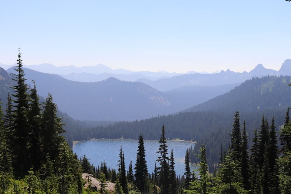
For the first 1.3 miles, the trail climbs through second-growth forest. The trees thin into subalpine openings; a ravine briefly levels out before steeper switchbacks bring you to the ridge around mile 3. A differently colored rock outcrop stands above the path on the way up. At the crest, Rainier hangs over the White River, with Little Tahoma and Emmons Glacier in view. The ridge is an exposed, wind-swept place, so take a moment there before deciding whether to continue. If six miles round trip is enough, this is a natural turnaround.

Along the ridgeThe extra three miles to Summit House alternate between forest and small alpine meadows.

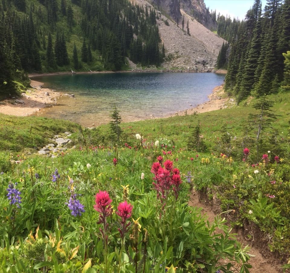
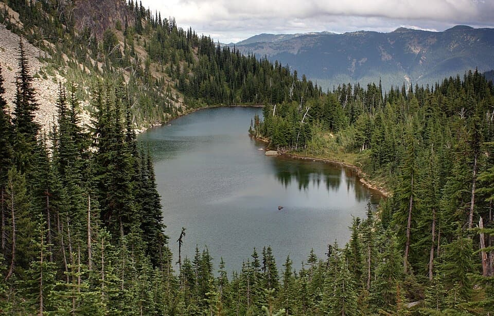
The extra three miles to Summit House alternate between forest and small alpine meadows. The tread gives way to a rocky service road along the crest, past a 6,776-foot high point and toward the top of the Green Valley ski run. Look east for a tarn in the basin below. The signature view is Rainier above the White River; old snags or ridge flowers make a good foreground. The ridge is noted for early-June wildflowers and early-August huckleberries, though snow can linger into early summer.

At Summit HouseSummit House sits at 6,782 feet and has a restaurant with views back toward Rainier.

Summit House sits at 6,782 feet and has a restaurant with views back toward Rainier. Check its current schedule before relying on it for food. Dogs are allowed on the trail on leash and on the patio, but not inside the restaurant. Potable drinking water isn't listed along the route, so carry enough for the full outing.

Trailhead and returnDrive east from Enumclaw on Highway 410 to Crystal Mountain Road (FS Road 7190), then follow FS…

Drive east from Enumclaw on Highway 410 to Crystal Mountain Road (FS Road 7190), then follow FS Road 7190510 to its end at Sand Flats Trailhead. The nearby horse camp has a pit toilet; the actual trailhead is farther along the access. A valid Recreation Pass is required. Retrace the same route from Summit House. This is a full-day hike over exposed ridge terrain, with a shorter six-mile round trip available if you turn around at the first crest.

Wildlife

Wildlife in Mount Rainier

All Mount Rainier wildlife maps

Sighting maps show where each species has been reported across Mount Rainier. Wildlife moves, so no sighting is guaranteed.

Keep exploring

Near Crystal Mountain Trail 1163

See it all on the map

Trails that start nearby

Places near the trailhead

Parkwolf’s Mount Rainier ranking

Top-rated trails in Mount Rainier

All 99 trails
  1. 1Wonderland TrailChallenging · 93 mi
  2. 2Skyline Trail LoopChallenging · 5.5 mi
  3. 3Mount Fremont Lookout TrailModerate · 5.6 mi
  4. 4Burroughs Mountain TrailModerate · 6.2 mi
  5. 5Summerland TrailModerate · 8.4 mi
  6. 6Naches Peak Loop TrailModerate · 3.5 mi

Take Parkwolf to Mount Rainier.

The audio tour guide for the drive, plus offline maps, trails, and wildlife heatmaps for when the signal drops.

4.7 from 8,600+ ratings

Download Parkwolf on the App StoreGet Parkwolf on Google Play