Dewey Lake via Chinook Pass in Mount Rainier National Park

Mount Rainier National Park, WA

Dewey Lake via Chinook Pass

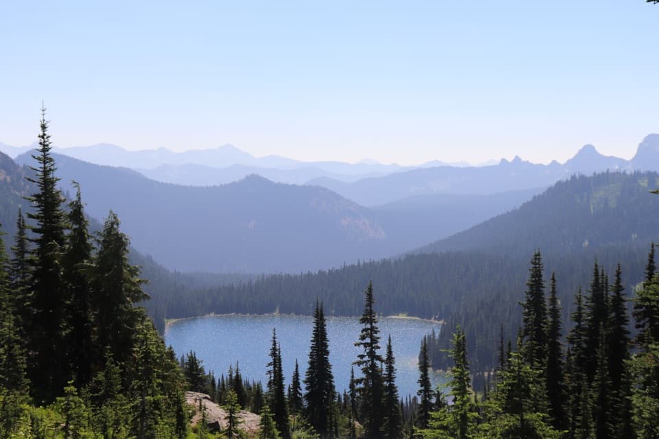
Six miles on the PCT to Dewey Lake beneath Naches Peak.

Photo: Wikimedia Commons
Length
6mi
Time
4hr
Elev. change
761ft
Difficulty
Moderate
  • Dogs allowed
  • High point 5,879 ft

Hear the audio tour

Tipsoo Lake and Chinook's Trail Bridge

Overview

About Dewey Lake via Chinook Pass

Why go

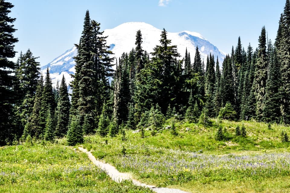
  • Open meadows, a tarn basin and lakeside campsites give the PCT approach a strong payoff.
  • A short optional spur adds a Mount Rainier viewpoint.

Heads up

  • The lake descent becomes a 700-foot climb on the return.
  • Snowy avalanche chutes and peak-summer mosquitoes can complicate timing.

Map & elevation

The route

Loading the Mount Rainier map
Full map
Elevation5,118–5,879 ft
TrailheadChinook Pass Overlook / PCT trailhead parking46.87476, -121.51720
Keep this map with you offline in the Parkwolf app

Plan your hike

Before you go

Parking

Use the Chinook Pass Overlook/PCT parking area on SR 410, not the Tipsoo Lake lot. The lot often fills in mid-season mornings. A day-use fee or accepted recreation pass is required; a free self-issued wilderness permit is available at the trailhead. A vault toilet is available, but there is no potable water.

Best time to go

The upper descent is rocky and eroded, with water-bar steps; the tread improves once you enter the forest. The 700-foot climb from the lake back to the junction is the part to save energy for. Snow often lasts into mid-June, and the avalanche chutes can be dangerous into late June or early July. Late July brings the flower show, huckleberries ripen around mid-August, and September brings fall color and elk bugling. Summer mosquitoes can be fierce around the lake, so bring repellent.

Safety

Snow can linger in the avalanche chutes into late June or early July, when crossings may be hazardous. The rocky, eroded descent has water-bar steps, and the 700-foot climb back out is strenuous. There is no potable water on the route. Dogs are prohibited on the westward branch into Mount Rainier National Park.

7 active Mount Rainier alerts

  • ClosureWildfire closures in the northern parkGrand Park 2 and Wonderland Complex fire closures affect trails, backcountry camps, and Sunrise access; stay out of closed areas.Official details
  • ClosureSR 165 bridge closed: no public access to Carbon River or Mowich LakeThe SR 165 Carbon River/Fairfax Bridge is closed to vehicles, bicycles, and pedestrians; there is no public access or alternate route to Carbon River or Mowich Lake.Official details
See all 7 alerts
A park ranger sits on a dash-mounted phone, talking, as Parkwolf’s Tour Guide plays “Army Cutworm Moths: A Grizzly Bear Buffet” on Grand Loop Road below Dunraven Pass in Yellowstone
Parkwolf Tour GuideThe highest, rockiest slopes around here are a summer buffet for grizzly bears.

Mount Rainier Tour Guide

Your drive to Dewey Lake via Chinook Pass, narrated.

Parkwolf is a GPS audio tour guide for Mount Rainier National Park. As you drive, it chimes in with what’s ahead: hidden gems, upcoming stops, history, geology, and wildlife, right through your car’s speakers.

See the Mount Rainier audio tour

Recorded for this trailhead

Tipsoo Lake and Chinook's Trail Bridge
0:00 / 0:35
“Up ahead is the Tipsoo Lake area near Chinook Pass, a good stop for a short lakeshore walk among the meadows.”

Plays as you drive up to this trailhead in the Parkwolf Mount Rainier Tour Guide.

More stories near here in the app

  • When Snow Turns Pink
  • Worms That Live in Ice
  • Why the River Looks Milky
  • The Road That Never Made a Ring
  • 77 audio storiesacross Mount Rainier’s roads, triggered by GPS as you drive
  • Wildlife heatmapsfor Mountain Goat, Black Bear, Wolverine, and 13 more
  • Works offlinemaps, 99 trails, 87 places, and audio download before you lose signal
  • CarPlay readysimple controls built for the drive
★★★★★
“Fantastic app with many points of information… It’s great to just turn on while you’re driving and it gives you an audio tour of the national Park. We love it!!!!”
JMJamesApp Store review
Download Parkwolf on the App StoreGet Parkwolf on Google Play

4.7 from 8,600+ ratings

Trail guide

Hiking Dewey Lake via Chinook Pass

The six-mile routeDewey Lake via Chinook Pass is a six-mile out-and-back on the Pacific Crest Trail, with about…

Dewey Lake via Chinook Pass is a six-mile out-and-back on the Pacific Crest Trail, with about 1,270 feet of total climbing. Start at the Chinook Pass Overlook/PCT lot, join the trail by a short access path, cross the SR 410 bridge and traverse the north side of Naches Peak. The PCT climbs gradually through open flower meadows, avalanche gullies and a small tarn basin to a high point near 5,900 feet, where Dewey Lake comes into view below. Allow about four hours. You'll descend to the lake, then climb back out on the same route.

The lake basinAt about 2.9 miles, two unsigned paths branch from the PCT.

At about 2.9 miles, two unsigned paths branch from the PCT. The northeast path reaches a Dewey Lake campsite and a small beach; the southwest path goes around a smaller unnamed lake and passes two campsites. The PCT continues along the main lake's south shore, with campsites and small beaches. Most day hikers turn around in this basin. If you want Mount Rainier views, a short westward spur from the Naches Peak junction climbs about 100 feet to a viewpoint; return to the junction before descending to the lake. The eastern stretch of a separate north-shore path is the only part of the lakeshore with Rainier in view.

Access and rulesUse the Chinook Pass Overlook/PCT parking area on SR 410, not the Tipsoo Lake lot.

Use the Chinook Pass Overlook/PCT parking area on SR 410, not the Tipsoo Lake lot. The parking area often fills in mid-season mornings. A day-use fee or accepted recreation pass is required, and a free self-issued wilderness permit is available at the trailhead. There is a vault toilet but no potable water. SR 410 closes for winter, so access is seasonal. Dogs are allowed on the PCT route to Dewey Lake; they are prohibited if you continue west into Mount Rainier National Park on the Naches Peak Loop.
Wildlife

Wildlife in Mount Rainier

All Mount Rainier wildlife maps

Sighting maps show where each species has been reported across Mount Rainier. Wildlife moves, so no sighting is guaranteed.

Keep exploring

Near Dewey Lake via Chinook Pass

See it all on the map

Trails that start nearby

Places near the trailhead

Parkwolf’s Mount Rainier ranking

Top-rated trails in Mount Rainier

All 99 trails
  1. 1Wonderland TrailChallenging · 93 mi
  2. 2Skyline Trail LoopChallenging · 5.5 mi
  3. 3Mount Fremont Lookout TrailModerate · 5.6 mi
  4. 4Burroughs Mountain TrailModerate · 6.2 mi
  5. 5Summerland TrailModerate · 8.4 mi
  6. 6Naches Peak Loop TrailModerate · 3.5 mi

Take Parkwolf to Mount Rainier.

The audio tour guide for the drive, plus offline maps, trails, and wildlife heatmaps for when the signal drops.

4.7 from 8,600+ ratings

Download Parkwolf on the App StoreGet Parkwolf on Google Play