Sheep Lake to Sourdough Gap Trail in Mount Rainier National Park

Mount Rainier National Park, WA

Sheep Lake to Sourdough Gap Trail

A lakeside pause before a steeper climb to a high saddle.

Photo: Flickr
Length
6.6mi
Time
4hr
Elev. change
1,027ft
Difficulty
Moderate
  • Dogs allowed
  • High point 6,427 ft
  • #43 of 99 in Mount Rainier

Hear the audio tour

Tipsoo Lake and Chinook's Trail Bridge

Overview

About Sheep Lake to Sourdough Gap Trail

Why go

  • Sheep Lake makes a natural rest stop before the open views from the gap.
  • The route shifts from open hillside to forest, meadow and alpine basin.

Heads up

  • A steeper 1.2-mile climb begins beyond Sheep Lake.
  • The trailhead lot is small, and there is no potable water at the site.

Map & elevation

The route

Loading the Mount Rainier map
Full map
Elevation5,400–6,427 ft
TrailheadChinook Pass PCT Trailhead46.87476, -121.51720
Keep this map with you offline in the Parkwolf app

Plan your hike

Before you go

Parking

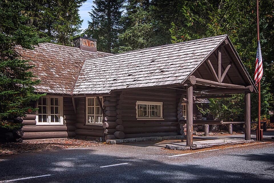
Use the Forest Service PCT lot on the north side of SR 410 just east of Chinook Pass; the trail begins at the east end behind the vault toilets. The lot has about 20 spaces. If full, park at Tipsoo Lake and add the signed quarter-mile approach. A valid recreation pass or day-use payment is required, and the free wilderness permit is completed at the trailhead.

Best time to go

The Forest Service lot is on the north side of SR 410 just east of Chinook Pass. Start at its east end behind the vault toilets. It has about 20 spaces; if full, use the Tipsoo Lake lot and follow the signed quarter-mile approach to the PCT lot. A valid recreation pass or day-use payment is required, and hikers must fill out the free wilderness permit at the trailhead. There is no potable water at the lot. Dogs may use this PCT route on leash no longer than six feet, including within the park's eastern PCT exception. Chinook Pass closes each winter, and snow can linger on the high trail into early summer, so check road and trail conditions before setting out.
Safety

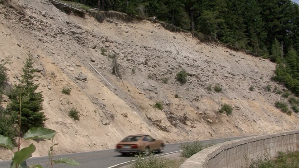
There is no potable water at the trailhead. The first mile follows a steep hillside above SR 410, and the climb beyond Sheep Lake is steeper. High-elevation snow and fast-changing weather can affect the upper route; SR 410 closes in winter, so check road and trail conditions before starting. Complete the free wilderness permit at the trailhead.
7 active Mount Rainier alerts

  • ClosureWildfire closures in the northern parkGrand Park 2 and Wonderland Complex fire closures affect trails, backcountry camps, and Sunrise access; stay out of closed areas.Official details
  • ClosureSR 165 bridge closed: no public access to Carbon River or Mowich LakeThe SR 165 Carbon River/Fairfax Bridge is closed to vehicles, bicycles, and pedestrians; there is no public access or alternate route to Carbon River or Mowich Lake.Official details
See all 7 alerts
A park ranger sits on a dash-mounted phone, talking, as Parkwolf’s Tour Guide plays “Army Cutworm Moths: A Grizzly Bear Buffet” on Grand Loop Road below Dunraven Pass in Yellowstone
Parkwolf Tour GuideThe highest, rockiest slopes around here are a summer buffet for grizzly bears.

Mount Rainier Tour Guide

Your drive to Sheep Lake to Sourdough Gap Trail, narrated.

Parkwolf is a GPS audio tour guide for Mount Rainier National Park. As you drive, it chimes in with what’s ahead: hidden gems, upcoming stops, history, geology, and wildlife, right through your car’s speakers.

See the Mount Rainier audio tour

Recorded for this trailhead

Tipsoo Lake and Chinook's Trail Bridge
0:00 / 0:35
“Up ahead is the Tipsoo Lake area near Chinook Pass, a good stop for a short lakeshore walk among the meadows.”

Plays as you drive up to this trailhead in the Parkwolf Mount Rainier Tour Guide.

More stories near here in the app

  • When Snow Turns Pink
  • Worms That Live in Ice
  • Why the River Looks Milky
  • The Road That Never Made a Ring
  • 77 audio storiesacross Mount Rainier’s roads, triggered by GPS as you drive
  • Wildlife heatmapsfor Mountain Goat, Black Bear, Wolverine, and 13 more
  • Works offlinemaps, 99 trails, 87 places, and audio download before you lose signal
  • CarPlay readysimple controls built for the drive
★★★★★
“Fantastic app with many points of information… It’s great to just turn on while you’re driving and it gives you an audio tour of the national Park. We love it!!!!”
JMJamesApp Store review
Download Parkwolf on the App StoreGet Parkwolf on Google Play

4.7 from 8,600+ ratings

Trail guide

Hiking Sheep Lake to Sourdough Gap Trail

The full walkSheep Lake to Sourdough Gap is a high-country Pacific Crest Trail out-and-back from Chinook…

Sheep Lake to Sourdough Gap is a high-country Pacific Crest Trail out-and-back from Chinook Pass. Published estimates range from 6 to 6.6 miles round trip. The more detailed leg distances add up to about 6.6 miles, while some route listings round the walk to 6 miles. Allow around four hours for a moderate walk with roughly 1,000 feet of climbing.

Along the first mileFrom the east end of the PCT lot, the trail traverses a hillside above SR 410.

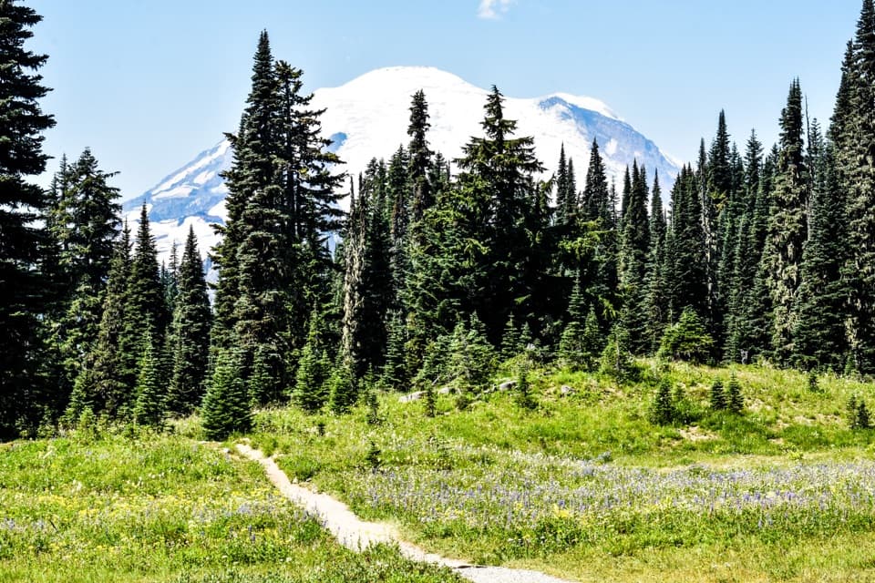
From the east end of the PCT lot, the trail traverses a hillside above SR 410. It is fairly level overall, with open views into the Rainier Fork of the American River valley and glimpses of Mount Rainier and Naches Peak. The PCT then turns north, leaving the road behind, and weaves through pockets of forest and small meadows.

A break at Sheep LakeThe climb eases as the route enters the lake basin.

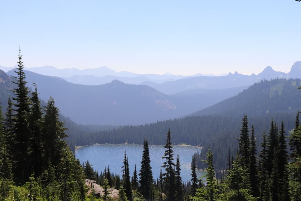
The climb eases as the route enters the lake basin. Sheep Lake appears beside a rocky outcrop where hikers stop by the water; there is also a small beach where wading is possible. The subalpine meadows are known for summer wildflowers, especially in July and August, though bloom timing varies. The route skirts the lake before the harder part begins.

The last climb and the gapBeyond the lake, the trail climbs the valley wall more steadily to Sourdough Gap, a rocky…

Beyond the lake, the trail climbs the valley wall more steadily to Sourdough Gap, a rocky saddle at about 6,400 feet. The view opens over Sheep Lake and the South Cascades, with Mount Adams and Mount St. Helens visible on clear days; Placer Lake and Norse Peak lie to the north. For a photo, frame Sheep Lake below from the saddle to show how the basin sits under the ridge. The PCT continues beyond the gap toward Crystal Lakes, but that extension is not part of this out-and-back.

A shorter versionIf you want the lake without the steepest climb, turn back at Sheep Lake for about 3.

If you want the lake without the steepest climb, turn back at Sheep Lake for about 3.7 miles round trip. Continuing to Sourdough Gap adds roughly 2.8 miles of walking and the best overlook of the basin; return the same way to the Chinook Pass lot.

Wildlife

Wildlife in Mount Rainier

All Mount Rainier wildlife maps

Sighting maps show where each species has been reported across Mount Rainier. Wildlife moves, so no sighting is guaranteed.

Keep exploring

Near Sheep Lake to Sourdough Gap Trail

See it all on the map

Trails that start nearby

Places near the trailhead

Parkwolf’s Mount Rainier ranking

Top-rated trails in Mount Rainier

All 99 trails
  1. 1Wonderland TrailChallenging · 93 mi
  2. 2Skyline Trail LoopChallenging · 5.5 mi
  3. 3Mount Fremont Lookout TrailModerate · 5.6 mi
  4. 4Burroughs Mountain TrailModerate · 6.2 mi
  5. 5Summerland TrailModerate · 8.4 mi
  6. 6Naches Peak Loop TrailModerate · 3.5 mi

Take Parkwolf to Mount Rainier.

The audio tour guide for the drive, plus offline maps, trails, and wildlife heatmaps for when the signal drops.

4.7 from 8,600+ ratings

Download Parkwolf on the App StoreGet Parkwolf on Google Play