Pacific Crest Trail: Chinook Pass to Laughingwater Creek Junction in Mount Rainier National Park

Mount Rainier National Park, WA

Pacific Crest Trail: Chinook Pass to Laughingwater Creek Junction

Lakes, meadows and Rainier views reward this long PCT traverse.

Photo: National Park Service
Length
8.9mi
Time
6hr
Elev. change
732ft
Difficulty
Moderate
  • Dogs allowed
  • High point 5,906 ft

Hear the audio tour

Tipsoo Lake and Chinook's Trail Bridge

Overview

About Pacific Crest Trail: Chinook Pass to Laughingwater Creek Junction

Why go

  • Dewey and Anderson lakes, with Rainier views on the southern half
  • A natural turnaround at Anderson Lake if you have one car

Heads up

  • The south end is a remote trail junction; the road exit adds 7.3 miles
  • A trip account reports 10.5 miles, versus about 8.9 miles mapped

Map & elevation

The route

Loading the Mount Rainier map
Full map
Elevation5,174–5,906 ft
TrailheadChinook Pass Trailhead46.87487, -121.51773
Keep this map with you offline in the Parkwolf app

Plan your hike

Before you go

Parking

Use the Tipsoo Lake parking area at Chinook Pass on State Route 410; the PCT crosses the road at the historic entrance arch. Summer parking can be limited. The far end is a trail junction, not a parking lot: reaching State Route 123 via Laughingwater Creek Trail adds about 7.3 miles, so arrange a shuttle or turn around. Tipsoo has toilets and picnic tables, but no food service.

Safety

This is a long, remote point-to-point walk with no road access at the south junction. Snow can linger into June or July, and Chinook Pass closes seasonally. Reaching State Route 123 from the PCT junction adds about 7.3 miles. Overnight camping in park wilderness requires a permit. Dogs are allowed on the PCT but not around Tipsoo Lake or on the park portion of Naches Peak Loop.

7 active Mount Rainier alerts

  • ClosureWildfire closures in the northern parkGrand Park 2 and Wonderland Complex fire closures affect trails, backcountry camps, and Sunrise access; stay out of closed areas.Official details
  • ClosureSR 165 bridge closed: no public access to Carbon River or Mowich LakeThe SR 165 Carbon River/Fairfax Bridge is closed to vehicles, bicycles, and pedestrians; there is no public access or alternate route to Carbon River or Mowich Lake.Official details
See all 7 alerts
A park ranger sits on a dash-mounted phone, talking, as Parkwolf’s Tour Guide plays “Army Cutworm Moths: A Grizzly Bear Buffet” on Grand Loop Road below Dunraven Pass in Yellowstone
Parkwolf Tour GuideThe highest, rockiest slopes around here are a summer buffet for grizzly bears.

Mount Rainier Tour Guide

Your drive to Pacific Crest Trail: Chinook Pass to Laughingwater Creek Junction, narrated.

Parkwolf is a GPS audio tour guide for Mount Rainier National Park. As you drive, it chimes in with what’s ahead: hidden gems, upcoming stops, history, geology, and wildlife, right through your car’s speakers.

See the Mount Rainier audio tour

Recorded for this trailhead

Tipsoo Lake and Chinook's Trail Bridge
0:00 / 0:35
“Up ahead is the Tipsoo Lake area near Chinook Pass, a good stop for a short lakeshore walk among the meadows.”

Plays as you drive up to this trailhead in the Parkwolf Mount Rainier Tour Guide.

More stories near here in the app

  • When Snow Turns Pink
  • Worms That Live in Ice
  • Why the River Looks Milky
  • The Road That Never Made a Ring
  • 77 audio storiesacross Mount Rainier’s roads, triggered by GPS as you drive
  • Wildlife heatmapsfor Mountain Goat, Black Bear, Wolverine, and 13 more
  • Works offlinemaps, 99 trails, 87 places, and audio download before you lose signal
  • CarPlay readysimple controls built for the drive
★★★★★
“Fantastic app with many points of information… It’s great to just turn on while you’re driving and it gives you an audio tour of the national Park. We love it!!!!”
JMJamesApp Store review
Download Parkwolf on the App StoreGet Parkwolf on Google Play

4.7 from 8,600+ ratings

Trail guide

Hiking Pacific Crest Trail: Chinook Pass to Laughingwater Creek Junction

A long PCT traverse, not a loopThis is the southbound Pacific Crest Trail from Chinook Pass to the Laughingwater Creek…

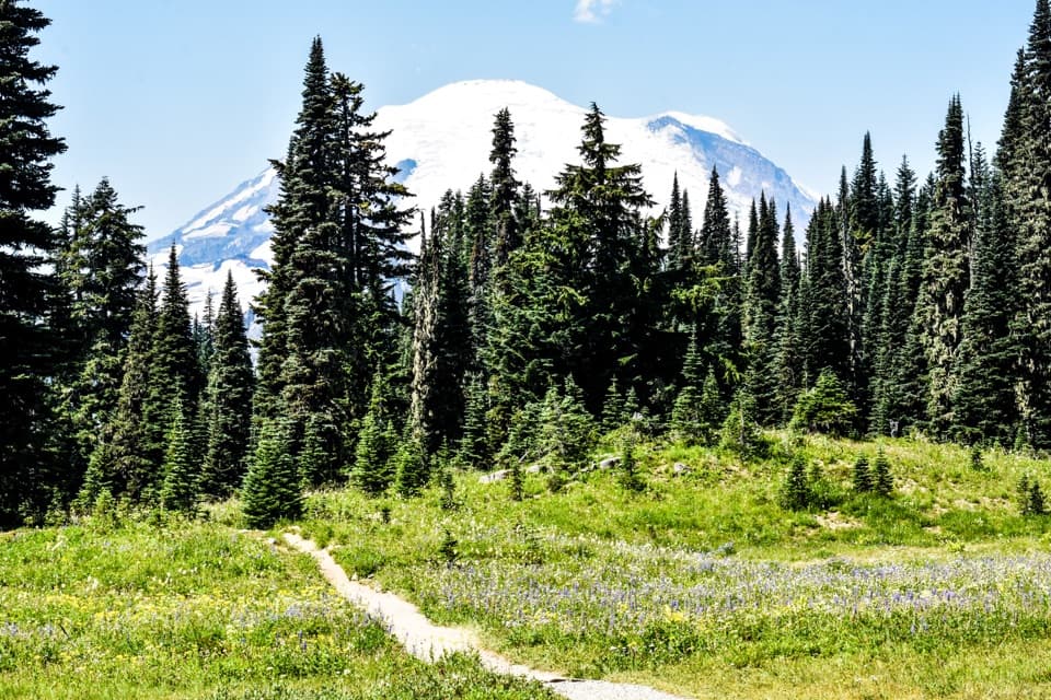
This is the southbound Pacific Crest Trail from Chinook Pass to the Laughingwater Creek junction, a point-to-point high-country walk. The mapped line is 8.86 miles one way, winding around the northeast side of Naches Peak, dropping to Dewey Lake, then climbing and contouring through rocky basins and open slopes toward a remote junction. Its draw is the sequence of lakes, summer flowers and Mount Rainier views; the finish is not at a road. One detailed trip account puts this same PCT leg at 10.5 miles, and no official mileage settles the gap, so plan for the longer figure and a full day. Allow about six hours of hiking, plus breaks and your exit plan; the effort is mainly distance, not a steep summit climb.

Around Naches PeakThe PCT crosses State Route 410 at the historic Chinook Entrance Arch and follows Naches Peak’s…

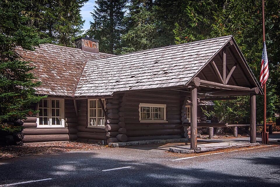
The PCT crosses State Route 410 at the historic Chinook Entrance Arch and follows Naches Peak’s northeast side past high ponds and subalpine forest. At the junction where Naches Peak Loop turns back toward Tipsoo Lake, stay with the PCT for Dewey Lake. Dogs are allowed on the PCT, but not around Tipsoo Lake or on the park section of the adjacent loop, so follow the PCT signs if you have a dog.

Dewey LakeThe trail drops into the Dewey Lakes basin and circles the lake before climbing out around…

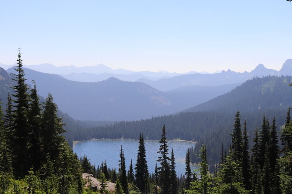
The trail drops into the Dewey Lakes basin and circles the lake before climbing out around Seymour Peak. Watch for the junction near the shore: an older route account found it easy to miss, so keep checking the PCT route as you follow the lake around. Dewey Lake is the best place to stop for a photo; include the firs and the near shore to show the shape of the basin, not just a patch of blue water.

Anderson Lake and the open countryAnderson Lake is roughly five miles from Chinook Pass and makes a useful turnaround if you have…

Anderson Lake is roughly five miles from Chinook Pass and makes a useful turnaround if you have one car; going there and back is about a 10-mile hike. Beyond the lake, the climb brings Mount Rainier into view for much of the remaining PCT. Rocky basins and open meadows keep the long ridge walk changing, with lupine and paintbrush in the summer bloom.

Getting out at the south endThe PCT leg ends at the Laughingwater Creek junction, not at a road.

The PCT leg ends at the Laughingwater Creek junction, not at a road. Reaching State Route 123 means leaving the PCT and following Laughingwater Creek Trail another 7.3 miles. Three Lakes Camp and a patrol cabin built in 1934 are on that separate route, not in the PCT mileage here. Arrange a shuttle, continue with an overnight plan, or turn back. Chinook Pass is a summer-only drive, and snow can linger on the high trail into June or July. Overnight camping in park wilderness requires a permit.

Wildlife

Wildlife in Mount Rainier

All Mount Rainier wildlife maps

Sighting maps show where each species has been reported across Mount Rainier. Wildlife moves, so no sighting is guaranteed.

Keep exploring

Near Pacific Crest Trail: Chinook Pass to Laughingwater Creek Junction

See it all on the map

Trails that start nearby

Places near the trailhead

Parkwolf’s Mount Rainier ranking

Top-rated trails in Mount Rainier

All 99 trails
  1. 1Wonderland TrailChallenging · 93 mi
  2. 2Skyline Trail LoopChallenging · 5.5 mi
  3. 3Mount Fremont Lookout TrailModerate · 5.6 mi
  4. 4Burroughs Mountain TrailModerate · 6.2 mi
  5. 5Summerland TrailModerate · 8.4 mi
  6. 6Naches Peak Loop TrailModerate · 3.5 mi

Take Parkwolf to Mount Rainier.

The audio tour guide for the drive, plus offline maps, trails, and wildlife heatmaps for when the signal drops.

4.7 from 8,600+ ratings

Download Parkwolf on the App StoreGet Parkwolf on Google Play