Eastside Loop in Mount Rainier National Park

Mount Rainier National Park, WA

Eastside Loop

A long loop from deep forest to high alpine meadows.

Photo: National Park Service
Length
34.5mi
Time
22hr
Elev. change
4,255ft
Difficulty
Challenging
  • Loop
  • No dogs
  • High point 6,529 ft
  • #21 of 99 in Mount Rainier

Hear the audio tour

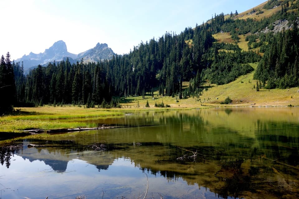
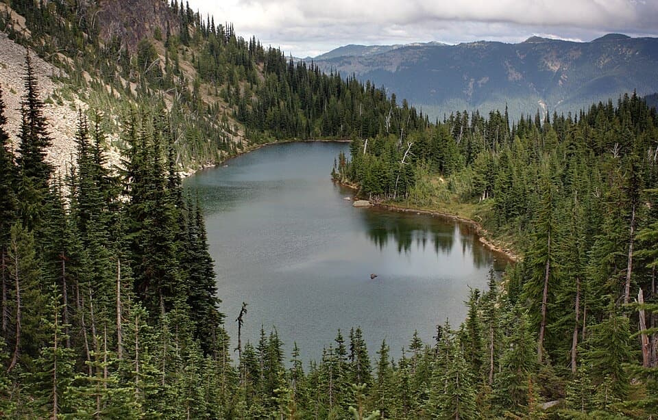
Owyhigh Lakes: A Basin Below Governors Ridge

Overview

About Eastside Loop

Why go

  • One continuous circuit links lakes, waterfalls, a divide ridge and high alpine meadows.
  • Indian Bar, Panhandle Gap and Summerland give the Wonderland section a strong high-country payoff.
  • The scenery changes from deep river canyon to open subalpine terrain over several days.

Heads up

  • A hard, long backpacking route with large climbs and high-country snow travel.
  • A long dry section between Indian Bar and Olallie Creek requires water planning.
  • The loop closes with a road walk between Fryingpan Creek and the Owyhigh access.

Map & elevation

The route

Loading the Mount Rainier map
Full map
Elevation2,274–6,529 ft
TrailheadOwyhigh Lakes Trailhead46.89070, -121.59680
Keep this map with you offline in the Parkwolf app

Plan your hike

Before you go

Parking

Use Owyhigh Lakes Trailhead on White River Road, reached from SR 410 by taking the White River/Sunrise fork and continuing about 2.5 miles. The circuit also uses a short Sunrise Park Road walk between Fryingpan Creek and the Owyhigh access; arrange transport if you do not want to walk that connector.

Safety

Pets are prohibited on park trails. Overnight wilderness camping requires a permit year-round; plan camps ahead, treat surface water and carry enough for the dry divide section. Snow can linger near Panhandle Gap and make travel more demanding.

7 active Mount Rainier alerts

  • ClosureWildfire closures in the northern parkGrand Park 2 and Wonderland Complex fire closures affect trails, backcountry camps, and Sunrise access; stay out of closed areas.Official details
  • ClosureSR 165 bridge closed: no public access to Carbon River or Mowich LakeThe SR 165 Carbon River/Fairfax Bridge is closed to vehicles, bicycles, and pedestrians; there is no public access or alternate route to Carbon River or Mowich Lake.Official details
See all 7 alerts
A park ranger sits on a dash-mounted phone, talking, as Parkwolf’s Tour Guide plays “Army Cutworm Moths: A Grizzly Bear Buffet” on Grand Loop Road below Dunraven Pass in Yellowstone
Parkwolf Tour GuideThe highest, rockiest slopes around here are a summer buffet for grizzly bears.

Mount Rainier Tour Guide

Your drive to Eastside Loop, narrated.

Parkwolf is a GPS audio tour guide for Mount Rainier National Park. As you drive, it chimes in with what’s ahead: hidden gems, upcoming stops, history, geology, and wildlife, right through your car’s speakers.

See the Mount Rainier audio tour

Recorded for this trailhead

Owyhigh Lakes: A Basin Below Governors Ridge
0:00 / 0:25
“Owyhigh Lakes trailhead is coming up, the start of a steady forest climb to two shallow lakes below jagged Governors Ridge.”

Plays as you drive up to this trailhead in the Parkwolf Mount Rainier Tour Guide.

More stories near here in the app

  • Fryingpan Creek: The Climb to Summerland
  • A Pika's Winter Haypile
  • A Red Fox in a Black Coat
  • Sunrise Road: Sideways Lava Columns
  • 77 audio storiesacross Mount Rainier’s roads, triggered by GPS as you drive
  • Wildlife heatmapsfor Mountain Goat, Black Bear, Wolverine, and 13 more
  • Works offlinemaps, 99 trails, 87 places, and audio download before you lose signal
  • CarPlay readysimple controls built for the drive
★★★★★
“Fantastic app with many points of information… It’s great to just turn on while you’re driving and it gives you an audio tour of the national Park. We love it!!!!”
JMJamesApp Store review
Download Parkwolf on the App StoreGet Parkwolf on Google Play

4.7 from 8,600+ ratings

Trail guide

Hiking Eastside Loop

A multiday circuitEastside Loop is a roughly 35-mile backpacking circuit linking the Owyhigh Lakes, Eastside,…

Eastside Loop is a roughly 35-mile backpacking circuit linking the Owyhigh Lakes, Eastside, Cowlitz Divide and Wonderland trails. From Owyhigh Lakes Trailhead it passes Deer Creek, turns north on Cowlitz Divide, visits Indian Bar and Panhandle Gap, then descends through Summerland and returns by Fryingpan Creek and Sunrise Park Road. Plan four or five days and roughly 7,400–9,000 feet of climbing; reported distances range from about 34 to 36 miles.

Plan for the commitmentThis is a hard, remote trip with long climbs and high-country travel.

This is a hard, remote trip with long climbs and high-country travel. Allow about 19–22 hours of hiking, then divide that effort across several days with camps that fit your permit. There are no services on the route. A long dry stretch lies between Indian Bar and Olallie Creek, so carry enough water before leaving either end.

From lakes to river canyonThe Owyhigh Trail climbs on forest switchbacks to Owyhigh Lakes, then crosses the pass and…

The Owyhigh Trail climbs on forest switchbacks to Owyhigh Lakes, then crosses the pass and drops to Deer Creek. Southbound on the Eastside Trail, the route follows the Chinook Creek and Ohanapecosh River valleys through dense forest; waterfalls punctuate the canyon, but the lowland views stay limited. At Stevens Canyon, the loop links through the Silver Falls area to Cowlitz Divide.

Over Cowlitz DivideCowlitz Divide climbs north through forest and huckleberry patches before reaching open ridge…

Cowlitz Divide climbs north through forest and huckleberry patches before reaching open ridge country. On clear stretches, the route looks toward Mount Rainier, Mount Adams, the Tatoosh Range and the Cowlitz Chimneys. This section brings another sustained climb after the Eastside's gentler river corridor.

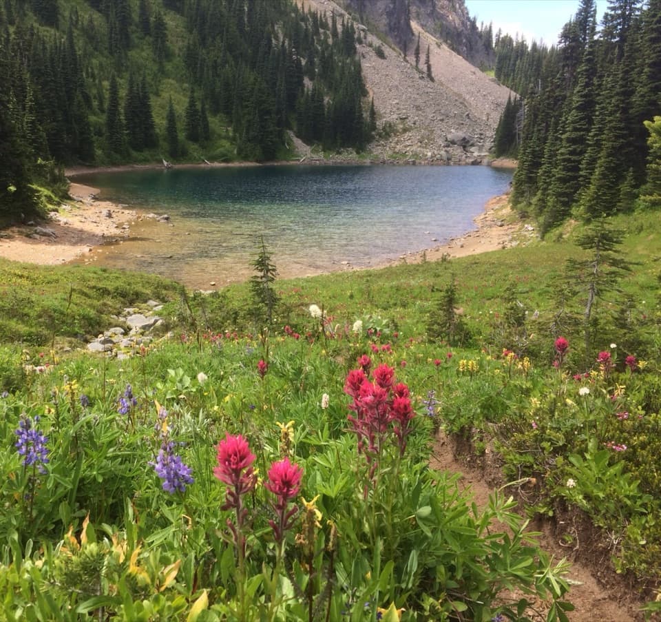
Indian Bar to SummerlandThe Wonderland Trail crosses Indian Bar, a broad subalpine valley split by the Ohanapecosh…

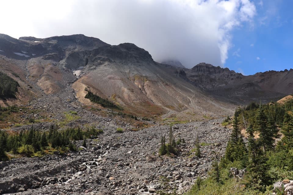
The Wonderland Trail crosses Indian Bar, a broad subalpine valley split by the Ohanapecosh River, with waterfalls below the rocky basin and small glacier remnants near its head. The route then climbs above the meadows to Panhandle Gap before descending to Summerland. Snow can linger around the gap and make footing and route-finding harder; stay on the marked tread to protect the fragile meadows.

Close the loopFrom Summerland, follow the Wonderland toward Fryingpan Creek, then use the Sunrise Park Road…

From Summerland, follow the Wonderland toward Fryingpan Creek, then use the Sunrise Park Road connector to return to Owyhigh Lakes Trailhead. Arrange your days and transport around that road walk, and carry a map for the long, remote sections.

Wildlife

Wildlife in Mount Rainier

All Mount Rainier wildlife maps

Sighting maps show where each species has been reported across Mount Rainier. Wildlife moves, so no sighting is guaranteed.

Keep exploring

Near Eastside Loop

See it all on the map

Trails that start nearby

Places near the trailhead

Parkwolf’s Mount Rainier ranking

Top-rated trails in Mount Rainier

All 99 trails
  1. 1Wonderland TrailChallenging · 93 mi
  2. 2Skyline Trail LoopChallenging · 5.5 mi
  3. 3Mount Fremont Lookout TrailModerate · 5.6 mi
  4. 4Burroughs Mountain TrailModerate · 6.2 mi
  5. 5Summerland TrailModerate · 8.4 mi
  6. 6Naches Peak Loop TrailModerate · 3.5 mi

Take Parkwolf to Mount Rainier.

The audio tour guide for the drive, plus offline maps, trails, and wildlife heatmaps for when the signal drops.

4.7 from 8,600+ ratings

Download Parkwolf on the App StoreGet Parkwolf on Google Play