Summerland–Panhandle Gap Trail in Mount Rainier National Park

#7 of 99 trails in Mount Rainier

Mount Rainier National Park, WA

Summerland–Panhandle Gap Trail

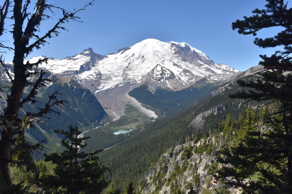
Rainier falls away as meadow trails rise to a rocky alpine saddle.

Photo: Wikimedia Commons
Length
12mi
Time
8hr
Elev. change
2,684ft
Difficulty
Challenging
  • No dogs
  • High point 6,614 ft

Hear the audio tour

Fryingpan Creek: The Climb to Summerland

Overview

About Summerland–Panhandle Gap Trail

Why go

  • A clear progression from creekside forest to meadow and high alpine terrain.
  • Summerland makes a worthwhile shorter turnaround if 12 miles is too much.

Heads up

  • The full outing is long, steep and high, with nearly 3,000 feet of climbing.
  • Lingering snow can make the final traverse a serious obstacle.

Map & elevation

The route

Loading the Mount Rainier map
Full map
Elevation3,930–6,614 ft
TrailheadFryingpan Creek / Summerland Trailhead46.88833, -121.61101
Keep this map with you offline in the Parkwolf app

Plan your hike

Before you go

Parking

The Fryingpan Creek parking area and Summerland spur trail closed on September 27, 2026 for the Fryingpan Creek Bridge replacement project. The National Park Service expects construction during the 2027–2029 seasons and says the parking area and spur remain closed for the project. The usual trailhead approach described below is unavailable during that closure; do not enter the construction area. Use the Fryingpan Creek parking area near White River Road; the Summerland trailhead is across the road. Space is limited and fills early on sunny summer days. No RV or oversize parking.

Safety

The Fryingpan Creek parking area and Summerland spur trail closed on September 27, 2026 for the Fryingpan Creek Bridge replacement project. The National Park Service expects construction during the 2027–2029 seasons and says the parking area and spur remain closed for the project. The usual trailhead approach described below is unavailable during that closure; do not enter the construction area. The final approach crosses a steep slope above boulders where snow can linger into late summer and become firm or icy. Check current trail conditions before committing to the traverse; the route is exposed above Summerland.

7 active Mount Rainier alerts

  • ClosureSummerland Trailhead closed for Fryingpan Creek Bridge constructionMentions Summerland Trailhead, referenced in this guideSummerland Trailhead is closed through the Fryingpan Creek Bridge replacement project; no parking or trail access is available at the trailhead.Official details
  • ClosureWildfire closures in the northern parkGrand Park 2 and Wonderland Complex fire closures affect trails, backcountry camps, and Sunrise access; stay out of closed areas.Official details
See all 7 alerts
A park ranger sits on a dash-mounted phone, talking, as Parkwolf’s Tour Guide plays “Army Cutworm Moths: A Grizzly Bear Buffet” on Grand Loop Road below Dunraven Pass in Yellowstone
Parkwolf Tour GuideThe highest, rockiest slopes around here are a summer buffet for grizzly bears.

Mount Rainier Tour Guide

Your drive to Summerland–Panhandle Gap Trail, narrated.

Parkwolf is a GPS audio tour guide for Mount Rainier National Park. As you drive, it chimes in with what’s ahead: hidden gems, upcoming stops, history, geology, and wildlife, right through your car’s speakers.

See the Mount Rainier audio tour

Recorded for this trailhead

Fryingpan Creek: The Climb to Summerland
0:00 / 0:25
“You're coming up on Fryingpan Creek trailhead, the start of the hike to Summerland.”

Plays as you drive up to this trailhead in the Parkwolf Mount Rainier Tour Guide.

More stories near here in the app

  • Owyhigh Lakes: A Basin Below Governors Ridge
  • A Pika's Winter Haypile
  • Beargrass Has No Seven-Year Clock
  • A Red Fox in a Black Coat
  • 77 audio storiesacross Mount Rainier’s roads, triggered by GPS as you drive
  • Wildlife heatmapsfor Mountain Goat, Black Bear, Wolverine, and 13 more
  • Works offlinemaps, 99 trails, 87 places, and audio download before you lose signal
  • CarPlay readysimple controls built for the drive
★★★★★
“Fantastic app with many points of information… It’s great to just turn on while you’re driving and it gives you an audio tour of the national Park. We love it!!!!”
JMJamesApp Store review
Download Parkwolf on the App StoreGet Parkwolf on Google Play

4.7 from 8,600+ ratings

Trail guide

Hiking Summerland–Panhandle Gap Trail

Access restrictionThe Fryingpan Creek parking area and Summerland spur trail closed on September 27, 2026 for the…

The Fryingpan Creek parking area and Summerland spur trail closed on September 27, 2026 for the Fryingpan Creek Bridge replacement project. The National Park Service expects construction during the 2027–2029 seasons and says the parking area and spur remain closed for the project. The usual trailhead approach described below is unavailable during that closure; do not enter the construction area.

A full day from forest to alpine countryThis is a 12-mile out-and-back from the Fryingpan Creek trailhead to Panhandle Gap, climbing…

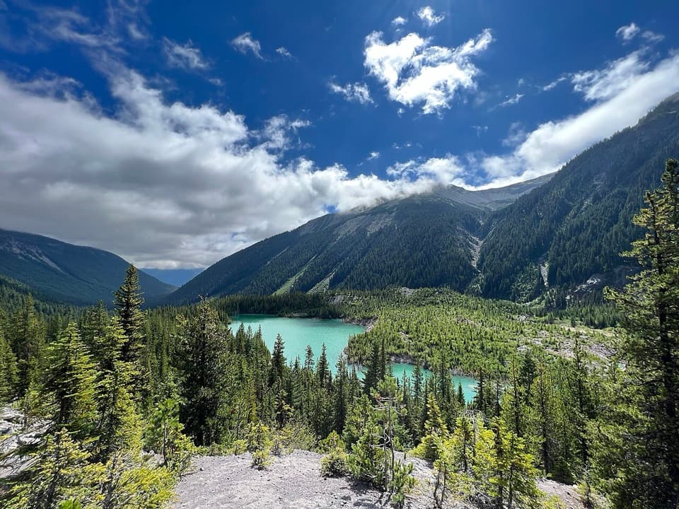
This is a 12-mile out-and-back from the Fryingpan Creek trailhead to Panhandle Gap, climbing about 2,950 feet to roughly 6,800 feet. You start beneath old-growth trees, pass the wildflower meadows and stone shelter at Summerland, then keep climbing through rocky terrain to a high saddle with a wide view south. It is a standout if you want a long, varied day on the east side of Rainier; plan on about eight hours, with extra time for stops and any lingering snow.

The climb into SummerlandThe first quarter-mile is nearly level beneath mature forest.

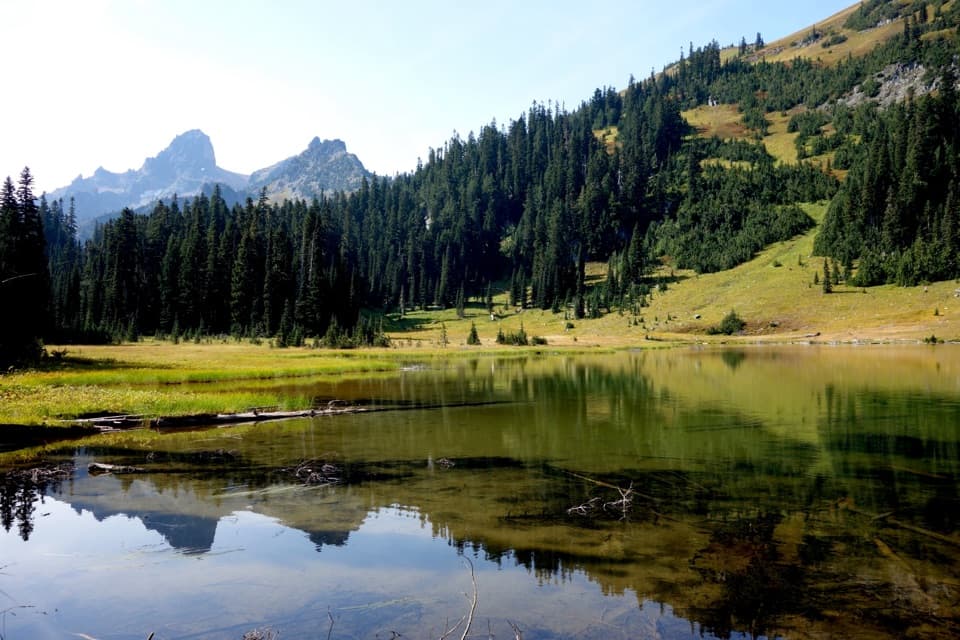
The first quarter-mile is nearly level beneath mature forest. The trail then climbs in switchbacks above Fryingpan Creek, whose water rushes through a rocky cleft below the path. As the forest thins, look for small streams, cascades and openings toward the Cowlitz Chimneys. Near Summerland, the route crosses the creek at a small cascade, then climbs steeply for about half a mile into open subalpine meadow.

The meadow is a good shorter hikeSummerland is about 4.5 miles from the trailhead, so turning around here makes a rewarding 8.

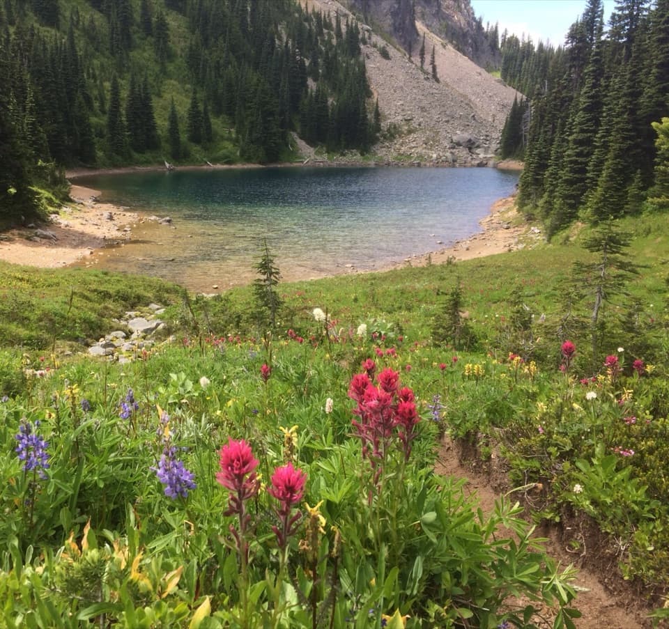
Summerland is about 4.5 miles from the trailhead, so turning around here makes a rewarding 8.4-mile day of its own. The open meadow looks toward Mount Rainier and Little Tahoma, with streams and seasonal wildflowers around the trail. A stone shelter and designated backcountry campsites sit nearby. Stay on the constructed trail through the fragile plants.

Keep going for the GapFrom Summerland, Panhandle Gap is another roughly 1.5 miles and 900 feet higher.

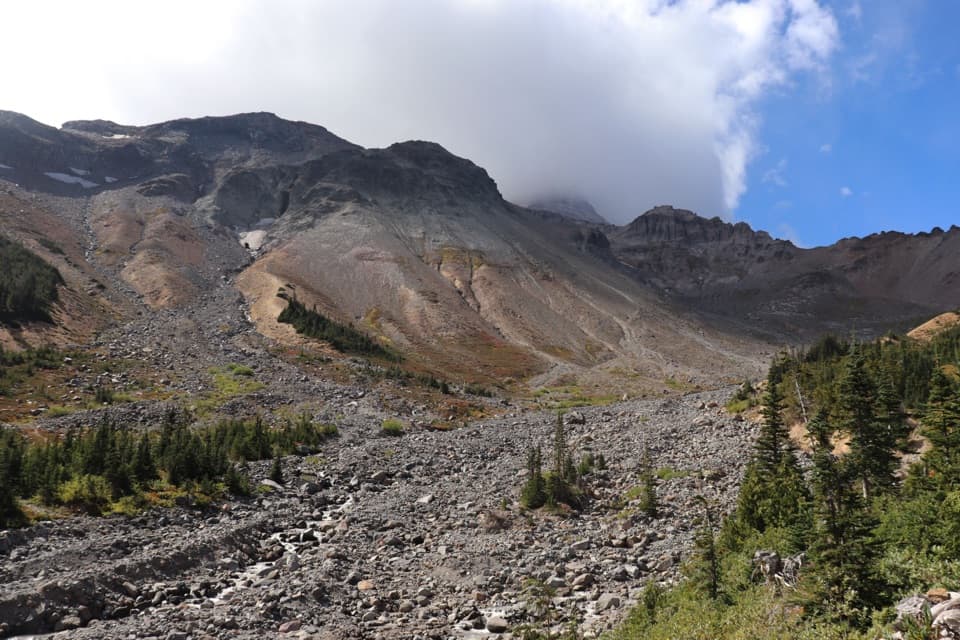
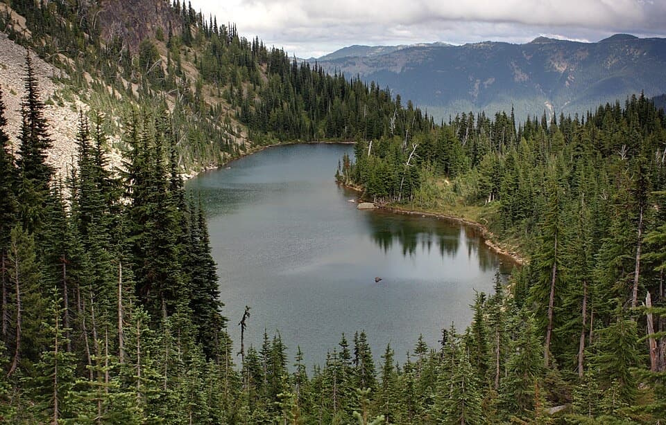
From Summerland, Panhandle Gap is another roughly 1.5 miles and 900 feet higher. The grassy meadow gives way to boulders, gravel, meltwater and shallow tarns that can hold ice or snow into summer. The route is marked in places with small stones or cairns, but snow can hide the tread. At the saddle, the view opens south to Goat Rocks and Mount Adams; Mount Hood can appear on a clear day. The Gap is the day-hike turnaround for this route.

Snow changes the final approachThe last traverse crosses a steep slope above boulders.

The last traverse crosses a steep slope above boulders. Snow can linger there into late summer, and a frozen crossing needs particular care; trekking poles may help. Check current trail conditions before committing to that section. The trail is exposed above Summerland, so the upper miles feel very different from the shaded approach.

Flowers, goats and a stone shelterAfter snowmelt, avalanche lilies are among the first flowers to appear; lupine, Indian…

After snowmelt, avalanche lilies are among the first flowers to appear; lupine, Indian paintbrush and other subalpine blooms follow, with north-facing slopes flowering later. Marmots and mountain goats use the high country, especially around Summerland and the Gap. E. S. Ingraham, an early climber and explorer, named Summerland. Its stone trail shelter is one of two masonry shelters built by the Civilian Conservation Corps in the park.

Plan the start and the turnaroundThe Fryingpan Creek parking area is near White River Road, across from the Summerland trailhead.

The Fryingpan Creek parking area is near White River Road, across from the Summerland trailhead. Parking is limited and fills early on sunny summer days; food service is not listed at the trailhead or along the route, so plan ahead. Treat stream water before drinking. Pets are not allowed on park trails. A wilderness permit is required if you camp at Summerland; day hikers do not need that camping permit.

Wildlife

Wildlife in Mount Rainier

All Mount Rainier wildlife maps

Sighting maps show where each species has been reported across Mount Rainier. Wildlife moves, so no sighting is guaranteed.

Keep exploring

Near Summerland–Panhandle Gap Trail

See it all on the map

Trails that start nearby

Places near the trailhead

Parkwolf’s Mount Rainier ranking

Top-rated trails in Mount Rainier

All 99 trails
  1. 1Wonderland TrailChallenging · 93 mi
  2. 2Skyline Trail LoopChallenging · 5.5 mi
  3. 3Mount Fremont Lookout TrailModerate · 5.6 mi
  4. 4Burroughs Mountain TrailModerate · 6.2 mi
  5. 5Summerland TrailModerate · 8.4 mi
  6. 6Naches Peak Loop TrailModerate · 3.5 mi

Take Parkwolf to Mount Rainier.

The audio tour guide for the drive, plus offline maps, trails, and wildlife heatmaps for when the signal drops.

4.7 from 8,600+ ratings

Download Parkwolf on the App StoreGet Parkwolf on Google Play