Spray Falls Trail in Mount Rainier National Park

Mount Rainier National Park, WA

Spray Falls Trail

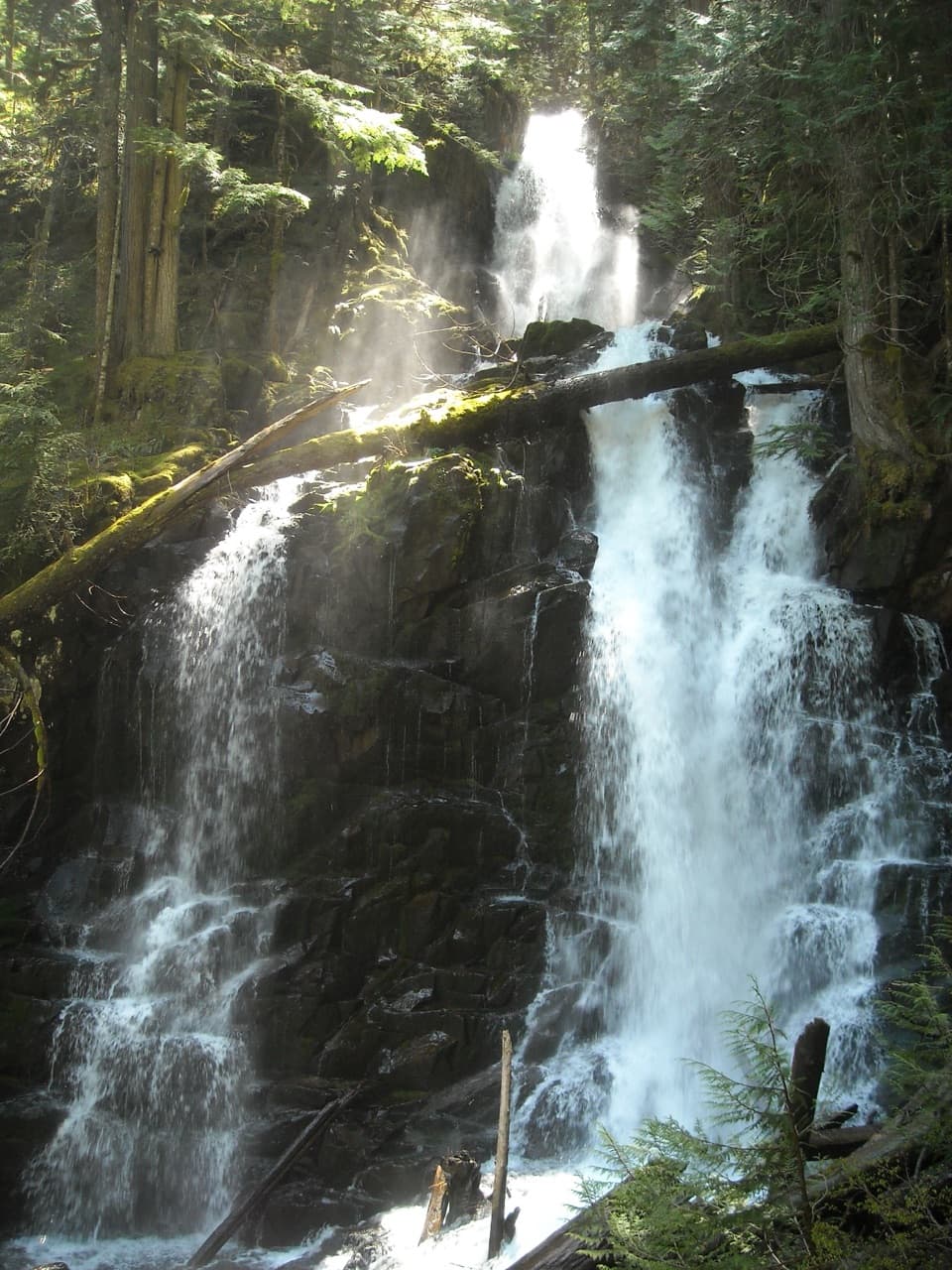
A forest roller ends at a 354-foot waterfall over a lava cliff.

Photo: National Park Service
Length
4mi
Time
3hr
Elev. change
239ft
Difficulty
Moderate
  • No dogs
  • High point 4,946 ft
  • #33 of 99 in Mount Rainier

Hear the audio tour

When People Added the Fish

Overview

About Spray Falls Trail

Why go

  • A 354-foot waterfall drops over a striking lava cliff.
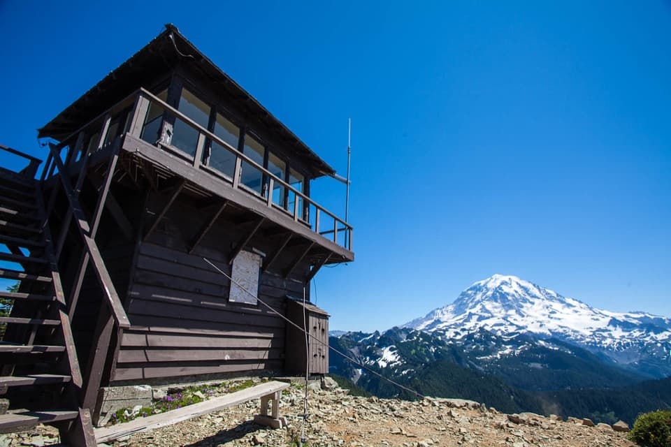
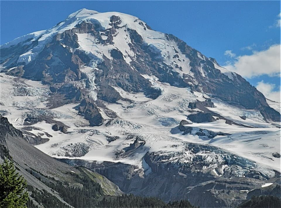
  • Eagle Cliff adds Mount Rainier and Mowich Glacier views to the forest walk.

Heads up

  • No public drive-up access; reaching Mowich requires a long Wonderland Trail backpacking approach.

Map & elevation

The route

Loading the Mount Rainier map
Full map
Elevation4,706–4,946 ft
TrailheadMowich Lake walk-in campground / Spray Park Trailhead46.93270, -121.86360
Keep this map with you offline in the Parkwolf app

Plan your hike

Before you go

Parking

The trailhead is on the southeast side of the Mowich Lake walk-in campground. There is no public vehicle access to Mowich Lake from SR 165 because Fairfax Bridge is permanently closed. The public approach from outside runs roughly 27 miles on the Wonderland Trail from Westside Road; plan a long-distance backpacking trip rather than a drive-up day hike.

Safety

The marked falls viewpoint does not require a creek crossing. Crossing Spray Creek for a closer angle involves scrambling over slippery, uneven rocks. There is no public vehicle approach to Mowich Lake; the only public approach from outside the park is a roughly 27-mile, one-way Wonderland Trail hike from Westside Road. Treat the trail as a backpacking side trip, and obtain a wilderness camping permit for overnight backcountry stays. Pets are not allowed on park trails.

7 active Mount Rainier alerts

  • ClosureSR 165 bridge closed: no public access to Carbon River or Mowich LakeMentions Mowich Lake, referenced in this guideThe SR 165 Carbon River/Fairfax Bridge is closed to vehicles, bicycles, and pedestrians; there is no public access or alternate route to Carbon River or Mowich Lake.Official details
  • CautionWestside Road rockfall hazard and vehicle restrictionMentions Westside Road, referenced in this guideWestside Road is open but lies in an active geohazard zone with rockfall danger; vehicles must park south of the Dry Creek barricade.Official details
See all 7 alerts
A park ranger sits on a dash-mounted phone, talking, as Parkwolf’s Tour Guide plays “Army Cutworm Moths: A Grizzly Bear Buffet” on Grand Loop Road below Dunraven Pass in Yellowstone
Parkwolf Tour GuideThe highest, rockiest slopes around here are a summer buffet for grizzly bears.

Mount Rainier Tour Guide

Your drive to Spray Falls Trail, narrated.

Parkwolf is a GPS audio tour guide for Mount Rainier National Park. As you drive, it chimes in with what’s ahead: hidden gems, upcoming stops, history, geology, and wildlife, right through your car’s speakers.

See the Mount Rainier audio tour

Recorded for this area

When People Added the Fish
0:00 / 0:33
“The fish in Rainier's lakes have a human history. These lakes were naturally fishless, even though native fish lived in the park's rivers.”

Plays on the road 0.7 mi from the trailhead in the Parkwolf Mount Rainier Tour Guide.

More stories near here in the app

  • Tolmie's Botanical Journey
  • The Bee That Shakes the Flower
  • Paul Peak: Downhill Into the Forest
  • An Alder's Underground Helpers
  • 77 audio storiesacross Mount Rainier’s roads, triggered by GPS as you drive
  • Wildlife heatmapsfor Mountain Goat, Black Bear, Wolverine, and 13 more
  • Works offlinemaps, 99 trails, 87 places, and audio download before you lose signal
  • CarPlay readysimple controls built for the drive
★★★★★
“Fantastic app with many points of information… It’s great to just turn on while you’re driving and it gives you an audio tour of the national Park. We love it!!!!”
JMJamesApp Store review
Download Parkwolf on the App StoreGet Parkwolf on Google Play

4.7 from 8,600+ ratings

Trail guide

Hiking Spray Falls Trail

A waterfall with a long approachSpray Falls Trail is a 4-mile out-and-back from the Mowich Lake walk-in campground, including a…

Spray Falls Trail is a 4-mile out-and-back from the Mowich Lake walk-in campground, including a quarter-mile connector on the Wonderland Trail and the short falls spur. Expect about 545 feet of climbing and roughly three hours on the walk. The route rolls through forest rather than climbing steadily, and it ends at the falls branch; the steep climb beyond leads to the separate, longer Spray Park meadow hike. There is no public vehicle access to Mowich Lake from SR 165 because the Fairfax Bridge is permanently closed. The public approach from outside runs roughly 27 miles one way on the Wonderland Trail from Westside Road, so this is a backpacking side trip, not a drive-up day hike.

Follow the lower Spray Park TrailStart on the southeast side of the walk-in campground and take Wonderland Trail for 0.

Start on the southeast side of the walk-in campground and take Wonderland Trail for 0.25 mile to the Spray Park junction. Turn east and continue over dirt singletrack with rolling pitches, roots, steps and creek bridges; the route crosses Lee Creek. About 1.5 miles from the campground, Eagle Cliff opens to Mount Rainier and Mowich Glacier on a clear day. From there it is about 0.3 mile to Eagle’s Roost, then 0.1 mile to the falls turnoff and another 0.1 mile on the signed spur. Return the same way.

The falls and the optional scrambleThe trail-side view is the payoff: Spray Creek drops 354 feet over a lava cliff in a veil of…

The trail-side view is the payoff: Spray Creek drops 354 feet over a lava cliff in a veil of water, fed by meltwater from the remains of Flett Glacier. Spray Falls and Spray Park were likely named in 1883, when a trail crew saw the cascade break into spray. For a closer angle, some hikers cross Spray Creek, but that means scrambling over slippery, uneven rocks. It is not needed to reach the marked viewpoint; stay on the trail if the creek crossing looks unsafe.

Make the access plan firstMowich’s usual hiking season is July to mid-October.

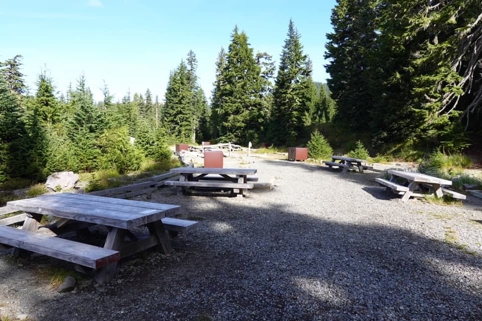
Mowich’s usual hiking season is July to mid-October. There is no food or drinking-water service at the trailhead; the campground has a privy, picnic tables and food lockers, and natural water needs treatment. Pets are prohibited on park trails. If your Wonderland approach involves overnight backcountry camping, get the required wilderness permit. The access distance makes this a worthwhile falls detour for a planned backpacking trip, but a poor choice for anyone expecting a short drive-up waterfall walk.

Wildlife

Wildlife in Mount Rainier

All Mount Rainier wildlife maps

Sighting maps show where each species has been reported across Mount Rainier. Wildlife moves, so no sighting is guaranteed.

Keep exploring

Near Spray Falls Trail

See it all on the map

Trails that start nearby

Places near the trailhead

Parkwolf’s Mount Rainier ranking

Top-rated trails in Mount Rainier

All 99 trails
  1. 1Wonderland TrailChallenging · 93 mi
  2. 2Skyline Trail LoopChallenging · 5.5 mi
  3. 3Mount Fremont Lookout TrailModerate · 5.6 mi
  4. 4Burroughs Mountain TrailModerate · 6.2 mi
  5. 5Summerland TrailModerate · 8.4 mi
  6. 6Naches Peak Loop TrailModerate · 3.5 mi

Take Parkwolf to Mount Rainier.

The audio tour guide for the drive, plus offline maps, trails, and wildlife heatmaps for when the signal drops.

4.7 from 8,600+ ratings

Download Parkwolf on the App StoreGet Parkwolf on Google Play