Glade Creek Trail in New River Gorge National Park

#8 of 49 trails in New River Gorge

New River Gorge National Park, WV

Glade Creek Trail

A gentle rail grade keeps you beside cascades most of the way.

Photo: National Park Service
Length
5.6mi
Time
2.5hr
Elev. change
705ft
Difficulty
Moderate
  • Dogs allowed
  • High point 1,952 ft

Hear the audio tour

Glade Creek's Waterfall Walk

Overview

About Glade Creek Trail

Why go

  • Creek access, small cascades and a footbridge break up the rail-grade walk.
  • A gentle grade makes the route feel less strenuous than its distance suggests.

Heads up

  • The lower section is narrow and rocky, with rough footing.
  • The full route needs a pickup, and the upper access road is rough.

Map & elevation

The route

Loading the New River Gorge map
Full map
Elevation1,247–1,952 ft
TrailheadLower Glade Creek Trailhead37.82700, -81.01054
Keep this map with you offline in the Parkwolf app

Plan your hike

Before you go

Parking

Lower Glade Creek Trailhead: take Glade Creek Road from WV 41 near Prince to its end, about 7 miles of gravel. The upper access is reached by an unmarked gravel road from WV 9; high-clearance 4WD is recommended. Parking is listed at the trailhead. Arrange a pickup for the one-way walk.

Safety

The section below the footbridge can be narrow and rocky. There is no drinking water at the trailheads, and creek water may contain harmful bacteria or parasites.

5 active New River Gorge alerts

  • ClosureKeeney’s Creek and Kates Plateau trail closuresMentions this trailSections of Keeney’s Creek Rail Trail and Kates Plateau Trail are closed because of structural damage and a dangerous slide.Official details
  • ClosureRend and Church Loop trails closedRend Trail is closed from both trailheads through approximately December 2027; Church Loop Trail is also closed because its only access is from Rend.Official details
See all 5 alerts
A park ranger sits on a dash-mounted phone, talking, as Parkwolf’s Tour Guide plays “Army Cutworm Moths: A Grizzly Bear Buffet” on Grand Loop Road below Dunraven Pass in Yellowstone
Parkwolf Tour GuideThe highest, rockiest slopes around here are a summer buffet for grizzly bears.

New River Gorge Tour Guide

Your drive to Glade Creek Trail, narrated.

Parkwolf is a GPS audio tour guide for New River Gorge National Park. As you drive, it chimes in with what’s ahead: hidden gems, upcoming stops, history, geology, and wildlife, right through your car’s speakers.

See the New River Gorge audio tour

Recorded for this trailhead

Glade Creek's Waterfall Walk
0:00 / 0:32
“You're nearing the lower Glade Creek trailhead by the campground, the starting point I'd choose for a short waterfall hike.”

Plays as you drive up to this trailhead in the Parkwolf New River Gorge Tour Guide.

More stories near here in the app

  • The Cost of Hawks Nest
  • A Hunt You Can’t Hear
  • The Beaver’s Orange Teeth
  • Listen Above the Leaves
  • 92 audio storiesacross New River Gorge’s roads, triggered by GPS as you drive
  • Wildlife heatmapsfor Black Bear, White-tailed Deer, Pileated Woodpecker, and 13 more
  • Works offlinemaps, 49 trails, 55 places, and audio download before you lose signal
  • CarPlay readysimple controls built for the drive
★★★★★
“Fantastic app with many points of information… It’s great to just turn on while you’re driving and it gives you an audio tour of the national Park. We love it!!!!”
JMJamesApp Store review
Download Parkwolf on the App StoreGet Parkwolf on Google Play

4.7 from 8,600+ ratings

Trail guide

Hiking Glade Creek Trail

A creek walk, end to endGlade Creek Trail is a 5.

Glade Creek Trail is a 5.6-mile, one-way walk on an old narrow-gauge railroad grade, following Glade Creek between the lower access near the New River and the upper trailhead. It is point to point, not a 5.6-mile loop or round trip. Allow about 2½ hours for the walk itself, then arrange a ride between the ends; walking back doubles the distance. I’d choose it for a long, unhurried stretch beside moving water rather than a quick waterfall stop. Without a pickup, the footbridge about 3 miles from the New River makes a straightforward 6-mile out-and-back.

The lower stretch is the rougher oneThe rail grade climbs gently, but the path below the footbridge can be narrow and rocky, with…

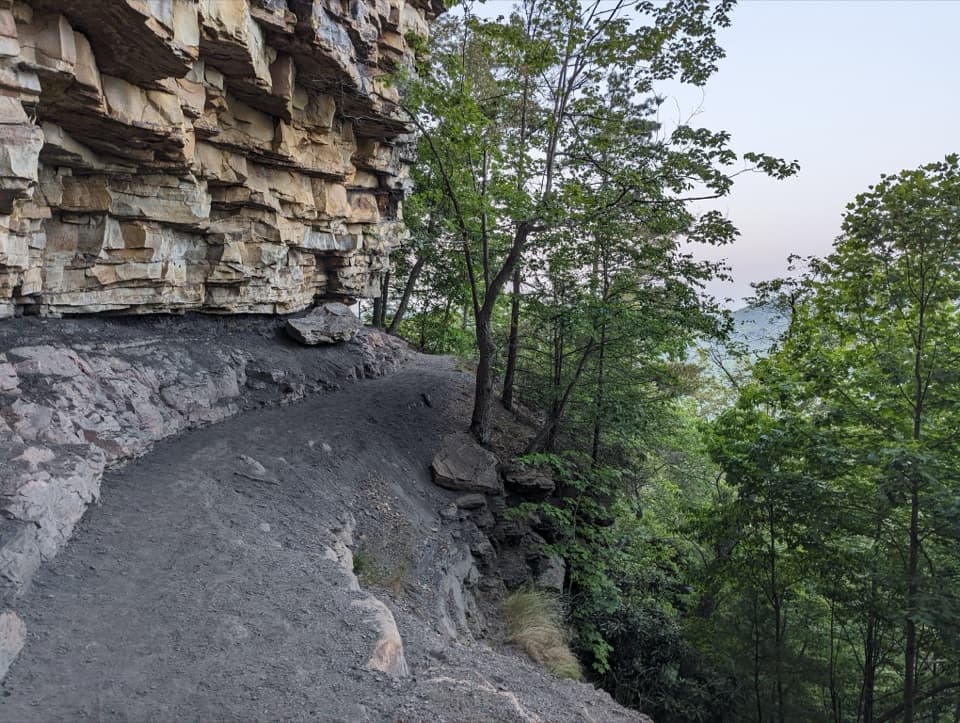
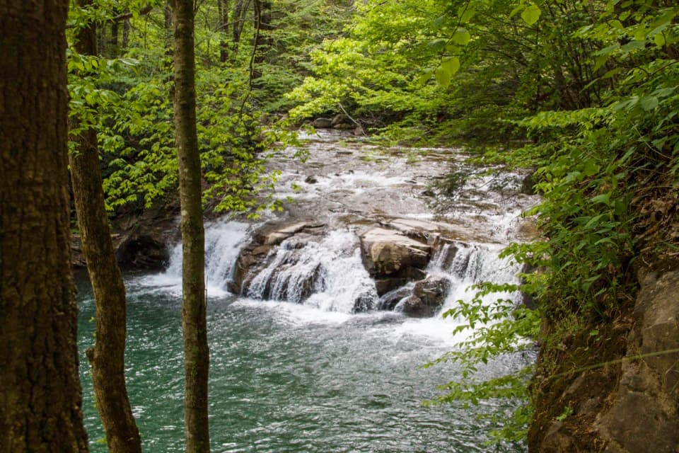
The rail grade climbs gently, but the path below the footbridge can be narrow and rocky, with branches across the tread. That uneven footing is the main effort; the reward is staying close to the creek. Small cascades, pools and swimming holes break up the wooded walk, and you can often step down to the water. Take the rougher sections slowly, especially if you are hiking with children. Don’t drink from the stream: it may contain harmful bacteria or parasites.

Use the footbridge to choose your distanceA footbridge crosses Glade Creek about 3 miles up from the New River, a useful halfway point…

A footbridge crosses Glade Creek about 3 miles up from the New River, a useful halfway point and natural place to turn around. The route beyond it is wider and better maintained, then continues toward the upper trailhead and passes beneath I-64. Kates Falls is a separate, steep 0.2-mile spur from Glade Creek Trail, rated strenuous; it is not the end of the 5.6-mile route. Count the approach to that spur and the return when you plan your day.

The old rail lineThe easy grade follows an abandoned narrow-gauge railroad through the gorge.

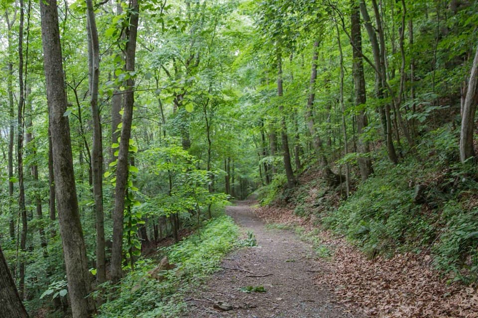
The easy grade follows an abandoned narrow-gauge railroad through the gorge. The rail corridor once served remote coal mines, so the trail is using the same practical line that carried people and supplies along the creek. It is a close-up water walk, with the stream and its little falls as the main draw. The route’s history is built into its shape: instead of climbing the slopes, it keeps to the old rail bed beside the water.

Set up both ends before you drive inThe lower trailhead is at the end of Glade Creek Road, reached from WV 41 near Prince by about…

The lower trailhead is at the end of Glade Creek Road, reached from WV 41 near Prince by about 7 miles of gravel. The upper access uses an unmarked gravel road approached from WV 9; it has steep terrain and tight switchbacks, and a high-clearance 4WD vehicle is recommended. Arrange your pickup before starting the one-way walk, and use the trailhead directions rather than the trail’s midpoint map pin. There is no drinking water at the trailheads. Dogs are allowed on park trails but must stay on a physical leash no longer than 6 feet.

Wildlife

Wildlife in New River Gorge

All New River Gorge wildlife maps

Sighting maps show where each species has been reported across New River Gorge. Wildlife moves, so no sighting is guaranteed.

Keep exploring

Near Glade Creek Trail

See it all on the map

Trails that start nearby

Places near the trailhead

Parkwolf’s New River Gorge ranking

Top-rated trails in New River Gorge

All 49 trails
  1. 1Endless Wall TrailModerate · 2.4 mi
  2. 2Long Point TrailModerate · 3.2 mi
  3. 3Grandview Rim TrailModerate · 3.2 mi
  4. 4Sandstone Falls BoardwalkEasy · 0.5 mi
  5. 5Castle Rock TrailChallenging · 0.6 mi
  6. 6Grandview Rim LoopModerate · 3 mi

Take Parkwolf to New River Gorge.

The audio tour guide for the drive, plus offline maps, trails, and wildlife heatmaps for when the signal drops.

4.7 from 8,600+ ratings

Download Parkwolf on the App StoreGet Parkwolf on Google Play