Parking
Start at the small Turkey Spur Road parking area at the north end of the route. The road is narrow, and extra-large vehicles are not recommended.

#6 of 49 trails in New River Gorge
New River Gorge National Park, WV
River views, exposed coal seams, and a rocky loop back.
Overview
Map & elevation
Plan your hike

The highest, rockiest slopes around here are a summer buffet for grizzly bears.
New River Gorge Tour Guide
Parkwolf is a GPS audio tour guide for New River Gorge National Park. As you drive, it chimes in with what’s ahead: hidden gems, upcoming stops, history, geology, and wildlife, right through your car’s speakers.
See the New River Gorge audio tourRecorded for this trailhead
Turkey Spur's Wooden Platforms“Turkey Spur Overlook is coming up, with steep wooden stairs leading to platforms above the trees. You can drive to its own small parking area rather than hiking from Grandview Main Overlook.”
Plays as you drive up to this trailhead in the Parkwolf New River Gorge Tour Guide.
More stories near here in the app
“Fantastic app with many points of information… It’s great to just turn on while you’re driving and it gives you an audio tour of the national Park. We love it!!!!”


Trail guide
Grandview Rim Loop is a roughly 3-mile lollipop linking Grandview Rim Trail, Grandview Walkway, and Castle Rock Trail. Start at the Turkey Spur Road parking area, follow the Rim south to a short overlook spur and Main Overlook, then return by Castle Rock and retrace the Rim’s northern stretch. Allow two to three hours with stops. If you want more than a roadside viewpoint but do not want a full-day hike, this is a good way to get both gorge views and close-up sandstone. It is the longer circuit that includes Castle Rock, not the separate one-mile Castle Rock/Rim loop.
From Turkey Spur, the dirt tread climbs steeply early, then eases into a more rolling walk. Much of the Rim is wooded, with several openings over the gorge; expect patches of trees between the views rather than a continuous overlook walk. The short spur is worth taking, then rejoin the main tread and continue to Grandview Walkway and Main Overlook. The loop feels harder than its mileage suggests once you reach the rocky return, so save a little time for that section instead of rushing back to the car.
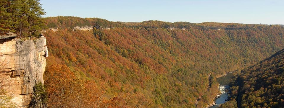
The overlook stands about 1,400 feet above the river and can show roughly seven miles of river and watershed on a clear day. Look down for the railroad following the river and Quinnimont on the opposite bank. For a useful phone photo, include the bend of the river and a stretch of track; without that scale, the gorge can look flatter than it feels from above.
Return along the walkway toward Castle Rock. The trail passes beneath layered, overhanging sandstone walls, with dark coal seams exposed in the rock. This is the most memorable close-up stretch, but the tread is uneven and the path runs near steep drop-offs. The National Park Service rates Castle Rock strenuous and does not recommend it for young children. Keep to the established path and take your time through the rough footing. Once Castle Rock rejoins the Rim, follow the familiar trail north to Turkey Spur.
The dark bands at Castle Rock are more than a color change: they are exposed coal seams, a visible reminder of the mining that shaped the gorge. From Main Overlook, the railroad and river lead your eye toward Quinnimont, where the first coal was shipped out of the gorge in 1873. The long layers of sandstone and shale were laid down as sediment and later cut open by the New River, leaving this high rim above the water.
Use the small parking area at the end of Turkey Spur Road. The road is narrow, and extra-large vehicles are not recommended. There is no drinking water at trailheads. Dogs are allowed on park trails; keep them on a physical leash no longer than six feet and bring water for them.
Wildlife
 18 sightingsBlack BearMost seen around 7 PMSighting map
 126 sightingsWhite-tailed DeerMost seen around 6 AMSighting map
 25 sightingsPileated WoodpeckerMost seen around 8 AMSighting map
 15 sightingsBarred OwlMost seen around 7 PMSighting map
 14 sightingsWild TurkeyMost seen around 6 AMSighting map
 58 sightingsCopperheadMost seen around 7 PMSighting map
Sighting maps show where each species has been reported across New River Gorge. Wildlife moves, so no sighting is guaranteed.
Keep exploring
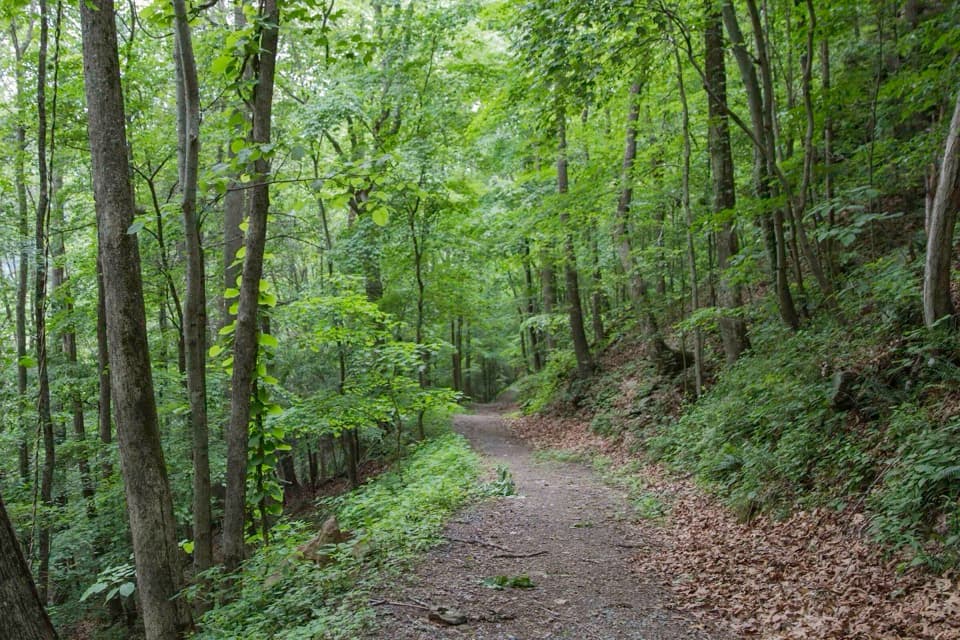 ChallengingLittle Laurel Trail2.6 mi · 2 hr · 0.8 mi awayAn old road drops from Grandview toward Royal's coal-town remains.
 EasyWoodland Loop Trail0.6 mi · 18 min · 1 mi awayAn easy forest loop from Grandview Shelter #2.
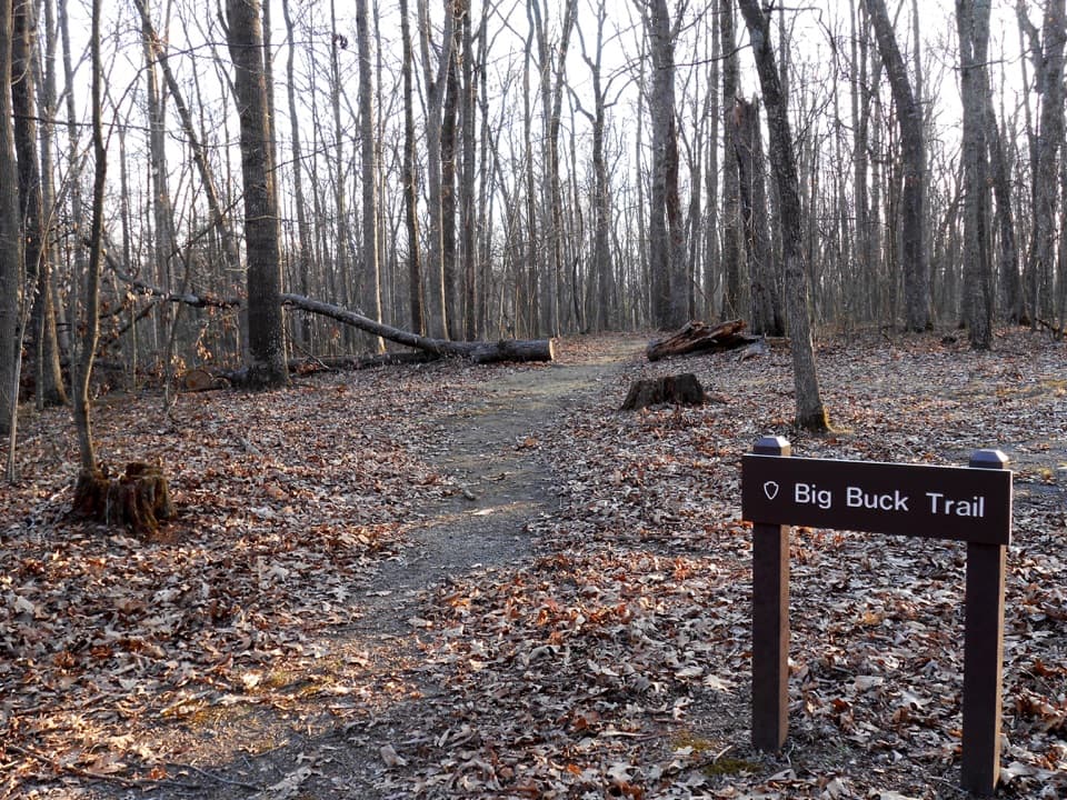 EasyBig Buck Trail0.9 mi · 30 min · 1 mi awayAn easy loop through Appalachian forest, with tree signs along the way.
 ModerateTunnel Trail0.5 mi · 30 min · 1.2 mi awayA short, shady walk beneath Grandview’s broad sandstone overhang.
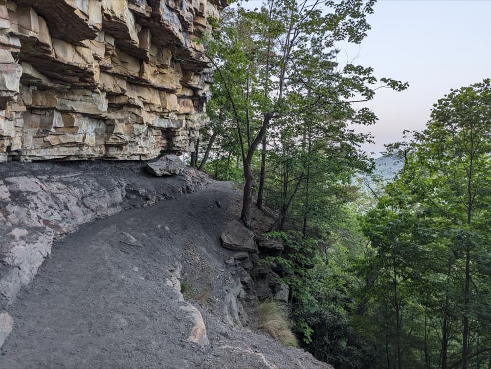 ChallengingCastle Rock Trail0.6 mi · 45 min · 1.2 mi awayWalk beneath layered walls and exposed coal along a strenuous gorge path.ModerateGrandview Rim Trail3.2 mi · 2 hr · 1.2 mi awayA wooded 1.6-mile route between two overlooks, with hills near Turkey Spur.
 ModerateTerry Top Trail3.4 mi · 2 hr · 1.8 mi awayA quiet ridge walk ending at a nineteenth-century family cemetery.
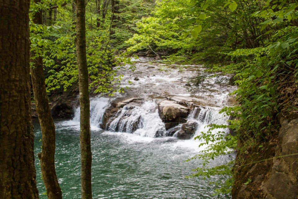 ModerateGlade Creek Trail5.6 mi · 2.5 hr · 3.2 mi awayA gentle rail grade keeps you beside cascades most of the way.
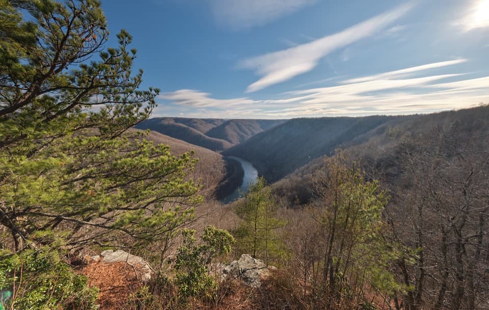 Sight · At the trailheadTurkey Spur OverlookA steep staircase climbs to wooden platforms above the river.
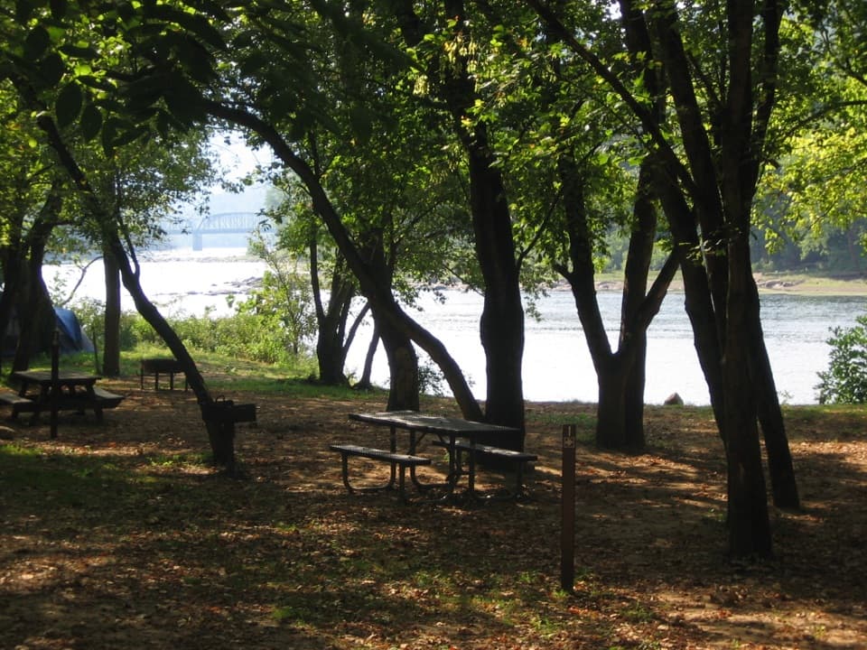 Campground · 0.8 mi awayGrandview Sandbar CampgroundWooded campsites put you beside the New River.
 Sight · 0.9 mi awayNorth OverlookA river bend framed by Grandview’s flowering rhododendrons.
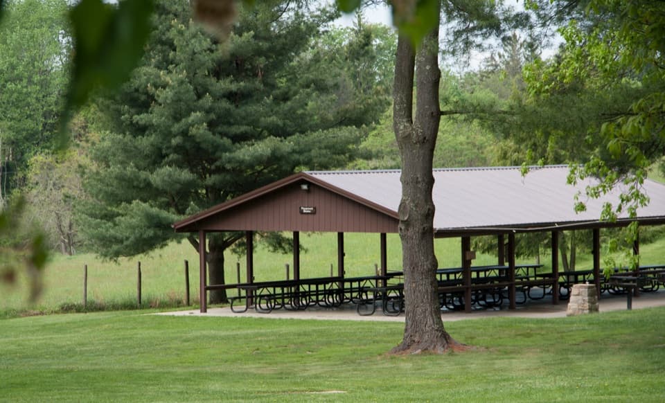 Picnic area · 1 mi awayGrandview Picnic AreaA meal stop among Grandview’s picnic shelters, playgrounds and trails.
 Sight · 1.2 mi awayCliffside AmphitheaterA 1,200-seat stage for live summer drama at Grandview.
 Sight · 1.2 mi awayGrandview Main OverlookSeven miles of river and gorge from one short overlook.
 Sight · 1.2 mi awayMill Creek River AccessA simple launch where Mill Creek meets the New River.
 Visitor center · 1.2 mi awayGrandview Visitor CenterMaps, a small shop, and a walk to a seven-mile river view.
Parkwolf’s New River Gorge ranking

The audio tour guide for the drive, plus offline maps, trails, and wildlife heatmaps for when the signal drops.