Parking
From US 19 in Fayetteville, follow WV 16 south through town and turn onto Gatewood Road toward Kaymoor and Cunard. After about 1.9 miles, turn left on Newton Road; the trailhead parking area is about 50 yards on the left.
#2 of 49 trails in New River Gorge
New River Gorge National Park, WV
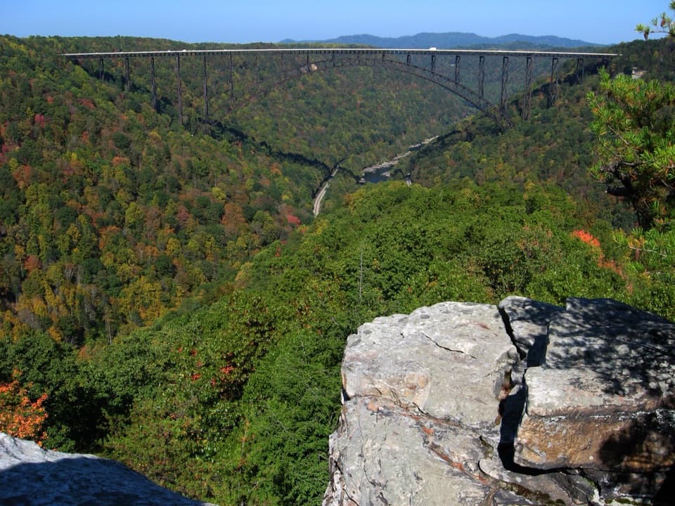
The bridge view repays the forest miles and rocky finish.
Overview
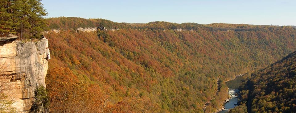
Long Point Trail is a 3.2-mile out-and-back from the Newton Road trailhead to a bare sandstone point above the New River Gorge. The park’s 1.6-mile figure is one way. You get a direct view of the New River Gorge Bridge and the cliffs of Endless Wall across the gorge, reached by a wooded walk with an open field along the way. Allow about 1½ to 2 hours for the walk and time at the point. The approach is mostly gentle, but the last stretch is rockier and steeper, and the return climbs the same route. This is a good choice for the park’s signature bridge view; it is less appealing if unprotected cliff edges make you uneasy or you want an entirely level stroll.
 Parkwolf’s verdictIs this the hike for you?
Map & elevation
Plan your hike

The highest, rockiest slopes around here are a summer buffet for grizzly bears.
New River Gorge Tour Guide
Parkwolf is a GPS audio tour guide for New River Gorge National Park. As you drive, it chimes in with what’s ahead: hidden gems, upcoming stops, history, geology, and wildlife, right through your car’s speakers.
See the New River Gorge audio tourRecorded for this trailhead
Long Point's Bridge View“You're coming up on Long Point Trailhead, with a three-point-two-mile round trip to a straight-on view of the New River Gorge Bridge. Allow an hour and a half to two hours.”
Plays as you drive up to this trailhead in the Parkwolf New River Gorge Tour Guide.
More stories near here in the app
“Fantastic app with many points of information… It’s great to just turn on while you’re driving and it gives you an audio tour of the national Park. We love it!!!!”


Trail guide
Start at the Newton Road parking area. The first stretch is nearly level along the forest edge, then crosses a former field where a wooden deck and interpretive panels explain how farmland returns to forest. The deck looks over the field, not the gorge. Past it, the dirt path runs through hardwoods along a gently rolling ridge. At about half a mile, stay on Long Point Trail at the signed Fayetteville Trail junction. Near three-quarters of a mile, Butcher Branch Trail joins from the right; continue straight. These side paths lead elsewhere, so follow the Long Point signs rather than turning at a junction.
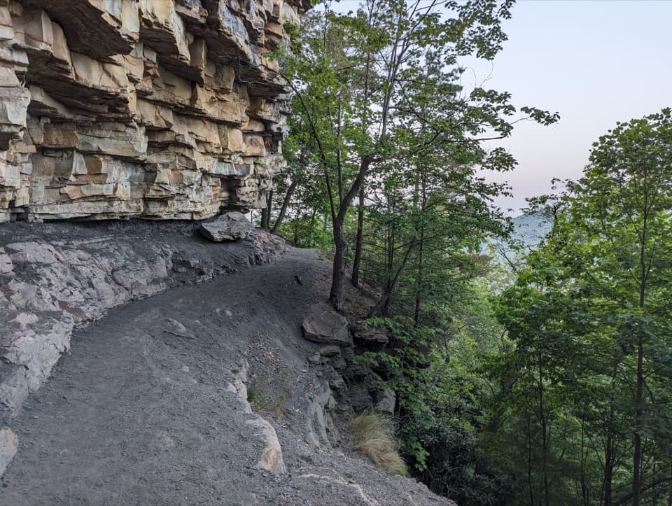
Most of the route descends gradually toward the point. Around one mile in, a bicycle rack marks the start of the final 0.2 mile, where bikes are not allowed. The tread narrows among rhododendrons, with more exposed rock and the steepest part of the hike. Small openings offer glimpses into the gorge before the main overlook. This is where the footing changes most; save a little energy for the climb back to Newton Road. Dogs are allowed on park trails, but must stay on a physical leash no longer than six feet. There is no drinking water at trailheads, so bring what you and your dog need.
The trail levels among pines on a broad, bare-rock outcrop. The New River Gorge Bridge spans the view, with forested slopes and the cliffs of Endless Wall opposite. A wide rock ledge can anchor a photo of the bridge, but the point has unprotected edges; keep back from the drop and supervise children. The bridge opened in 1977. Its single steel arch is 3,030 feet long and stands 876 feet above the New River, a scale that is easy to appreciate from across the gorge.
A vault or composting toilet is listed at the trailhead, but visitor reports about its availability conflict, so do not count on it without checking. For a separate meal near the park, Arrowhead Bike Farm’s Handle Bar + Kitchen serves fish tacos and West Virginia pork brats, with local craft beer. It is a separate stop, not a facility on the trail.
Wildlife
 18 sightingsBlack BearMost seen around 7 PMSighting map
 126 sightingsWhite-tailed DeerMost seen around 6 AMSighting map
 25 sightingsPileated WoodpeckerMost seen around 8 AMSighting map
 15 sightingsBarred OwlMost seen around 7 PMSighting map
 14 sightingsWild TurkeyMost seen around 6 AMSighting map
 58 sightingsCopperheadMost seen around 7 PMSighting map
Sighting maps show where each species has been reported across New River Gorge. Wildlife moves, so no sighting is guaranteed.
Keep exploring
 EasyTimber Ridge Trail1 mi · 30 min · At the trailheadA short wooded link into the Fayetteville trail network.
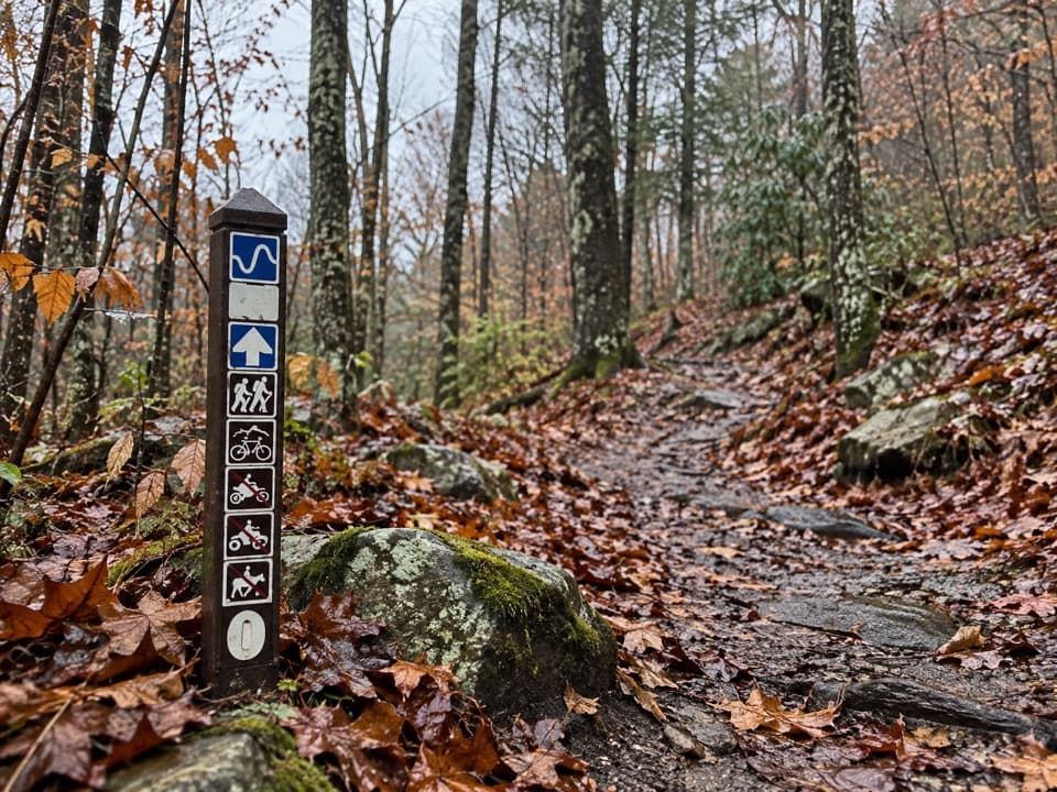 ModerateLeCroy Trail1.8 mi · 1.3 hr · 0.1 mi awayNarrow singletrack, a rock bridge, and a rhododendron tunnel.
 ModerateCraig Branch and Kaymoor Trail Loop4.9 mi · 2.5 hr · 0.6 mi awayMine ruins, gorge views, and 821 steps in one loop.
 ModerateCraig Branch Trail2.4 mi · 1.5 hr · 0.6 mi awayA 2.4-mile gravel descent links Arrowhead with the Kaymoor Trail.
 EasyClovis Trail1.1 mi · 30 min · 0.6 mi awayA compact forest loop with a few easy rock patches.
 ModerateButcher Branch Trail0.8 mi · 30 min · 0.6 mi awayA wooded connector to Long Point, with a rocky falls spur.
 ChallengingKaymoor Miners Trail2 mi · 2.5 hr · 0.6 mi awayA steep mine descent with a gorge view before the long stairs.
 EasyAdena Trail3.4 mi · 2.3 hr · 0.7 mi awayRolling forest tread makes a gentle loop for walkers and newer riders.
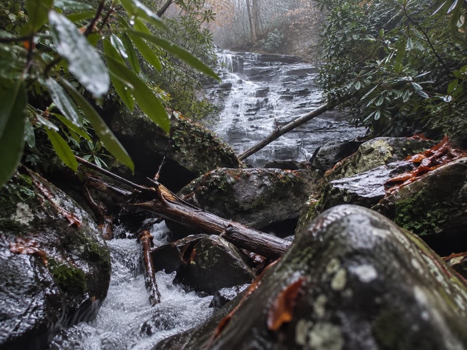 Sight · 0.6 mi awayButcher Branch FallsA close-up waterfall reached by a short, steep spur.
 Sight · 0.8 mi awayKaymoor One MineA coal mine and coke ovens linked by 821 steps.
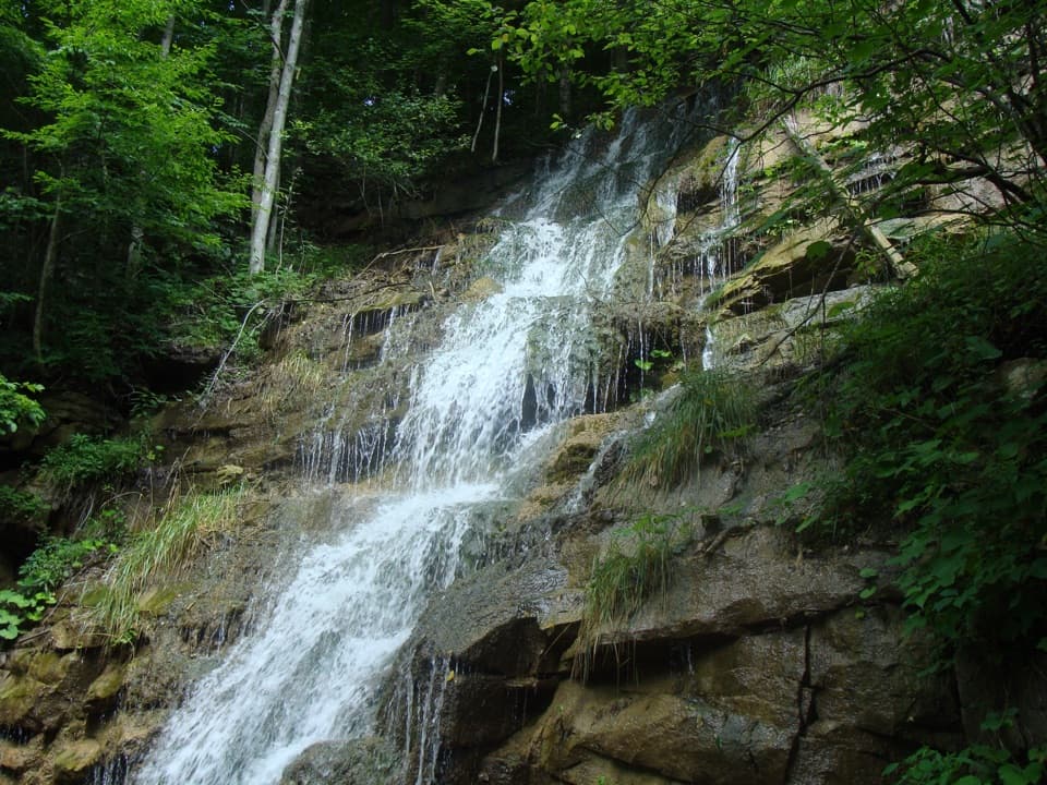 Sight · 1.2 mi awayKaymoor Mine FallsA mossy cascade where mine drainage meets Wolf Creek.Sight · 1.3 mi awayLong Point OverlookA rough last pitch opens onto the park’s signature bridge view.
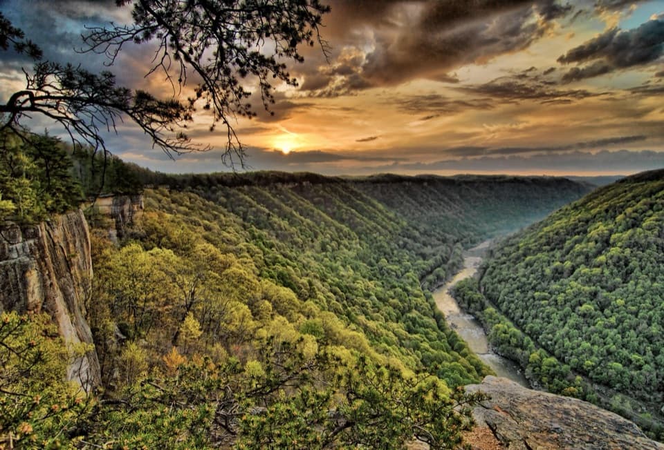 Sight · 1.3 mi awayDiamond Point OverlookA cliff-edge view down nearly 1,000 feet to the New River.
 Restaurant · 1.6 mi awayCathedral CafeA former church turned cafe with towering stained glass.
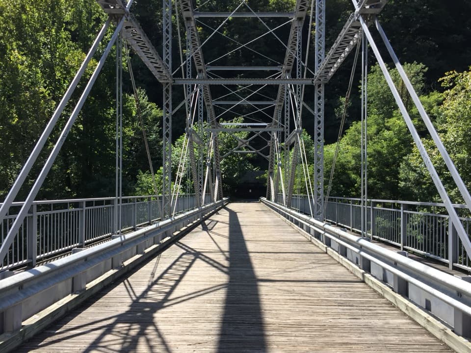 Sight · 1.6 mi awayTunney Hunsaker BridgeA historic lower crossing on Fayette Station Road's one-way gorge drive.
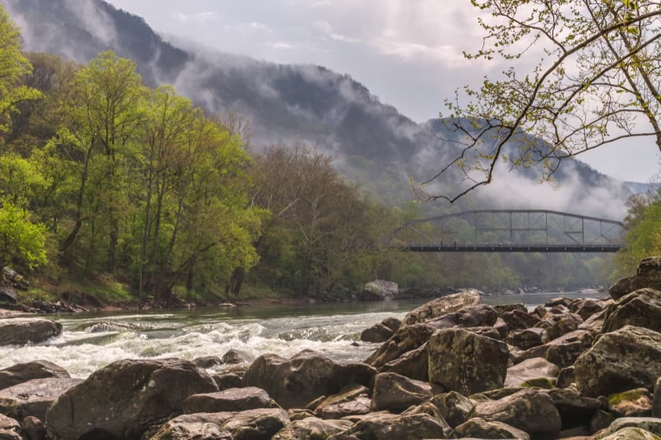 Sight · 1.8 mi awayFayette Station River AccessRapids, two bridges, and the gorge from river level.
Parkwolf’s New River Gorge ranking
The audio tour guide for the drive, plus offline maps, trails, and wildlife heatmaps for when the signal drops.