Kates Plateau Trail in New River Gorge National Park

New River Gorge National Park, WV

Kates Plateau Trail

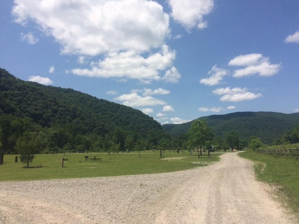
Old logging roads, fields and a steep creek crossing.

Length
8.9mi
Time
5.5hr
Elev. change
768ft
Difficulty
Challenging
  • Dogs allowed
  • High point 2,720 ft

Hear the audio tour

A Flame on a Miner's Cap

Overview

About Kates Plateau Trail

Why go

  • Old logging roads, open fields and wetland edges give the walk changing scenery.
  • Look for signs of beaver, deer and turkey.

Heads up

  • The Polls Plateau access adds about 1.75 trail miles each way.
  • The Kates Branch crossing is steep and challenging.

Map & elevation

The route

Loading the New River Gorge map
Full map
Elevation1,952–2,720 ft
TrailheadPolls Plateau Trailhead, road-end access on Polls Branch Road37.78572, -81.00026
Keep this map with you offline in the Parkwolf app

Plan your hike

Before you go

Parking

Use the parking area at the end of Polls Branch Road. From I-64 Exit 133 (Bragg), head north about 0.8 mile, turn left at the church onto Polls Branch Road and continue to its end. Follow Polls Plateau Trail about 1.75 trail miles to the Kates Plateau junction.

Safety

The Kates Branch crossing can be challenging and involves steep terrain. There is no drinking water at trailheads; carry your own.

5 active New River Gorge alerts

  • ClosureKeeney’s Creek and Kates Plateau trail closuresMentions this trailSections of Keeney’s Creek Rail Trail and Kates Plateau Trail are closed because of structural damage and a dangerous slide.Official details
  • ClosureRend and Church Loop trails closedRend Trail is closed from both trailheads through approximately December 2027; Church Loop Trail is also closed because its only access is from Rend.Official details
See all 5 alerts
A park ranger sits on a dash-mounted phone, talking, as Parkwolf’s Tour Guide plays “Army Cutworm Moths: A Grizzly Bear Buffet” on Grand Loop Road below Dunraven Pass in Yellowstone
Parkwolf Tour GuideThe highest, rockiest slopes around here are a summer buffet for grizzly bears.

New River Gorge Tour Guide

Your drive to Kates Plateau Trail, narrated.

Parkwolf is a GPS audio tour guide for New River Gorge National Park. As you drive, it chimes in with what’s ahead: hidden gems, upcoming stops, history, geology, and wildlife, right through your car’s speakers.

See the New River Gorge audio tour

Recorded for this area

A Flame on a Miner's Cap
0:00 / 0:33
“Before electric headlamps, a coal miner might work by a little flame mounted on his cap. A carbide lamp made its own fuel. Water dripped from an upper chamber onto calcium carbide below, producing acetylene gas.”

Plays on the road 1.3 mi from the trailhead in the Parkwolf New River Gorge Tour Guide.

More stories near here in the app

  • Choosing Your Rafting Trip
  • The Soldier Behind the Bridge
  • Antlers Start Over Every Year
  • Glade Creek's Waterfall Walk
  • 92 audio storiesacross New River Gorge’s roads, triggered by GPS as you drive
  • Wildlife heatmapsfor Black Bear, White-tailed Deer, Pileated Woodpecker, and 13 more
  • Works offlinemaps, 49 trails, 55 places, and audio download before you lose signal
  • CarPlay readysimple controls built for the drive
★★★★★
“Fantastic app with many points of information… It’s great to just turn on while you’re driving and it gives you an audio tour of the national Park. We love it!!!!”
JMJamesApp Store review
Download Parkwolf on the App StoreGet Parkwolf on Google Play

4.7 from 8,600+ ratings

Trail guide

Hiking Kates Plateau Trail

Is this the right walk?Kates Plateau Trail is a strenuous out-and-back from Polls Branch Road through old logging…

Kates Plateau Trail is a strenuous out-and-back from Polls Branch Road through old logging roads, fields, hardwood forest and wetland edges. The named trail is listed at 5.1 miles round trip. Reaching its junction from the road-end lot follows Polls Plateau Trail for about 1.75 miles each way; the full outing from parking is about 8.9 miles round trip on the mapped route. Allow five to six hours. Choose it for a long woods walk and a rugged creek crossing, not a quick stop.

Follow the routePark at the end of Polls Branch Road and follow Polls Plateau Trail to the Kates Plateau…

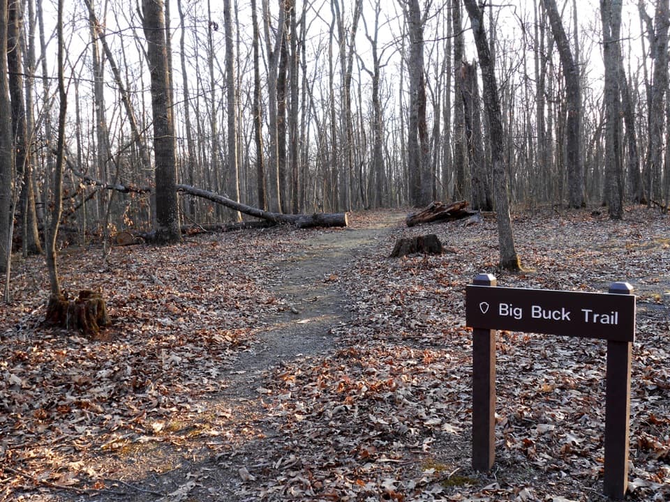
Park at the end of Polls Branch Road and follow Polls Plateau Trail to the Kates Plateau junction; the approach is a real stretch of trail, not a roadside spur. Kates continues toward Upper Glade Creek over old logging roads, through fields and forest, and near wetlands. Follow the blazes through the woods. Drainages and old roadbeds can make parts of the Polls approach less obvious.

The demanding sectionKates Branch is a challenging crossing with steep terrain, so allow time to pick your way…

Kates Branch is a challenging crossing with steep terrain, so allow time to pick your way through it. There is another steep section on the route. Trailheads have no drinking water; carry enough for the longer outing. Pets are allowed on a physical leash no longer than six feet. Watch for signs of beaver, deer and turkey rather than expecting a sighting.

Wildlife

Wildlife in New River Gorge

All New River Gorge wildlife maps

Sighting maps show where each species has been reported across New River Gorge. Wildlife moves, so no sighting is guaranteed.

Keep exploring

Near Kates Plateau Trail

See it all on the map

Trails that start nearby

Places near the trailhead

Parkwolf’s New River Gorge ranking

Top-rated trails in New River Gorge

All 49 trails
  1. 1Endless Wall TrailModerate · 2.4 mi
  2. 2Long Point TrailModerate · 3.2 mi
  3. 3Grandview Rim TrailModerate · 3.2 mi
  4. 4Sandstone Falls BoardwalkEasy · 0.5 mi
  5. 5Castle Rock TrailChallenging · 0.6 mi
  6. 6Grandview Rim LoopModerate · 3 mi

Take Parkwolf to New River Gorge.

The audio tour guide for the drive, plus offline maps, trails, and wildlife heatmaps for when the signal drops.

4.7 from 8,600+ ratings

Download Parkwolf on the App StoreGet Parkwolf on Google Play