Kaymoor Miners Trail in New River Gorge National Park

#7 of 49 trails in New River Gorge

New River Gorge National Park, WV

Kaymoor Miners Trail

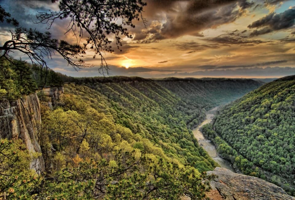
A steep mine descent with a gorge view before the long stairs.

Photo: National Park Service
Length
2mi
Time
2.5hr
Elev. change
902ft
Difficulty
Challenging
  • Dogs allowed
  • High point 1,991 ft

Hear the audio tour

Kaymoor Top and the Mine Descent

Overview

About Kaymoor Miners Trail

Why go

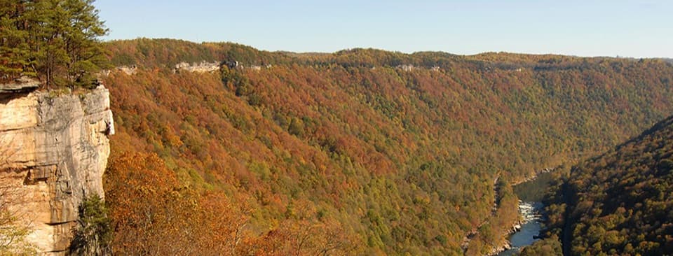
  • A gorge overlook appears before the hardest stair section.
  • The mine remains make the descent an unusually tangible history walk.

Heads up

  • The steep return recovers about 900 feet of descent.
  • The full lower leg adds 821 wooden steps each way.
Kaymoor Miners Trail is a strenuous out-and-back from Kaymoor Top down to the abandoned mine works and town site near the river. The published full route is 1.0 mile one way, 2.0 miles round trip, with about 900 feet of descent before you turn uphill; allow about 2.5 hours. You come for the steep forest descent and the unusually tangible remains of a coal operation. This is not a low-effort walk: the way down is only half the job.
Parkwolf’s verdictIs this the hike for you?

Map & elevation

The route

Loading the New River Gorge map
Full map
Elevation1,089–1,991 ft
TrailheadKaymoor Top Trailhead38.04520, -81.06757
Keep this map with you offline in the Parkwolf app

Plan your hike

Before you go

Parking

On WV 16 south through Fayetteville, turn onto Gatewood Road; after 2 miles, turn onto Kaymoor No. 1 Road. About 1 mile later, at the T-intersection, turn left; the lot is about 50 yards on the right. The small, narrow lot may not fit large RVs or trailers.

Safety

The full route drops about 900 feet; rocky steps and switchbacks plus the lower 821-step staircase make the return strenuous. Do not climb on the fragile mine structures or walk on/cross the active private railroad at river level. Dogs require a physical leash no longer than 6 feet.

5 active New River Gorge alerts

  • ClosureKaymoor Miners Trail weekday closureMentions this trailThe upper Kaymoor Miners Trail is closed Monday–Thursday through November 19 for trail rehabilitation.Official details
  • ClosureRend and Church Loop trails closedRend Trail is closed from both trailheads through approximately December 2027; Church Loop Trail is also closed because its only access is from Rend.Official details
See all 5 alerts
A park ranger sits on a dash-mounted phone, talking, as Parkwolf’s Tour Guide plays “Army Cutworm Moths: A Grizzly Bear Buffet” on Grand Loop Road below Dunraven Pass in Yellowstone
Parkwolf Tour GuideThe highest, rockiest slopes around here are a summer buffet for grizzly bears.

New River Gorge Tour Guide

Your drive to Kaymoor Miners Trail, narrated.

Parkwolf is a GPS audio tour guide for New River Gorge National Park. As you drive, it chimes in with what’s ahead: hidden gems, upcoming stops, history, geology, and wildlife, right through your car’s speakers.

See the New River Gorge audio tour

Recorded for this trailhead

Kaymoor Top and the Mine Descent
0:00 / 0:24
“You're nearing Kaymoor Top Trailhead, the start of a steep descent to a coal mine that closed in nineteen sixty-two.”

Plays as you drive up to this trailhead in the Parkwolf New River Gorge Tour Guide.

More stories near here in the app

  • Arrowhead's Clovis Loop
  • Long Point's Bridge View
  • The Tulips Above Your Head
  • Wolf Creek and Kaymoor Mine Falls
  • 92 audio storiesacross New River Gorge’s roads, triggered by GPS as you drive
  • Wildlife heatmapsfor Black Bear, White-tailed Deer, Pileated Woodpecker, and 13 more
  • Works offlinemaps, 49 trails, 55 places, and audio download before you lose signal
  • CarPlay readysimple controls built for the drive
★★★★★
“Fantastic app with many points of information… It’s great to just turn on while you’re driving and it gives you an audio tour of the national Park. We love it!!!!”
JMJamesApp Store review
Download Parkwolf on the App StoreGet Parkwolf on Google Play

4.7 from 8,600+ ratings

Trail guide

Hiking Kaymoor Miners Trail

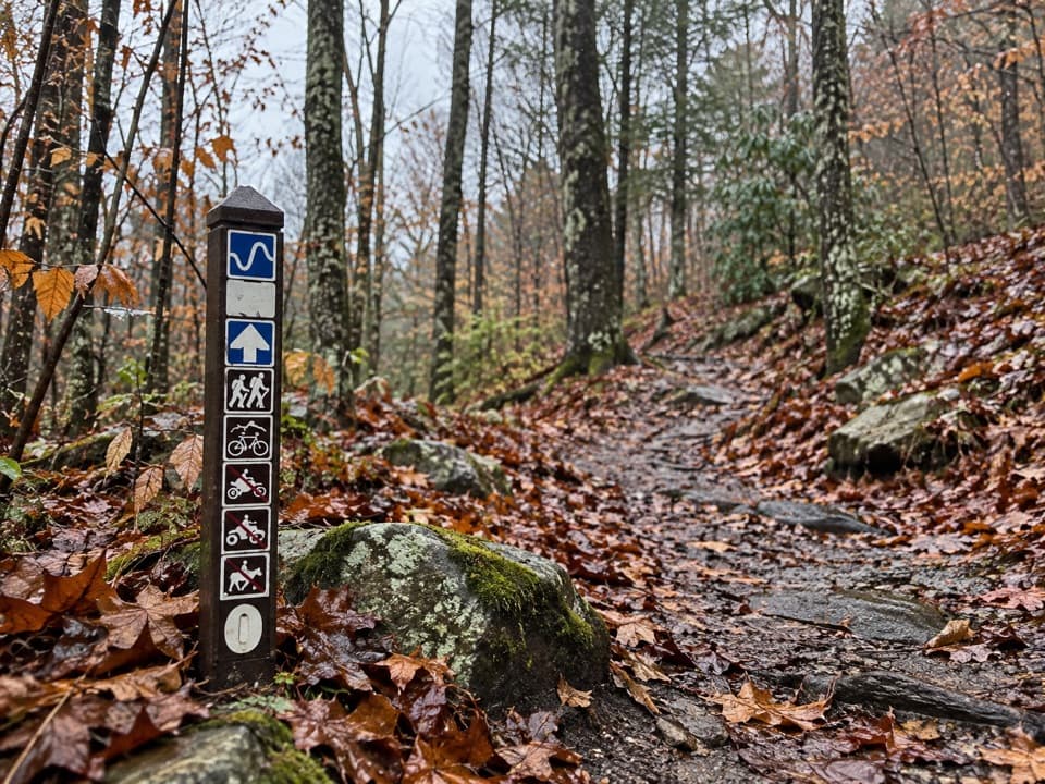
Follow the trail to the bottomThe route starts beneath the forest canopy and drops by rocky steps and switchbacks. About 0.

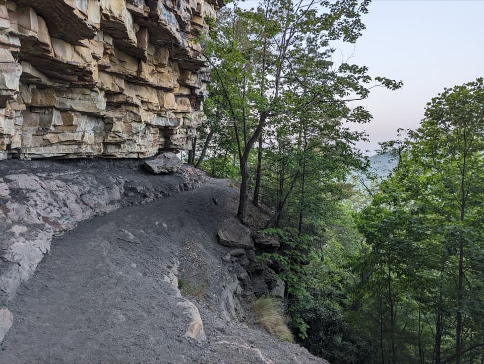
The route starts beneath the forest canopy and drops by rocky steps and switchbacks. About 0.2 mile down, a short spur to the right reaches a gorge view before the main stair section. At roughly the half-mile mark, you meet the Kaymoor Trail at the mine site. The full descent continues down 821 wooden steps to the remains of the coal-processing plant, coke ovens, and the Kaymoor Bottom town site near river level. The trail stops short of the New River.

You retrace the whole descent on the way back. Visitors repeatedly describe the climb out as the hardest part, especially the wooden stairway, so save energy for it. If you want to photograph the gorge, stop at the signed view before starting down the stairs; the mine remains make the lower end the other strong subject.

A shorter turnaroundYou can turn around at the mine junction instead of taking the 821-step stairway to Kaymoor…

You can turn around at the mine junction instead of taking the 821-step stairway to Kaymoor Bottom. That upper section is about 0.5 mile each way, or roughly 1 mile round trip. It is still steep, with rocky steps and switchbacks, but leaves out the long lower staircase and the buildings at the bottom. Choose this if the full stair descent would make the return more than you want to take on.

A coal town built down the gorgeLow Moor Coal established Kaymoor in 1900 to supply coal and coke to its iron furnaces.

Low Moor Coal established Kaymoor in 1900 to supply coal and coke to its iron furnaces. Kaymoor Top stood on the ridge; the mine workings occupied the slope below; Kaymoor Bottom sat near the railroad at river level. The Miners Trail lets you read that vertical layout on foot, though the terrain makes the distance feel more consequential than the number suggests.

The operation shipped its first coal on August 23, 1900. Kaymoor One produced more than 16.9 million tons over 62 years and closed in 1962. At its peak, more than 800 people worked there. The remaining complex is one of the gorge's most intact mine sites and was added to the National Register of Historic Places in 1990.

Parking, water, and dogsFor Kaymoor Top, follow WV 16 south through Fayetteville, turn onto Gatewood Road; after 2…

For Kaymoor Top, follow WV 16 south through Fayetteville, turn onto Gatewood Road; after 2 miles, turn onto Kaymoor No. 1 Road. About 1 mile later, at the T-intersection, turn left; the parking area is about 50 yards on the right. The lot is small and narrow, and large RVs or trailers may not fit. A vault or composting toilet is listed at the trailhead; no food or drinking water is listed there, so bring what you need before starting down.

Dogs are allowed on park trails, including this one, but must stay on a physical leash no longer than 6 feet. The climb and stairs are a lot for a pet, so think through the return before bringing one.

Protect the historic siteThe mine walls and other constructed features are fragile.

The mine walls and other constructed features are fragile. Do not climb, sit on, or walk along them. The active railroad at river level is private property: do not go onto or across the tracks. The hike does not reach the river.

Is this the hike for you?Mileage deserves a caveat: the connected mapped line measures about 0.

Mileage deserves a caveat: the connected mapped line measures about 0.62 mile one way, shorter than the published figure. Use the one-mile figure for planning and expect the steep return; do not let the map trace talk you into budgeting for an easy stroll.

Wildlife

Wildlife in New River Gorge

All New River Gorge wildlife maps

Sighting maps show where each species has been reported across New River Gorge. Wildlife moves, so no sighting is guaranteed.

Keep exploring

Near Kaymoor Miners Trail

See it all on the map

Trails that start nearby

Places near the trailhead

Parkwolf’s New River Gorge ranking

Top-rated trails in New River Gorge

All 49 trails
  1. 1Endless Wall TrailModerate · 2.4 mi
  2. 2Long Point TrailModerate · 3.2 mi
  3. 3Grandview Rim TrailModerate · 3.2 mi
  4. 4Sandstone Falls BoardwalkEasy · 0.5 mi
  5. 5Castle Rock TrailChallenging · 0.6 mi
  6. 6Grandview Rim LoopModerate · 3 mi

Take Parkwolf to New River Gorge.

The audio tour guide for the drive, plus offline maps, trails, and wildlife heatmaps for when the signal drops.

4.7 from 8,600+ ratings

Download Parkwolf on the App StoreGet Parkwolf on Google Play