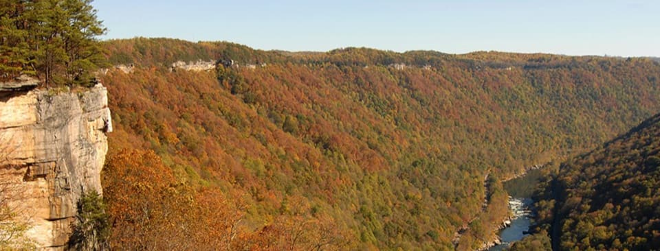
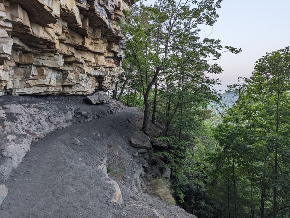
Parking
Use the Craig Branch Trailhead parking area off Kaymoor No. 1 Road; it is about 0.25 mile beyond the T intersection. Adena meets Craig Branch at two access points 0.3 and 0.4 mile from the lot.

New River Gorge National Park, WV
Rolling forest tread makes a gentle loop for walkers and newer riders.
Overview
Map & elevation
Plan your hike

The highest, rockiest slopes around here are a summer buffet for grizzly bears.
New River Gorge Tour Guide
Parkwolf is a GPS audio tour guide for New River Gorge National Park. As you drive, it chimes in with what’s ahead: hidden gems, upcoming stops, history, geology, and wildlife, right through your car’s speakers.
See the New River Gorge audio tourRecorded for this trailhead
Arrowhead's Clovis Loop“Up ahead is the Arrowhead trailhead, where Clovis is my pick for a short woodland walk. Its one-point-one-mile loop takes about half an hour, with gently rolling ground and a few rocky patches.”
Plays as you drive up to this trailhead in the Parkwolf New River Gorge Tour Guide.
More stories near here in the app
“Fantastic app with many points of information… It’s great to just turn on while you’re driving and it gives you an audio tour of the national Park. We love it!!!!”


Trail guide
Adena Trail is a roughly 3.4-mile loop in Arrowhead’s forest trail network. The stored circuit connects two Adena path sections through a short Clovis link and the short mapped return connector. Published mileage labels differ, so use the complete connected line and the route 2 markers rather than counting one section alone.
Use the Craig Branch Trailhead parking area off Kaymoor No. 1 Road. The Adena route meets Craig Branch at two points about 0.3 and 0.4 mile from the lot. Choose either access, then add the same distance on your return; that makes the full outing about 4.0 to 4.2 miles from the car. Budget roughly two to two and a half hours, depending on how long you stop at junctions.
This is a forest walk or beginner-friendly ride with low-grade rolling dips and light climbs and descents. The tread is about 30 to 36 inches wide, with some rock-surfaced patches, broad turns and switchbacks. It is easy to intermediate, with a little more shape and texture than a flat stroll.
The route joins the neighboring Clovis and Dalton trails, so keep the map handy at each junction and follow route 2 to stay on the full circuit. The short Clovis connection is part of the loop; the optional Dalton branch is not.
Arrowhead was built in 2011 with 78,544 volunteer hours from more than 1,000 Order of the Arrow members. The looping tread and connecting routes are part of that youth service project.
Dogs may come on the trail on a physical leash no longer than six feet. There is no drinking water at trailheads, so bring what you and your dog need.
Wildlife
 18 sightingsBlack BearMost seen around 7 PMSighting map
 126 sightingsWhite-tailed DeerMost seen around 6 AMSighting map
 25 sightingsPileated WoodpeckerMost seen around 8 AMSighting map
 15 sightingsBarred OwlMost seen around 7 PMSighting map
 14 sightingsWild TurkeyMost seen around 6 AMSighting map
 58 sightingsCopperheadMost seen around 7 PMSighting map
Sighting maps show where each species has been reported across New River Gorge. Wildlife moves, so no sighting is guaranteed.
Keep exploring
 ModerateCraig Branch and Kaymoor Trail Loop4.9 mi · 2.5 hr · 0.1 mi awayMine ruins, gorge views, and 821 steps in one loop.
 ModerateCraig Branch Trail2.4 mi · 1.5 hr · 0.1 mi awayA 2.4-mile gravel descent links Arrowhead with the Kaymoor Trail.
 EasyClovis Trail1.1 mi · 30 min · 0.1 mi awayA compact forest loop with a few easy rock patches.
 ChallengingKaymoor Miners Trail2 mi · 2.5 hr · 0.3 mi awayA steep mine descent with a gorge view before the long stairs.
 ModerateButcher Branch Trail0.8 mi · 30 min · 0.4 mi awayA wooded connector to Long Point, with a rocky falls spur.
 ModerateDalton Trail6.4 mi · 3.5 hr · 0.6 mi awayA rhododendron tunnel and a long, twisty ridge trail.
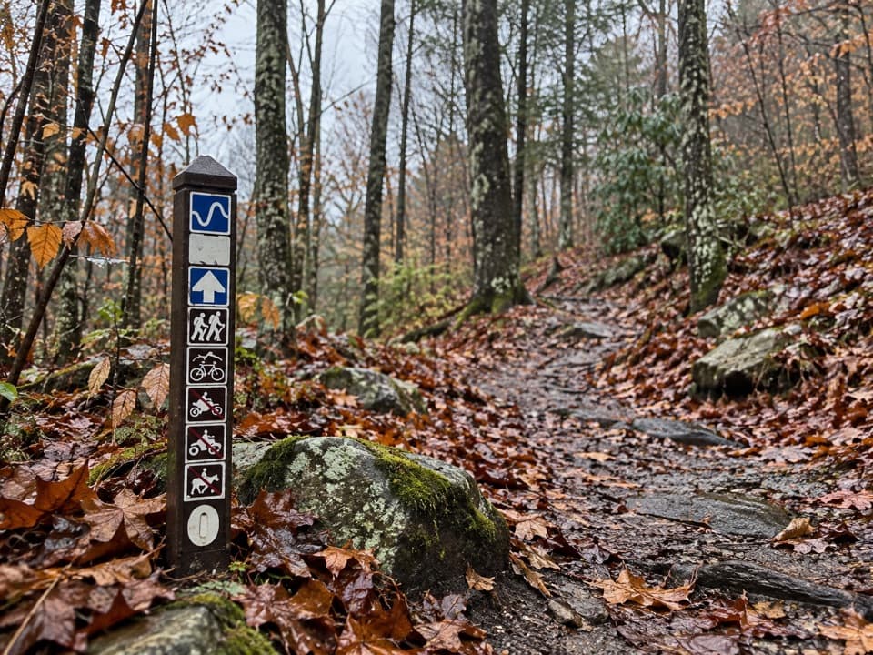 ModerateLeCroy Trail1.8 mi · 1.3 hr · 0.6 mi awayNarrow singletrack, a rock bridge, and a rhododendron tunnel.
 EasyTimber Ridge Trail1 mi · 30 min · 0.7 mi awayA short wooded link into the Fayetteville trail network.
 Sight · 0.5 mi awayKaymoor One MineA coal mine and coke ovens linked by 821 steps.
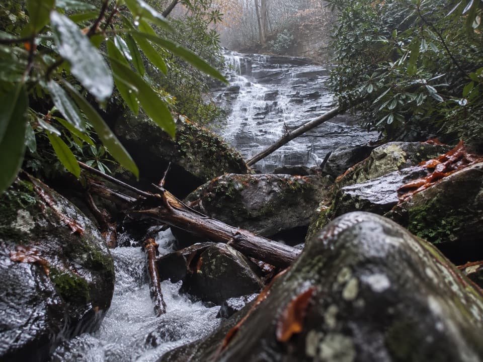 Sight · 0.8 mi awayButcher Branch FallsA close-up waterfall reached by a short, steep spur.
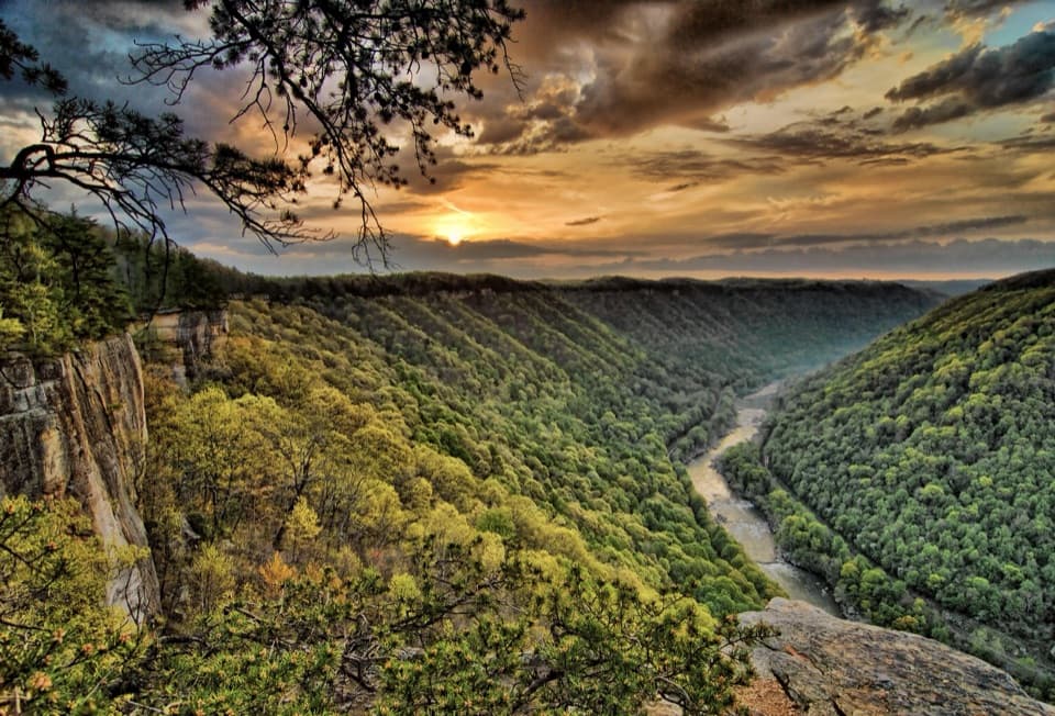 Sight · 0.9 mi awayDiamond Point OverlookA cliff-edge view down nearly 1,000 feet to the New River.
 Sight · 1.5 mi awayLong Point OverlookA rough last pitch opens onto the park’s signature bridge view.
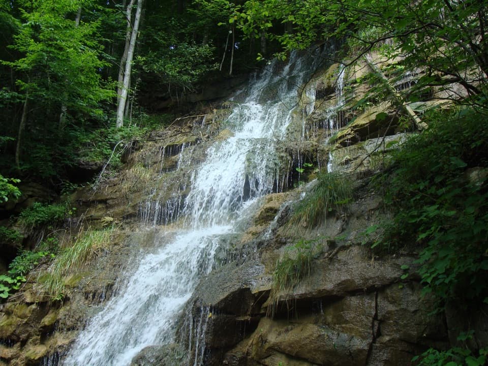 Sight · 1.5 mi awayKaymoor Mine FallsA mossy cascade where mine drainage meets Wolf Creek.
 Sight · 1.5 mi awayNuttallburg Historic SiteA preserved coal town with a rust-red tipple and a tricky drive.
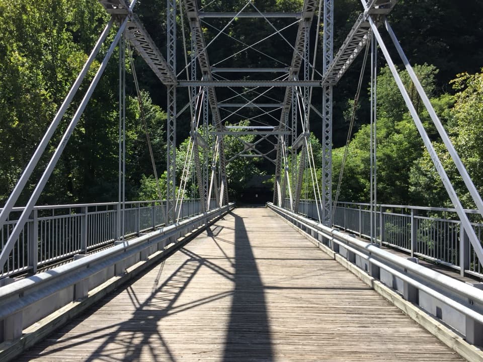 Sight · 1.8 mi awayTunney Hunsaker BridgeA historic lower crossing on Fayette Station Road's one-way gorge drive.
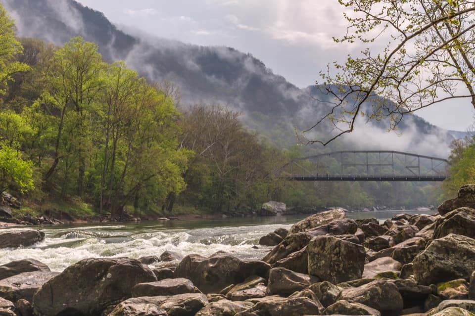 Sight · 2 mi awayFayette Station River AccessRapids, two bridges, and the gorge from river level.
Parkwolf’s New River Gorge ranking

The audio tour guide for the drive, plus offline maps, trails, and wildlife heatmaps for when the signal drops.