Rainforest Trail A in Pacific Rim National Park Reserve

#2 of 19 trails in Pacific Rim

Pacific Rim National Park Reserve, BC

Rainforest Trail A

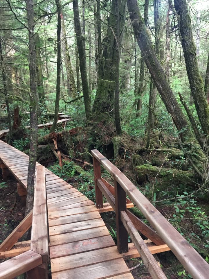
Boardwalks thread giant cedars and stair-stepped ravines.

Photo: Wikimedia Commons
Length
1km
Time
30min
Elevation
Flat
Difficulty
Moderate
  • Loop
  • Dogs allowed
  • High point 60 m

Hear the audio tour

Rainforest Trails A and B

Overview

About Rainforest Trail A

Why go

  • A compact way to walk through the coastal rainforest.
  • Boardwalk decks and panels make the short loop engaging.
  • Large cedars and hemlocks are close to the path.

Heads up

  • Many stairs make the short loop feel more strenuous.

Map & elevation

The route

Loading the Pacific Rim map
Full map
Elevation50–60 m
TrailheadRainforest Trail A entrance49.04302, -125.68150
Keep this map with you offline in the Parkwolf app

Plan your hike

Before you go

Parking

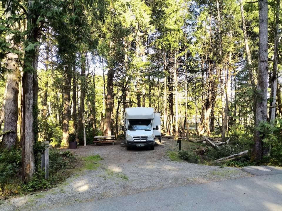
The small Rainforest parking lot is on the ocean side of Highway 4, between Green Point Campground and Wick Road. It has two outhouses and a credit-card Automated Park Use Machine; RVs and buses are not permitted. Large vehicles can use the Combers lot and walk 2 km on ʔapsčiik t̓ašii to reach the Rainforest trails.

Safety

Cross Highway 4 only at the pedestrian-controlled crossing, and activate the signal before crossing. The loop has many staircases and steps down into and back out of ravines.

7 active Pacific Rim alerts

  • CautionWolf warning in Long Beach UnitMentions Long Beach Unit, referenced in this guideA wolf warning remains active in the Long Beach Unit; leave pets at home because dogs attract wolves. Check current trail conditions before travelling.Official details
  • CautionLong Beach trails: limited access and boardwalk hazardsMentions Long Beach, referenced in this guideShorepine Bog and Willowbrae trails have limited access, and Combers Beach Trail is rated Caution; use care and follow posted signs.Official details
See all 7 alerts
A park ranger sits on a dash-mounted phone, talking, as Parkwolf’s Tour Guide plays “Army Cutworm Moths: A Grizzly Bear Buffet” on Grand Loop Road below Dunraven Pass in Yellowstone
Parkwolf Tour GuideThe highest, rockiest slopes around here are a summer buffet for grizzly bears.

Pacific Rim Tour Guide

Your drive to Rainforest Trail A, narrated.

Parkwolf is a GPS audio tour guide for Pacific Rim National Park Reserve. As you drive, it chimes in with what’s ahead: hidden gems, upcoming stops, history, geology, and wildlife, right through your car’s speakers.

See the Pacific Rim audio tour

Recorded for this trailhead

Rainforest Trails A and B
0:00 / 0:25
“Up ahead are the Rainforest trails, with boardwalks among western red cedars and hemlocks. A and B are separate one-kilometre loops, about half an hour each, with plenty of stairs down into ravines and back up.”

Plays as you drive up to this trailhead in the Parkwolf Pacific Rim Tour Guide.

More stories near here in the app

  • Combers Beach
  • Wickaninnish Beach
  • Trees Growing from Trees
  • The Float at the End of the Kelp
  • 34 audio storiesacross Pacific Rim’s roads, triggered by GPS as you drive
  • Wildlife heatmapsfor Orca, Humpback Whale, Black Bear, and 13 more
  • Works offlinemaps, 19 trails, 52 places, and audio download before you lose signal
  • CarPlay readysimple controls built for the drive
★★★★★
“Fantastic app with many points of information… It’s great to just turn on while you’re driving and it gives you an audio tour of the national Park. We love it!!!!”
JMJamesApp Store review
Download Parkwolf on the App StoreGet Parkwolf on Google Play

4.7 from 8,600+ ratings

Trail guide

Hiking Rainforest Trail A

A short rainforest loopRainforest Trail A is a 1 km (0.

Rainforest Trail A is a 1 km (0.62 mi) loop through the temperate rainforest in Pacific Rim National Park Reserve’s Long Beach Unit. Allow about 30 minutes, longer if you stop at the interpretive panels. It is a compact forest walk, not a beach route: Trail A is on the inland side of Highway 4 and returns to its own entrance. A national park entry pass is required. The park calls the route moderate, and the repeated stairs make the short distance more of a workout than a flat boardwalk stroll.

How the loop unfoldsAfter crossing from the shared lot, the boardwalk follows the highway briefly, then bends…

After crossing from the shared lot, the boardwalk follows the highway briefly, then bends deeper into the forest. A junction sends the loop down into the trees; the path keeps dropping and climbing through ravines before wooden steps bring you back toward the entrance. A short side trail is described leading to a small creek view; it is an optional spur, not the route’s endpoint. Rainforest Trail B is a separate loop, so the two sides of the highway should not be mistaken for one circuit.

Boardwalks, ravines and treesMost of A is an approximately 80 cm-wide wooden boardwalk, with gravel between sections.

Most of A is an approximately 80 cm-wide wooden boardwalk, with gravel between sections. Staircases and steps descend into and climb back out of several ravines. Handrails line the staircases and elevated boardwalk; the route is well marked, and wide decks hold interpretive panels. This is easy to follow, but repeated stairs and a narrow walkway mean it is not a flat accessible stroll. Look up for western red cedars and western hemlocks, canopy birds, and listen for trickling water. The trees are close to the path, so framing a curve of boardwalk with trunks gives a better sense of the walk than a canopy-only photo.

A living coastal landscapeThe forest is part of a coast where Nuu-chah-nulth peoples have lived for millennia and…

The forest is part of a coast where Nuu-chah-nulth peoples have lived for millennia and continue to actively manage their lands and territories. The region’s culture is interwoven with its temperate rainforest, islands, beaches and waterways; that wider context belongs alongside the tree and plant life described on the trail. Parks Canada describes the loop as a good experience in rain or shine.

Getting to Trail AThe small shared Rainforest parking lot is on the ocean side of Highway 4, between Green Point…

The small shared Rainforest parking lot is on the ocean side of Highway 4, between Green Point Campground and Wick Road. Trail A starts opposite it; use the pedestrian-controlled crossing, activate the signal and take care crossing. Dogs are allowed on the trail on leash. The lot has two outhouses and a credit-card Park Use Machine, but RVs and buses cannot park there. Large vehicles can use the Combers lot and walk 2 km on ʔapsčiik t̓ašii to reach the Rainforest trails.

Wildlife

Wildlife in Pacific Rim

All Pacific Rim wildlife maps

Sighting maps show where each species has been reported across Pacific Rim. Wildlife moves, so no sighting is guaranteed.

Keep exploring

Near Rainforest Trail A

See it all on the map

Trails that start nearby

Places near the trailhead

Parkwolf’s Pacific Rim ranking

Top-rated trails in Pacific Rim

All 19 trails
  1. 1West Coast TrailChallenging · 75 km
  2. 3Rainforest Trail BModerate · 1 km
  3. 4South Beach TrailModerate · 1.6 km
  4. 5Halfmoon Bay TrailModerate · 3.6 km
  5. 6Shorepine Bog TrailEasy · 0.8 km
  6. 7Cox Bay LookoutChallenging · 0.7 km

Take Parkwolf to Pacific Rim.

The audio tour guide for the drive, plus offline maps, trails, and wildlife heatmaps for when the signal drops.

4.7 from 8,600+ ratings

Download Parkwolf on the App StoreGet Parkwolf on Google Play