Grizzly Peak Trail in Peter Lougheed Provincial Park

Peter Lougheed Provincial Park, AB

Grizzly Peak Trail

Short, steep climb with one scrambly step and a wide summit view.

Length
6.4km
Time
4.5hr
Elev. change
844m
Difficulty
Challenging
  • Dogs allowed
  • High point 2,497 m
  • #12 of 66 in Peter Lougheed

Hear the audio tour

Grizzly Peak: The Steep Summit Route

Overview

About Grizzly Peak Trail

Why go

  • A broad summit panorama after a direct climb
  • About 3 km from roadside access to the summit

Heads up

  • Steep gain with loose footing and a hand-assisted cliff-band step
  • Informal roadside access with no confirmed official trail status

Map & elevation

The route

Loading the Peter Lougheed map
Full map
Elevation1,653–2,497 m
TrailheadRipple Rock Creek roadside access, east side of Highway 4050.75072, -115.13222
Keep this map with you offline in the Parkwolf app

Plan your hike

Before you go

Parking

Route reports place the start on the east side of Highway 40 just south of Ripple Rock Creek; no marked lot or capacity was confirmed. The separate Grizzly Creek day-use parking area is about 1 km away. Access is informal, so check signs and restrictions before leaving your vehicle. A Kananaskis Conservation Pass applies at eligible park and public-land parking sites; exact applicability of this shoulder is unconfirmed.

Safety

Very steep, loose terrain with a short hand-assisted scramble through a cliff band and faint branches on upper slopes. Official access and maintenance status are unconfirmed. Dogs must remain leashed no longer than 2 metres in Alberta provincial parks.

4 active Peter Lougheed alerts

  • ClosureTrail closures and Three Isle detourThree trail sections remain closed; stay out of closed areas and follow the signed Three Isle detour to reach the open backcountry campgrounds.Official details
  • CautionBear activity near Elpoca and ValleyviewFrequent bear activity has been noted along Valleyview Road from Elpoca Day Use Area south to Highway 40, near Little Highwood Pass and Valleyview Day Use Areas; use bear precautions.Official details
See all 4 alerts
A park ranger sits on a dash-mounted phone, talking, as Parkwolf’s Tour Guide plays “Army Cutworm Moths: A Grizzly Bear Buffet” on Grand Loop Road below Dunraven Pass in Yellowstone
Parkwolf Tour GuideThe highest, rockiest slopes around here are a summer buffet for grizzly bears.

Peter Lougheed Tour Guide

Your drive to Grizzly Peak Trail, narrated.

Parkwolf is a GPS audio tour guide for Peter Lougheed Provincial Park. As you drive, it chimes in with what’s ahead: hidden gems, upcoming stops, history, geology, and wildlife, right through your car’s speakers.

See the Peter Lougheed audio tour

Recorded for this trailhead

Grizzly Peak: The Steep Summit Route
0:00 / 0:30
“You're approaching the informal roadside start for Grizzly Peak at Ripple Rock Creek.”

Plays as you drive up to this trailhead in the Parkwolf Peter Lougheed Tour Guide.

More stories near here in the app

  • Grizzly Creek: A Quick Valley View
  • Reading a Ram's Horns
  • King Creek: A Pause or a Canyon Walk
  • The Creek Behind the Lake Fish
  • 41 audio storiesacross Peter Lougheed’s roads, triggered by GPS as you drive
  • Wildlife heatmapsfor Grizzly Bear, Canada Lynx, Black Bear, and 13 more
  • Works offlinemaps, 66 trails, 41 places, and audio download before you lose signal
  • CarPlay readysimple controls built for the drive
★★★★★
“Fantastic app with many points of information… It’s great to just turn on while you’re driving and it gives you an audio tour of the national Park. We love it!!!!”
JMJamesApp Store review
Download Parkwolf on the App StoreGet Parkwolf on Google Play

4.7 from 8,600+ ratings

Trail guide

Hiking Grizzly Peak Trail

What you are taking onGrizzly Peak Trail is an informal out-and-back from Highway 40 at Ripple Rock Creek to a…

Grizzly Peak Trail is an informal out-and-back from Highway 40 at Ripple Rock Creek to a 2,538-metre summit. Plan on about 6.4 km (4 miles) round trip, roughly 850–900 metres of climbing, and four to five hours. The mileage looks modest, but most of that climb comes in about 3 km each way. This is for hikers who want a direct summit outing and are comfortable with a steep, loose trail and a short scramble. I could not confirm an official trail designation, maintenance status, or authorization for the reported roadside access. Check signs and parking restrictions before leaving the road.

From the creek to the cliffsThe reported start is on the east shoulder of Highway 40, just south of Ripple Rock Creek, with…

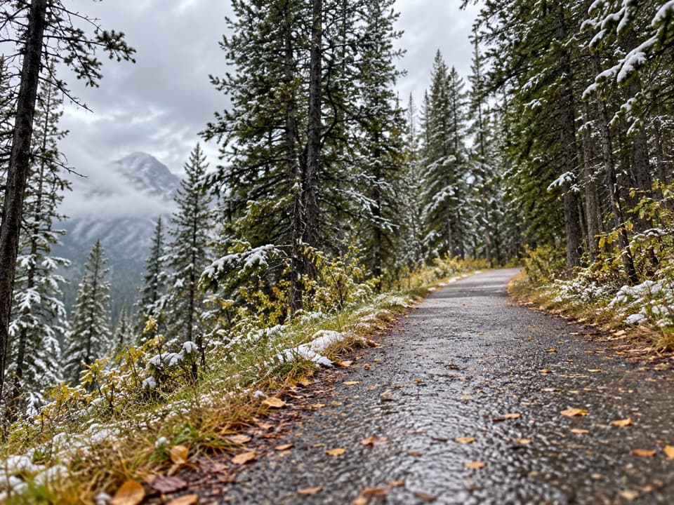
The reported start is on the east shoulder of Highway 40, just south of Ripple Rock Creek, with the route beginning on the creek’s north bank. It climbs through trees and small rock bands, eases briefly, then steepens again as it emerges onto open slopes. Near the cliff wall, the line traverses below the rock before steep switchbacks gain height quickly. The change from forest to open ground is a useful marker that the upper part of the climb is beginning.

Around the summit blockThere are faint branches on the open slopes.

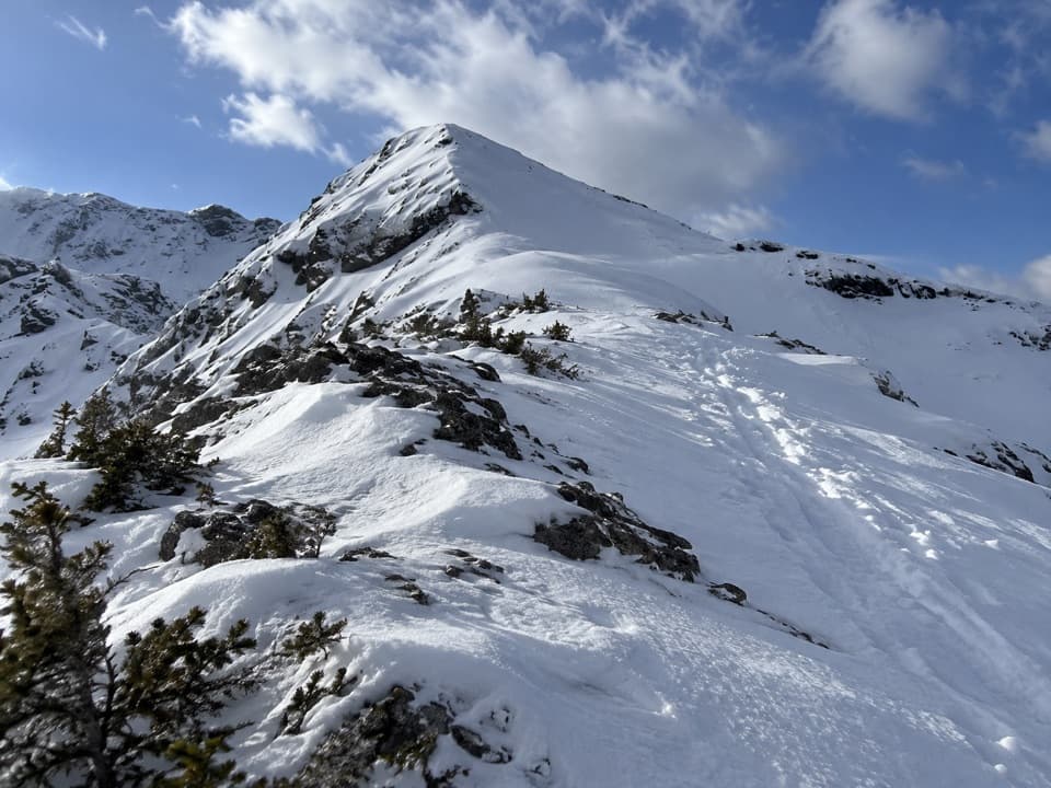
There are faint branches on the open slopes. Stay on the lower traverse beneath the cliff wall, then follow the route around the right side of the summit block. A short cliff-band step is the crux and calls for your hands. Above it, the route crosses a steep, hard-packed slope to a grassy ridge. Some descriptions say the obvious tread fades near a scree gully; the last stretch to the saddle and summit is on open ground rather than a built path. Keep to the described line: the separate South Ridge route is a different, more technical outing.

At the topThe summit sits above a broad saddle between Grizzly Peak and Mount Evan-Thomas.

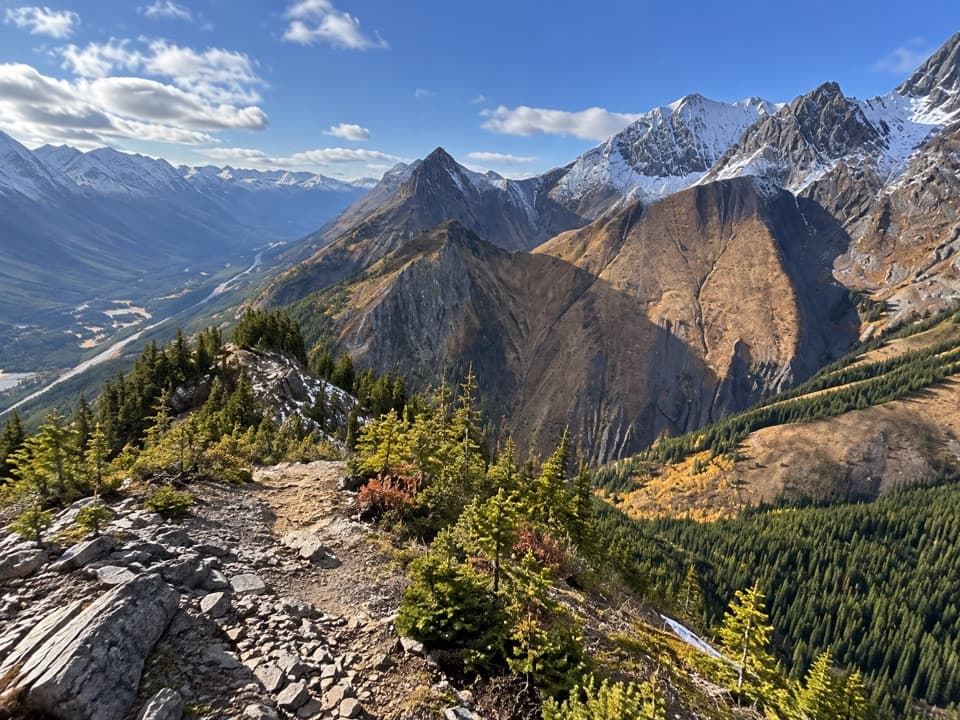
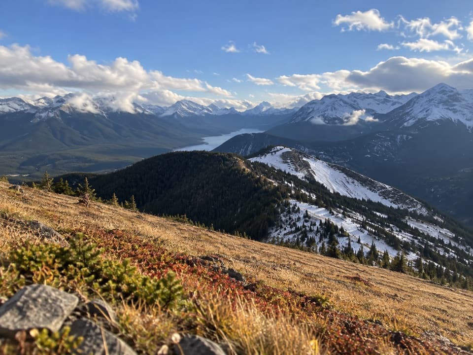
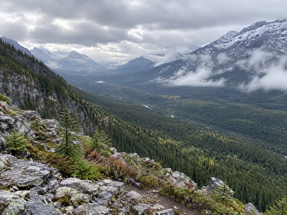
The summit sits above a broad saddle between Grizzly Peak and Mount Evan-Thomas. From the ridge, look east toward Mount Evan-Thomas, Packenham and Mount Hood; west, Mount Joffre rises beyond the Kananaskis Lakes. The wide panorama is the reward for the relentless climb. A strip of the rocky ridge in the foreground gives a phone photo a sense of the height without losing the mountain view.

Start, parking and rulesRoute reports place roadside parking on the east side of Highway 40 just south of Ripple Rock…

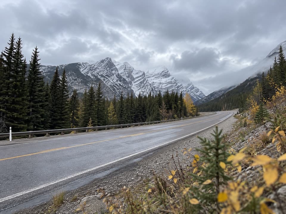
Route reports place roadside parking on the east side of Highway 40 just south of Ripple Rock Creek; no marked lot or parking capacity was confirmed. This is not the Grizzly Creek day-use parking area, which is about 1 km away. The access is informal, so only park and enter where signs and conditions allow. A Kananaskis Conservation Pass is required for vehicles at eligible park and public-land sites; whether this roadside shoulder qualifies was not confirmed. Alberta Parks allows pets in provincial parks on a leash no longer than 2 metres. I found no reliable information about toilets, drinking water or food at this roadside start, so do not count on a refill there.

Wildlife

Wildlife in Peter Lougheed

All Peter Lougheed wildlife maps

Sighting maps show where each species has been reported across Peter Lougheed. Wildlife moves, so no sighting is guaranteed.

Keep exploring

Near Grizzly Peak Trail

See it all on the map

Trails that start nearby

Places near the trailhead

Parkwolf’s Peter Lougheed ranking

Top-rated trails in Peter Lougheed

All 66 trails
  1. 1Rawson Lake TrailModerate · 7.8 km
  2. 2Ptarmigan Cirque Interpretive TrailModerate · 4.5 km
  3. 3Burstall Pass TrailChallenging · 14.8 km
  4. 4Chester Lake TrailModerate · 9.2 km
  5. 5Upper Kananaskis Lake LoopModerate · 15.7 km
  6. 6Sarrail Ridge via Rawson LakeChallenging · 11.7 km

Take Parkwolf to Peter Lougheed.

The audio tour guide for the drive, plus offline maps, trails, and wildlife heatmaps for when the signal drops.

4.7 from 8,600+ ratings

Download Parkwolf on the App StoreGet Parkwolf on Google Play