Drakes Estero Kayak Launch in Point Reyes National Seashore

Sight · Point Reyes National Seashore

Drakes Estero Kayak Launch

Paddle into a hushed marine wilderness of seals, rays and birds

Photo: National Park Service
Type
Sight
Nearest trail
1 mi
Audio stories
3 nearby
  • Parking
  • Restrooms

Hear the audio tour

Drakes Estero Kayak Launch

Overview

About Drakes Estero Kayak Launch

Why stop

  • Rare access to a quiet marine wilderness
  • Sheltered estuary paddling with abundant birdlife

Heads up

  • Tide timing can leave you on mudflats
  • Seasonal boating closure and rough approach road
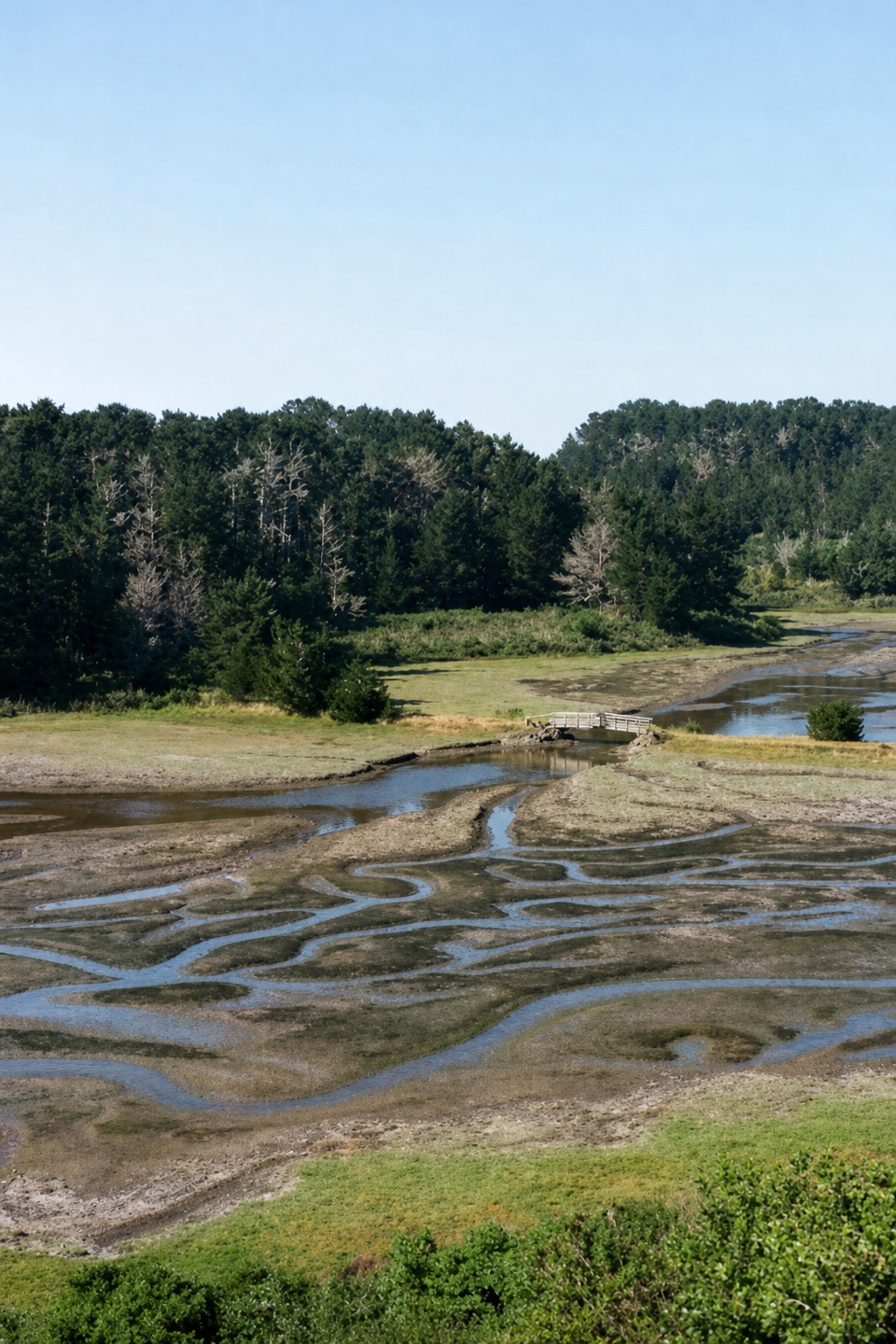
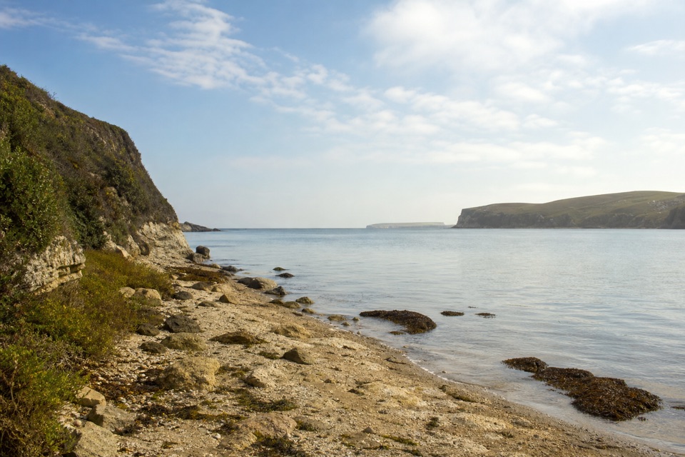
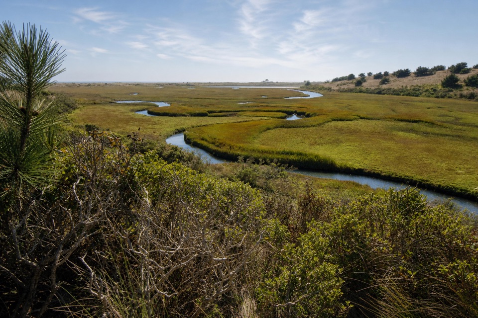
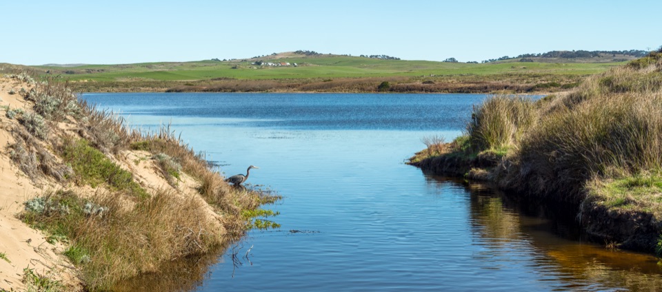
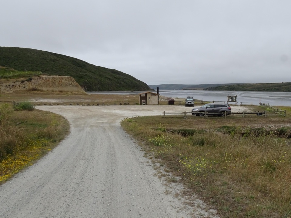
This small gravel pull-in at the water's edge is the way into Drakes Estero and Estero de Limantour, a relatively undisturbed marine wilderness of tidal channels and mudflats. This is the designated launch for the esteros, and paddlers who make the effort often describe the experience as quiet and peaceful, with little more than water sounds and birdcalls for company.
Parkwolf’s verdictWhy stop here

Map

Where it is

Loading the Point Reyes map
Full map
SightDrakes Estero Kayak Launch38.08290, -122.93203
Keep this map with you offline in the Parkwolf app

Plan your stop

Before you go

Best time to go

Kayaking and canoeing are permitted from July 1 through February 28. Boating is closed from March 1 through June 30 to protect harbor seals during pupping season. Plan your visit around those dates, since arriving in spring means no paddling at all. Overnight use is prohibited.


The parking area and facilities

The lot is small, unpaved, and holds around 20 vehicles in total. A vault toilet building sits on the south side along with litter and recycling receptacles. There is a notice board, and that is essentially the extent of the facilities. No accessibility features or designated accessible spaces are confirmed here. Come prepared to be self-sufficient rather than counting on amenities.

4 active Point Reyes alerts

  • ClosureOld Tocaloma/Platform Bridge closed to vehiclesDo not drive across the Old Tocaloma/Platform Bridge; it is closed to all vehicular traffic until further notice.Official details
  • ClosurePalomarin Beach Trail closedPalomarin Beach Trail is closed to all visitors, employees, and residents until further notice; do not use the trail. - The trail is closed because unstable and failing sections have made it unsafe.Official details
See all 4 alerts
A park ranger sits on a dash-mounted phone, talking, as Parkwolf’s Tour Guide plays “Army Cutworm Moths: A Grizzly Bear Buffet” on Grand Loop Road below Dunraven Pass in Yellowstone
Parkwolf Tour GuideThe highest, rockiest slopes around here are a summer buffet for grizzly bears.

Point Reyes Tour Guide

Your drive to Drakes Estero Kayak Launch, narrated.

Parkwolf is a GPS audio tour guide for Point Reyes National Seashore. As you drive, it chimes in with what’s ahead: hidden gems, upcoming stops, history, geology, and wildlife, right through your car’s speakers.

Recorded for this place

Drakes Estero Kayak Launch
0:00 / 0:31
“You're approaching the access road for Drakes Estero Kayak Launch; the water is another seven tenths of a mile down a narrow gravel lane. This is a place for a planned paddle, not a casual waterfront stop.”

Plays as you drive up to Drakes Estero Kayak Launch in the Parkwolf Point Reyes Tour Guide.

More stories near here in the app

  • Cypress Tree Tunnel and KPH Station
  • Estero Trailhead and Home Bay
  • Point Reyes Beach North
  • The Samoa Rescue
  • 61 audio storiesacross Point Reyes’s roads, triggered by GPS as you drive
  • Wildlife heatmapsfor Northern Elephant Seal, Grey Whale, Humpback Whale, and 13 more
  • Works offlinemaps, 65 trails, 41 places, and audio download before you lose signal
  • CarPlay readysimple controls built for the drive
★★★★★
“Fantastic app with many points of information… It’s great to just turn on while you’re driving and it gives you an audio tour of the national Park. We love it!!!!”
JMJamesApp Store review
Download Parkwolf on the App StoreGet Parkwolf on Google Play

4.7 from 8,600+ ratings

Guide

More about Drakes Estero Kayak Launch

What you can see and doLaunch a kayak or canoe from the southwest corner of the lot and explore the estero's arms and…
  • Launch a kayak or canoe from the southwest corner of the lot and explore the estero's arms and channels.
  • Watch for harbor seals, bat rays, leopard sharks, and a wide range of birds and fish. Sightings are never guaranteed, though visitors regularly report birdlife and bat rays.
  • Clamming is allowed only in the northern section of Drakes Estero. Fishing is otherwise prohibited.

  • Motorized vessels and drones are prohibited.

Finding the launchFrom Bear Valley Visitor Center, follow Sir Francis Drake Boulevard west roughly 8.

From Bear Valley Visitor Center, follow Sir Francis Drake Boulevard west roughly 8.4 miles, staying with the signs for the Lighthouse. Continue past the Home Ranch and Estero Trailhead road to the Drakes Estero sign, just before the bridge over Schooner Creek, and turn left. The access road runs about 0.7 miles south on dirt and gravel to the parking area beside the launch. Drive time from the visitor center is roughly 20 minutes. This is a different spot from the Estero Trailhead, so aim for the launch itself rather than the trailhead parking.

Tides and safetyPaddling here is tide-dependent.

Paddling here is tide-dependent. At low tide you may be left stuck on mudflats or forced to wade between the parking area and open water, so check tide tables before committing to a launch window. Currents near the mouth of the estero can be very strong and may pull paddlers toward Drakes Bay as the tide retreats. Check weather and marine forecasts before you go. Carry a Coast Guard-approved personal flotation device for each person aboard and follow California boating requirements. Keep at least 300 feet, about 90 meters, from harbor seals at all times.

What to bringYour own boat and paddling gear, plus a Coast Guard-approved flotation device for each person…
  • Your own boat and paddling gear, plus a Coast Guard-approved flotation device for each person aboard.
  • Printed or downloaded tide and forecast information, along with any maps you want.
  • Water, food, sun protection, wind layers, and footwear you do not mind getting muddy.
  • A bag for your own trash if the receptacles are full.
Honest drawbacksThe approach lane is narrow, unpaved, and slow going, and the lot is genuinely small.

The approach lane is narrow, unpaved, and slow going, and the lot is genuinely small. Facilities are minimal. Getting the tide wrong can spoil a trip here, and the long spring closure rules out a good part of the year. If you want easy amenities or a casual stop, this is a place to skip. If you paddle and can time the water right, it rewards the planning.

Wildlife

Wildlife in Point Reyes

All Point Reyes wildlife maps

Sighting maps show where each species has been reported across Point Reyes. Wildlife moves, so no sighting is guaranteed.

Keep exploring

Near Drakes Estero Kayak Launch

See it all on the map

Trails nearby

More stops nearby

Parkwolf’s Point Reyes ranking

Top sights in Point Reyes

All 41 places
  1. 1Point Reyes LighthouseSight
  2. 2Chimney RockSight
  3. 3Drakes BeachBeach
  4. 4Cypress Tree TunnelSight
  5. 5Alamere FallsSight
  6. 6Pierce Point RanchSight

Take Parkwolf to Point Reyes.

The audio tour guide for the drive, plus offline maps, trails, and wildlife heatmaps for when the signal drops.

4.7 from 8,600+ ratings

Download Parkwolf on the App StoreGet Parkwolf on Google Play