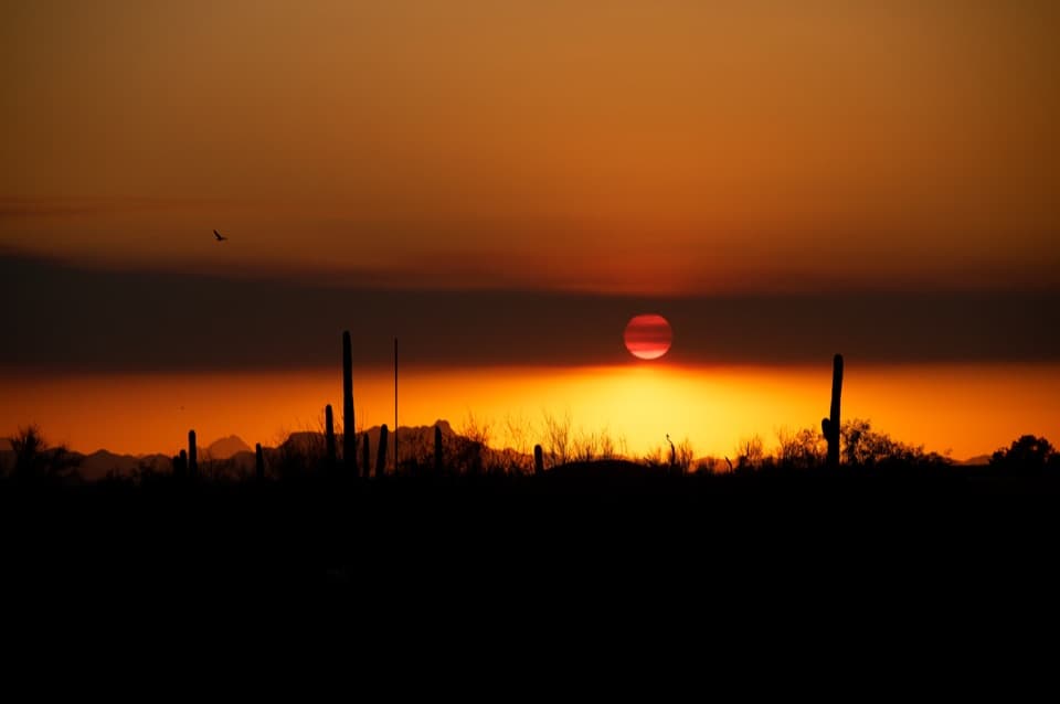
Hope Camp Trail in Saguaro National Park

Saguaro National Park, AZ

Hope Camp Trail

A long desert road leads to old windmills and wide Rincon views.

Photo: National Park Service
Length
7mi
Time
4hr
Elev. change
213ft
Difficulty
Moderate
  • No dogs
  • High point 3,310 ft
  • #19 of 74 in Saguaro

Hear the audio tour

Loma Alta: Ridgeview’s Canyon View

Overview

About Hope Camp Trail

Why go

  • An early lookout stacks three Rincon peaks above the saguaro valley.
  • Windmills and tanks make the old ranch road feel like a destination.

Heads up

  • The broad old road can feel like a long approach before the best views.
  • Exposed miles and the return the same way call for heat-aware timing.

Map & elevation

The route

Loading the Saguaro map
Full map
Elevation3,097–3,310 ft
TrailheadLoma Alta Trailhead32.13294, -110.68700
Keep this map with you offline in the Parkwolf app

Plan your hike

Before you go

Parking

Use Loma Alta Trailhead at the north end of Camino Loma Alta, approached from Old Spanish Trail. The final half-mile is rocky, unpaved and subject to washouts; passenger cars may continue to the trailhead when passable, but spaces are limited and often fill on weekends. Horse trailers park in the lower area beyond the pavement. Follow the Camino Loma Alta approach rather than private roads.

Safety

The broad desert route has only patchy shade; carry water for the full walk and choose cooler hours. The final half-mile of access road can wash out, and visitors should turn around if Rincon Creek floods it. Dogs are prohibited on this trail; service animals are exempt.

3 active Saguaro alerts

  • ClosureTucson Mountain District road closuresSeveral Tucson Mountain District roads are closed; follow posted closures and use McCain Loop to bypass the Kinney Road closure.Official details
  • CautionVehicle break-ins reported at trailheadsVehicle break-ins have occurred at King Canyon Trailhead and other park trailheads; secure your vehicle and valuables.Official details
See all 3 alerts
A park ranger sits on a dash-mounted phone, talking, as Parkwolf’s Tour Guide plays “Army Cutworm Moths: A Grizzly Bear Buffet” on Grand Loop Road below Dunraven Pass in Yellowstone
Parkwolf Tour GuideThe highest, rockiest slopes around here are a summer buffet for grizzly bears.

Saguaro Tour Guide

Your drive to Hope Camp Trail, narrated.

Parkwolf is a GPS audio tour guide for Saguaro National Park. As you drive, it chimes in with what’s ahead: hidden gems, upcoming stops, history, geology, and wildlife, right through your car’s speakers.

See the Saguaro audio tour

Recorded for this trailhead

Loma Alta: Ridgeview’s Canyon View
0:00 / 0:25
“You’re approaching Loma Alta Trailhead, where Ridgeview offers a shorter uphill outing with views into Box Canyon and toward Rincon Peak.”

Plays as you drive up to this trailhead in the Parkwolf Saguaro Tour Guide.

More stories near here in the app

  • Water From a Seed
  • The Living Saguaro Harvest
  • Javelina Picnic Area and Freeman Homestead
  • Javelina Rocks: Stripes in the Stone
  • 43 audio storiesacross Saguaro’s roads, triggered by GPS as you drive
  • Wildlife heatmapsfor Black Bear, Mountain Lion, Mule Deer, and 13 more
  • Works offlinemaps, 74 trails, 40 places, and audio download before you lose signal
  • CarPlay readysimple controls built for the drive
★★★★★
“Fantastic app with many points of information… It’s great to just turn on while you’re driving and it gives you an audio tour of the national Park. We love it!!!!”
JMJamesApp Store review
Download Parkwolf on the App StoreGet Parkwolf on Google Play

4.7 from 8,600+ ratings

Trail guide

Hiking Hope Camp Trail

A long valley walk, not a summit hikeHope Camp Trail is a 7-mile out-and-back from Loma Alta Trailhead to Saguaro National Park’s…

Hope Camp Trail is a 7-mile out-and-back from Loma Alta Trailhead to Saguaro National Park’s boundary, following old ranch roads through Rincon Valley. Allow about four hours for a rolling desert walk with a slight climb near the start and a long return the same way. Go for the early views across the valley and the line-camp remains; if you want a steep, rocky ascent to a summit, this is more of a broad approach road than a mountain climb. The route has patches of mesquite shade, but long stretches are exposed, so bring enough water and time it for cooler hours.

Follow the ranch road eastPass the gate and keep on Hope Camp Trail when Ridge View branches north.

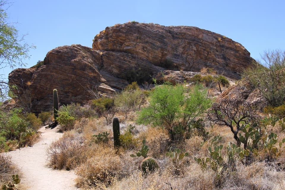
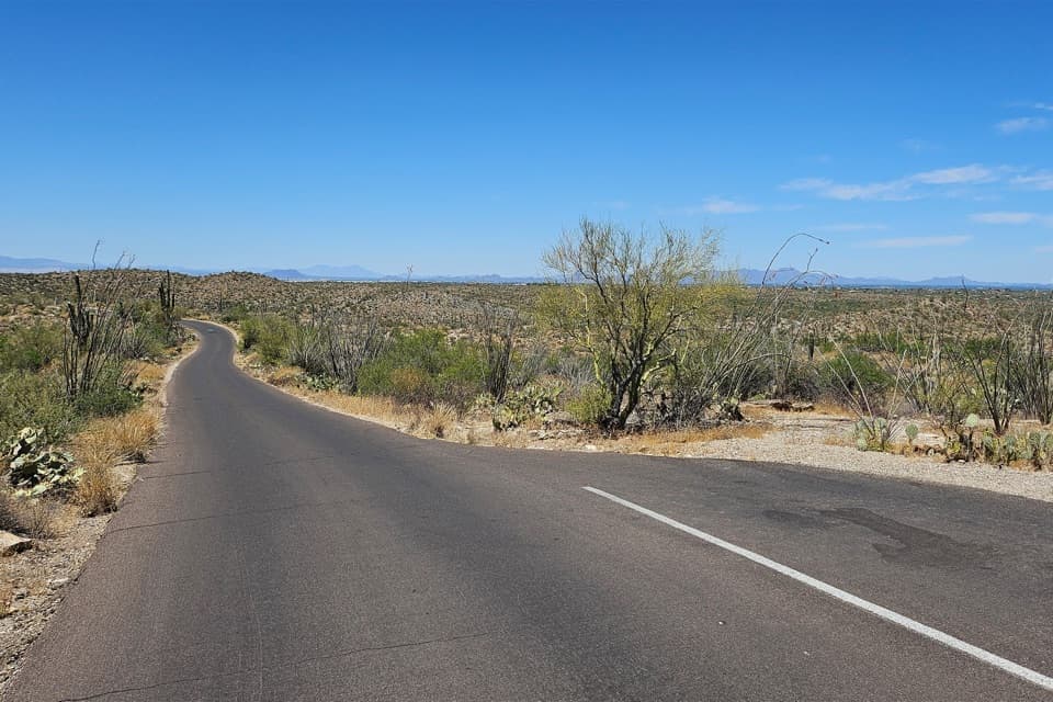
Pass the gate and keep on Hope Camp Trail when Ridge View branches north. An early lookout opens across Tanque Verde Peak, Mica Mountain and Rincon Peak above the saguaro valley. The track then drops toward the Rincon Creek floodplain and Coyote Wash. Expect a broad, rough dirt road rather than a narrow single-track path; horses and bicycles also use it. Stay on the marked Hope Camp route at the Quilter junction, continue past Deer Camp and Hope Camp, and turn around at the signed park boundary. The trail continues beyond it on the Arizona Trail, toward the Mexico border.

The line campsDeer Camp and Hope Camp were ranch line camps used during cattle roundups.

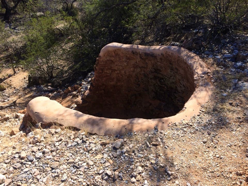
Deer Camp and Hope Camp were ranch line camps used during cattle roundups. Windmills, rusted tanks and other equipment are the remnants to look for along the way. The old ranch roads were the working routes through this valley, and the Rocking K and X-9 ranches were among the operations that shaped its ranching history. Hope Camp makes a useful shorter turnaround at about 5.6 miles round trip; the full walk adds roughly half a mile beyond it to reach the boundary.

Saguaros and the mountain viewSaguaro, prickly pear, mesquite and palo verde fill the lower valley, with a crested saguaro…

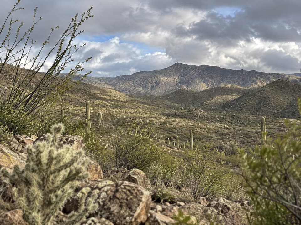
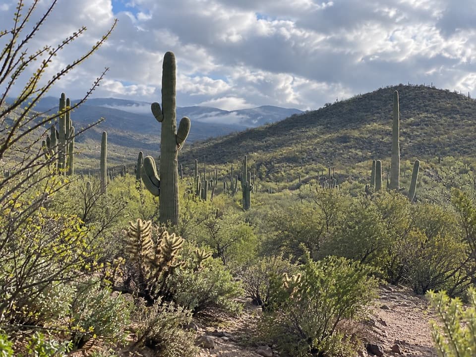
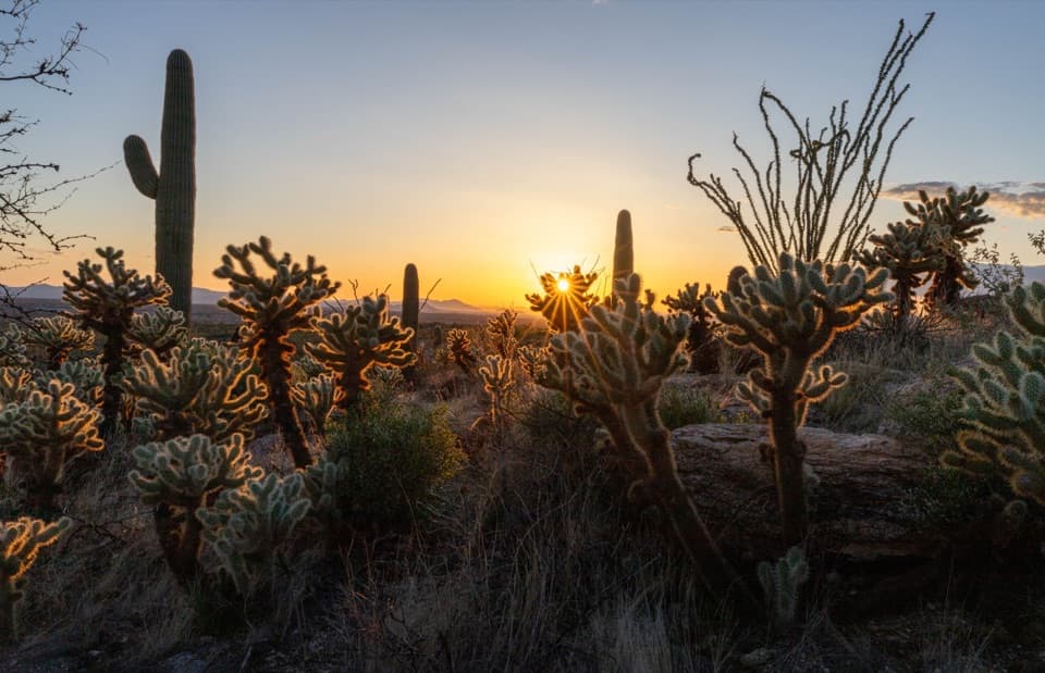
Saguaro, prickly pear, mesquite and palo verde fill the lower valley, with a crested saguaro beyond Deer Camp and the Santa Rita Mountains appearing to the south near Hope Camp. After good fall or winter rain, Mexican gold poppies may flower here. For a photo, frame the windmill and tanks at Hope Camp with the surrounding desert trees; the early lookout is the place for the three Rincon peaks.

Getting there and making it workUse Loma Alta Trailhead at the north end of Camino Loma Alta, approached from Old Spanish Trail.

Use Loma Alta Trailhead at the north end of Camino Loma Alta, approached from Old Spanish Trail. The final half-mile is rocky, unpaved and subject to washouts. Passenger cars can continue to the trailhead when the road is passable, but the small parking area often fills on weekends; horse trailers use the lower area beyond the pavement. Follow the Camino Loma Alta approach rather than private roads. Dogs are not allowed on this trail; service animals are exempt from the park’s pet restrictions. If Rincon Creek is flooding the access road, turn around.

Wildlife

Wildlife in Saguaro

All Saguaro wildlife maps

Sighting maps show where each species has been reported across Saguaro. Wildlife moves, so no sighting is guaranteed.

Keep exploring

Near Hope Camp Trail

See it all on the map

Trails that start nearby

Places near the trailhead

Parkwolf’s Saguaro ranking

Top-rated trails in Saguaro

All 74 trails
  1. 1Wasson Peak via King Canyon and Gould Mine LoopChallenging · 7.8 mi
  2. 2Hugh Norris Trail to Wasson PeakChallenging · 10 mi
  3. 3Bridal Wreath Falls TrailModerate · 5.9 mi
  4. 4King Canyon Trail to Wasson PeakModerate · 7 mi
  5. 5Valley View Overlook Nature TrailEasy · 0.8 mi
  6. 6Freeman Homestead TrailEasy · 1 mi

Take Parkwolf to Saguaro.

The audio tour guide for the drive, plus offline maps, trails, and wildlife heatmaps for when the signal drops.

4.7 from 8,600+ ratings

Download Parkwolf on the App StoreGet Parkwolf on Google Play