Asgard Head walking track in Blue Mountains National Park

Blue Mountains National Park, NSW

Asgard Head walking track

A 6 km return walk to an open Grose Valley lookout.

Length
6km
Time
2hr
Elev. change
114m
Difficulty
Moderate
  • No dogs
  • High point 989 m
  • #41 of 110 in Blue Mountains

Hear the audio tour

Asgard Head and the Plateau Walk

Overview

About Asgard Head walking track

Why go

  • Wide views over the Grose Valley from a distinctive sandstone lookout.
  • The six-kilometre core route avoids the rougher nearby detours.

Heads up

  • The open track has little shade.
  • The final lookout branch is rougher and more uneven than the fire trail.

Map & elevation

The route

Loading the Blue Mountains map
Full map
Elevation875–989 m
TrailheadVictoria Falls Road – Asgard Swamp fire-trail entrance-33.56797, 150.28475
Keep this map with you offline in the Parkwolf app

Plan your hike

Before you go

Parking

From Mount Victoria, turn onto Victoria Falls Road and continue a little over 4.5 km to the Asgard Swamp fire-trail entrance on the left. The road is dirt and has been described as passable in a 2WD vehicle. No dedicated parking area or capacity was documented.

Safety

The route is exposed with little shade, and the lookout branch crosses uneven ground in cliff-ringed country. Keep back from cliff edges. Current access from Victoria Falls Road was not confirmed by NPWS; check local alerts before going. Domestic pets are prohibited except certified assistance animals. NPWS recommends a trip-intention form and PLB for remote-area visits.

3 active Blue Mountains alerts

  • ClosureRoads and tracks closed across Blue Mountains National ParkMany roads, fire trails and walking tracks across Blue Mountains National Park are closed; do not enter closed areas.Official details
  • CautionPark-wide solid-fuel fire banA park fire ban is active across Blue Mountains National Park: campfires and solid-fuel barbecues and stoves are prohibited. - Gas and electric cookers are permitted, subject to safety rules.Official details
See all 3 alerts
A park ranger sits on a dash-mounted phone, talking, as Parkwolf’s Tour Guide plays “Army Cutworm Moths: A Grizzly Bear Buffet” on Grand Loop Road below Dunraven Pass in Yellowstone
Parkwolf Tour GuideThe highest, rockiest slopes around here are a summer buffet for grizzly bears.

Blue Mountains Tour Guide

Your drive to Asgard Head walking track, narrated.

Parkwolf is a GPS audio tour guide for Blue Mountains National Park. As you drive, it chimes in with what’s ahead: hidden gems, upcoming stops, history, geology, and wildlife, right through your car’s speakers.

See the Blue Mountains audio tour

Recorded for this trailhead

Asgard Head and the Plateau Walk
0:00 / 0:24
“The Asgard Head track entrance is coming up on Victoria Falls Road, for a walk across the open plateau to a Grose Valley view. Allow about two hours for the six kilometre return.”

Plays as you drive up to this trailhead in the Parkwolf Blue Mountains Tour Guide.

More stories near here in the app

  • Ikara Head's Rocky Valley View
  • Victoria Falls: Lookout or Waterfall
  • The Bat That Follows Its Nose
  • The Wallaby in the Undergrowth
  • 188 audio storiesacross Blue Mountains’s roads, triggered by GPS as you drive
  • Wildlife heatmapsfor Grey Kangaroo, Wombat, Red-necked Wallaby, and 13 more
  • Works offlinemaps, 110 trails, 84 places, and audio download before you lose signal
  • CarPlay readysimple controls built for the drive
★★★★★
“Fantastic app with many points of information… It’s great to just turn on while you’re driving and it gives you an audio tour of the national Park. We love it!!!!”
JMJamesApp Store review
Download Parkwolf on the App StoreGet Parkwolf on Google Play

4.7 from 8,600+ ratings

Trail guide

Hiking Asgard Head walking track

The routeAsgard Head is a 6 km return walk from the Victoria Falls Road fire-trail entrance, with a…

Asgard Head is a 6 km return walk from the Victoria Falls Road fire-trail entrance, with a short branch to the lookout. Allow about two hours. Most of the walk follows a broad track across open plateau country. Route sources agree on the distance but put the total climb between about 200 and 295 m, so treat ascent as an estimate.

The approachThe track drops on sandy ground from the road.

The track drops on sandy ground from the road. A little over a kilometre in, it crosses Asgard Brook; the crossing also gives a first look toward the nearby wetland. The route continues on the fire trail before the rougher, narrower branch to Asgard Head. On the return, the final hill back to the road is unavoidable.

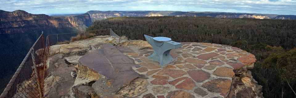
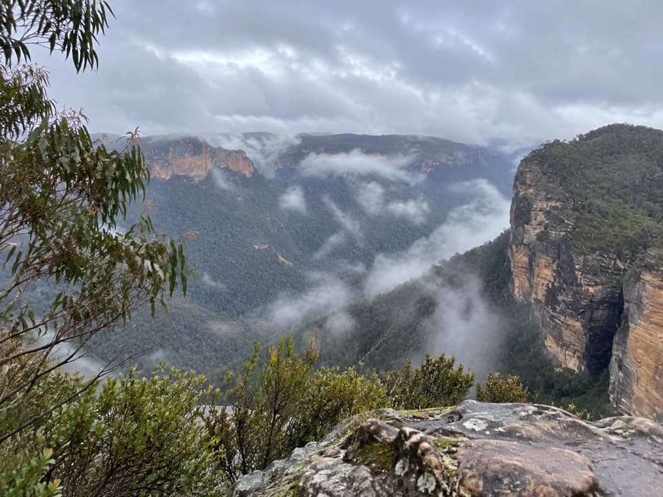
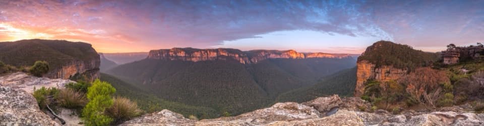
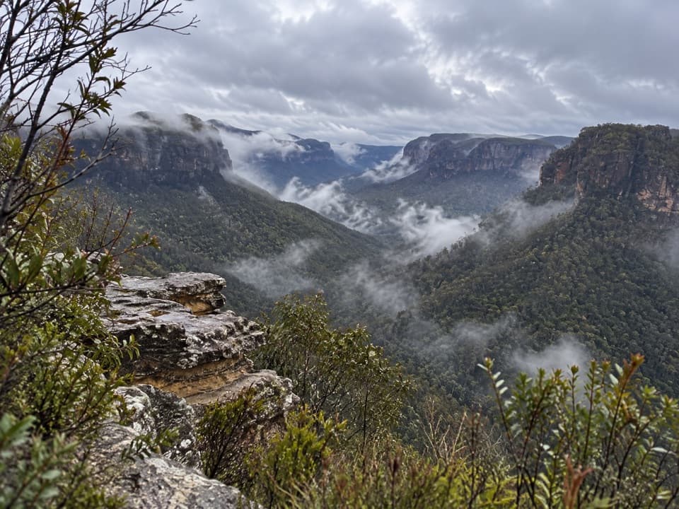
The viewAsgard Head opens east over the forested Grose Valley toward Burra Korain Head, with Victoria…

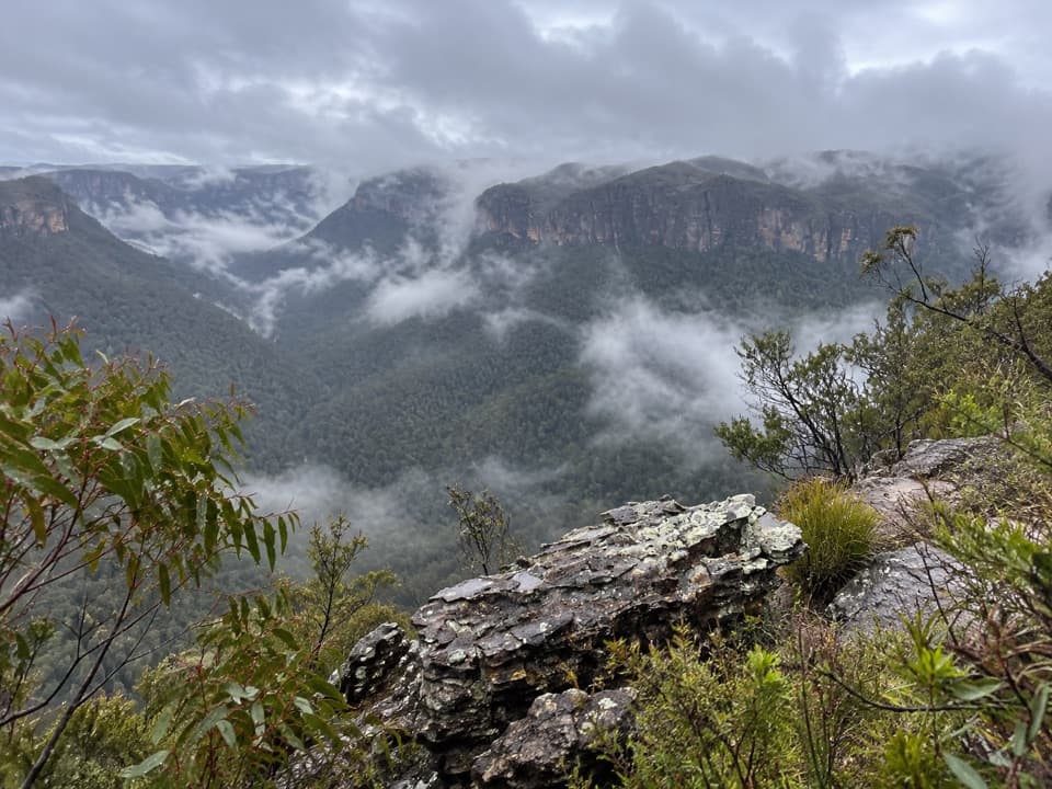
Asgard Head opens east over the forested Grose Valley toward Burra Korain Head, with Victoria Falls to the south. The walk is exposed and has little shade, but the open sandstone country and the broad valley view are the reason to come. Expect a rougher, uneven approach at the lookout than on the fire trail.

Optional detoursKeep this route distinct from the longer Asgard Swamp walk.

Keep this route distinct from the longer Asgard Swamp walk. The swamp and Pagoda Rock, Thor Head and the old mine are reached on separate side paths; accounts that add them run about 7.1 to 9.5 km. Those branches add rougher footing, and the Thor Head and mine approaches are steep or exposed. The mine spur reaches a nineteenth-century prospecting tunnel and a partly intact brick coke oven that was never fired. The plateau's names—Asgard, Thor, Valhalla and Ikara—come from Norse mythology.

Access and rulesThe approach is from Victoria Falls Road, a dirt road reported to be passable in a 2WD vehicle;…

The approach is from Victoria Falls Road, a dirt road reported to be passable in a 2WD vehicle; the fire-trail entrance is a little over 4.5 km from the highway. Current access for this specific route could not be confirmed, so check park alerts before setting out. Dogs and other pets are prohibited in NSW national parks except certified assistance animals. NPWS recommends a trip-intention form and a personal locator beacon for visitors going into remote parts of the park.

Wildlife

Wildlife in Blue Mountains

All Blue Mountains wildlife maps

Sighting maps show where each species has been reported across Blue Mountains. Wildlife moves, so no sighting is guaranteed.

Keep exploring

Near Asgard Head walking track

See it all on the map

Trails that start nearby

Places near the trailhead

Parkwolf’s Blue Mountains ranking

Top-rated trails in Blue Mountains

All 110 trails
  1. 1Grand Canyon trackModerate · 6.3 km
  2. 2Three Sisters walkEasy · 0.8 km
  3. 3Lockley Pylon walking trackModerate · 7 km
  4. 4National PassChallenging · 5.1 km
  5. 5Wentworth Pass loop walking trackChallenging · 5 km
  6. 6Prince Henry Cliff walkModerate · 7 km

Take Parkwolf to Blue Mountains.

The audio tour guide for the drive, plus offline maps, trails, and wildlife heatmaps for when the signal drops.

4.7 from 8,600+ ratings

Download Parkwolf on the App StoreGet Parkwolf on Google Play