Humpback Rocks in Blue Ridge Parkway

#9 of 188 sights in Blue Ridge Parkway

Sight · Blue Ridge Parkway

Humpback Rocks

Short, steep climb to a sweeping rocky perch with valley views

Photo: National Park Service
Type
Sight
Nearest trail
0.6 mi
Audio stories
6 nearby
  • Trailhead
  • Parking
  • Scenic viewpoint
  • Restrooms

Hear the audio tour

Humpback Rocks: A Classic Parkway Climb

Overview

About Humpback Rocks

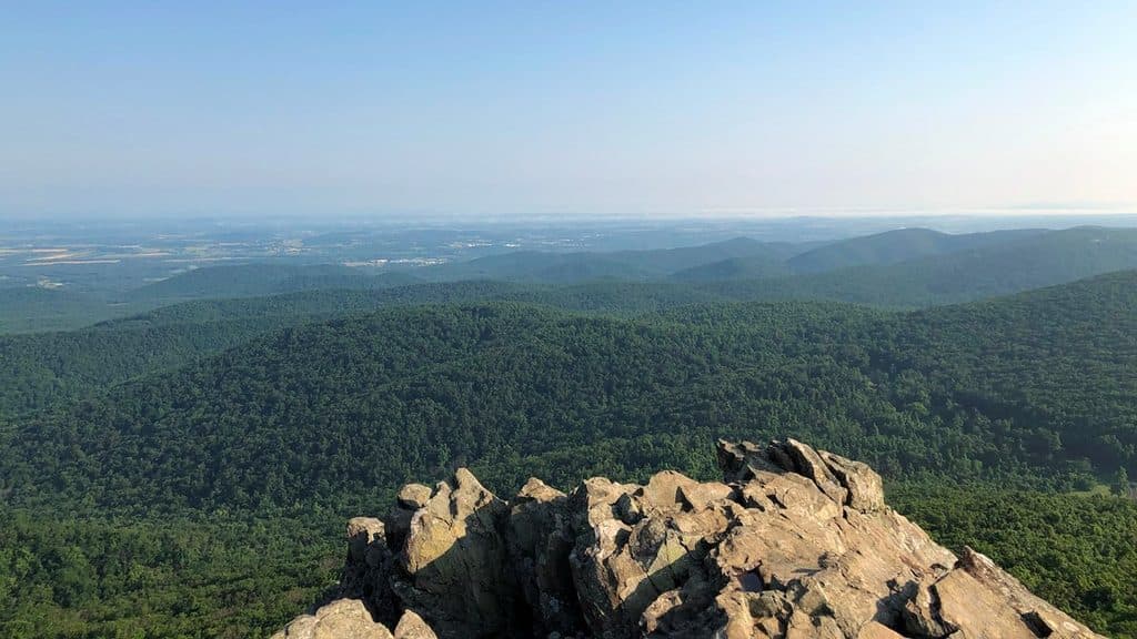
Humpback Rocks is the Parkway’s classic short-and-steep payoff: a rugged greenstone outcrop topping Humpback Mountain with sweeping views over the Shenandoah Valley and the Blue Ridge. It sits just south of the Parkway’s northern entrance (around MP 5.8), so it gets a lot of love—and a lot of traffic.

Why stop

  • Short, steep climb with huge payoff views
  • Historic Mountain Farm and visitor center nearby

Heads up

  • Very crowded and parking fills fast
  • Rocky, eroded tread can be slick after rain
Short, stout, and spectacular. If you’re near the Parkway’s north end, this is the headline hike—just plan around the crowds and bring real hiking shoes.
Parkwolf’s verdictBottom line

Map

Where it is

Loading the Blue Ridge Parkway map
Full map
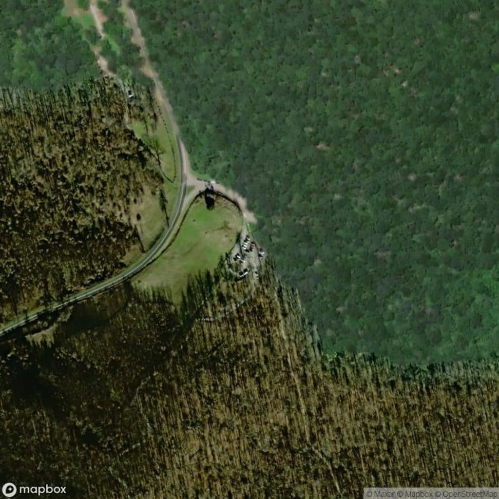
SightHumpback Rocks37.96083, -78.90028
Keep this map with you offline in the Parkwolf app

Local know-how

Tips for visiting Humpback Rocks

  1. Arrive before 9 a.m. or go on weekdays to find parking.

  2. Follow blue blazes and turn left near the top for the outcrop.

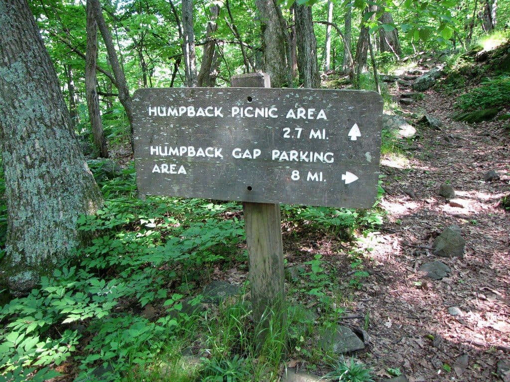
  3. If the main lot is full, start from the Picnic Area at MP 8.5.

  4. Wear sturdy shoes—steep steps, roots, and slick rock after rain.

  5. For sunrise or sunset, pack a headlamp for the hike in/out.

Plan your stop

Before you go

Best time to visit

  • Timing: Arrive early morning on weekdays to beat the parking crunch; sunrise is gorgeous and far less crowded. Sunset is excellent too—bring a headlamp for the descent.
  • Seasons: Fall foliage weekends are packed; winter offers solitude but can be icy. After rain, expect slick rock and mud.
  • Photography: Morning light favors the valley views and often brings clear air and softer contrasts.

Logistics and amenities

  • Primary access: Visitor Center parking area near MP 5.8; trail starts across the Parkway at a kiosk.
  • Overflow/alternate access: Humpback Rocks Picnic Area (MP 8.5) also serves hikes here.
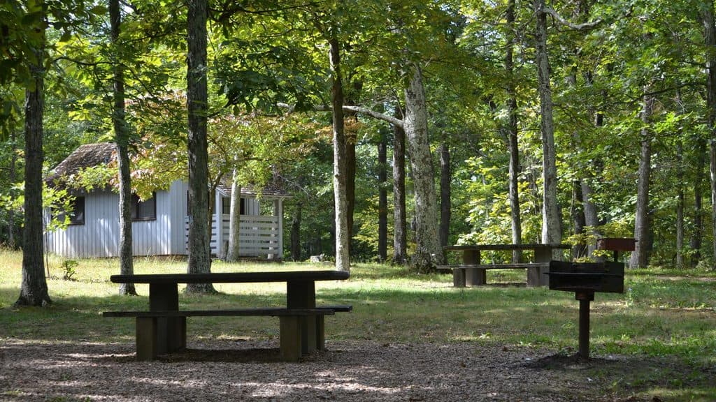
  • Facilities: Restrooms and drinking water are available seasonally at the Picnic Area; restrooms are also available at the Visitor Center. No services on the summit.

2 active Blue Ridge Parkway alerts

  • ClosureNorth Carolina Helene-related closuresAvoid the closed Parkway section from MP 344.2–355.3; recreation of any kind is prohibited there.Official details
  • ClosureVirginia Parkway closures and detourFollow the signed detour around the closed James River Bridge and avoid the closed Roanoke Mountain Loop. - James River Bridge (MP 63.5–63.Official details
Blue Ridge Parkway alerts
A park ranger sits on a dash-mounted phone, talking, as Parkwolf’s Tour Guide plays “Army Cutworm Moths: A Grizzly Bear Buffet” on Grand Loop Road below Dunraven Pass in Yellowstone
Parkwolf Tour GuideThe highest, rockiest slopes around here are a summer buffet for grizzly bears.

Blue Ridge Parkway Tour Guide

Your drive to Humpback Rocks, narrated.

Parkwolf is a GPS audio tour guide for Blue Ridge Parkway. As you drive, it chimes in with what’s ahead: hidden gems, upcoming stops, history, geology, and wildlife, right through your car’s speakers.

See the Blue Ridge Parkway audio tour

Recorded for this place

Humpback Rocks: A Classic Parkway Climb
Listen
“You're now getting close to Humpback Rocks, home to one of the most essential hikes on the northern part of the Parkway. The main trail is a definite workout, climbing steadily with lots of stone steps and roots.”

Plays as you drive up to Humpback Rocks in the Parkwolf Blue Ridge Parkway Tour Guide.

More stories near here in the app

  • The Hand-Dug Tunnel Under Rockfish Gap
  • Humpback Rocks: A Steep Hike or Historic Farm
  • Humpback Rocks Visitor Center and Mountain Farm
  • Humpback Rocks Picnic Area and Greenstone Overlook
  • 277 audio storiesacross Blue Ridge Parkway’s roads, triggered by GPS as you drive
  • Wildlife heatmapsfor Black Bear, Elk, White-tailed Deer, and 13 more
  • Works offlinemaps, 112 trails, 232 places, and audio download before you lose signal
  • CarPlay readysimple controls built for the drive
★★★★★
“…We knew we wanted to drive the Blue Ridge Parkway. The narration was impeccably timed. The facts and info provided were meaningful. Without it, the trip would not have been near as awesome.”
Ashl GApp Store review
Download Parkwolf on the App StoreGet Parkwolf on Google Play

4.7 from 8,600+ ratings

Guide

More about Humpback Rocks

The HikeMost people tackle a roughly 2-mile round trip from the main trailhead near the Humpback Rocks…

Most people tackle a roughly 2-mile round trip from the main trailhead near the Humpback Rocks Visitor Center. The blue‑blazed path climbs about 700–800 feet in just over a mile, with rock and timber steps, roots, and some eroded sections. Near the top, turn left at the junction for the outcrop. Expect to work—then sprawl out on broad, grippy rock slabs at the summit. Benches along the way offer quick breathers.

If you want alternatives or more mileage, you can link nearby trails into loops (including routes from the Picnic Area at MP 8.5) or connect with longer area paths.

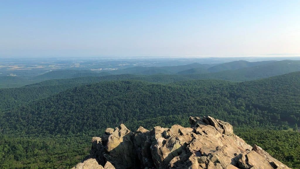
What You’ll SeeThe exposed summit delivers big, wide‑angle views—west to the Shenandoah Valley and north along…

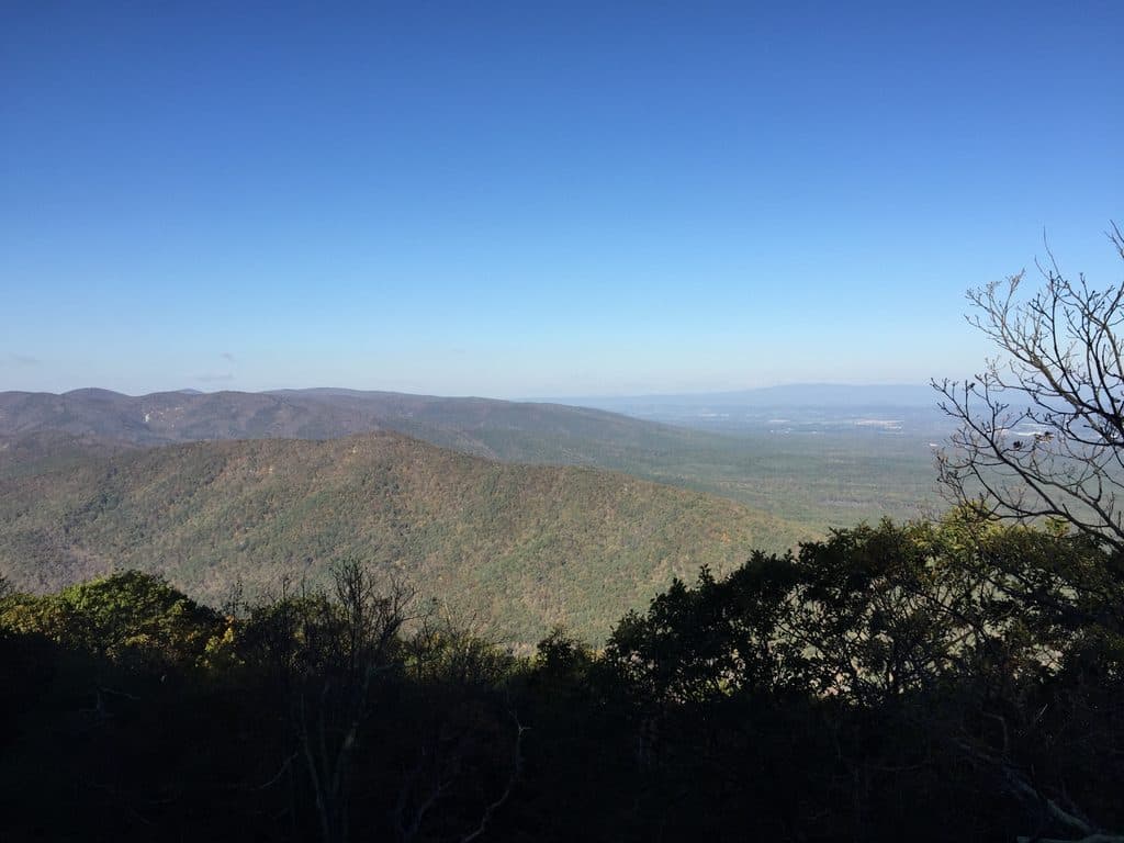
The exposed summit delivers big, wide‑angle views—west to the Shenandoah Valley and north along the Blue Ridge crest. On clear days, raptors ride thermals over the cliffs, and the rock itself is a distinctive greenstone outcrop that contrasts with the otherwise forested ridges.

History next doorAcross the Parkway from the trailhead, the Humpback Rocks Visitor Center and Mountain Farm…

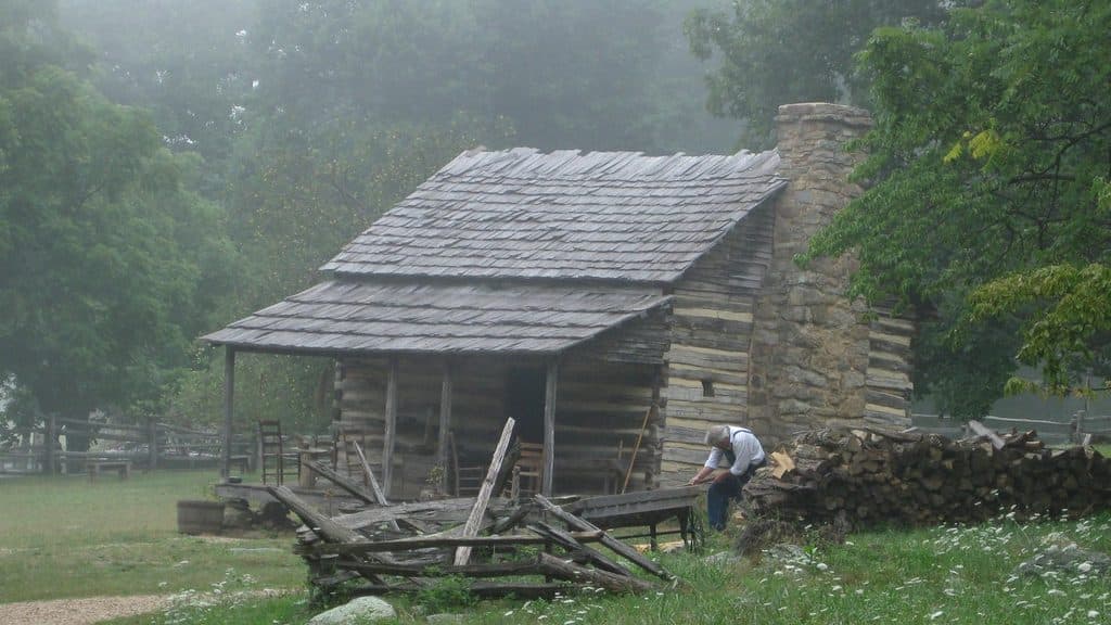
Across the Parkway from the trailhead, the Humpback Rocks Visitor Center and Mountain Farm showcase relocated 19th‑century buildings and exhibits on Appalachian mountain life. It’s an easy add‑on before or after your hike.

WildlifeTypical Blue Ridge forest wildlife lives here—songbirds, squirrels, chipmunks, deer—with the…

Typical Blue Ridge forest wildlife lives here—songbirds, squirrels, chipmunks, deer—with the best viewing in the woods rather than on the exposed rock. Look up for hawks and vultures soaring along the ridge.

Wildlife

Wildlife in Blue Ridge Parkway

All Blue Ridge Parkway wildlife maps

Sighting maps show where each species has been reported across Blue Ridge Parkway. Wildlife moves, so no sighting is guaranteed.

Parkwolf’s Blue Ridge Parkway ranking

Top sights in Blue Ridge Parkway

All 232 places
  1. 1Linn Cove ViaductSight
  2. 2Mount MitchellSight
  3. 3Mount Mitchell State ParkSight
  4. 4Craggy Pinnacle OverlookSight
  5. 5Linville FallsSight
  6. 6Peaks of OtterSight

Take Parkwolf to Blue Ridge Parkway.

The audio tour guide for the drive, plus offline maps, trails, and wildlife heatmaps for when the signal drops.

4.7 from 8,600+ ratings

Download Parkwolf on the App StoreGet Parkwolf on Google Play