Farleitter Crag Trail in Cairngorms National Park

#20 of 260 trails in Cairngorms

Cairngorms National Park, SC

Farleitter Crag Trail

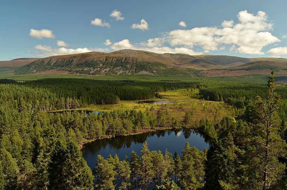
A steep climb through old pines to a crag above the lochans.

Photo: Wikimedia Commons
Length
4km
Time
1.5hr
Elev. change
76m
Difficulty
Challenging
  • Loop
  • High point 350 m

Hear the audio tour

Uath Lochans and Farleitter Crag

Overview

About Farleitter Crag Trail

Why go

  • Crag-top views over the lochans, Spey valley and Glen Feshie hills
  • Old Scots pines, mossy rocks and a chance of red squirrels

Heads up

  • Long, steep slopes make this short loop strenuous; surfaces can be muddy after rain

Map & elevation

The route

Loading the Cairngorms map
Full map
Elevation274–350 m
TrailheadUath Lochans Forestry car park57.09662, -3.92443
Keep this map with you offline in the Parkwolf app

Plan your hike

Before you go

Parking

Start at the free Uath Lochans Forestry car park beside the picnic area. From Aviemore, take the B9152 south to Kincraig, turn left opposite the war memorial toward Feshiebridge, then turn right at the T-junction toward Insh. After just under half a mile, turn left onto the signed no-through road and follow it for about 1 mile (1.6 km) to the car park on the right. PH21 1NX is farther along the road than the car park. Overnight parking is not permitted.

Safety

The route is strenuous for its length, with many long, steep slopes and occasional loose or uneven ground that can be wet and muddy after rain. Open water is present by the picnic area; keep children close near the lochans.

3 active Cairngorms alerts

  • CautionStorm Boelo high windsStorm Boelo will bring extremely windy weather to the Cairngorms; take extra care and limit time outdoors. - The Park Authority expects the very windy weather to last until Monday 26 October.Official details
  • ClosureGlenmore wildfire closures and dangerous treesWildfire damage has closed Allt Mor car park and the path to Sugarbowl/Utsi’s Bridge; keep out of the closed area.Official details
See all 3 alerts
A park ranger sits on a dash-mounted phone, talking, as Parkwolf’s Tour Guide plays “Army Cutworm Moths: A Grizzly Bear Buffet” on Grand Loop Road below Dunraven Pass in Yellowstone
Parkwolf Tour GuideThe highest, rockiest slopes around here are a summer buffet for grizzly bears.

Cairngorms Tour Guide

Your drive to Farleitter Crag Trail, narrated.

Parkwolf is a GPS audio tour guide for Cairngorms National Park. As you drive, it chimes in with what’s ahead: hidden gems, upcoming stops, history, geology, and wildlife, right through your car’s speakers.

See the Cairngorms audio tour

Recorded for this trailhead

Uath Lochans and Farleitter Crag
0:00 / 0:24
“Uath Lochans is ahead, with small lochs and marshy woodland to explore on foot. I'd choose the white-marked loop for a gentle forest outing: about an hour, with boardwalks and a few short steeper sections.”

Plays as you drive up to this trailhead in the Parkwolf Cairngorms Tour Guide.

More stories near here in the app

  • Where the Ice Melted
  • Sgòr Gaoith from Allt Ruadh
  • Loch Insh, Paddling and the Boathouse
  • A River with Many Channels
  • 298 audio storiesacross Cairngorms’s roads, triggered by GPS as you drive
  • Wildlife heatmapsfor Red Deer, Reindeer, Osprey, and 13 more
  • Works offlinemaps, 260 trails, 90 places, and audio download before you lose signal
  • CarPlay readysimple controls built for the drive
★★★★★
“Fantastic app with many points of information… It’s great to just turn on while you’re driving and it gives you an audio tour of the national Park. We love it!!!!”
JMJamesApp Store review
Download Parkwolf on the App StoreGet Parkwolf on Google Play

4.7 from 8,600+ ratings

Trail guide

Hiking Farleitter Crag Trail

A short, serious climbFarleitter Crag Trail is a 2.

Farleitter Crag Trail is a 2.5-mile (4 km) loop from Uath Lochans picnic area, climbing through Inshriach Forest to the wooded rim of Farleitter Crag and returning to the car park. Allow about 1½ hours. The distance is modest, but the route is graded strenuous because it has many long, steep slopes. Choose it for a compact uphill walk to a crag view, not for an easy stroll beside the water.

Through the forestThe trail leaves the picnic area and climbs beneath tall pines.

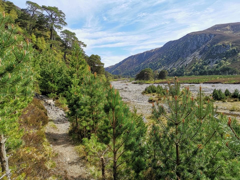
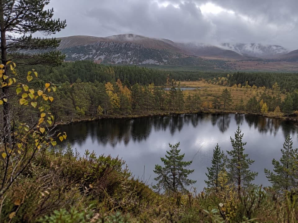
The trail leaves the picnic area and climbs beneath tall pines. Much of the uphill is enclosed by woodland; as you gain height, the Uath lochans begin to appear between the trees. The path follows the wooded rim of Farleitter Crag, with rocky outcrops along the way. Expect to work uphill for much of this short circuit, then keep your footing on the return where the slope drops away again.

What to notice underfootThe path is generally firm and smooth, but the route also has occasional loose or uneven…

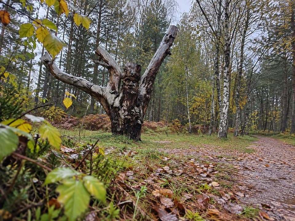
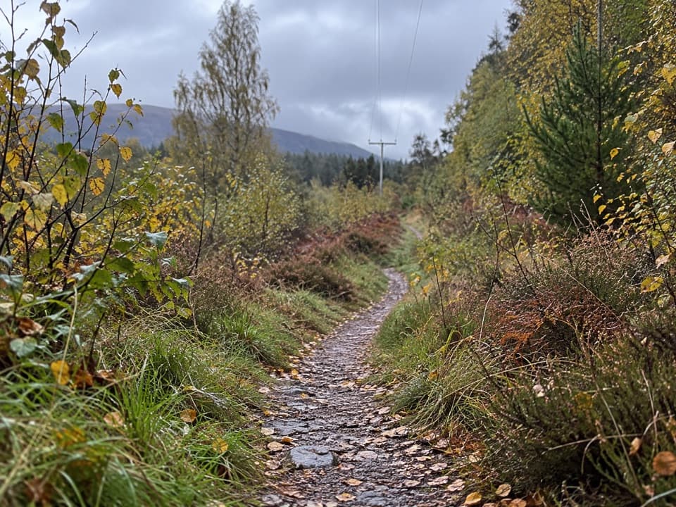
The path is generally firm and smooth, but the route also has occasional loose or uneven stretches. Rain can leave sections wet and muddy, so shoes with grip help on the steeper parts. Moss and lichen cover rocks in the woodland, and Scots pines here are more than 120 years old. Take a moment to look closely at the rock surfaces; they give the climb more to notice than trees alone.

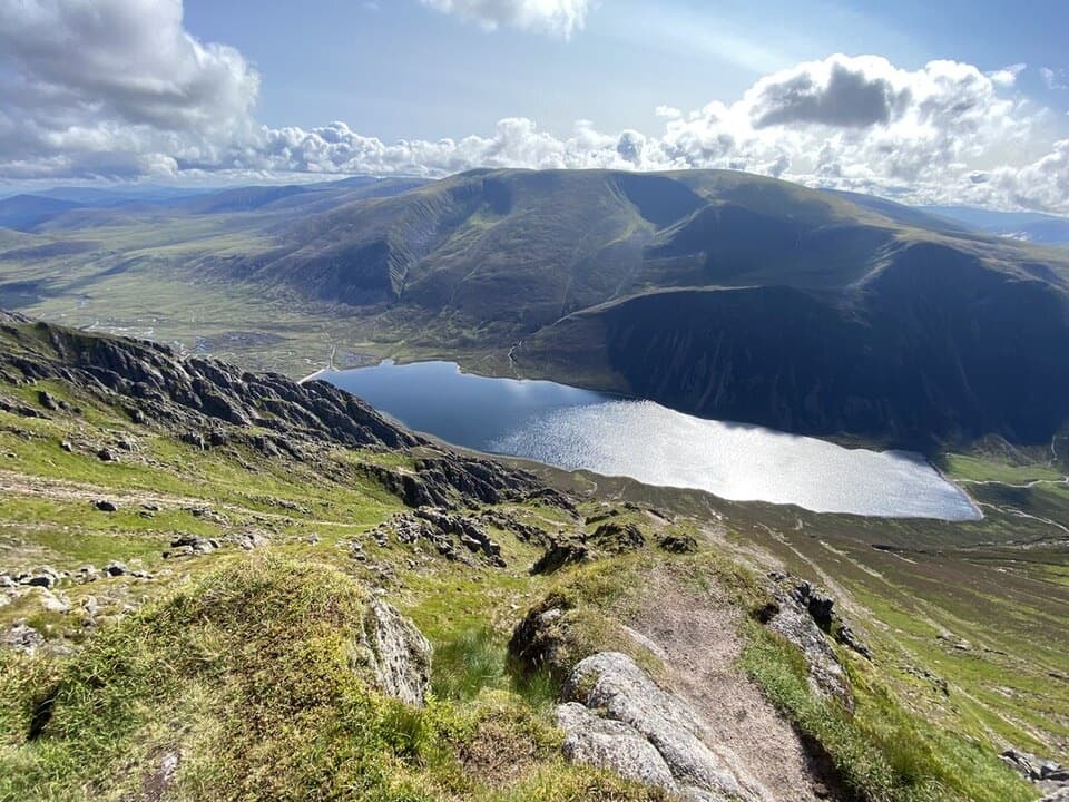
At the cragThe reward is the view from the wooded edge of the crag: the Uath lochans sit among the trees,…

The reward is the view from the wooded edge of the crag: the Uath lochans sit among the trees, with the Spey valley and Glen Feshie hills beyond. A small cairn marks the crag-top area, and a bench provides a place to pause. For a photograph, frame a lochan through the pines or include a strip of crag in the foreground so the view still feels part of the walk. Keep an eye out for red squirrels in the forest.

Pick the walk that fitsThe separate Uath Lochans Trail is a gentler option: about 1½ miles (2.

The separate Uath Lochans Trail is a gentler option: about 1½ miles (2.4 km), one hour, mostly gentle gradients with a few moderately steep sections, and narrow gravel path with boardwalk. It stays close to the wetlands, where frogs and dragonflies are worth looking for. Farleitter Crag is the choice when you want the longer climb and hillside outlook; the two trail names describe different routes from the same starting area. Some route guides join Farleitter Crag with the separate lochans circuit for about 3.25 miles; that combined option is longer than the 2.5-mile standalone loop described here.

Getting to the startThe free Uath Lochans Forestry car park and picnic area are the trailhead.

The free Uath Lochans Forestry car park and picnic area are the trailhead. There is no public toilet there; the nearest public toilets are in Aviemore, Glenmore and Kingussie, and the nearest places to eat are in Kincraig. These are separate stops, so plan food and facilities before you set off. Overnight parking is not permitted at the car park.

Wildlife

Wildlife in Cairngorms

All Cairngorms wildlife maps

Sighting maps show where each species has been reported across Cairngorms. Wildlife moves, so no sighting is guaranteed.

Keep exploring

Near Farleitter Crag Trail

See it all on the map

Trails that start nearby

Places near the trailhead

Parkwolf’s Cairngorms ranking

Top-rated trails in Cairngorms

All 260 trails
  1. 1Loch an Eilein CircuitEasy · 5 km
  2. 2Lairig GhruChallenging · 30.6 km
  3. 3Ben Macdui and Cairn Gorm CircuitChallenging · 19.8 km
  4. 4Loch Morlich TrailModerate · 5.6 km
  5. 5Meall a’ Bhuachaille CircuitChallenging · 8 km
  6. 6Loch Muick CircuitModerate · 12.5 km

Take Parkwolf to Cairngorms.

The audio tour guide for the drive, plus offline maps, trails, and wildlife heatmaps for when the signal drops.

4.7 from 8,600+ ratings

Download Parkwolf on the App StoreGet Parkwolf on Google Play