North Trail in Canyonlands National Park

Canyonlands National Park, UT

North Trail

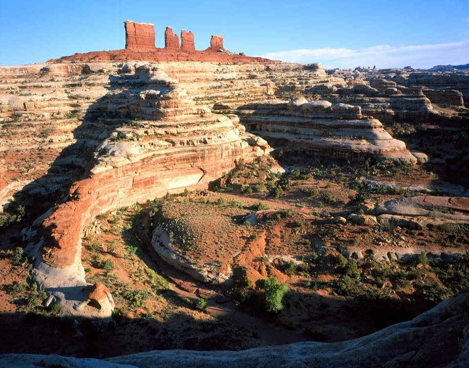
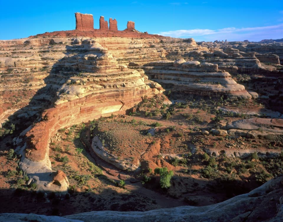
A primitive descent through North Trail Canyon into Elaterite Basin.

Length
6.2mi
Time
3.5hr
Elev. change
1,457ft
Difficulty
Moderate
  • No dogs
  • High point 6,516 ft
Parkwolf audio tour43 stories across Canyonlands’s roads

Overview

About North Trail

Why go

  • A rare V-shaped passage through the Wingate cliffs
  • Elaterite Butte, old ranching traces, and an oil-rig boiler in a quiet basin

Heads up

  • Remote point-to-point logistics; retracing the route is 12.4 miles
  • Primitive routefinding and no dependable drinking water

Map & elevation

The route

Loading the Canyonlands map
Full map
Elevation5,059–6,516 ft
TrailheadNorth Trailhead on North Point Road38.23889, -110.13489
Keep this map with you offline in the Parkwolf app

Plan your hike

Before you go

Parking

From Hans Flat Ranger Station, drive about 2.5 miles toward the Flint Trail to North Point Road, then another mile toward Panorama Point to the North Trailhead. The approach is remote and rough; two-wheel-drive visitors may leave a car at the junction and walk the final mile.

Safety

Expect a steep 150-foot switchback descent and a total 1,422-foot drop. The trail is primitive; cairns do not replace a topographic map, and the wash can be hard to identify. Do not depend on canyon seeps for water, and avoid the drainage when storms threaten because flash floods can arrive without warning. Overnight travel requires a backcountry permit; pets are prohibited on hiking trails.

2 active Canyonlands alerts

  • ClosureRain-damaged Needles backcountry roads impassableRecent rains have made several Needles backcountry roads impassable; do not drive these routes.Official details
  • CautionMaze access roads require high-clearance 4WDOnly use high-clearance 4WD to reach Hans Flat or Horseshoe Canyon in The Maze; low-clearance vehicles are not recommended on these damaged, rutted, muddy routes.Official details
Canyonlands alerts
A park ranger sits on a dash-mounted phone, talking, as Parkwolf’s Tour Guide plays “Army Cutworm Moths: A Grizzly Bear Buffet” on Grand Loop Road below Dunraven Pass in Yellowstone
Parkwolf Tour GuideThe highest, rockiest slopes around here are a summer buffet for grizzly bears.

Canyonlands Tour Guide

Your drive to North Trail, narrated.

Parkwolf is a GPS audio tour guide for Canyonlands National Park. As you drive, it chimes in with what’s ahead: hidden gems, upcoming stops, history, geology, and wildlife, right through your car’s speakers.

See the Canyonlands audio tour
  • 43 audio storiesacross Canyonlands’s roads, triggered by GPS as you drive
  • Wildlife heatmapsfor Bighorn Sheep, Mule Deer, Coyote, and 13 more
  • Works offlinemaps, 63 trails, 65 places, and audio download before you lose signal
  • CarPlay readysimple controls built for the drive
★★★★★
“Fantastic app with many points of information… It’s great to just turn on while you’re driving and it gives you an audio tour of the national Park. We love it!!!!”
JMJamesApp Store review
Download Parkwolf on the App StoreGet Parkwolf on Google Play

4.7 from 8,600+ ratings

Trail guide

Hiking North Trail

What this route isNorth Trail is a 6.

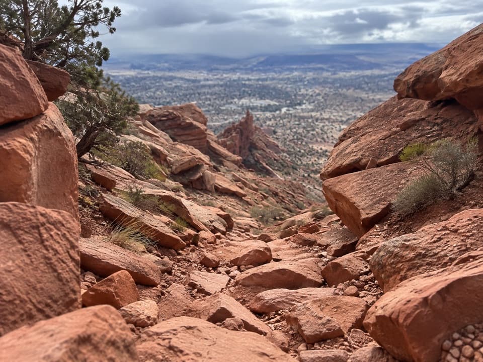
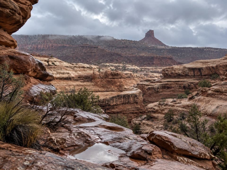
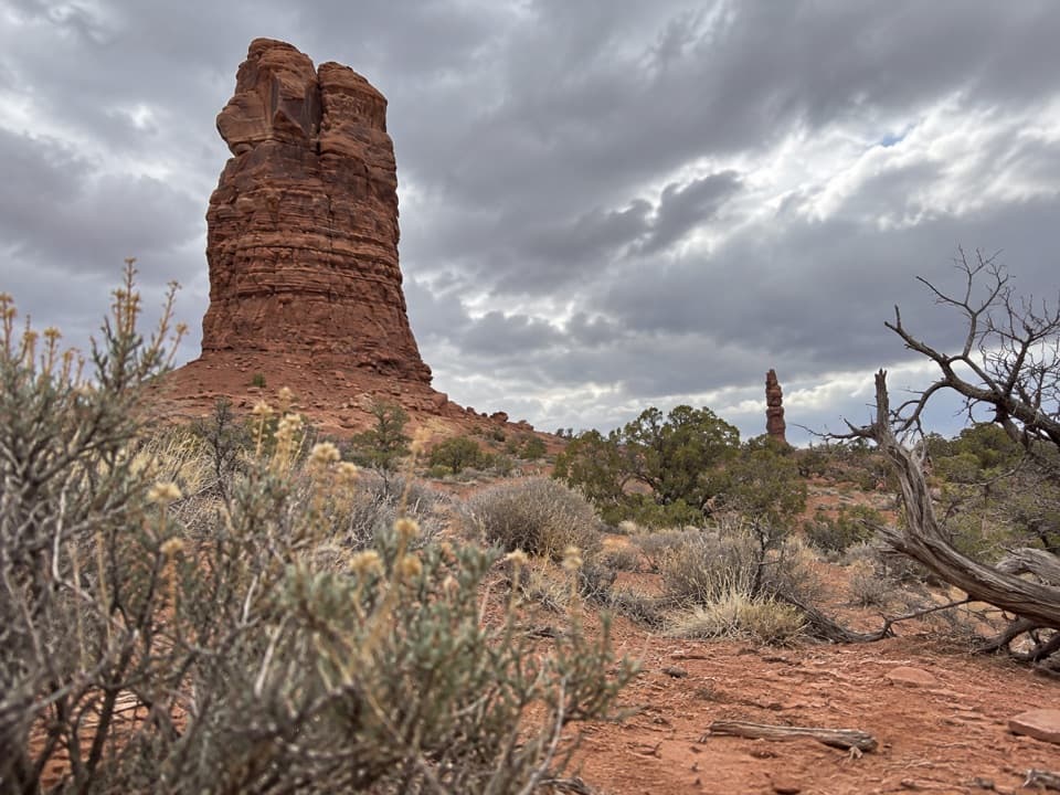
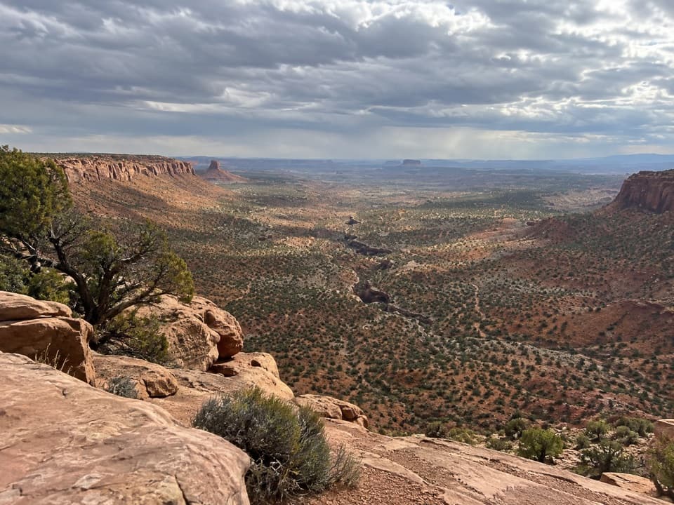
North Trail is a 6.2-mile one-way descent from the North Trailhead on North Point Road to Millard Canyon Road, losing about 1,422 feet in roughly 3½ hours. It drops through North Trail Canyon into Elaterite Basin, with Elaterite Butte ahead through much of the lower walk. This is point to point: stage a vehicle at both ends or plan it as a leg of a backcountry trip; walking back to North Point makes it 12.4 miles.

Through the Wingate slotThe route starts gently through trees, then bends back along a bench to the canyon head.

The route starts gently through trees, then bends back along a bench to the canyon head. Short, steep switchbacks descend about 150 feet into a narrow, V-shaped passage through Wingate sandstone. The orange walls slope toward a tight corridor at the bottom, an unusual break through cliffs that usually stop other canyons above the White Rim.

Follow the canyon into the basinBelow the slot, the tread becomes less rocky and follows a sandy wash through Chinle shale and…

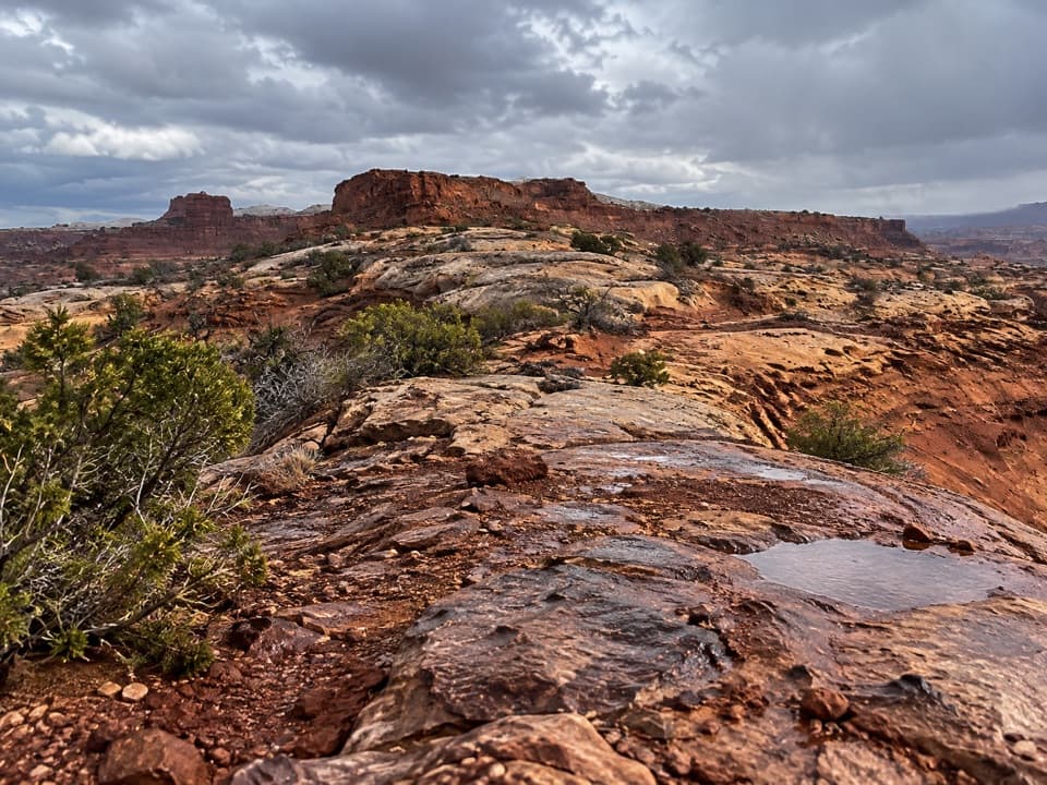
Below the slot, the tread becomes less rocky and follows a sandy wash through Chinle shale and mudstone. Look up for blind arches in the cliffs and toward Elaterite Butte across the basin. The canyon gradually opens into a shallow wash and broad grassy flat. Small potholes and seeps may hold water, but they are unreliable, and the seeps can leave a white alkaline crust; carry what you need rather than counting on them.

Sheep country and a failed oil searchA sheep rancher named John Boline used Elaterite Basin as winter pasture in the 1890s.

A sheep rancher named John Boline used Elaterite Basin as winter pasture in the 1890s. Local lore says he rolled rocks onto the trail each spring to keep other sheepmen from finding it. Near the road, an old steam boiler remains from the Nequoia Oil Company drilling rig brought here in 1920; it spent a year searching for oil without success.

Access and self-relianceThe trailhead is off North Point Road, a remote dirt-road approach.

The trailhead is off North Point Road, a remote dirt-road approach. A two-wheel-drive vehicle can be left at the road junction and the last mile walked to the trailhead. The trail is primitive but marked by cairns; routes through washes can be hard to distinguish, so carry a topographic map and know how to use it. There are no food, gas, or potable-water services in The Maze, and flash floods can arrive without warning. Overnight trips require a backcountry permit, and pets are not allowed on hiking trails. The lower route enters the Orange Cliffs Unit of Glen Canyon National Recreation Area, which shares the Maze backcountry plan and permit system.

Wildlife

Wildlife in Canyonlands

All Canyonlands wildlife maps

Sighting maps show where each species has been reported across Canyonlands. Wildlife moves, so no sighting is guaranteed.

Keep exploring

Near North Trail

See it all on the map

Trails that start nearby

Places near the trailhead

Parkwolf’s Canyonlands ranking

Top-rated trails in Canyonlands

All 63 trails
  1. 1Mesa Arch TrailEasy · 0.6 mi
  2. 2Chesler Park Loop and Joint TrailChallenging · 10.7 mi
  3. 3Druid Arch TrailChallenging · 10.8 mi
  4. 4Grand View Point TrailEasy · 1.8 mi
  5. 5Horseshoe Canyon Trail to the Great GalleryChallenging · 7 mi
  6. 6White Rim Overlook TrailEasy · 1.8 mi

Take Parkwolf to Canyonlands.

The audio tour guide for the drive, plus offline maps, trails, and wildlife heatmaps for when the signal drops.

4.7 from 8,600+ ratings

Download Parkwolf on the App StoreGet Parkwolf on Google Play