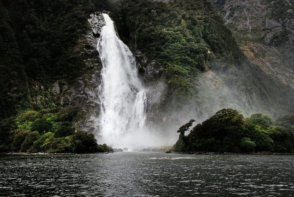
Earland Falls in Fiordland National Park

Sight · Fiordland National Park

Earland Falls

174 m Routeburn waterfall that drenches the track after rain

Type
Sight
Nearest trail
4 km
Audio stories
1 nearby
  • Scenic viewpoint
  • #21 of 91 sights

Hear the audio tour

Whio on the Whitewater: Blue Ducks of the Hollyford

Overview

About Earland Falls

Earland Falls is a head-turning, high-volume cascade on the Routeburn Track. Fed by Lake Roberts, it plunges down a sheer, glaciated wall and often throws spray straight across the track—intimate, wild, and very Fiordland.

Why stop

  • Towering waterfall (~174 m) right beside the Routeburn Track
  • Reachable as a 2.5–3 hr return walk from The Divide

Heads up

  • Main track can be impassable after heavy rain; detour may be required
  • Busy during Great Walks season; parking pressure at The Divide
  • You can’t see the very top due to the concave drop

Map

Where it is

Loading the Fiordland map
Full map
SightEarland Falls-44.80321, 168.15765
Keep this map with you offline in the Parkwolf app

Local know-how

Tips for visiting Earland Falls

  1. Start early to secure parking at The Divide trailhead.

  2. Check DOC track alerts and the forecast—high flows can close the main route.

  3. Pack a reliable rain jacket; the spray at the falls can soak you.

  4. Add Key Summit if the weather’s clear for a bigger payoff.

  5. After heavy rain, use the signed detour below the falls and expect slick footing.

Plan your stop

Before you go

Best time to visit

  • For drama, go after rainfall—be ready for spray and potential detours.
  • For fewer people and easier parking, arrive early, especially during the Great Walks season (roughly October–April).
  • Photographers: the falls are close-range; bring a lens cloth for spray and expect moody, misty light after rain.

Getting There

Most day walkers start from The Divide on SH94 and follow the Routeburn Track to the falls—plan roughly 7.5 km total and about 2.5–3 hours for the out-and-back. The track is part of a Great Walk: well formed, well marked, and popular.

A park ranger sits on a dash-mounted phone, talking, as Parkwolf’s Tour Guide plays “Army Cutworm Moths: A Grizzly Bear Buffet” on Grand Loop Road below Dunraven Pass in Yellowstone
Parkwolf Tour GuideThe highest, rockiest slopes around here are a summer buffet for grizzly bears.

Fiordland Tour Guide

Your drive to Earland Falls, narrated.

Parkwolf is a GPS audio tour guide for Fiordland National Park. As you drive, it chimes in with what’s ahead: hidden gems, upcoming stops, history, geology, and wildlife, right through your car’s speakers.

See the Fiordland audio tour

Recorded for this area

Whio on the Whitewater: Blue Ducks of the Hollyford
Listen
“As you travel beside the Hollyford River, you're in the territory of one of New Zealand's rarest birds, the whio, or blue duck.”

Plays on the road 3 km from Earland Falls in the Parkwolf Fiordland Tour Guide.

More stories near here in the app

  • Tuna of the Hollyford: Fiordland’s Long‑Lived River Travelers
  • The Great Watershed
  • The Divide: Gateway to the Routeburn and Key Summit
  • Pop's View Lookout and the Hollyford Valley
  • 126 audio storiesacross Fiordland’s roads, triggered by GPS as you drive
  • Wildlife heatmapsfor Kea, Fiordland Penguin, Blue Duck, and 13 more
  • Works offlinemaps, 68 trails, 124 places, and audio download before you lose signal
  • CarPlay readysimple controls built for the drive
★★★★★
“Fantastic app with many points of information… It’s great to just turn on while you’re driving and it gives you an audio tour of the national Park. We love it!!!!”
JMJamesApp Store review
Download Parkwolf on the App StoreGet Parkwolf on Google Play

4.7 from 8,600+ ratings

Guide

More about Earland Falls

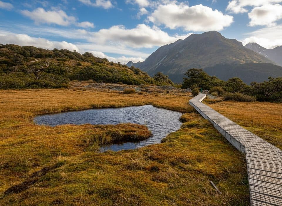
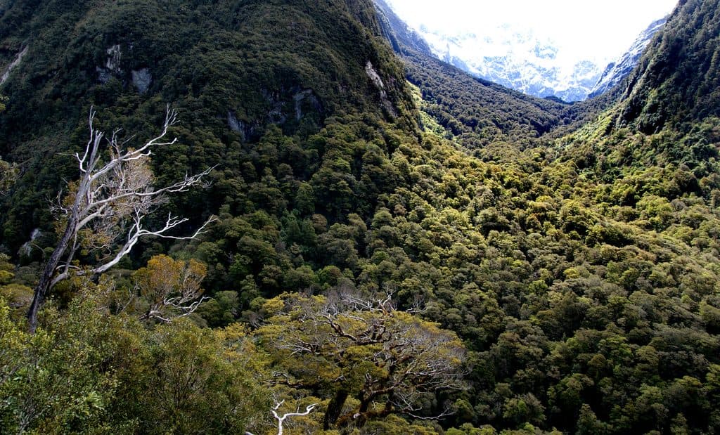
What You’ll SeeExpect lush, mossy beech forest, ferns, and frequent glimpses of big mountain country.

Expect lush, mossy beech forest, ferns, and frequent glimpses of big mountain country. At the falls, you’ll feel the spray at the base; because the drop is concave, the true top stays hidden from the track viewpoint. On clear days, sections of the approach offer expansive views, and many hikers add nearby Key Summit for an even bigger panorama.

Conditions and SafetyFlow varies dramatically.

Flow varies dramatically. After rain, Earland roars and can flood the main route—use the signed detour track when water is high. Surfaces get slick, and conditions change fast in Fiordland. Check Department of Conservation track alerts and weather before you go and carry proper rain gear.

WildlifeKeep an eye and ear out in the forest for native birds like fantails, robins, tomtits, and…

Keep an eye and ear out in the forest for native birds like fantails, robins, tomtits, and bellbirds—this section of bush is lively, especially on calmer, drier days.

AmenitiesThere are no facilities at the falls themselves.

There are no facilities at the falls themselves. The Divide trailhead has a shelter, toilets, and tables, but once you’re on the track it’s just you, the forest, and a lot of water.

Make a Day of ItIf conditions and time allow, pair Earland Falls with the Key Summit side trip—together they…

If conditions and time allow, pair Earland Falls with the Key Summit side trip—together they make one of the standout day hikes off Milford Road.

Wildlife

Wildlife in Fiordland

All Fiordland wildlife maps

Sighting maps show where each species has been reported across Fiordland. Wildlife moves, so no sighting is guaranteed.

Keep exploring

Near Earland Falls

See it all on the map

Trails nearby

More stops nearby

Parkwolf’s Fiordland ranking

Top sights in Fiordland

All 124 places
  1. 1Milford Sound / PiopiotahiSight
  2. 2Mitre PeakSight
  3. 3Mitre Peak ViewpointSight
  4. 4Doubtful Sound / PateaSight
  5. 5Waimānu / Stirling FallsSight
  6. 6Bowen FallsSight

Take Parkwolf to Fiordland.

The audio tour guide for the drive, plus offline maps, trails, and wildlife heatmaps for when the signal drops.

4.7 from 8,600+ ratings

Download Parkwolf on the App StoreGet Parkwolf on Google Play