Waldron Trail via Hermit Trail in Grand Canyon National Park

Grand Canyon National Park, AZ

Waldron Trail via Hermit Trail

A steep descent, a quiet canyon crossing, then a switchback climb out.

Photo: CC BY 2.0
Length
6.1mi
Time
5hr
Elev. change
1,293ft
Difficulty
Challenging
  • No dogs
  • High point 6,637 ft

Hear the audio tour

Hermits Rest’s Cabin and Fireplace

Overview

About Waldron Trail via Hermit Trail

Why go

  • The Waldron branch adds a quiet, steep climb across a distinct side canyon.

Heads up

  • Rocky switchbacks and the long return climb make this a demanding half-day.

Map & elevation

The route

Loading the Grand Canyon map
Full map
Elevation5,344–6,637 ft
TrailheadHermit Trailhead near Hermits Rest36.06054, -112.21236
Keep this map with you offline in the Parkwolf app

Plan your hike

Before you go

Parking

Start at the Hermit Trailhead just west of Hermits Rest. From March 1 through November 30, day hikers must take the free Hermit Route shuttle; parking is not available at the trailhead. Hermit Road is open to all traffic from December through February, when the shuttle does not run. Walk about a quarter mile down the dirt access road from Hermits Rest to the trailhead; restrooms are at Hermits Rest.

Safety

For experienced desert hikers: expect a steep, rocky descent and a hard climb back, with less-distinct tread on the Waldron branch. There is no dependable water along that branch; carry all water and treat natural sources. Summer heat and winter ice can make the upper Hermit switchbacks hazardous. Pets are prohibited below the rim.

4 active Grand Canyon alerts

  • CautionFlash-flood hazard near Phantom RanchMentions Phantom Ranch, referenced in this guideRiver trips passing Phantom Ranch may encounter flash flooding with little or no warning, even when storms are not visible overhead. Check today’s hiking messages and hazards before traveling.Official details
  • ClosureInner Canyon and North Rim trail closuresDo not enter the closed trails, bridges, campgrounds, and inner-canyon areas.Official details
See all 4 alerts
A park ranger sits on a dash-mounted phone, talking, as Parkwolf’s Tour Guide plays “Army Cutworm Moths: A Grizzly Bear Buffet” on Grand Loop Road below Dunraven Pass in Yellowstone
Parkwolf Tour GuideThe highest, rockiest slopes around here are a summer buffet for grizzly bears.

Grand Canyon Tour Guide

Your drive to Waldron Trail via Hermit Trail, narrated.

Parkwolf is a GPS audio tour guide for Grand Canyon National Park. As you drive, it chimes in with what’s ahead: hidden gems, upcoming stops, history, geology, and wildlife, right through your car’s speakers.

See the Grand Canyon audio tour

Recorded for this trailhead

Hermits Rest’s Cabin and Fireplace
0:00 / 0:33
“Up ahead is Hermits Rest at the end of Hermit Road.”

Plays as you drive up to this trailhead in the Parkwolf Grand Canyon Tour Guide.

More stories near here in the app

  • Pima Point and the Cataract Plains
  • Monument Creek Vista and the Greenway
  • The Abyss’s Sheer Drop
  • Mohave Point’s Rapids and Rock Formations
  • 79 audio storiesacross Grand Canyon’s roads, triggered by GPS as you drive
  • Wildlife heatmapsfor California Condor, Bighorn Sheep, American Bison, and 13 more
  • Works offlinemaps, 73 trails, 96 places, and audio download before you lose signal
  • CarPlay readysimple controls built for the drive
★★★★★
“Fantastic app with many points of information… It’s great to just turn on while you’re driving and it gives you an audio tour of the national Park. We love it!!!!”
JMJamesApp Store review
Download Parkwolf on the App StoreGet Parkwolf on Google Play

4.7 from 8,600+ ratings

Trail guide

Hiking Waldron Trail via Hermit Trail

The full Waldron outingWaldron Trail via Hermit Trail is a 6.

Waldron Trail via Hermit Trail is a 6.1-mile out-and-back from Hermit Trailhead near Hermits Rest. Follow Hermit Trail down to Waldron Basin and its junction, turn onto the Waldron branch, then climb switchbacks up the opposite side before retracing the same line. Plan on about five hours. This is a hard canyon hike for experienced desert hikers; the 3-mile round trip to Waldron Basin is a shorter way to experience the descent.

Take the left branchFrom Hermits Rest, Hermit Trail drops steeply through switchbacks in Kaibab limestone and…

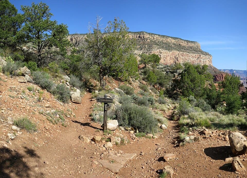
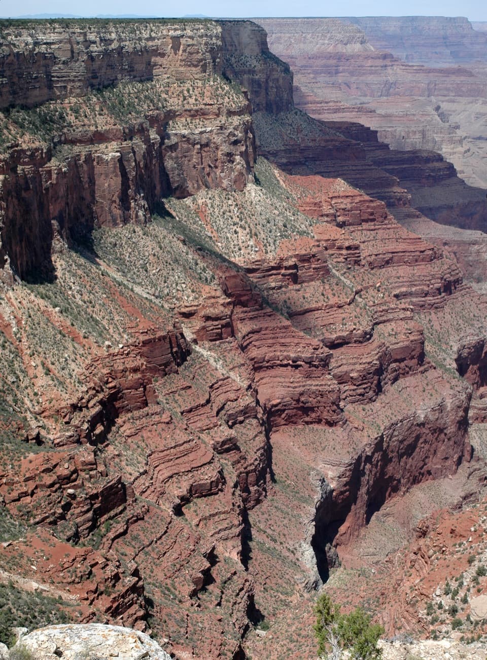
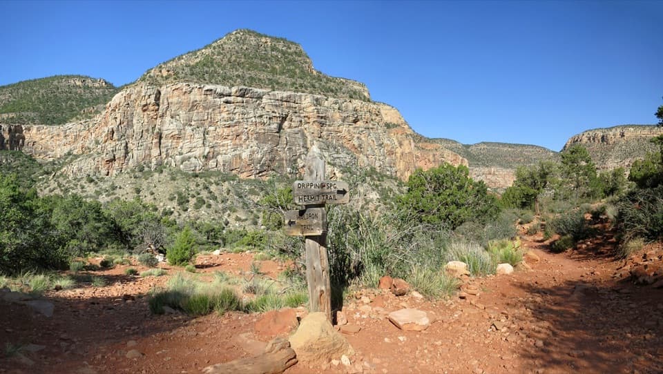
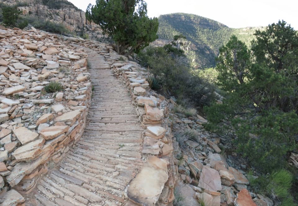
From Hermits Rest, Hermit Trail drops steeply through switchbacks in Kaibab limestone and Coconino Sandstone. At the Waldron junction, take the left-hand branch; hikers continuing down Hermit Trail stay right. The Waldron route briefly eases, then climbs the other side on steep, rocky switchbacks. The tread is less traveled and can be hard to follow, so load an offline map and pay attention at the fork.

The climb is the commitmentThe first descent is only half the work.

The first descent is only half the work. The Waldron branch climbs out of the drainage, and the return adds the long climb back to Hermits Rest. There is no dependable water along the Waldron branch, so carry everything you need and treat any natural water. Summer shade can still exceed 100°F; avoid the hottest part of the day. Winter ice can hide on the upper switchbacks.

A route built for the Hermit CampThe Hermit Trail was built in 1911 for the Santa Fe Railroad's Hermit Camp, a luxury camp below…

The Hermit Trail was built in 1911 for the Santa Fe Railroad's Hermit Camp, a luxury camp below the rim that opened a decade before Phantom Ranch and closed in 1930. The old route still carries you past fragments of its hand-fitted stone paving.

Start at Hermits RestThe Hermit Trailhead is just west of Hermits Rest, reached by a short walk down the dirt access…

The Hermit Trailhead is just west of Hermits Rest, reached by a short walk down the dirt access road. From March 1 through November 30, Hermit Road is shuttle-only for day visitors; take the free Hermit Route bus because there is no day-hiker parking at the trailhead. From December through February, vehicles can use the road and the shuttle does not run. Restrooms are at Hermits Rest. Pets are not allowed below the rim.
Wildlife

Wildlife in Grand Canyon

All Grand Canyon wildlife maps

Sighting maps show where each species has been reported across Grand Canyon. Wildlife moves, so no sighting is guaranteed.

Keep exploring

Near Waldron Trail via Hermit Trail

See it all on the map

Trails that start nearby

Places near the trailhead

Parkwolf’s Grand Canyon ranking

Top-rated trails in Grand Canyon

All 73 trails
  1. 1Rim-to-Rim: North Kaibab to Bright AngelChallenging · 23.5 mi
  2. 2South Kaibab TrailChallenging · 6.3 mi
  3. 3Bright Angel TrailChallenging · 7.8 mi
  4. 4Rim TrailModerate · 12.8 mi
  5. 5Rim-to-Rim: South Kaibab to North KaibabChallenging · 21 mi
  6. 6Cape Royal TrailEasy · 0.8 mi

Take Parkwolf to Grand Canyon.

The audio tour guide for the drive, plus offline maps, trails, and wildlife heatmaps for when the signal drops.

4.7 from 8,600+ ratings

Download Parkwolf on the App StoreGet Parkwolf on Google Play