Inspiration Peak Trail in Joshua Tree National Park

Joshua Tree National Park, CA

Inspiration Peak Trail

A rocky summit adds the view Keys View can't give.

Length
1.8mi
Time
1.5hr
Elev. change
381ft
Difficulty
Moderate
  • No dogs
  • High point 5,554 ft
  • #24 of 60 in Joshua Tree

Hear the audio tour

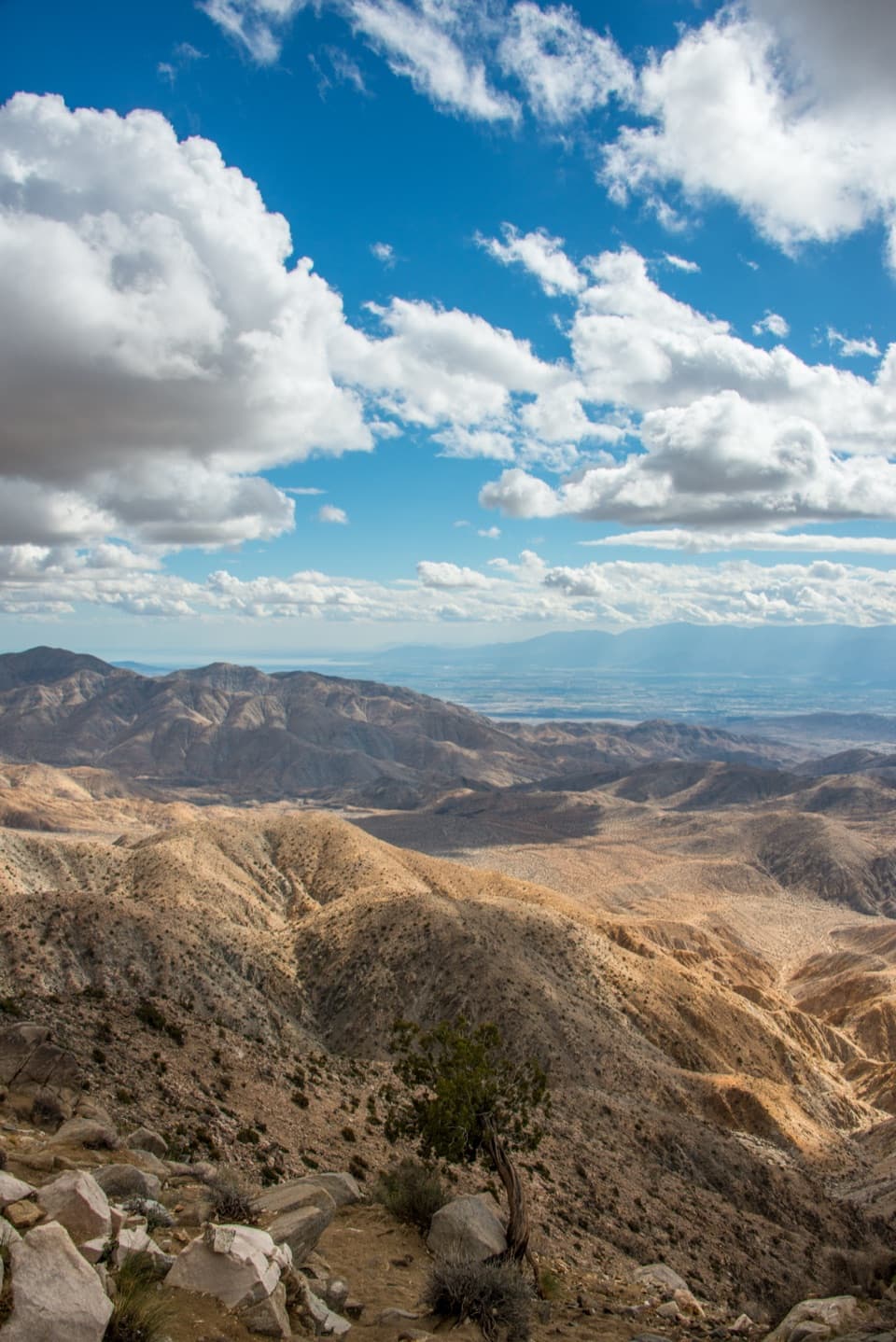
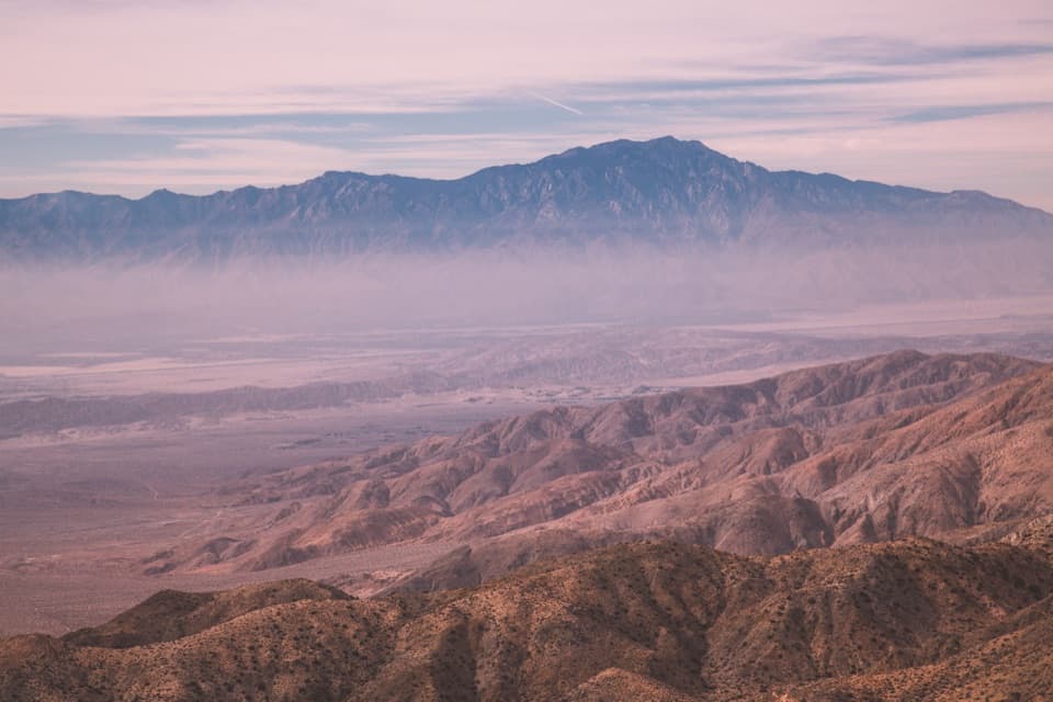
Keys View Over the Coachella Valley

Overview

About Inspiration Peak Trail

Why go

  • The summit sees north across the park, beyond Keys View’s south-facing overlook.
  • Short mileage still brings a real ridge climb and rocky summit ledge.

Heads up

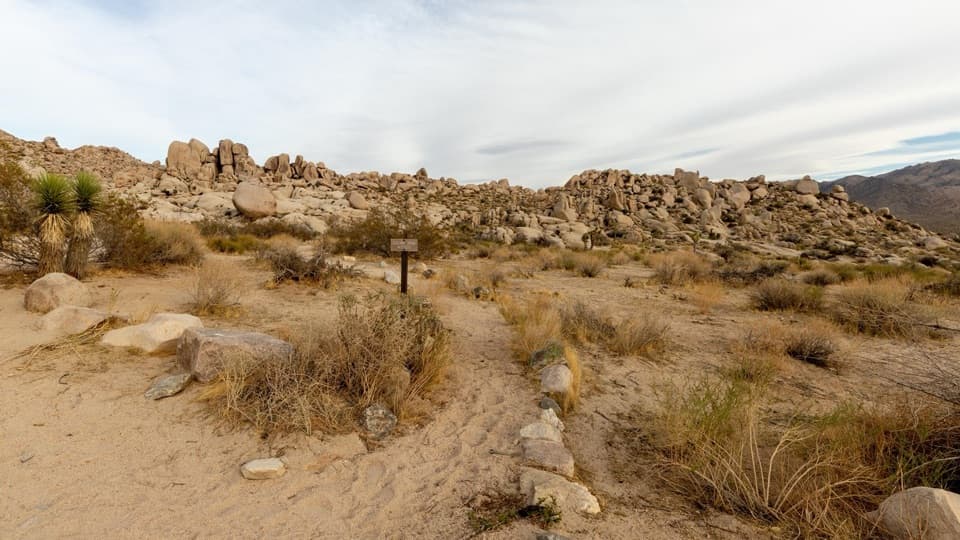
  • Unmarked, unmaintained tread gets faint after the first rise.

Map & elevation

The route

Loading the Joshua Tree map
Full map
Elevation5,174–5,554 ft
TrailheadUpper Keys View Parking Lot33.92720, -116.18745
Keep this map with you offline in the Parkwolf app

Plan your hike

Before you go

Parking

Use the Upper Keys View parking lot at the end of Keys View Road. The unmarked route starts on the west side of the lot; the paved quarter-mile Keys View loop is a separate walk. The upper lot has 38 standard spaces and a vault toilet, but no running water.

Safety

This unsigned, unmaintained route has loose rock and faint tread after the first ridge, plus a short descent and climb at the saddle. The park warns that crowd-created routes can require advanced route-finding and scrambling. The rocky summit has a steep south face; stay back from the edge. Avoid hiking in summer heat; park guidance advises against 10 a.m. to 5 p.m. hikes in summer. Pets are not allowed on park trails.

5 active Joshua Tree alerts

  • ClosureOasis of Mara Trail closed past the OasisThe Oasis of Mara Trail is closed past the Oasis due to a heavy flooding event; do not continue beyond the Oasis. Check current park conditions before visiting.Official details
  • ClosureSR 62 and US 95 closed by floodingFlooding has closed portions of SR 62 and US 95; avoid the closed segments.Official details
See all 5 alerts
A park ranger sits on a dash-mounted phone, talking, as Parkwolf’s Tour Guide plays “Army Cutworm Moths: A Grizzly Bear Buffet” on Grand Loop Road below Dunraven Pass in Yellowstone
Parkwolf Tour GuideThe highest, rockiest slopes around here are a summer buffet for grizzly bears.

Joshua Tree Tour Guide

Your drive to Inspiration Peak Trail, narrated.

Parkwolf is a GPS audio tour guide for Joshua Tree National Park. As you drive, it chimes in with what’s ahead: hidden gems, upcoming stops, history, geology, and wildlife, right through your car’s speakers.

See the Joshua Tree audio tour

Recorded for this trailhead

Keys View Over the Coachella Valley
0:00 / 0:31
“Up ahead is Keys View, a drive-up overlook where the ridge drops nearly a mile into the Coachella Valley. I'd keep this stop for the sheer scale of the view.”

Plays as you drive up to this trailhead in the Parkwolf Joshua Tree Tour Guide.

More stories near here in the app

  • The Underground Dam Behind an Oasis
  • A Packrat's Time Capsule
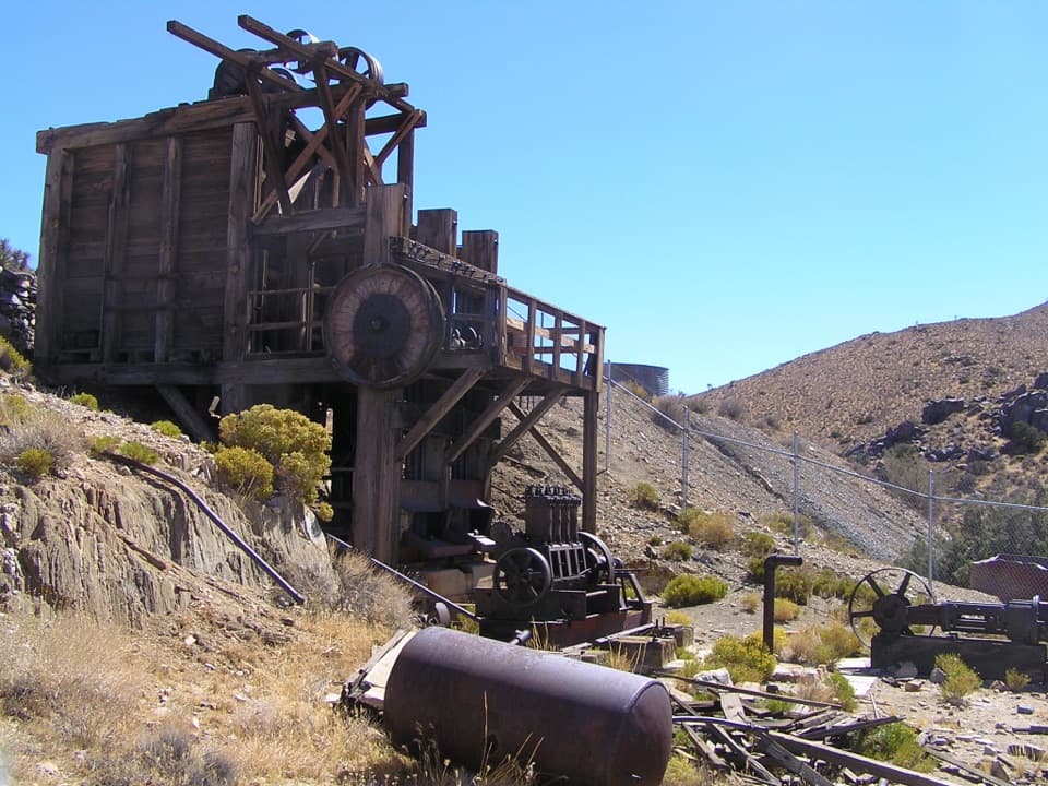
  • Lost Horse Mine and Its Stamp Mill
  • Crystals in the Granite
  • 89 audio storiesacross Joshua Tree’s roads, triggered by GPS as you drive
  • Wildlife heatmapsfor Bighorn Sheep, Golden Eagle, Desert Tortoise, and 13 more
  • Works offlinemaps, 60 trails, 64 places, and audio download before you lose signal
  • CarPlay readysimple controls built for the drive
★★★★★
“Fantastic app with many points of information… It’s great to just turn on while you’re driving and it gives you an audio tour of the national Park. We love it!!!!”
JMJamesApp Store review
Download Parkwolf on the App StoreGet Parkwolf on Google Play

4.7 from 8,600+ ratings

Trail guide

Hiking Inspiration Peak Trail

A rough summit walkInspiration Peak Trail is an unmarked, 1.

Inspiration Peak Trail is an unmarked, 1.8-mile out-and-back from the Upper Keys View parking lot to a rocky summit ledge. It adds a steep climb to the paved overlook, with views that reach north across the park as well as south over the Coachella Valley. Give it about 1 to 1.5 hours with a stop at the top; it suits hikers comfortable choosing their way across rough, unsigned ground.

Up to the ridge, down to a saddleThe route leaves the west side of the lot and climbs over loose rock.

The route leaves the west side of the lot and climbs over loose rock. A few switchbacks ease the first 0.3 mile, which rises about 400 feet to the first ridge. Don't mistake that crest for the summit: the path drops roughly 100 feet into a saddle, then climbs steeply to the higher ledge. Tread gets faint beyond the first rise, so keep track of the route before turning back.

The view above Keys ViewFrom the ledge, look north for Ryan Mountain, Queen Mountain and the Wonderland of Rocks.

From the ledge, look north for Ryan Mountain, Queen Mountain and the Wonderland of Rocks. South and southwest, the Salton Sea and San Jacinto sit beyond the desert; San Gorgonio rises to the west. Turn back toward the lot and the cars below look small. For a photo, include part of the rocky ledge and the overlook far below; it shows the climb better than a tight shot of the distant mountains. If you want a short, steep walk after the overlook, this adds a genuinely different view.

Know what you're getting intoThis route isn't on the park's designated hiking list and has no maintained trail signs.

This route isn't on the park's designated hiking list and has no maintained trail signs. The National Park Service warns that crowd-created routes can demand scrambling and advanced route-finding; here, the faint tread and loose rock are the main challenge. In summer, park guidance is to avoid hiking from 10 a.m. to 5 p.m.; this rocky slope is exposed. The summit's south face falls away steeply, so stay well back from the edge. Pets aren't allowed on park trails. The Upper Keys View lot has a vault toilet but no running water; its separate paved quarter-mile viewpoint loop is an easier option.

Wildlife

Wildlife in Joshua Tree

All Joshua Tree wildlife maps

Sighting maps show where each species has been reported across Joshua Tree. Wildlife moves, so no sighting is guaranteed.

Keep exploring

Near Inspiration Peak Trail

See it all on the map

Trails that start nearby

Places near the trailhead

Parkwolf’s Joshua Tree ranking

Top-rated trails in Joshua Tree

All 60 trails
  1. 1Hidden Valley Nature TrailEasy · 1 mi
  2. 2Barker Dam Nature TrailEasy · 1.3 mi
  3. 3Ryan Mountain TrailChallenging · 3 mi
  4. 4Fortynine Palms Oasis TrailChallenging · 3 mi
  5. 5Lost Palms Oasis TrailChallenging · 7.5 mi
  6. 6Arch Rock TrailEasy · 1.3 mi

Take Parkwolf to Joshua Tree.

The audio tour guide for the drive, plus offline maps, trails, and wildlife heatmaps for when the signal drops.

4.7 from 8,600+ ratings

Download Parkwolf on the App StoreGet Parkwolf on Google Play