Parking
Use designated hiker parking around Black Rock Nature Center or Black Rock Backcountry Trailhead near campsite 30. Parking can fill on busy days; do not park in a campsite unless you reserved it.
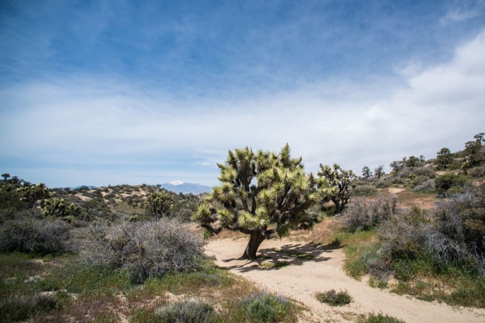
Joshua Tree National Park, CA
Climb from a sandy wash to an open ridge and far horizons.
Overview
Map & elevation
Plan your hike

The highest, rockiest slopes around here are a summer buffet for grizzly bears.
Joshua Tree Tour Guide
Parkwolf is a GPS audio tour guide for Joshua Tree National Park. As you drive, it chimes in with what’s ahead: hidden gems, upcoming stops, history, geology, and wildlife, right through your car’s speakers.
See the Joshua Tree audio tourRecorded for this trailhead
Black Rock Canyon and Its Jellystone Past“You're approaching Black Rock Canyon, a separate corner of the park with dense Joshua trees and its own trail network.”
Plays as you drive up to this trailhead in the Parkwolf Joshua Tree Tour Guide.
More stories near here in the app
“Fantastic app with many points of information… It’s great to just turn on while you’re driving and it gives you an audio tour of the national Park. We love it!!!!”


Trail guide
Panorama Loop is a 6.6-mile lollipop loop from the Black Rock area: follow a sandy wash to the Little San Bernardino ridgeline, circle the ridge, then retrace the shared access trail. You get a long stretch of desert ridge, Joshua tree forest and pinyon-juniper woodland, with mountain views as the payoff. This is a strenuous half-day hike, not a quick viewpoint walk: allow three to five hours and expect more than 1,100 feet of climbing. Pick it when you want a real workout along with the scenery.
Start south and uphill from Black Rock Nature Center. At the far end of the campground, follow the Panorama Loop marker into the wash. The trail network here crisscrosses and joins other routes, so carry a map that shows the full circuit and check it before each junction. Route advice differs on which direction makes the steep sections easier; either way, be ready for a hard climb and a rocky descent. The 6.6 miles include the access from the Black Rock area and the return, not the optional Warren Peak spur.
Use designated hiker parking around Black Rock Nature Center or Black Rock Backcountry Trailhead near campsite 30. Parking can fill on busy days; don't park in a campsite unless you reserved it. There is no separate activity fee or hike reservation, though park entrance fees may apply.
The start follows a sandy wash through desert woodland, with loose, deep sand that makes the first miles feel slower than the distance suggests. The trail then climbs out of the canyon on steep switchbacks. Underfoot, expect a mix of sand, hard-packed dirt and uneven rock; narrow sections leave little room to pass. The grade eases as you gain the ridge, but the climb is the hike's main physical commitment.
On the ridgeline, the route opens to broad views south toward the Santa Rosa and San Jacinto ranges and west toward the San Bernardinos. The changing vegetation is part of the walk: dense Joshua trees give way to pinyon-juniper woodland, while the canyon's striated rock and low Mojave mound cactus reward a slower look. For a useful photo, include the path or a foreground Joshua tree so the picture holds both the trail and the scale of the ridges.
There is little shade, cell service is unreliable and there is no running water on the route. The park warns against this strenuous hike in summer or whenever it is hot; winter, spring and fall are the better seasons. Carry all the water you need and keep an offline map handy. Pets are not allowed on park trails; leashed service animals are permitted.
A separate spur reaches Warren Peak from the loop. It adds climbing and distance, so leave it out if you are following the 6.6-mile itinerary. If that is more than you want, Black Rock's 4-mile Short Loop is a shorter way to explore the same rugged landscape.
Wildlife
 129 sightingsBighorn SheepMost seen around 6 PMSighting map
 15 sightingsGolden EagleMost seen around 10 AMSighting map
 413 sightingsDesert TortoiseMost seen around 8 AMSighting map
 275 sightingsCoyoteMost seen around 6 AMSighting map
 47 sightingsBobcatMost seen around 6 PMSighting map
 32 sightingsMule DeerMost seen around 6 AMSighting map
Sighting maps show where each species has been reported across Joshua Tree. Wildlife moves, so no sighting is guaranteed.
Keep exploring
 ChallengingWarren Peak Trail6.3 mi · 4 hr · At the trailheadLong desert miles lead to a steep summit and wide western views.
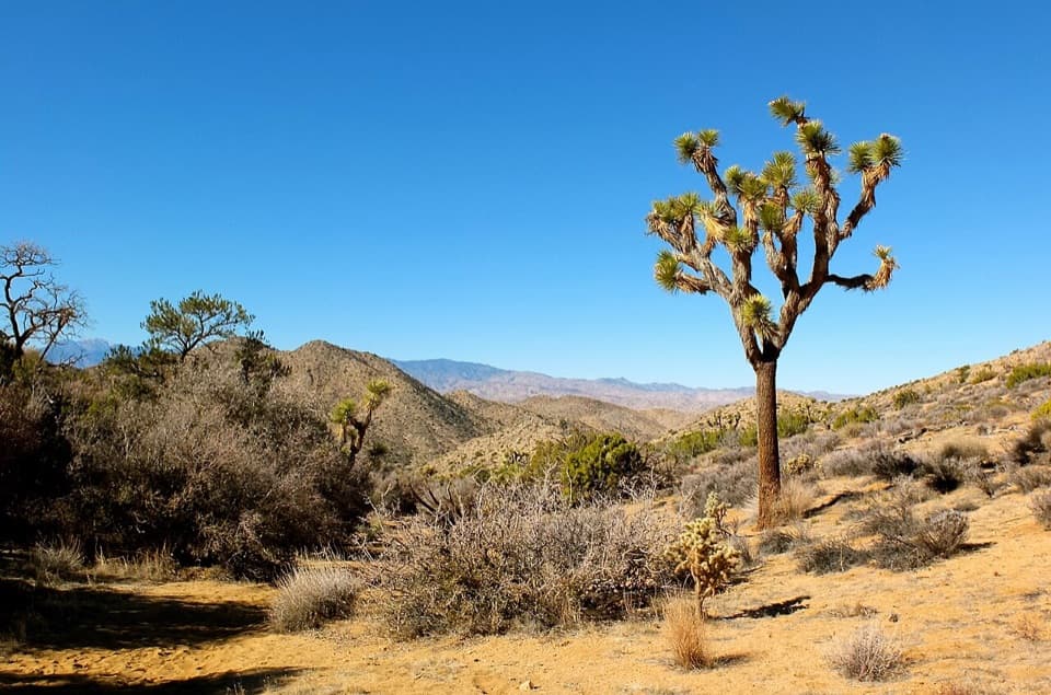 EasyBlack Rock Canyon Trail3.5 mi · 2 hr · At the trailheadA sandy wash climbs toward a spring and the Panorama junction.
 ChallengingBurnt Hill Trail7.3 mi · 4.5 hr · At the trailheadA varied Black Rock loop through a wash, canyon and open valley.
 ChallengingCalifornia Riding and Hiking Trail36.6 mi · 18 hr · At the trailheadA 36.6-mile traverse from Black Rock Canyon to North Entrance.
 ChallengingEureka Peak Trail9.6 mi · 7 hr · At the trailheadA long sandy climb to a 360-degree summit view.
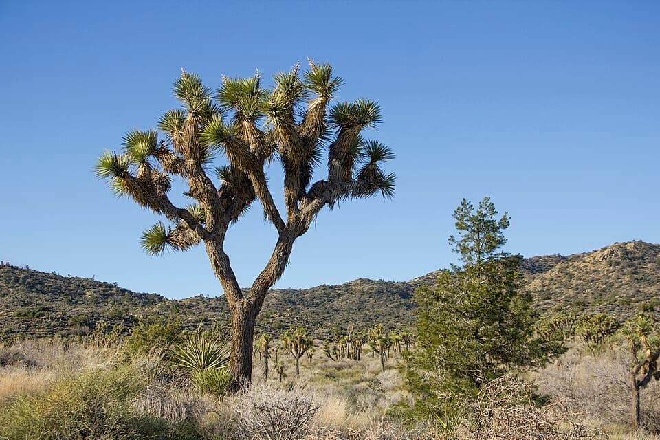 ModerateShort Loop Trail4 mi · 2.5 hr · At the trailheadA four-mile loop through washes, ravines and pinyon hills.
 ModerateHi-View Nature Trail1.3 mi · 1.5 hr · 0.7 mi awayShort loop, wide views, and more climb than the mileage suggests.
 ModerateBigfoot Trail7.9 mi · 6 hr · 3.7 mi awayA remote one-way traverse through open valleys and rocky canyons.
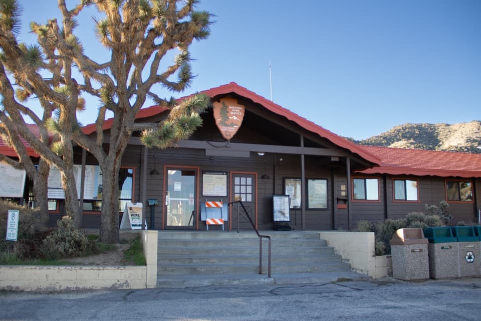 Visitor center · 0.2 mi awayBlack Rock Nature CenterRanger advice, rotating art, and a Yogi Bear campground story.
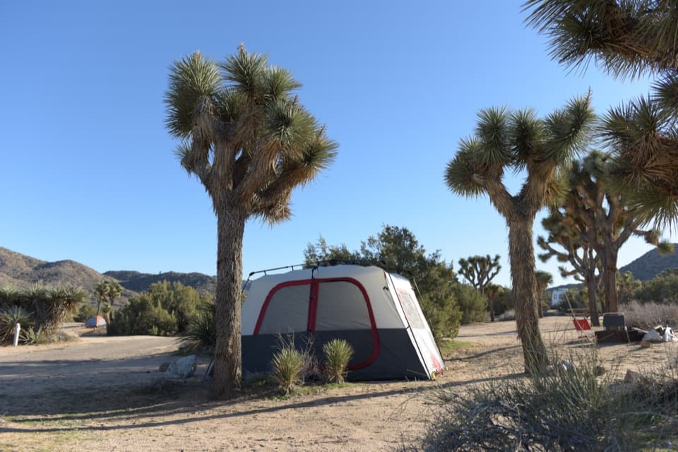 Campground · 0.3 mi awayBlack Rock CampgroundCamp beneath Joshua trees with a Jellystone Park past.
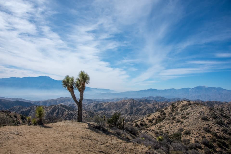 Sight · 3.7 mi awayEureka PeakA steep dirt-road detour to a wide 360-degree summit view.
 Sight · 3.8 mi awayNancy Karl Trail OverlookA sandy trail leads to a wayside view over the desert basin.
 Visitor center · 5.8 mi awayJoshua Tree Visitor CenterPick up a map and ranger advice before the West Entrance.
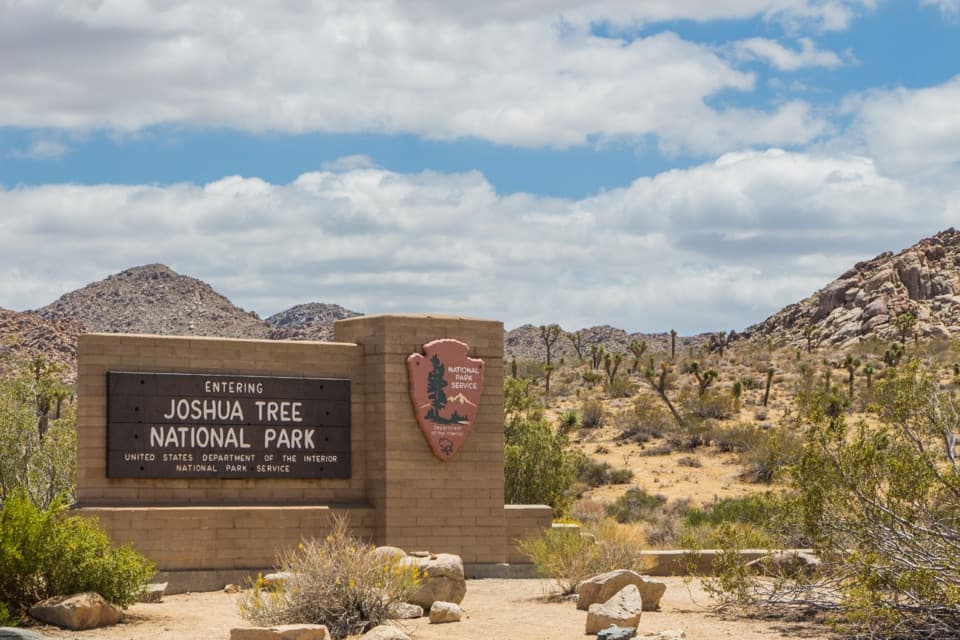 Entrance station · 7.2 mi awayWest Entrance and Welcome SignThe west-gate sign, water fill, and first stop on the park drive.
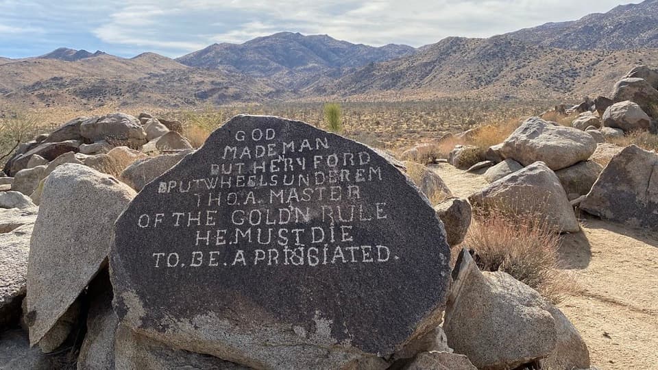 Sight · 8.5 mi awaySamuelson RocksCarved desert messages from a man whose story went missing.
Parkwolf’s Joshua Tree ranking

The audio tour guide for the drive, plus offline maps, trails, and wildlife heatmaps for when the signal drops.





