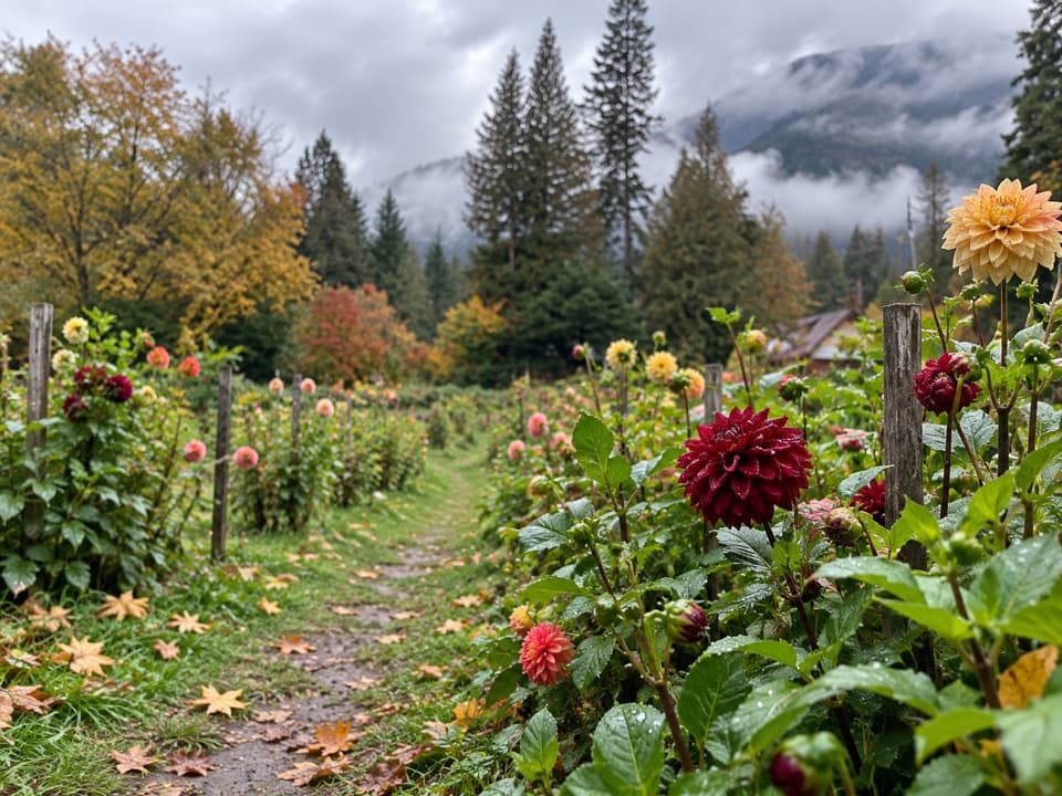
Hilgard Pass / Ten Mile Pass Loop in North Cascades National Park

North Cascades National Park, WA

Hilgard Pass / Ten Mile Pass Loop

A demanding loop from Stehekin to two high mountain passes.

Photo: National Park Service
Length
28mi
Time
20hr
Elev. change
5,387ft
Difficulty
Challenging
  • Loop
  • Dogs allowed
  • High point 6,594 ft

Hear the audio tour

Company Creek: Mountain Views and Hilgard Pass

Overview

About Hilgard Pass / Ten Mile Pass Loop

Why go

  • Two high passes, open larches and quiet creek basins in one loop.
  • Flat and dispersed creekside campsites with water to treat.

Heads up

  • Long, steep climbs, a creek ford and a difficult fire-scarred traverse.
  • Stehekin access requires a boat or floatplane.

Map & elevation

The route

Loading the North Cascades map
Full map
Elevation1,207–6,594 ft
TrailheadCompany Creek Trailhead48.35219, -120.72872
Keep this map with you offline in the Parkwolf app

Plan your hike

Before you go

Parking

Stehekin has no road connection to Chelan; arrive by passenger boat or floatplane. From the landing, follow Stehekin Valley Road about 4.5 miles to Harlequin Campground, then Company Creek Road about 1 mile to the trailhead. Trailhead parking details were not found.

Safety

A free self-issued wilderness permit is required. The high traverse between Ten Mile and Hilgard passes is obscure through old fire damage. The Company Creek ford can be hazardous during peak runoff, and snow can make Hilgard Pass dangerous.

7 active North Cascades alerts

  • ClosureStehekin Valley Road closed after landslidesMentions Stehekin Valley Road, referenced in this guideStehekin Valley Road is closed because landslides damaged it; additional precipitation and flood-related hazards persist.Official details
  • ClosureWildfire closures and Stehekin fire advisoryWildfire-related closures remain in effect; stay out of all closed trails, camps, and areas.Official details
See all 7 alerts
A park ranger sits on a dash-mounted phone, talking, as Parkwolf’s Tour Guide plays “Army Cutworm Moths: A Grizzly Bear Buffet” on Grand Loop Road below Dunraven Pass in Yellowstone
Parkwolf Tour GuideThe highest, rockiest slopes around here are a summer buffet for grizzly bears.

North Cascades Tour Guide

Your drive to Hilgard Pass / Ten Mile Pass Loop, narrated.

Parkwolf is a GPS audio tour guide for North Cascades National Park. As you drive, it chimes in with what’s ahead: hidden gems, upcoming stops, history, geology, and wildlife, right through your car’s speakers.

See the North Cascades audio tour

Recorded for this trailhead

Company Creek: Mountain Views and Hilgard Pass
0:00 / 0:30
“Company Creek Trailhead is ahead, the start of a steep climb toward views of Sable Ridge and glaciated Bonanza Peak. Those views begin a little over two miles up, so even a shorter outing means a substantial uphill walk.”

Plays as you drive up to this trailhead in the Parkwolf North Cascades Tour Guide.

More stories near here in the app

  • Two Teachers, One Salary
  • Harlequin Bridge and the River Walk
  • Small Frog, Big Chorus
  • Salmon That Stay in the Lake
  • 83 audio storiesacross North Cascades’s roads, triggered by GPS as you drive
  • Wildlife heatmapsfor Mountain Goat, Black Bear, Mule Deer, and 10 more
  • Works offlinemaps, 88 trails, 76 places, and audio download before you lose signal
  • CarPlay readysimple controls built for the drive
★★★★★
“Fantastic app with many points of information… It’s great to just turn on while you’re driving and it gives you an audio tour of the national Park. We love it!!!!”
JMJamesApp Store review
Download Parkwolf on the App StoreGet Parkwolf on Google Play

4.7 from 8,600+ ratings

Trail guide

Hiking Hilgard Pass / Ten Mile Pass Loop

The commitmentThis 28-mile loop starts at the Company Creek trailhead in Stehekin Valley, climbs over Hilgard…

This 28-mile loop starts at the Company Creek trailhead in Stehekin Valley, climbs over Hilgard Pass, crosses the high country toward Ten Mile Pass, then descends Devore Creek and returns by Stehekin River Trail and a short road connection. Most of the route crosses Glacier Peak Wilderness on National Forest land; the valley ends are in Lake Chelan National Recreation Area. It is a rugged, remote backpacking trip with narrow, lightly maintained tread. Allow roughly 20 hours of hiking over two or three days. A free, self-issued wilderness permit is required.

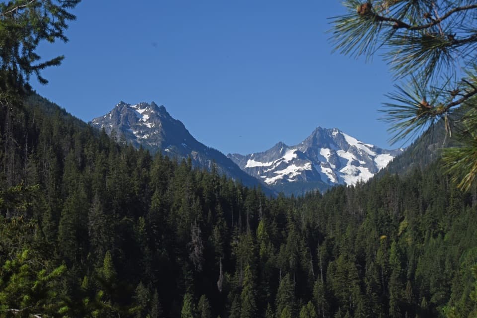
Climbing Company CreekFrom the 1,200-foot trailhead the route climbs steeply through open forest for about 2 miles,…

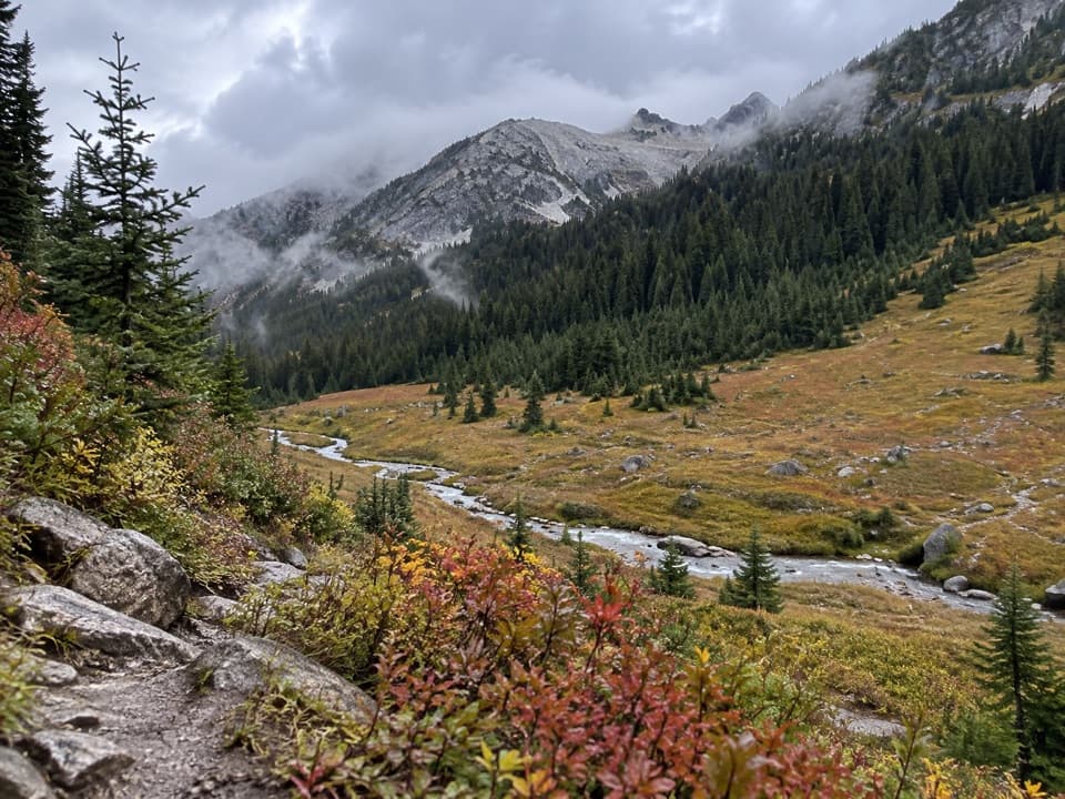
From the 1,200-foot trailhead the route climbs steeply through open forest for about 2 miles, then traverses a steep sidehill with rocky bluffs and slide paths through thicker timber. At about mile 5, ford Company Creek; the crossing can be hazardous during peak runoff. Above it, the route follows the creek into its basin before steep switchbacks climb to Hilgard Pass. Water is plentiful along Company Creek, but there are no campsite facilities and stream water needs treatment. Snow at Hilgard Pass can make the crossing dangerous.

Between the passesThe traverse from Hilgard toward Ten Mile crosses remote, fire-damaged country.

The traverse from Hilgard toward Ten Mile crosses remote, fire-damaged country. The tread south of Ten Mile Pass is obscure and difficult to follow after the 2015 Wolverine Fire, so carry a reliable offline map and expect slow route-finding. This is the section that makes the loop a poor fit for anyone new to backcountry navigation.

Down Devore CreekTen Mile Pass lies in open larch forest.

Ten Mile Pass lies in open larch forest. From the pass the trail drops through timber into Ten Mile Basin, then through Fourth of July Basin and steep, brushy hillside toward the Stehekin River. The terrain changes from open high-country views to a long descent through forest and dry slopes. Devore has dispersed campsites without facilities, with water available to treat.

Closing the loopAt the Devore Creek junction, follow Stehekin River Trail back toward the valley.

At the Devore Creek junction, follow Stehekin River Trail back toward the valley. A short walk on the valley roads links the two trailheads and closes the circuit; the route does not retrace the pass crossing. The two valley trailheads are about half a mile apart. Leashed pets are allowed in the Lake Chelan National Recreation Area, and pets are allowed on most surrounding National Forest land.

Reaching the trailheadStehekin has no road connection to Chelan; reach it by passenger boat or floatplane.

Stehekin has no road connection to Chelan; reach it by passenger boat or floatplane. From the landing, travel about 4.5 miles up Stehekin Valley Road to Harlequin Campground, then about 1 mile along Company Creek Road to the trailhead. Trailhead parking details were not found.

Wildlife

Wildlife in North Cascades

All North Cascades wildlife maps

Sighting maps show where each species has been reported across North Cascades. Wildlife moves, so no sighting is guaranteed.

Keep exploring

Near Hilgard Pass / Ten Mile Pass Loop

See it all on the map

Trails that start nearby

Places near the trailhead

Parkwolf’s North Cascades ranking

Top-rated trails in North Cascades

All 88 trails
  1. 1Sahale Arm TrailChallenging · 11.8 mi
  2. 2Cascade Pass TrailModerate · 7.4 mi
  3. 3Heather–Maple Pass LoopChallenging · 7.2 mi
  4. 4Hidden Lake TrailChallenging · 9 mi
  5. 5Copper Ridge / Chilliwack River LoopChallenging · 33.5 mi
  6. 6Thunder Knob TrailModerate · 3.8 mi

Take Parkwolf to North Cascades.

The audio tour guide for the drive, plus offline maps, trails, and wildlife heatmaps for when the signal drops.

4.7 from 8,600+ ratings

Download Parkwolf on the App StoreGet Parkwolf on Google Play