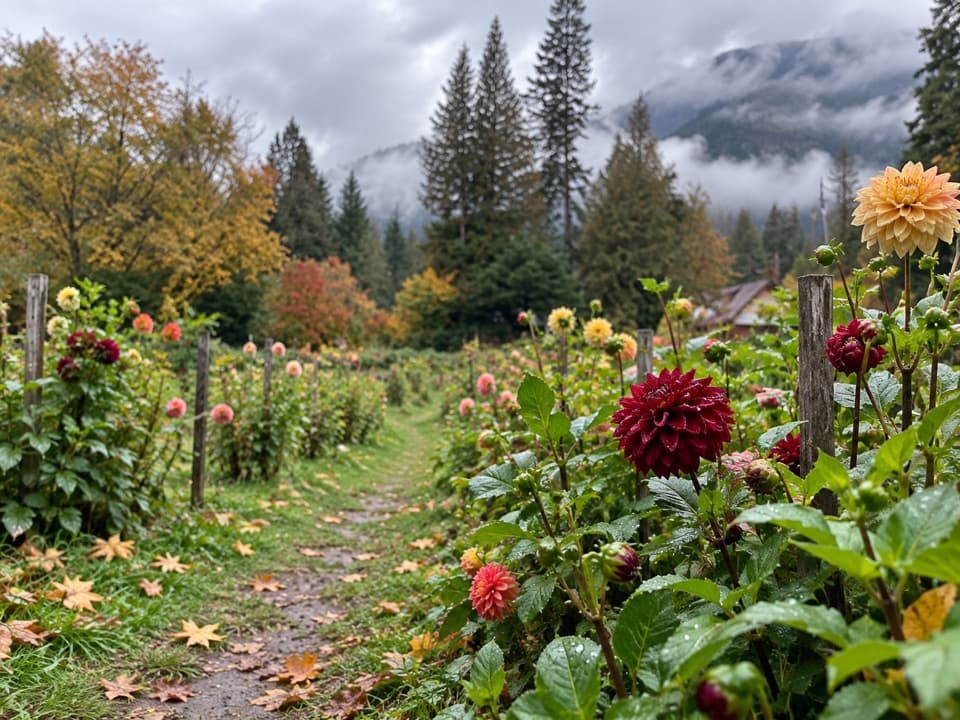
Rainbow Mist Trail in North Cascades National Park

North Cascades National Park, WA

Rainbow Mist Trail

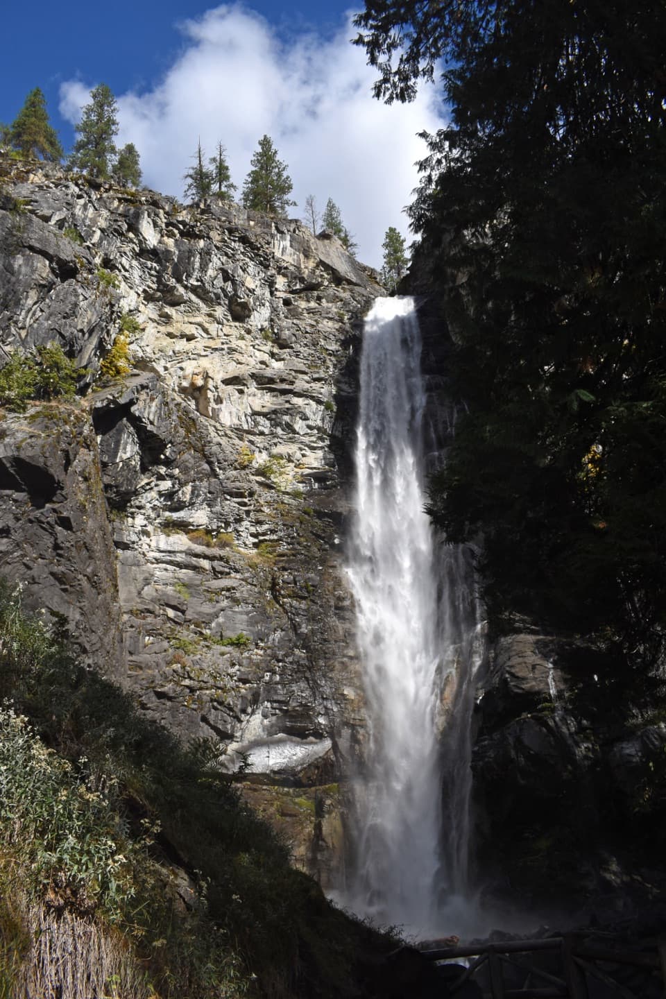
Two viewpoints bring you close to a 312-foot waterfall.

Length
0.3mi
Time
20min
Elev. change
73ft
Difficulty
Easy
  • Loop
  • No dogs
  • High point 1,333 ft
  • #38 of 88 in North Cascades

Hear the audio tour

Rainbow Falls: Two Views of the Drop

Overview

About Rainbow Mist Trail

Why go

  • Two distinct waterfall views for a very short walk
  • The lower viewing area is wheelchair accessible

Heads up

  • A brief outing rather than a half-day hike
  • The upper view involves steps or a short climb

Map & elevation

The route

Loading the North Cascades map
Full map
Elevation1,261–1,333 ft
TrailheadRainbow Falls parking / shuttle turnaround48.34220, -120.70130
Keep this map with you offline in the Parkwolf app

Plan your hike

Before you go

Parking

Start at the Rainbow Falls roadside parking and shuttle turnaround on Stehekin Valley Road, about 3.5 miles from Stehekin Landing. A picnic table and restroom are at the stop; parking capacity and current transit arrangements were not established.

Safety

Mist keeps the steps and constructed surfaces damp; they can be slippery or icy in cold weather. Wet rocks beside the water are slick, so stay within the formed viewpoints.

7 active North Cascades alerts

  • ClosureStehekin Valley Road closed after landslidesMentions Stehekin Valley Road, referenced in this guideStehekin Valley Road is closed because landslides damaged it; additional precipitation and flood-related hazards persist.Official details
  • InfoLimited services at Stehekin Landing after flood damageMentions Stehekin Landing, referenced in this guideSome services at Stehekin Landing remain limited after the December 2025 flood damaged the wastewater treatment plant and other basic infrastructure.Official details
See all 7 alerts
A park ranger sits on a dash-mounted phone, talking, as Parkwolf’s Tour Guide plays “Army Cutworm Moths: A Grizzly Bear Buffet” on Grand Loop Road below Dunraven Pass in Yellowstone
Parkwolf Tour GuideThe highest, rockiest slopes around here are a summer buffet for grizzly bears.

North Cascades Tour Guide

Your drive to Rainbow Mist Trail, narrated.

Parkwolf is a GPS audio tour guide for North Cascades National Park. As you drive, it chimes in with what’s ahead: hidden gems, upcoming stops, history, geology, and wildlife, right through your car’s speakers.

See the North Cascades audio tour

Recorded for this trailhead

Rainbow Falls: Two Views of the Drop
0:00 / 0:34
“Rainbow Falls is coming up, with a three-hundred-and-twelve-foot drop just a short walk from the road. Give it about twenty minutes and see both viewpoints if you can.”

Plays as you drive up to this trailhead in the Parkwolf North Cascades Tour Guide.

More stories near here in the app

  • Buckner Orchard: Heirloom Apples and a Working Ditch
  • Harlequin Bridge and the River Walk
  • Rainbow Loop: A Traverse with Lake Views
  • Company Creek: Mountain Views and Hilgard Pass
  • 83 audio storiesacross North Cascades’s roads, triggered by GPS as you drive
  • Wildlife heatmapsfor Mountain Goat, Black Bear, Mule Deer, and 10 more
  • Works offlinemaps, 88 trails, 76 places, and audio download before you lose signal
  • CarPlay readysimple controls built for the drive
★★★★★
“Fantastic app with many points of information… It’s great to just turn on while you’re driving and it gives you an audio tour of the national Park. We love it!!!!”
JMJamesApp Store review
Download Parkwolf on the App StoreGet Parkwolf on Google Play

4.7 from 8,600+ ratings

Trail guide

Hiking Rainbow Mist Trail

A short waterfall walkRainbow Mist Trail is a short roadside path network to two viewpoints at Rainbow Falls, a…

Rainbow Mist Trail is a short roadside path network to two viewpoints at Rainbow Falls, a 312-foot drop in Stehekin. Plan for about 0.3 mile round trip and roughly 20 minutes on the path with a brief look. Some published mileage is 0.25 mile; the mapped route stored here follows the roadside approach and both viewing areas. This is a waterfall stop, not a long hike.

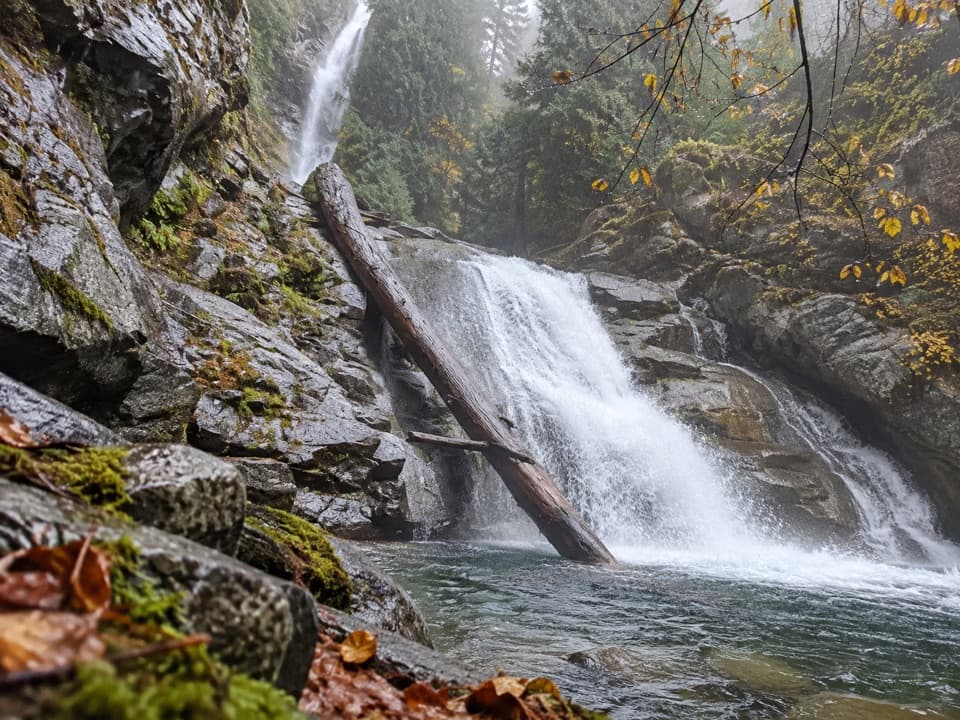
Take in both viewpointsThe lower viewpoint looks across the pool and smaller cascade, with part of the taller falls…

The lower viewpoint looks across the pool and smaller cascade, with part of the taller falls above. A brief climb reaches the upper viewpoint closer to the tall drop; a gentler switchback approach and a short stair route are both described. The lower viewpoint is the wheelchair-accessible section. For a photo, frame the pool below from the lower area, then go up for a closer view of the main drop.

Mist keeps the built trail damp, and the steps and nearby rocks can be slick or icy. Stay on the formed viewpoints. Dogs are not allowed on park trails; service animals are excepted.

Why the falls hang over the valleyRainbow Creek rises near McAlester Mountain and Dee Dee Lakes and flows year-round, usually…

Rainbow Creek rises near McAlester Mountain and Dee Dee Lakes and flows year-round, usually strongest during spring runoff in May and June. Continental ice carved Stehekin Valley deeper than the smaller Rainbow Creek valley, leaving a hanging valley; the creek cuts through the old glacial rubble before dropping over its edge. On a sunny day, spray can make a rainbow.

The start is beside the Rainbow Falls roadside parking and shuttle turnaround, about 3.5 miles from Stehekin Landing. The stop has a picnic table, interpretive sign, and restroom; plan how you’ll travel up the valley before heading out.

Wildlife

Wildlife in North Cascades

All North Cascades wildlife maps

Sighting maps show where each species has been reported across North Cascades. Wildlife moves, so no sighting is guaranteed.

Keep exploring

Near Rainbow Mist Trail

See it all on the map

Trails that start nearby

Places near the trailhead

Parkwolf’s North Cascades ranking

Top-rated trails in North Cascades

All 88 trails
  1. 1Sahale Arm TrailChallenging · 11.8 mi
  2. 2Cascade Pass TrailModerate · 7.4 mi
  3. 3Heather–Maple Pass LoopChallenging · 7.2 mi
  4. 4Hidden Lake TrailChallenging · 9 mi
  5. 5Copper Ridge / Chilliwack River LoopChallenging · 33.5 mi
  6. 6Thunder Knob TrailModerate · 3.8 mi

Take Parkwolf to North Cascades.

The audio tour guide for the drive, plus offline maps, trails, and wildlife heatmaps for when the signal drops.

4.7 from 8,600+ ratings

Download Parkwolf on the App StoreGet Parkwolf on Google Play