Upper South Fork Skokomish River Trail in Olympic National Park

Olympic National Park, WA

Upper South Fork Skokomish River Trail

Old-growth river valley, rough meadows, and a hard-won alpine lake.

Length
15.2mi
Time
10hr
Elev. change
2,910ft
Difficulty
Challenging
  • No dogs
  • High point 4,009 ft
Parkwolf audio tour204 stories across Olympic’s roads

Overview

About Upper South Fork Skokomish River Trail

Why go

  • Old-growth forest, river crossings, meadows, and an alpine lake make a varied full-day route.
  • A remote lake basin rewards the long climb.

Heads up

  • The South Fork ford is unbridged, and other crossings use logs or rocks.
  • Brushy, faint tread beyond the park boundary makes navigation part of the hike.
Upper South Fork Skokomish River Trail is a 15.2-mile out-and-back to Lake Sundown, about 7.6 miles each way from the shared Upper/Lower South Fork trailhead. Allow around 10 hours; the route climbs about 3,325 feet and gets much rougher after the park boundary. It is for strong hikers comfortable with wet crossings and finding faint tread. The reward is a real change of scenery: old-growth river valley below, then steep forest, open meadows, tarns, and a clear alpine lake. Start early and carry an offline map; this is too long and too easy to lose for a casual late-day attempt.
Parkwolf’s verdictIs it worth the long day?

Map & elevation

The route

Loading the Olympic map
Full map
Elevation1,099–4,009 ft
TrailheadSkokomish Upper/Lower South Fork Trailhead47.47932, -123.45210
Keep this map with you offline in the Parkwolf app

Plan your hike

Before you go

Parking

Use the shared Skokomish Upper/Lower South Fork Trailhead at the end of Forest Service Road 2361. From Shelton, take West Skokomish Valley Road to Govey Road/Forest Service Road 23, then follow Forest Service Road 2361 to its end. The lot fits roughly a dozen vehicles or more; there is no toilet or other service.

Safety

This 15.2-mile hike gains about 3,325 feet. The South Fork crossing at roughly 2.4 miles is an unbridged ford; other stream crossings may require logs or rock hopping. Beyond the park boundary at about 5.1 miles, the steep, brushy tread is often faint or disappears in meadows. Use offline navigation, expect wet feet, and protect against devil’s club. Pets are prohibited in the park; overnight backcountry camping requires a wilderness permit.

6 active Olympic alerts

  • CautionUS 101 Hoh River Bridge reduced to one laneUS 101 at the Hoh River Bridge is restricted to one lane of alternating traffic; obey the signals and 25 mph speed limit.Official details
  • ClosureStaircase wilderness trails and campsites remain closedWilderness trails and campsites around Staircase remain closed during recovery from the Bear Gulch Fire; the developed Staircase area, including the Rapids Loop, campground, and ranger station, is…Official details
See all 6 alerts
A park ranger sits on a dash-mounted phone, talking, as Parkwolf’s Tour Guide plays “Army Cutworm Moths: A Grizzly Bear Buffet” on Grand Loop Road below Dunraven Pass in Yellowstone
Parkwolf Tour GuideThe highest, rockiest slopes around here are a summer buffet for grizzly bears.

Olympic Tour Guide

Your drive to Upper South Fork Skokomish River Trail, narrated.

Parkwolf is a GPS audio tour guide for Olympic National Park. As you drive, it chimes in with what’s ahead: hidden gems, upcoming stops, history, geology, and wildlife, right through your car’s speakers.

See the Olympic audio tour
  • 204 audio storiesacross Olympic’s roads, triggered by GPS as you drive
  • Wildlife heatmapsfor Olympic Marmot, Humpback Whale, Grey Whale, and 13 more
  • Works offlinemaps, 148 trails, 94 places, and audio download before you lose signal
  • CarPlay readysimple controls built for the drive
★★★★★
“Fantastic app with many points of information… It’s great to just turn on while you’re driving and it gives you an audio tour of the national Park. We love it!!!!”
JMJamesApp Store review
Download Parkwolf on the App StoreGet Parkwolf on Google Play

4.7 from 8,600+ ratings

Trail guide

Hiking Upper South Fork Skokomish River Trail

Through the river valleyThe first half-mile follows an old forest-road bed under alders before narrowing into dirt and…

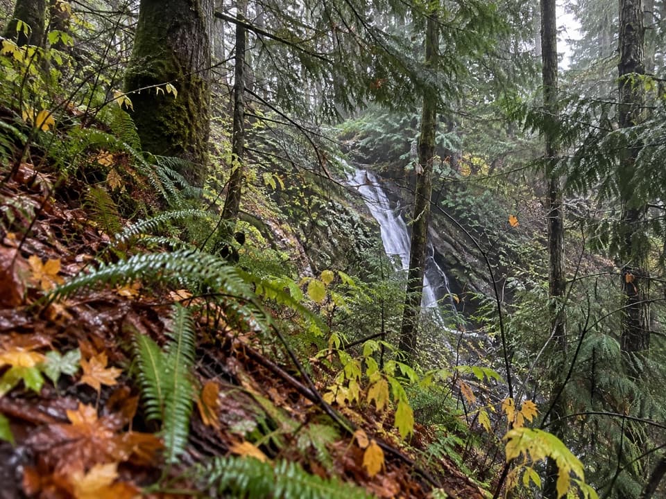
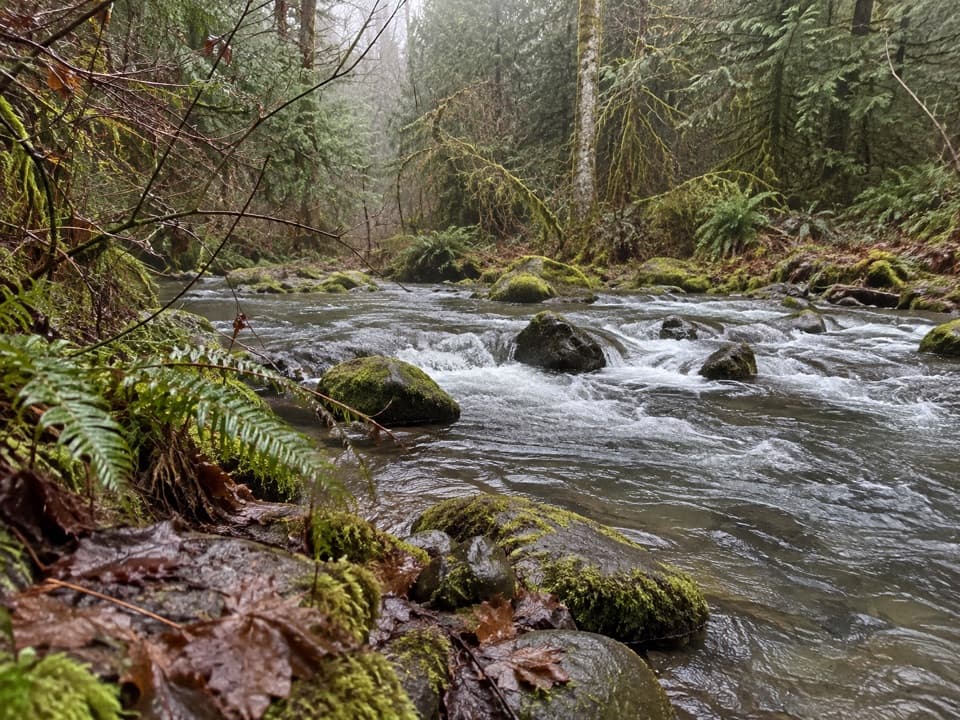
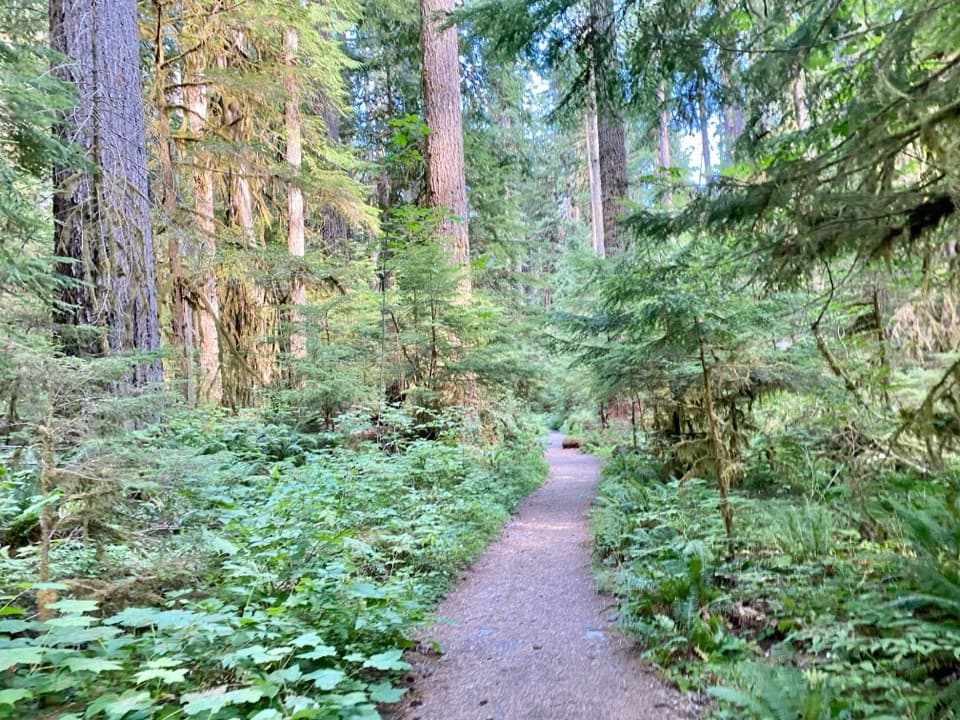
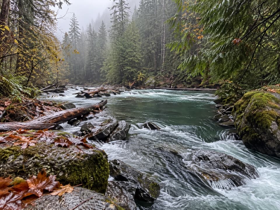
The first half-mile follows an old forest-road bed under alders before narrowing into dirt and forest duff. You hear the South Fork from a ledge but don't get a river view. Pass Elephant Stump and cross Rule Creek on a bridge at about 1.2 miles. Soon after, the main river crossing is on a fallen cedar. At roughly 2.4 miles the trail reaches the bank again: this time the South Fork is unbridged and must be forded.

Beyond the ford, the path can seem to vanish in a small clearing; keep straight to the cut log at the far end, then turn uphill around the knoll. Brush and devil's club crowd the tread. Startup Creek comes at about 4 miles, crossed by a fallen log when present or by rock hopping.

Above the park boundaryAt about 5.

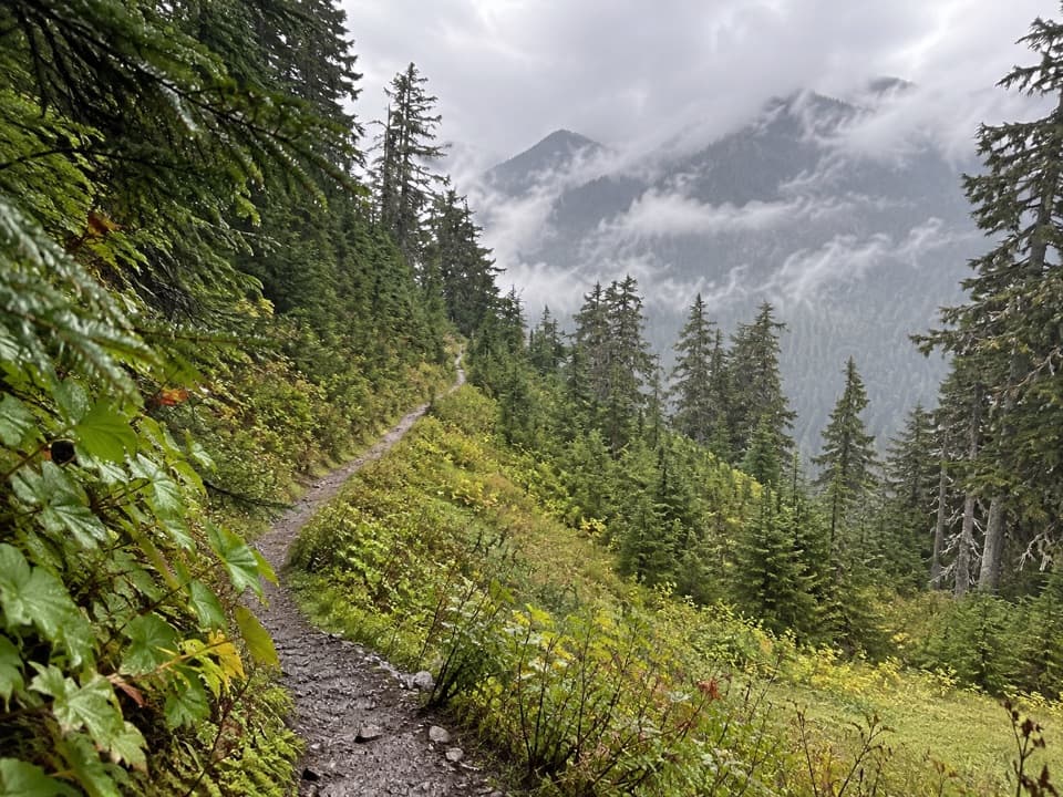
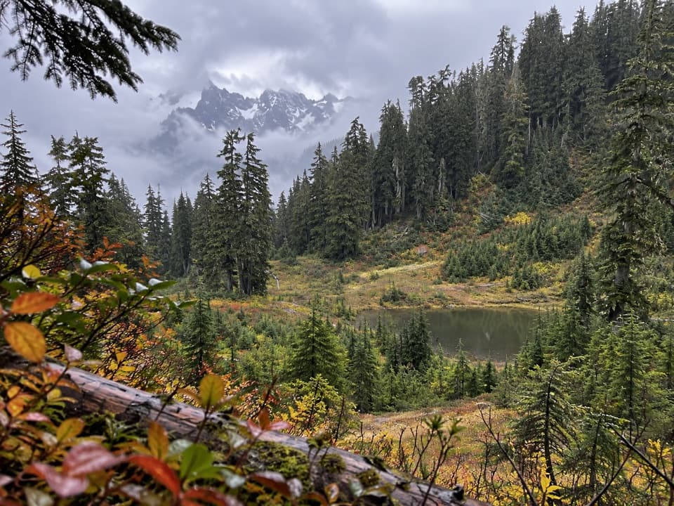
At about 5.1 miles the trail enters Olympic National Park and changes from a broader forest tread to a steep, narrow, eroding path. It climbs through brushy forest to Riley Camp's meadow, then crosses another marshy meadow where the tread is easy to miss. The final climb passes two small tarns and reaches Sundown Pass, listed at about 4,125 feet. The pass itself is partly screened by trees; the bigger view comes as the route drops nearly 400 feet toward the Graves Creek junction.

Continue to Lake SundownThe lake is beyond the Graves Creek junction, so don't mistake the junction for the turnaround.

The lake is beyond the Graves Creek junction, so don't mistake the junction for the turnaround. Follow the Sundown Lake trail the last short stretch to the clear water and campsites. This is the route's best open-water view: frame the tarn-like lake with the meadow and dark firs, rather than shooting from the mostly tree-covered pass. The lakeside sites are backcountry camps, not services; there is no food, potable water, or toilet on the route.

Access and rulesThe trailhead is at the end of Forest Service Road 2361, about 30 road miles from Shelton via…

The trailhead is at the end of Forest Service Road 2361, about 30 road miles from Shelton via West Skokomish Valley Road and Forest Service Road 23. The lot fits roughly a dozen vehicles or more, but has no toilet or other services. Pets are prohibited inside the park, so they cannot accompany you on the full hike to the lake. Overnight camping in the park backcountry requires a wilderness permit; this is a day-hike route when completed in one long outing.

Wildlife

Wildlife in Olympic

All Olympic wildlife maps

Sighting maps show where each species has been reported across Olympic. Wildlife moves, so no sighting is guaranteed.

Keep exploring

Near Upper South Fork Skokomish River Trail

See it all on the map

Trails that start nearby

Places near the trailhead

Parkwolf’s Olympic ranking

Top-rated trails in Olympic

All 148 trails
  1. 1Hall of Mosses TrailEasy · 0.8 mi
  2. 2Hurricane Hill TrailModerate · 3.3 mi
  3. 3Sol Duc Falls Nature TrailEasy · 1.6 mi
  4. 4High Divide Loop (Seven Lakes Basin)Challenging · 19 mi
  5. 5Hoh River TrailChallenging · 34.8 mi
  6. 6Shi Shi Beach and Point of Arches TrailModerate · 8 mi

Take Parkwolf to Olympic.

The audio tour guide for the drive, plus offline maps, trails, and wildlife heatmaps for when the signal drops.

4.7 from 8,600+ ratings

Download Parkwolf on the App StoreGet Parkwolf on Google Play