Tissington Trail in Peak District National Park

Peak District National Park, EN

Tissington Trail

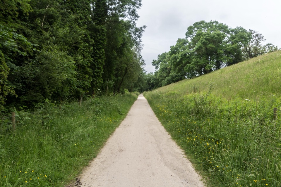
A former railway makes a long White Peak crossing feel gentler.

Photo: Wikimedia Commons
Length
21.1km
Time
5.5hr
Elev. change
219m
Difficulty
Moderate
  • High point 345 m

Hear the audio tour

When Ashbourne Becomes the Pitch

Overview

About Tissington Trail

Why go

  • A former rail bed keeps most of the long walk gradual.
  • Ashbourne Tunnel and railway remains add historic interest.

Heads up

  • The 13.1-mile route is one way and needs a return plan.

Map & elevation

The route

Loading the Peak District map
Full map
Elevation126–345 m
TrailheadAshbourne Tissington Trail access53.01960, -1.73970
Keep this map with you offline in the Parkwolf app

Plan your hike

Before you go

Parking

Start at the Ashbourne Tissington Trail access beside the bike-hire centre. Pay-and-display parking is available at both Ashbourne and Parsley Hay. This is a point-to-point walk, so arrange transport to the far end or plan to retrace the route.


Safety

Short steeper sections near Seven Arches and Mapleton may challenge wheelchair users. Walkers share this traffic-free route with cyclists and horse riders.

5 active Peak District alerts

  • ClosureA54 Cat and Fiddle road closureThe A54 Macclesfield Main Road (Cat and Fiddle) is fully closed to all traffic from 27 July through 30 October 2026 during phase 1 improvement works.Official details
  • ClosureHooks Carr (Stanage Popular) car park closureHooks Carr (Stanage Popular) car park will be partially or fully closed from 6 October for four weeks.Official details
See all 5 alerts
A park ranger sits on a dash-mounted phone, talking, as Parkwolf’s Tour Guide plays “Army Cutworm Moths: A Grizzly Bear Buffet” on Grand Loop Road below Dunraven Pass in Yellowstone
Parkwolf Tour GuideThe highest, rockiest slopes around here are a summer buffet for grizzly bears.

Peak District Tour Guide

Your drive to Tissington Trail, narrated.

Parkwolf is a GPS audio tour guide for Peak District National Park. As you drive, it chimes in with what’s ahead: hidden gems, upcoming stops, history, geology, and wildlife, right through your car’s speakers.

Recorded for this area

When Ashbourne Becomes the Pitch
0:00 / 0:29
“In Ashbourne, the football pitch is the town itself. On Shrove Tuesday and Ash Wednesday, the Up’ards and Down’ards move a painted leather ball toward old mill sites about three miles apart.”

Plays on the road 1.8 km from the trailhead in the Parkwolf Peak District Tour Guide.

More stories near here in the app

  • The Lead Workings on Thorpe Cloud
  • The Anglers Who Made the Dove Famous
  • Dovedale Stepping Stones and Thorpe Cloud
  • Tissington Village and Hall
  • 298 audio storiesacross Peak District’s roads, triggered by GPS as you drive
  • Wildlife heatmapsfor Red Deer, Red Fox, Eurasian Otter, and 13 more
  • Works offlinemaps, 88 trails, 76 places, and audio download before you lose signal
  • CarPlay readysimple controls built for the drive
★★★★★
“Fantastic app with many points of information… It’s great to just turn on while you’re driving and it gives you an audio tour of the national Park. We love it!!!!”
JMJamesApp Store review
Download Parkwolf on the App StoreGet Parkwolf on Google Play

4.7 from 8,600+ ratings

Trail guide

Hiking Tissington Trail

The old railway crossingThe Tissington Trail is a 13.

The Tissington Trail is a 13.1-mile, one-way walk from Ashbourne to Parsley Hay, following the former Buxton–Ashbourne railway across the White Peak. The published figure is rounded to 13 miles; this full visitor route uses a short public bridleway link into Parsley Hay. Choose it for a long cross-country walk rather than a loop or summit climb. You finish far from your start, so arrange a lift or be ready to retrace the route.
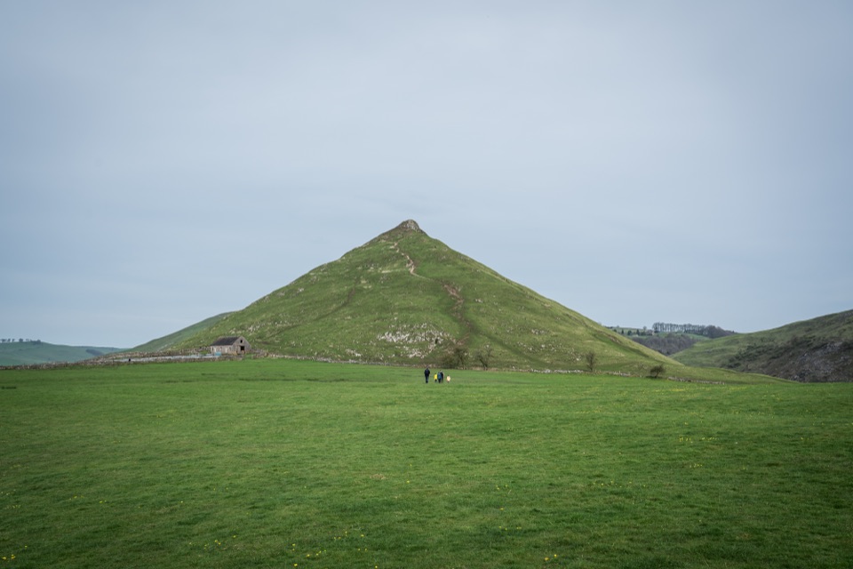
Mostly gentle, not flatThe traffic-free track is shared with walkers, cyclists and horse riders.

The traffic-free track is shared with walkers, cyclists and horse riders. Its former rail bed keeps most of the gradients easy, but short steeper sections around Seven Arches and Mapleton interrupt the steady pace. Allow about five to six hours on foot. At Ashbourne, the route passes through Ashbourne Tunnel. Former platforms and a signal box recall the railway, which opened in 1899 and once carried milk to London. Tissington village is a worthwhile diversion, but it is off the mapped line.

Plan both endsStart at the Ashbourne trail access beside the bike-hire centre.

Start at the Ashbourne trail access beside the bike-hire centre. Both ends have pay-and-display parking, toilets and refreshments; the trail itself is free to use. This is a through walk, so plan a pickup at Parsley Hay or a return over the same 13 miles. The short steeper grades at Seven Arches and Mapleton may challenge wheelchair users.

Wildlife

Wildlife in Peak District

All Peak District wildlife maps

Sighting maps show where each species has been reported across Peak District. Wildlife moves, so no sighting is guaranteed.

Keep exploring

Near Tissington Trail

See it all on the map

Trails that start nearby

Places near the trailhead

Parkwolf’s Peak District ranking

Top-rated trails in Peak District

All 88 trails
  1. 1The Roaches and Lud’s Church Circular from Hen CloudModerate · 12.2 km
  2. 2Mam Tor Circular WalkModerate · 4.8 km
  3. 3Castleton, Mam Tor & the Great Ridge WalkModerate · 10.5 km
  4. 4Stanage Edge from HathersageModerate · 10.6 km
  5. 5Kinder Scout Circular via Jacob’s LadderChallenging · 12.1 km
  6. 6Padley Gorge and Burbage Brook WalkEasy · 3.7 km

Take Parkwolf to Peak District.

The audio tour guide for the drive, plus offline maps, trails, and wildlife heatmaps for when the signal drops.

4.7 from 8,600+ ratings

Download Parkwolf on the App StoreGet Parkwolf on Google Play