J.O. Pass Trail in Sequoia National Park

Sequoia National Park, CA

J.O. Pass Trail

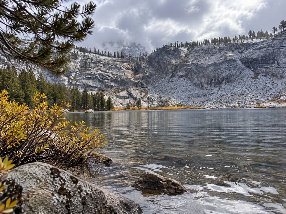
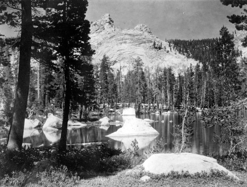
A rocky wilderness pass links Sequoia to Jennie Lakes.

Length
2.5mi
Time
2hr
Elev. change
440ft
Difficulty
Moderate
  • No dogs
  • High point 9,446 ft
Parkwolf audio tour71 stories across Sequoia’s roads

Overview

About J.O. Pass Trail

Why go

  • A compact forest route reaches a high-country pass and trail junction.
  • Openings near the pass look back into Sequoia.

Heads up

  • One-way segment with no parking at its saved start.
  • Faint tread and several nearby junctions call for careful navigation.

Map & elevation

The route

Loading the Sequoia map
Full map
Elevation9,006–9,446 ft
TrailheadRowell Meadow Trail junction36.67577, -118.74453
Keep this map with you offline in the Parkwolf app

Plan your hike

Before you go

Parking

Use the Rowell Meadow or Big Meadows trailhead approaches in Jennie Lakes Wilderness. The saved route starts at the Rowell Meadow Trail junction, not a parking area; coming from the Sequoia side via the Twin Lakes trail network adds mileage. Plan a return or through-route before setting out.

Best time to go

The Forest Service lists Rowell Meadow and Big Meadows as trailhead approaches; the mapped segment begins at the Rowell Meadow Trail junction, not a parking lot. From the Sequoia side, the Twin Lakes trail network is another approach, with extra mileage. The Forest Service lists a June-to-November season, weather permitting. If you continue into Sequoia or Kings Canyon backcountry overnight from Jennie Lakes Wilderness, get the required wilderness permit.

Safety

The rocky approach and faint tread can make route-finding harder around the junctions. Pets are not allowed on the park portion of the route; leashed pets are allowed on National Forest trails beyond the boundary.

8 active Sequoia alerts

  • CautionStage 1 fire restrictionsStage 1 fire restrictions are in effect due to high fire danger and catastrophic-wildfire risk; the restrictions reduce the possibility of accidental human-caused fires that could threaten visitors…Official details
  • ClosureGrant Grove trails and areas closed for prescribed burnSome trails and areas around Grant Grove and the General Grant Tree are closed for safety during a prescribed burn and until they are cleared of hazards.Official details
See all 8 alerts
A park ranger sits on a dash-mounted phone, talking, as Parkwolf’s Tour Guide plays “Army Cutworm Moths: A Grizzly Bear Buffet” on Grand Loop Road below Dunraven Pass in Yellowstone
Parkwolf Tour GuideThe highest, rockiest slopes around here are a summer buffet for grizzly bears.

Sequoia Tour Guide

Your drive to J.O. Pass Trail, narrated.

Parkwolf is a GPS audio tour guide for Sequoia National Park. As you drive, it chimes in with what’s ahead: hidden gems, upcoming stops, history, geology, and wildlife, right through your car’s speakers.

See the Sequoia audio tour

More stories near here in the app

  • A Pika's Winter Harvest
  • Dorst Creek Campground and Muir Grove
  • Wuksachi Lodge
  • Halstead Meadow Picnic Area
  • 71 audio storiesacross Sequoia’s roads, triggered by GPS as you drive
  • Wildlife heatmapsfor Black Bear, Mountain Lion, Bobcat, and 13 more
  • Works offlinemaps, 99 trails, 68 places, and audio download before you lose signal
  • CarPlay readysimple controls built for the drive
★★★★★
“…The kids and my husband and I all agree that the narration really added to our experience driving through the parks. We learned so much about the history and the flora & fauna.”
JessestblondeApp Store review
Download Parkwolf on the App StoreGet Parkwolf on Google Play

4.7 from 8,600+ ratings

Trail guide

Hiking J.O. Pass Trail

A one-way pass connectorJ.O. Pass Trail is a 2.48-mile one-way segment from the Rowell Meadow Trail junction to J.O.

J.O. Pass Trail is a 2.48-mile one-way segment from the Rowell Meadow Trail junction to J.O. Pass, where it meets the Jennie Lake Trail. It is a connector, not a loop: walking back the same way makes it about five miles, and continuing onward needs an exit plan. The saved line starts at the junction, so the approach from a parking area adds mileage. The route starts at Sequoia’s edge and continues into Jennie Lakes Wilderness.

Forest, junctions and open rockThe first stretch rolls through lodgepole pines, with a few short rises.

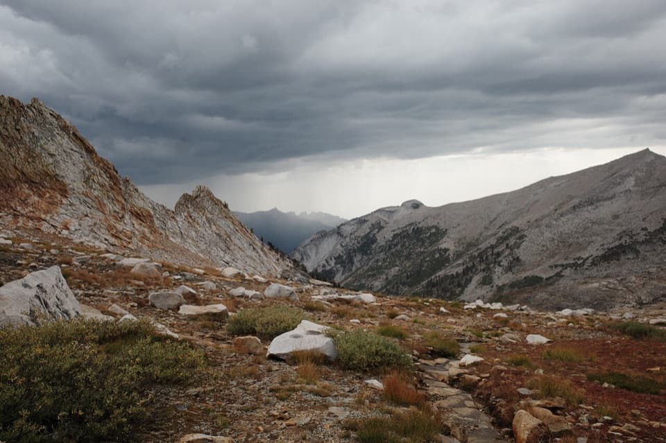
The first stretch rolls through lodgepole pines, with a few short rises. The route reaches the Weaver Lake Trail junction, where it is easy to turn onto a different lake route, so check your map before continuing. Farther along, fir and mountain pines replace the denser lodgepoles; a rocky section leads to the pass. Expect a natural surface and some faint tread.

The view and the onward routeNear the pass, openings look back toward Sequoia.

Near the pass, openings look back toward Sequoia. A short cutover called Profile View, east of the trail beyond the Weaver Lake junction, gives another view into the park; that spur is not part of the saved line. At J.O. Pass, this segment ends at the Jennie Lake Trail. The connector is more rewarding as part of a longer high-country walk than as a short out-and-back.

Pets and footingPets are prohibited on National Park trails, while leashed pets are allowed on surrounding…

Pets are prohibited on National Park trails, while leashed pets are allowed on surrounding National Forest trails. Since the full mapped route begins on the park side and crosses the boundary, leave pets behind for this hike. The rocky pass approach and faint tread make an offline map useful.

Wildlife

Wildlife in Sequoia

All Sequoia wildlife maps

Sighting maps show where each species has been reported across Sequoia. Wildlife moves, so no sighting is guaranteed.

Keep exploring

Near J.O. Pass Trail

See it all on the map

Trails that start nearby

Places near the trailhead

Parkwolf’s Sequoia ranking

Top-rated trails in Sequoia

All 99 trails
  1. 1Congress TrailEasy · 2.7 mi
  2. 2General Sherman Tree TrailModerate · 1 mi
  3. 3Moro Rock TrailModerate · 0.5 mi
  4. 4High Sierra TrailChallenging · 48.9 mi
  5. 5Mount Whitney TrailChallenging · 22 mi
  6. 6Lakes Trail to Pear LakeChallenging · 12.8 mi

Take Parkwolf to Sequoia.

The audio tour guide for the drive, plus offline maps, trails, and wildlife heatmaps for when the signal drops.

4.7 from 8,600+ ratings

Download Parkwolf on the App StoreGet Parkwolf on Google Play