Shotgun Pass Trail in Sequoia National Park

Sequoia National Park, CA

Shotgun Pass Trail

A rocky pass crossing with a steep, loose descent to Silver Lake.

Length
3.9mi
Time
4.5hr
Elev. change
2,375ft
Difficulty
Challenging
  • No dogs
  • High point 11,421 ft
Parkwolf audio tour71 stories across Sequoia’s roads

Overview

About Shotgun Pass Trail

Why go

  • A real high-country pass crossing with Silver Lake on the descent.
  • The full traverse gives a changing route through granite, meadow and alpine terrain.

Heads up

  • The north tread can be extremely faint, and the south descent is steep over loose gravel.
  • No direct road access; it only makes sense as part of a longer wilderness route.

Map & elevation

The route

Loading the Sequoia map
Full map
Elevation9,045–11,421 ft
TrailheadShotgun Pass Trail Junction on Franklin Pass Trail36.40880, -118.52916
Keep this map with you offline in the Parkwolf app

Plan your hike

Before you go

Parking

There is no roadside lot at either end. The northern start is a backcountry junction on Franklin Pass Trail, reached through the Mineral King trail system; roadside parking is at the Farewell Gap–Franklin Lakes trailhead. Plan a separate wilderness exit from the forest-boundary end.

Safety

The north tread is difficult to follow across meadow, and the descent from Shotgun Pass is extremely steep over loose granite gravel. The route reaches roughly 11,400 feet and is remote; use backcountry navigation skills and check current conditions with the Western Divide Ranger District.

8 active Sequoia alerts

  • CautionStage 1 fire restrictionsStage 1 fire restrictions are in effect due to high fire danger and catastrophic-wildfire risk; the restrictions reduce the possibility of accidental human-caused fires that could threaten visitors…Official details
  • ClosureGrant Grove trails and areas closed for prescribed burnSome trails and areas around Grant Grove and the General Grant Tree are closed for safety during a prescribed burn and until they are cleared of hazards.Official details
See all 8 alerts
A park ranger sits on a dash-mounted phone, talking, as Parkwolf’s Tour Guide plays “Army Cutworm Moths: A Grizzly Bear Buffet” on Grand Loop Road below Dunraven Pass in Yellowstone
Parkwolf Tour GuideThe highest, rockiest slopes around here are a summer buffet for grizzly bears.

Sequoia Tour Guide

Your drive to Shotgun Pass Trail, narrated.

Parkwolf is a GPS audio tour guide for Sequoia National Park. As you drive, it chimes in with what’s ahead: hidden gems, upcoming stops, history, geology, and wildlife, right through your car’s speakers.

See the Sequoia audio tour

More stories near here in the app

  • Mineral King Trailheads and Honeymoon Cabin
  • Sawtooth Trailhead and Monarch Lakes
  • Mineral King Ranger Station
  • Cold Springs Campground and Nature Trail
  • 71 audio storiesacross Sequoia’s roads, triggered by GPS as you drive
  • Wildlife heatmapsfor Black Bear, Mountain Lion, Bobcat, and 13 more
  • Works offlinemaps, 99 trails, 68 places, and audio download before you lose signal
  • CarPlay readysimple controls built for the drive
★★★★★
“…The kids and my husband and I all agree that the narration really added to our experience driving through the parks. We learned so much about the history and the flora & fauna.”
JessestblondeApp Store review
Download Parkwolf on the App StoreGet Parkwolf on Google Play

4.7 from 8,600+ ratings

Trail guide

Hiking Shotgun Pass Trail

The route in briefShotgun Pass Trail is a 3.

Shotgun Pass Trail is a 3.9-mile, one-way backcountry traverse from a junction on Franklin Pass Trail, over Shotgun Pass, past Silver Lake and down toward the forest boundary. It climbs from about 10,200 feet to a high point near 11,400 feet. Allow four to six hours for this segment alone; the approach to its start and the exit from its far end are separate, longer wilderness travel. This makes sense as part of a multi-day Mineral King itinerary, not as a roadside day hike.

Following the faint treadThe north side crosses open alpine ground and meadow before the climb gets clearer near tree…

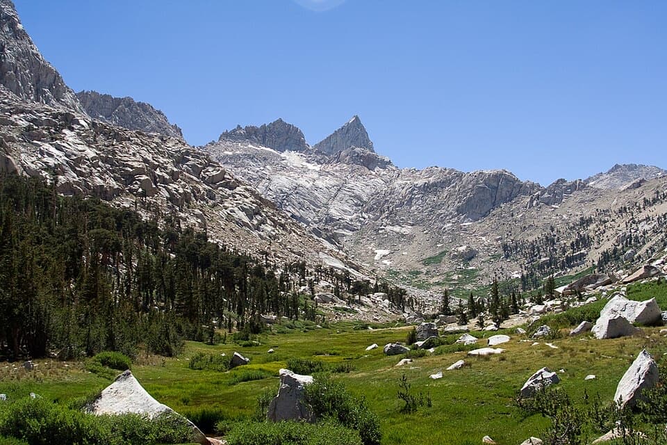
The north side crosses open alpine ground and meadow before the climb gets clearer near tree line. A 2012 trip account describes the first mile as hard to follow, with fallen branches and only occasional arrowhead blazes; the traveler had to work out the line across a meadow. Don't count on a continuous, obvious path through this section.

The pass and the descentThe route reaches a pale granite ridge above tree line.

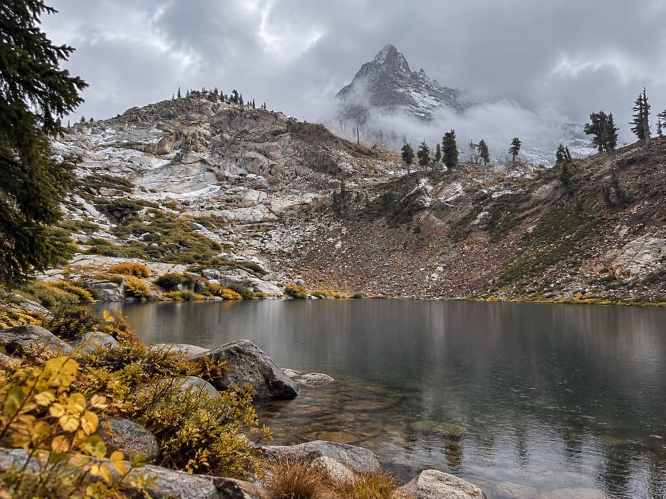
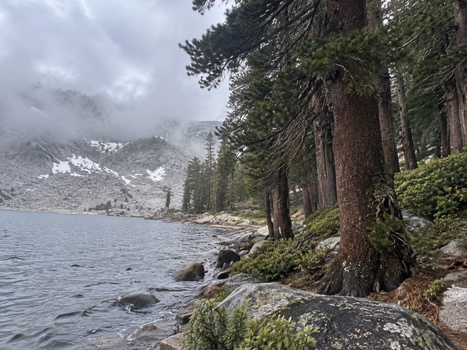
The route reaches a pale granite ridge above tree line. The south side is the hard part: it drops very steeply over loose granite gravel before reaching Silver Lake, then continues toward Shotgun Creek and the forest boundary. From the lake, turn back toward the pass; the water in the foreground gives the high ridge a useful sense of scale. The full traverse continues beyond the lake.

Plan it as a wilderness traverseThere is no road at either end.

There is no road at either end. The northern start is a backcountry junction on Franklin Pass Trail, reached from the Mineral King trail system; plan a separate route out from the forest-boundary end. The mileage above covers only Shotgun Pass Trail, not those approaches. Overnight stays in the Golden Trout Wilderness require a permit. Pets can't go on the park section of the trail. Ask the Western Divide Ranger District for current trail information before committing to this faint, steep route.

Wildlife

Wildlife in Sequoia

All Sequoia wildlife maps

Sighting maps show where each species has been reported across Sequoia. Wildlife moves, so no sighting is guaranteed.

Keep exploring

Near Shotgun Pass Trail

See it all on the map

Trails that start nearby

Places near the trailhead

Parkwolf’s Sequoia ranking

Top-rated trails in Sequoia

All 99 trails
  1. 1Congress TrailEasy · 2.7 mi
  2. 2General Sherman Tree TrailModerate · 1 mi
  3. 3Moro Rock TrailModerate · 0.5 mi
  4. 4High Sierra TrailChallenging · 48.9 mi
  5. 5Mount Whitney TrailChallenging · 22 mi
  6. 6Lakes Trail to Pear LakeChallenging · 12.8 mi

Take Parkwolf to Sequoia.

The audio tour guide for the drive, plus offline maps, trails, and wildlife heatmaps for when the signal drops.

4.7 from 8,600+ ratings

Download Parkwolf on the App StoreGet Parkwolf on Google Play