Hawksbill Summit via Upper Hawksbill in Shenandoah National Park

#14 of 163 trails in Shenandoah

Shenandoah National Park, VA

Hawksbill Summit via Upper Hawksbill

A short climb to Shenandoah’s high point and its stone-walled panorama.

Photo: National Park Service
Length
2.1mi
Time
1.5hr
Elev. change
410ft
Difficulty
Easy
  • Dogs allowed
  • High point 4,042 ft

Hear the audio tour

Upper Hawksbill: The Gentler Summit Approach

Overview

About Hawksbill Summit via Upper Hawksbill

Why go

  • A straightforward route to the park’s highest summit
  • A stone platform with broad valley views

Heads up

  • The upper gravel climb is steeper than the first stretch
  • No water or toilets are identified at the trailhead

Map & elevation

The route

Loading the Shenandoah map
Full map
Elevation3,632–4,042 ft
TrailheadUpper Hawksbill Trailhead Parking38.54372, -78.39318
Keep this map with you offline in the Parkwolf app

Plan your hike

Before you go

Parking

Use Upper Hawksbill parking on Skyline Drive at mile 46.5; the Hawksbill Gap lot serves different summit routes. The park entrance fee applies. Lot capacity and a typical fill time were not documented. Skyline Drive can close in severe weather.

Safety

The final gravel approach is the steepest section. Cliffs west of Byrds Nest 2 and the north slope below the viewing platform are closed to protect fragile high-elevation habitat; stay on the open route and platform. The trail is not ADA-compliant.

2 active Shenandoah alerts

  • ClosureOld Rag Trailhead main lot closedThe Old Rag Trailhead main parking lot is closed to vehicles and pedestrians for infrastructure improvements; use the existing overflow lots. - Work is expected to be completed by November 2026.Official details
  • ClosureBackcountry camping and zone closuresBackcountry camping is prohibited on the Appalachian Trail from Lewis Mountain to Big Meadows, and the Naked Creek backcountry zone is closed.Official details
Shenandoah alerts
A park ranger sits on a dash-mounted phone, talking, as Parkwolf’s Tour Guide plays “Army Cutworm Moths: A Grizzly Bear Buffet” on Grand Loop Road below Dunraven Pass in Yellowstone
Parkwolf Tour GuideThe highest, rockiest slopes around here are a summer buffet for grizzly bears.

Shenandoah Tour Guide

Your drive to Hawksbill Summit via Upper Hawksbill, narrated.

Parkwolf is a GPS audio tour guide for Shenandoah National Park. As you drive, it chimes in with what’s ahead: hidden gems, upcoming stops, history, geology, and wildlife, right through your car’s speakers.

See the Shenandoah audio tour

Recorded for this trailhead

Upper Hawksbill: The Gentler Summit Approach
0:00 / 0:25
“Up ahead is the Upper Hawksbill trailhead, the gentler approach to the park's highest summit. Allow about an hour and a half for the two point one mile round trip, with a steeper gravel climb near the top.”

Plays as you drive up to this trailhead in the Parkwolf Shenandoah Tour Guide.

More stories near here in the app

  • Old Rag View Overlook: A Distant Mountain Profile
  • Hawksbill Gap: The Short, Steep Summit Route
  • Spitler Knoll Overlook: Meadow and Mountain Views
  • Crescent Rock Overlook: Hawksbill Without the Hike
  • 146 audio storiesacross Shenandoah’s roads, triggered by GPS as you drive
  • Wildlife heatmapsfor Black Bear, Bald Eagle, White-tailed Deer, and 13 more
  • Works offlinemaps, 163 trails, 142 places, and audio download before you lose signal
  • CarPlay readysimple controls built for the drive
★★★★★
“Fantastic app with many points of information… It’s great to just turn on while you’re driving and it gives you an audio tour of the national Park. We love it!!!!”
JMJamesApp Store review
Download Parkwolf on the App StoreGet Parkwolf on Google Play

4.7 from 8,600+ ratings

Trail guide

Hiking Hawksbill Summit via Upper Hawksbill

A manageable climb to the high pointHawksbill Summit via Upper Hawksbill is a 2.

Hawksbill Summit via Upper Hawksbill is a 2.1-mile out-and-back from Upper Hawksbill parking to the stone viewing platform at the top of Shenandoah’s highest peak, then back on the same trail. Allow about 1½ hours; the route gains 520 feet. It is the easiest of the park’s named Hawksbill approaches, but it is not a level stroll: a gravel section steepens near the top, and the final tread is uneven. Choose it for a straightforward summit hike with a big payoff and a short enough commitment to leave time elsewhere in the park. The 2.9-mile loop and the shorter, steeper 1.7-mile approach from Hawksbill Gap reach the same summit by different routes.

Follow the Upper Hawksbill TrailThe walk leaves from the lot at Skyline Drive mile 46.

The walk leaves from the lot at Skyline Drive mile 46.5 and climbs through forest on dirt and gravel. Early stretches trade mild rises for flatter interludes. At roughly 0.65 mile, turn right at the junction onto a mostly gravel section that gets noticeably steeper. Near 0.95 mile, keep right; around mile 1, turn left where the route meets Lower Hawksbill, and Byrds Nest 2 comes into view. The platform is roughly 1.05 miles from the lot by a local route measurement. Those junction distances are wayfinding clues, not signed mileposts, so follow the Upper Hawksbill route to the shelter and platform, then retrace the same trail. Stay on this line unless you mean to change hikes: the 1.7-mile route from Hawksbill Gap is a separate, rockier approach.

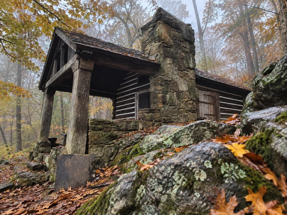
Pause at Byrds Nest 2The day-use shelter sits near the summit, just before the stone viewing platform.

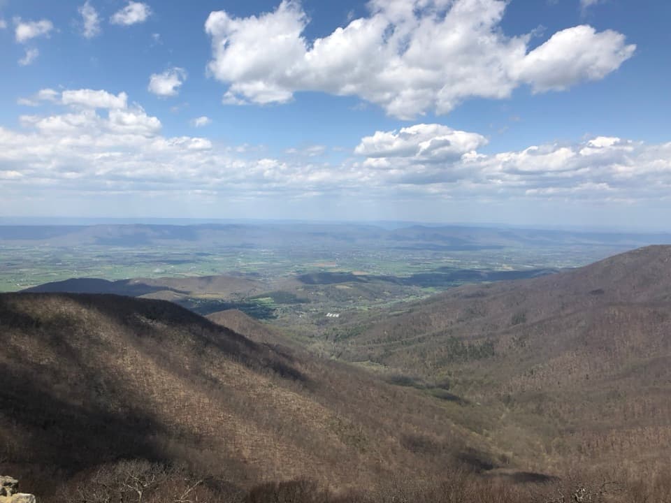
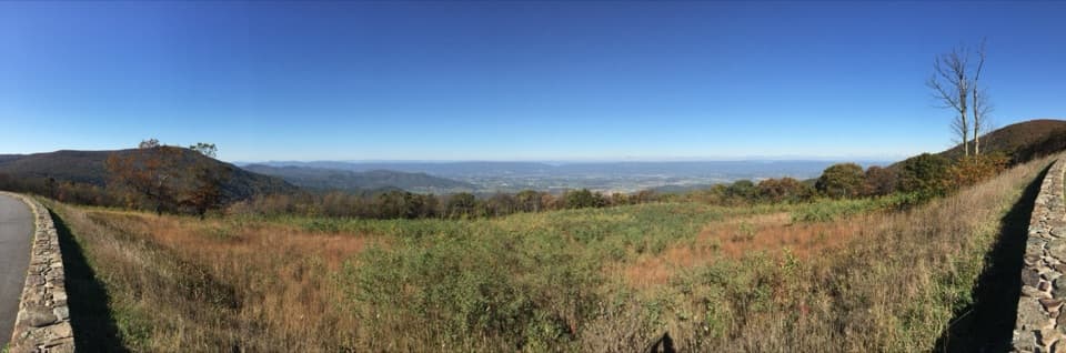
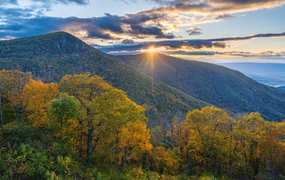
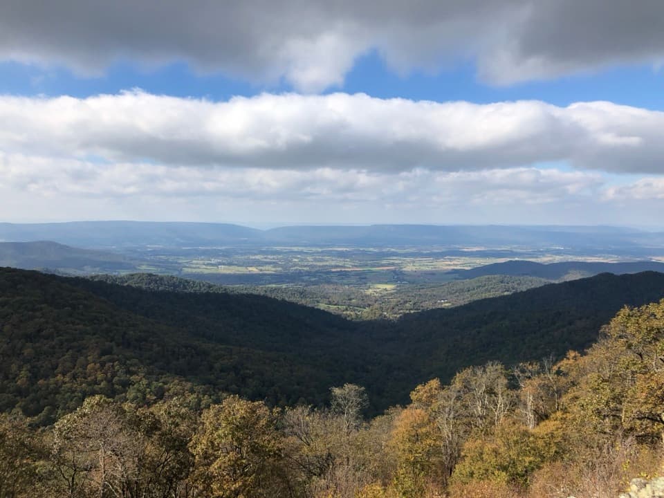
The day-use shelter sits near the summit, just before the stone viewing platform. From the platform, the Shenandoah Valley, Blue Ridge Mountains, and Virginia Piedmont spread out in a 360-degree panorama. Air quality and haze make a real difference to how far the ridges stand out. For a photo, use the stone parapet or summit ledges as foreground and let the valley run behind them; that gives the view a sense of height and place. The summit is the reason to keep going beyond the shelter, but there is no need to leave the open platform to find another viewpoint.

A summit with a storyThe stone observation platform was donated to the park in 1963 by U.S.

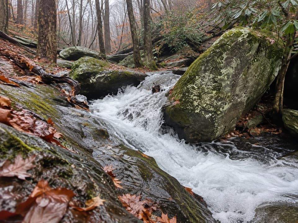
The stone observation platform was donated to the park in 1963 by U.S. Senator Harry Byrd, who had played a major role in creating Shenandoah National Park in the 1930s. The nearby day-use shelter carries the Byrd name too. Later restoration work repaired the platform masonry and improved heavily used tread for maintenance access. Hawksbill’s cool, moist high-elevation habitat also supports the endangered Shenandoah salamander, which lives only on the park’s highest peaks. There is no promise of seeing one; staying on the established path helps protect the small habitat and fragile plants around the summit.

Plan the accessStart at Upper Hawksbill parking on Skyline Drive at mile 46.

Start at Upper Hawksbill parking on Skyline Drive at mile 46.5; Hawksbill Gap is a different trailhead for other summit routes. A park entrance fee applies, but this hike has no separate activity fee or reservation requirement. Dogs are allowed on leash no longer than six feet. The trail is listed as year-round, though access still depends on Skyline Drive being open. The route is not ADA-compliant, and no drinking water or toilets are identified at the lot or along the trail. Big Meadows Wayside at mile 51 is a separate drive stop for refreshments and restrooms; no particular food specialty was confirmed.

Wildlife

Wildlife in Shenandoah

All Shenandoah wildlife maps

Sighting maps show where each species has been reported across Shenandoah. Wildlife moves, so no sighting is guaranteed.

Keep exploring

Near Hawksbill Summit via Upper Hawksbill

See it all on the map

Trails that start nearby

Places near the trailhead

Parkwolf’s Shenandoah ranking

Top-rated trails in Shenandoah

All 163 trails
  1. 1Old Rag Summit via Berry HollowChallenging · 5.4 mi
  2. 2Hawksbill LoopModerate · 2.9 mi
  3. 3Marys Rock Summit TrailModerate · 3.7 mi
  4. 4Stony Man HikeEasy · 1.6 mi
  5. 5Cedar Run - Whiteoak CircuitChallenging · 8.1 mi
  6. 6Blackrock Summit LoopEasy · 1 mi

Take Parkwolf to Shenandoah.

The audio tour guide for the drive, plus offline maps, trails, and wildlife heatmaps for when the signal drops.

4.7 from 8,600+ ratings

Download Parkwolf on the App StoreGet Parkwolf on Google Play